


Hurunui River overview
The Hurunui is the most important River in Canterbury for paddlers. It has navigable flows all year round and offers a good variety of whitewater runs.
From Lake Sumner down, there are a variety of runs, catering for all types of paddlers.
Upper Hurunui (described as one run)
- Lake to Sisters (I/II) Hike into the Lake, and paddle to Sisters River (I/II)
- Sisters Gorge (II) from Sisters River to Jollie Brook
- Jollie Brook (II) from Jollie Brook to Seaward River
Middle Hurunui
- Maori Gully (III) from Seaward River to (almost) the Surveys stream
- Hawarden Gap (II+) from Surveyors Stream to Mandamus River
Lower Hurunui
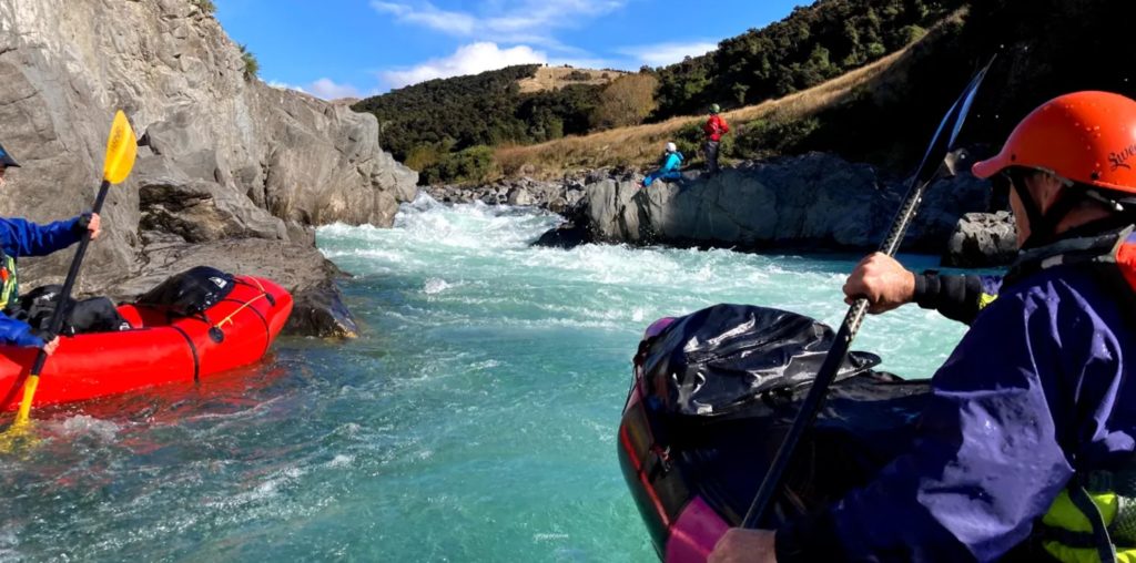
Middle Hurunui River: Hawarden Gap (II+)
The Hawarden Gap is a bit of an under-utilised gem. 12 km of Class II open gravel channel through rugged farmland has plenty of play features to practice eddies and technique before the valley constricts at the Hawarden Gap where the real fun begins. The river is aligned such that a norwester is funneled up the river and can be pretty extreme. So it’s a fair weather run.
By Road
Head north up State Highway One from Christchurch, when you get to Waipara, turn left and head up State Highway Seven. Turn left at the past the tea rooms in Waikari and head down the Hawarden Waikari Road. Straight through Hawarden and along Horsley Down Road, which curves to the left to become Lake Sumner Road. Turn of onto Powers road a couple of km short of a long straight. Continue on via Peaks, Hewletts, and Creans Roads to Alpine Horse Treks. Sign in and confirm your permission then follow the private farm track leaving gates as you find them. A koha is expected and you must call in advance.
Leave your shuttle vehicle and return to Lake Sumner Road. After Jacks Saddle the Hurunui Valley comes into view and, four km on, at the bottom of the hill you will find the unmarked Maori Gully take-out. This is the put-in for the Hawarden Gap run.
Note the shuttle takes about an hour so make sure you have extra food and warm clothes for the long wait.
On the River
Twelve kilometres of interesting but not particularly challenging Class II ends a couple of km after the confluence with the Glenrae River where the valley constricts.
A right hand turn at the base of a small grass area with a visible farm track heralds the Hawarden Gap. Eddy out river left and inspect the gap for hazards. The entire river is pumping through a four metre wide chute (the Gap). This creates a grunty drop, basically straight through but very boily. Class II paddlers can portage on river right.
At higher flows it is very boily with recirculation and the prospect of some serious downtime.
Below this is another rapid, that dog legs to the right and then a series of slightly easier rapids in a steep sided gorge before the gradient eases off and the river opens out again after a kilometre.
There is another short gorge with some small rapids before the river spills out on the plains and becomes braided. The takeout is where the river opens out. It is near the Mandamus River confluence.
Gauge
The Hurunui gauge is here
View Larger Topographic Map