


Hurunui River overview
The Hurunui is arguably the most important River in Canterbury for paddlers. It has navigable flows all year round and offers a good variety of whitewater runs.
From Lake Sumner down, there are a variety of runs, catering for all types of paddlers.
Upper Hurunui (described as one run)
- Lake to Sisters (I/II) Hike into the Lake, and paddle to Sisters River (I/II)
- Sisters Gorge (II) from Sisters River to Jollie Brook
- Jollie Brook (II) from Jollie Brook to Seaward River
Middle Hurunui
- Maori Gully (III) from Seaward River to (almost) the Surveys stream
- Hawarden Gap (II+) from Surveyors Stream to Mandamus River
Lower Hurunui
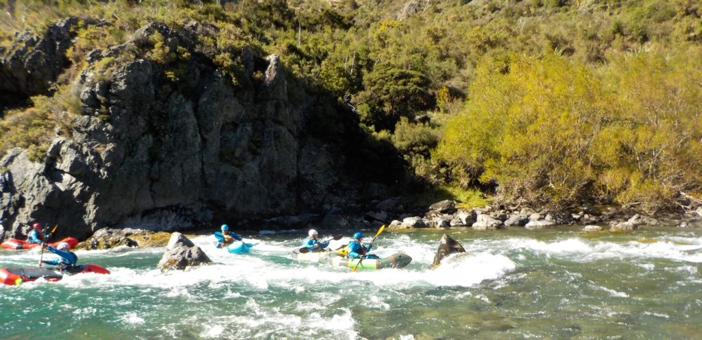
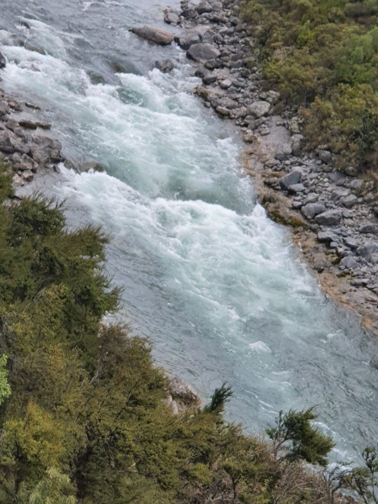
Middle Hurunui River: Maori Gully (III)
This short gorge section of the Hurunui is one reason why there are so many whitewater kayakers in Canterbury. Every kayaker in Christchurch in the past 50 years has nervously faced and often swum Maori Gully.
This Grade 3 section is 1.6km of varied and distinctive rapids that vary only slowly over the decades. It is a stepping stone from Grade 2 to Grade 3. Being confident in Maori Gully at flows from 15 to 50 cumecs means you are ready to move onto the easier Grade 4 runs.
Flows over 50 cumecs turn the whole section into a long piece of continuous Grade 3 where a reliable roll is essential. People lose boats and paddles at higher flows. At the summer flow range the run is a series of pool-drop rapids, with two longer rapids, which have easy entries but harder exits. The pools are safe recovery places.
The rapids vary from longer rapids with the occasional boulder to sharp ledge drops into pools. The rapids have names, some of which go back to before 1970. The rapid descriptions are from Hugh Canard and WWWC.
By Road
Head north up State Highway One from Christchurch, when you get to Waipara, turn left and head up State Highway Seven. Turn left at the past the tea rooms in Waikari and head down the Hawarden Waikari Road. Straight through Hawarden and along Horsley Down Road, which curves to the left to become Lake Sumner Road After Jacks Saddle the Hurunui Valley comes into view and four km on at the bottom of the hill you will find the unmarked Maori Gully take-out. Leave a Shuttle at the small grassed are where Kanuka/manuka first appear on the right hand side of the road heading up. Walk down and check the take-out if it’s not familiar.
Park at the Seaward river confluence put in.
On the River
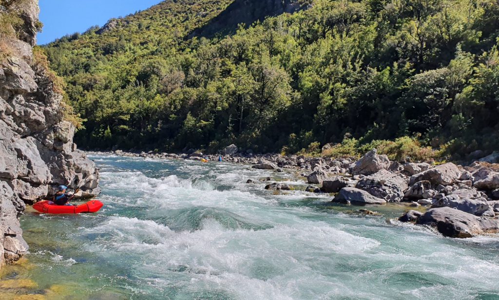
The section starts at the confluence with the Seaward River.
The entrance rapid is a straight forward wave train of 50 m then gathers a bit of pace towards a couple of rocks in the middle of the channel and a bluff with a buffer wave on the left turning corner. There is an easy sneak route down the hard left that avoids all the action. On the right side of the bluff is the Magic Roundabout, so named because it forms a nice 5m diameter whirlpool. Paddlers go round and round playing on the eddies behind two nicely placed mid stream boulders. There are also good eddies on both the left and right sides of the river plus plenty of flat water downstream to recover swimmers. At high flow it becomes more intimidating.
Round the corner the gorge widens a bit and there is a gravel beach on the right hand side, on the left hand side is Simons’ Hole. It is a pour-over at low flows, a very retentive hole over about 30 cumecs, and a large hole/wave at 50 cumecs. Most paddlers avoid it as it’s quite hard to exit. It is easily avoided by paddling down the right side of the river.
A short stretch downstream is the first of the two longer rapids. This one doesn’t seem to have a name. It starts with bedrock ledges and small pour-overs, then has two substantial centre holes near the end as the rapid kicks left. The chicken line is hard right. It pays to catch eddies here because the exit hole gets bigger and bigger with more water.
A big pool then into the second long rapid, Bum Rock, named rather aptly (a cleft rock that vaguely resembles a bum or a least an upside-down set of thighs). This rapid is generally run from left to right, moving right after Bum Rock and avoiding the various largish holes. Most lines are through wave trains left of Bum Rock, then down the hard right, crossing into the centre, looking for the green chute. A deep pool follows.
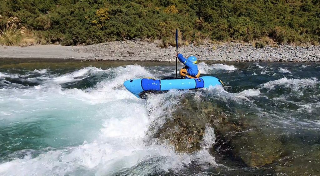
Then it’s The Elevator, marked by a prominent centre rock and a horizon line. At low flows it’s right. At higher flows both sides are OK. It’s called the Elevator because you can catch the centre eddy and the water carries you upstream.
Another pool, then the crux drop Cheesegrater. This is a smooth drop of 1.5m with a foaming hole bank to bank. At any flow the hole conveys all the water right to left in a typewriter move. That would be OK except that the left bank is undercut and has a few very hard rocks about 1m below the whitewater. Packrafts have been wedged under here with and without people in them. Swimmers get pushed into the undercut and get a few bruises on the hidden rocks.
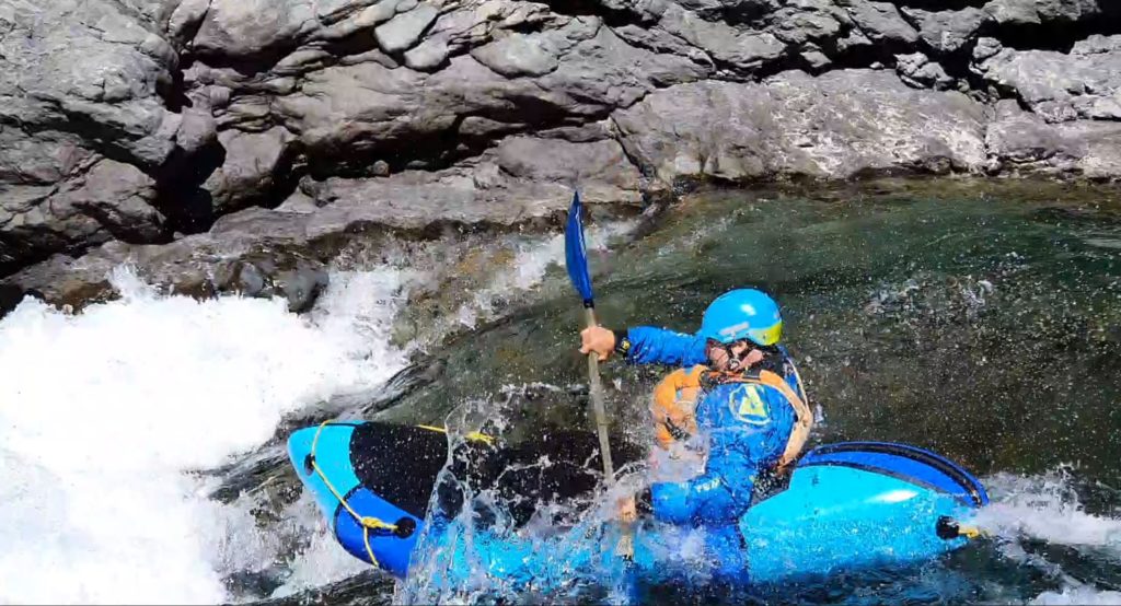
The key consideration is left to right momentum, heading right as you hit the top. The tiny eddy on river left immediately above the drop is called Grandstand Eddy.
After these drops comes the last major rapid, this consists of a number of holes and waves, with a bluff at the bottom as the river turns to the left. There is eddy on the right that you can surf some of the waves/holes from and a big eddy at the bottom to wait in, if you don’t feel like surfing.
From here on down, things ease off, thought the are still a number of fun rapids, plus the Pop Up spot on the river left (a favourite amongst local kayakers who like to pull pop ups).
The river flows down towards the final whitewater comprising two river wide waves with a big hole centre left.
The most important thing from here is not to miss the get out unless you like walking a lot. Look out for a rock spire on the right hand side that you can paddle around, the get out is just round the bluff from here, If it’s your first time find this get out by descending some steep steps from the grassy area where the road clears the Kanuka.
Maori Gully has a reputation for being a bit of a test piece but has no willow hazards and given a correct whitewater swim posture has not proved hazardous to date.
There are play waves everywhere and it’s a great place to learn to use these to cross fast water. The eddies on river left are large and on the right are quite small. Good paddlers learn to use the waves and eddies to progress to harder rivers.
River Gauge
Don’t run it for your first time at any flow over 30 cumecs. Below 30 cumecs it is technical pool-drop character ideal for beginner paddlers pushing into Grade 3 (the drops are distinct and can be inspected or portaged and the pools provide plenty of time to recover) From 30-50 the degree of technicality may reduce but the river becomes faster and pushier and packrafts may struggle to punch through. Above this flow it is continuous and challenging. At high flow it becomes Class IV.
The gauge is here
View Larger Topographic Map