


This is a packrafting overnight run that starts on the lower slopes of Ruapehu and bounces its way down to join the Whanganui below Owhango. Most of the flow off Ruapehu is diverted to the Tongariro Power Scheme so it’s best after heavy rain but grade is heavily flow dependant.
The Whakapapa is renowned with kayakers for its annual releases. Release flows allow a kayak day trip. It is a gem of a packraft trip at much lower flows but is slow and needs to be done as an overnighter. There are access issues so check with WWNZ for latest information.
Shuttle
Put-in
The Whakapapa intake road is no longer open to the public except on release days. Release days are too powerful for packrafters. This means the only realistic option is a bush bash to enter the river below the 11m Matariki Falls. This is located on SH47 with a layby at a location marked as Mohuia Rapids. This would not be a place to leave a vehicle.
Whakapapanui above the 11m waterfall (bush-bash to below waterfall)
Take-out
Several options exist. The first take-out is at Ohinetonga Road on the 42 Traverse near Owhango. Downstream of this there is a take-out at the end of Te Rena Road Kakahi (7.5km down river from Owhango) or go all the way to Pariaka on the Whanganui getting out at the Power station by “Blazing Saddles” (canoe outfitters and possible shuttle).
On the River
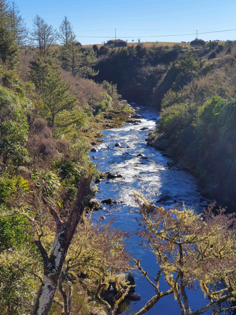
Check for put-in options close to your trip. The default is to drop in below the waterfall and grovel down the Whakapapanui for 2km. Once in the Whakapapanui it is bouldery technical paddling/ grovelling/ walking the dog. At the Whakapanui confluence with the Whakapapa-iti the river becomes the Whakapapa. At the confluence volume picks up for 5km before most of the flow is diverted to the Tongariro Power Scheme.
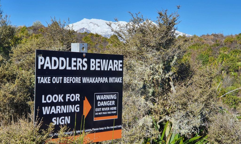
Watch for the intake warning sign.
There are oodles of bouldery Class III rapids in the form of boulder-banks, walls and boulder gardens. Some rapids may go Class III+ depending on flow and lots will go Class IV in a fresh. After about 7km below the intake the river swings to the north and continues parallel to SH4. It is 23km from the intake to the first takeout. Due to the amount of scouting and caution required you will need to camp half way. There are a few emergency exits across farmland in this areas but generally you are in an incised gorge through forest.
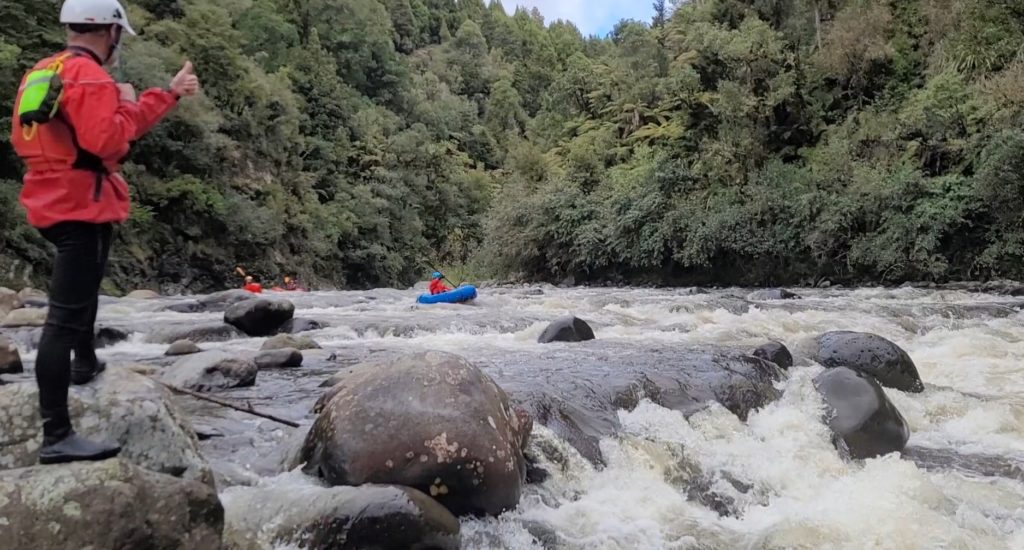
Boat scout diligently and, where you can’t see clearly, shore scout as required.
The last two rapids at the bridge on the 42 Traverse can be Class IV in higher flows. They are III+ in low flows. Always think about portage if the flow is low enough to expose a lot of bone breaking boulders.
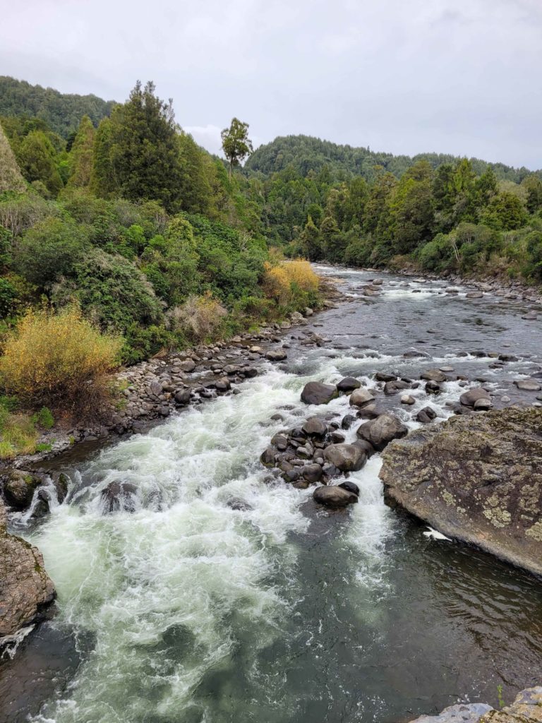
The two rapids under the bridge can be Class IV at higher flows.
View Larger Topographic Map
Camping
Like much of the central north island, there are large swathes of private land in and around this trip. Before heading out, it is critical to study the Herenga ā Nuku / Walking Access maps to see where the public land is. For example, all but a small reserve at the put-in is private land, as are areas on the true left bank and around the intake road. Do your homework, and keep to public land when walking, camping, scouting or portaging. WWNZ requests that, until an agreement is reached, you do not ask for intake road access directly without consulting WWNZ.
Gauge
The gauge is the Whakapapa below intake
It has been scratched down at 3 cumec by keen packrafting trout anglers. A better minimum flow would be 7 cumec. Release flows require a natural flow of 16 cumec and are often called off. A release is too robust for packrafters leave those days for the kayakers.
Flash floods down this catchment are not unlikely so go after rain not during and be very mindful of the forecast.
Options
Whakapaiti
If the river is up the Whakapapaiti is a viable but longer (by 3km) alternative. It is bouncy Class III.
Owhango to Pariaka (II/III)
This is a pleasant day trip that starts with nice boulder gardens approaching Class III at times (easily portaged) before easing, after a few km, to Class II all the way to Pariaka (allow 5 hrs)