


The Tauherenikau river flows from Mount Hector in the Taruara ranges to Lake Wairarapa. It drains the area of the Tararua ranges between the Waiohine River and the Hutt River.
As the Tauherenikau exits the range, it flows through a stunning gorge. It is the smallest of the three rivers draining the Southern Tararua ranges. As a result, it requires heavy rainfall to make a viable trip.
A pleasant 2hr walk through mixed beech podocarp forest takes you from the Hutt Valley to the Wairarapa, where 4hrs of gorge await you.
Depending on the flows and the time available, you can add some paddling above the gorge. There are great camping opportunities if you wish to tailor your trip to include spending a night in the valley before getting on the river.
Plus there’s even an option for a much shorter beginners day trip.
Car Shuttle
The most direct access to the valley is from Kaitoke. The shuttle is not straightforward. Both the Kiwi Ranch Road and Bucks Road have limited traffic so hitching is not an option. Typically you will need to drive to the Bucks Road road end to leave a vehicle and then re-cross the Remutaka Hill Road to park at the Kiwi Ranch road-end. To get to the Kiwi Ranch road-end take Marchant road off SH2 for 2km then Kiwi Ranch Road.
On foot – Kiwi Ranch Rd to Smith Creek Shelter
The walk into Smiths Creek over The Puffer saddle track takes two hours. There are several slips on the track and a diversion track has been built to sidle above them. They are pretty minor so currently (late 2018) it is easier to ignore the signs and follow the old track. Carefully pick a path across the slips or at worst drop into stream-bed and regain the track beyond the slips.
For an overnight trip, the best camping is on the main river flats above the gorge.
On foot – Alternate options for longer trips
At the Smiths Creek shelter, the river flow can be re-assessed and you can decide whether to walk up-river to extend your paddle.
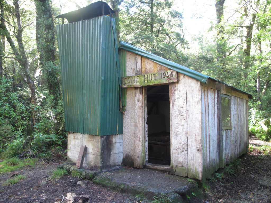
From Cone to Smiths Creek there is a series of river terraces and flats with a well-marked tramping track. As the track up-river follows the river you can scout for hazards and it will be obvious when the flow becomes insufficient. It is three hours to Tutuwai hut (20 bunks) and four to Cone hut (historic 6 bunks).
For a through trip, you can access the Tauherenikau Valley by a three hour walk from Walls Whare (Waiohine Gorge Road road end) over Cone Saddle. Then walk downstream until there is sufficient flow.
Tauherenikau River, Cone Hut to Smith Creek Shelter (II)
Above Cone Hut the Tauherenikau steepens and is very rocky. This section is known as the “Upper Gorge” by trampers, who descend the river by scrambling over rocks and swimming pools.
The river below Cone Hut is typically single channel but braids into two channels in places. It is common for there to be trees and logs obstructing the channel. Large flows are required to make this section viable.
Tauherenikau Lower Gorge (II+/III)
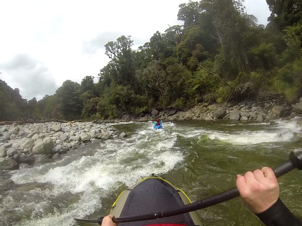
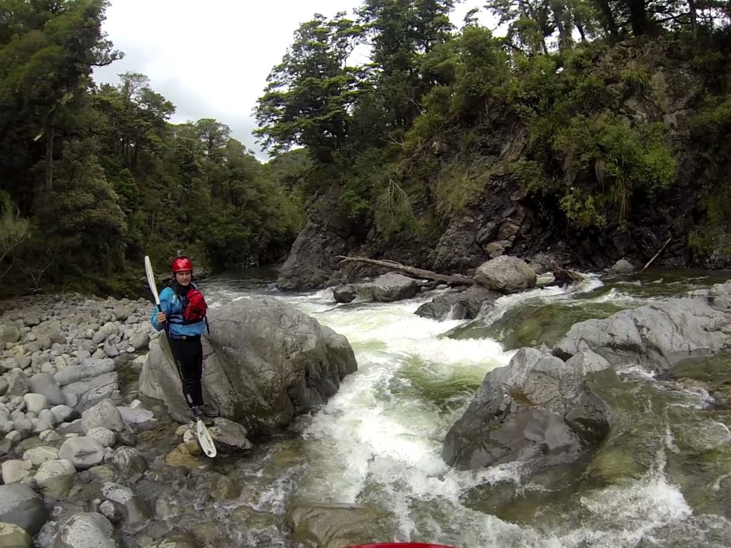
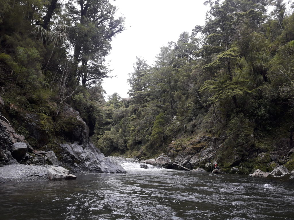
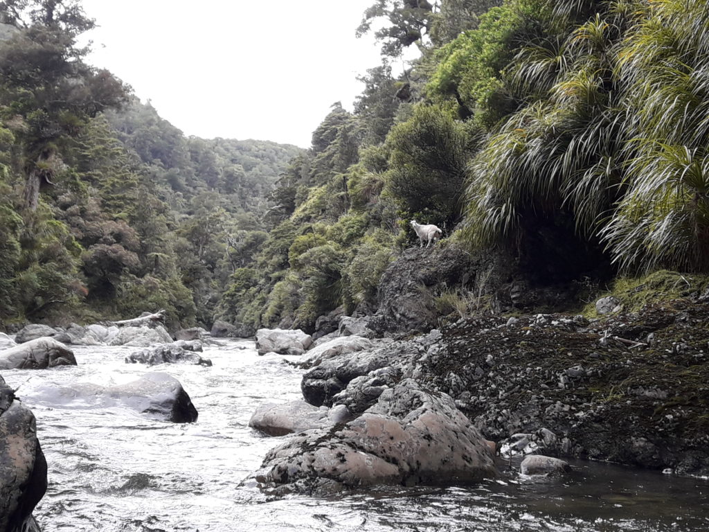
At Smiths Creek, the river turns to the east and passes through the Tauherenikau Lower Gorge. The first half of the gorge consists of a series of pools and drops with large boulders up to meter in size. Horizon lines are common and it is difficult to boat scout, particularly in higher flows where some rapids will be pushy with limited opportunity to eddy out in packrafts. Cautious shore scouting is needed.
For the first hour and a half below Smiths Creek there are a number of rapids that need to be scouted to ensure that the drops are free of logs. A number of logs were present in December 2018. After 1.5 to 2 hours the valley opens out to an area of terraces and the bed load reduces in size to small boulders and cobbles. The channel is still incised below the terraces. From this point, the river gradient eases and rapids are milder. There is a tramping track below the first gorge which connects to Bucks Road.
Portages are possible on either bank but the south (true right) is probably best. It is likely that there is an overgrown hunters track on true right. The kie-kie can be very thick at terrace level.
The gorge is very scenic with podocarp and beech forest towering above the river. At about the halfway point the vegetation on the true right becomes regenerating manuka scrub on reverting farmland. Just before the take-out, the river completes a large oxbow and pine forest is visible on the true left. The river also braids at several points near the take out. A number of large eucalyptus trees atop a bluff on river right herald the camping area at the road end. Continue around the corner a few hundred meters and a track with wooden steps extends down to the riverbank on the true right.
From the road-end, it is increasingly shallow as the river loses water through its bed to the aquifers of the Wairarapa Plains.
Learners option
Wait for a flow of 10 cumecs and walk in from Bucks Road on the Tauherenikau Gorge Track to paddle the class II section.
River Flows
For the Cone Hut to Smith Creek (II) section, you’ll want at least 20 cumecs for it to be paddleable.
For the Lower Gorge:
>10 cumecs and you’ll be looking at III/III+ in the upper part of the lower gorge.
10 cumecs gives II+/III- paddling and is the ideal packrafting flow. This allows sufficient water for the bouldery rapids after Smiths Creek.
5-9 cumecs will mean a few more mandatory portages over rocky drops in the upper part of the gorge.
<5 cumecs Frustratingly low for Packrafting. More suitable for trampers on “gorge/tubing trips”. These flows would involves walking down a boulder-strewn river bed and floating the pools.
The river can rise quickly so check the rain radar and the Bulls Mound rain gauge immediately before your trip.
You can view all the gauges in the region through the Wellington Regional Council site;
We really enjoyed this trip (lower gorge only). The gorge is narrow with some shear walls and the big boulder rapids are exciting. We did scout quite a few of them which helped us choose a fun line. Sometime squeezing a drop in between big boulders barely a packraft apart. The walk in was pleasant and easier than Waiohine and Waingawa. 7.5 cumics was a nice flow, no issues and never too intense. Looking forward to doing it again in summer.
Lots of ducks but mostly brown ones