


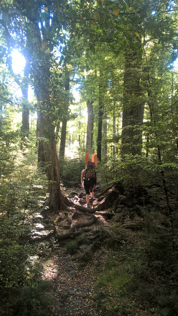
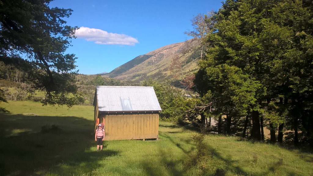
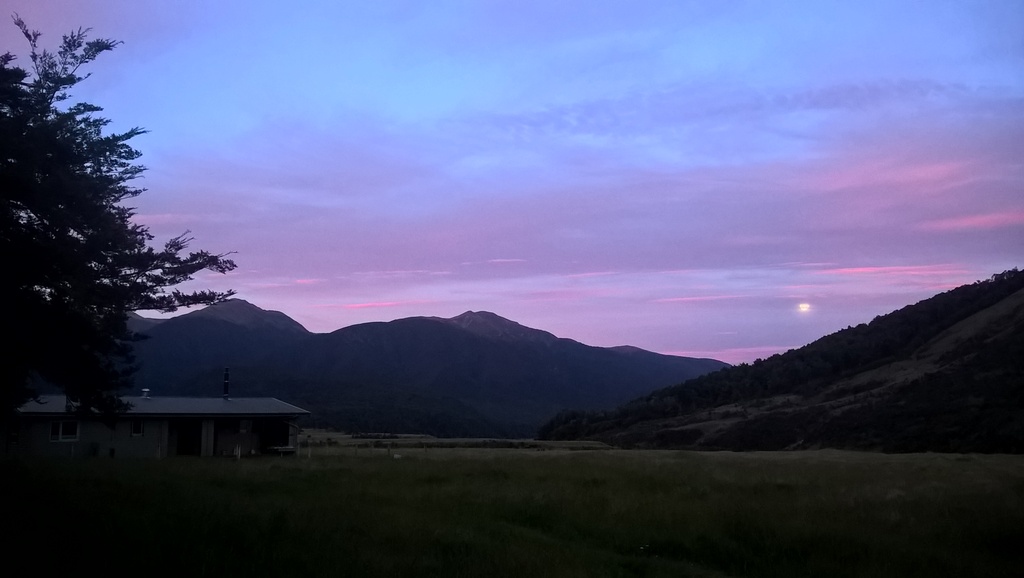
Another lovely river in the Lewis Pass region. An extended but beautiful and straightforward walk in through beech forest and river flats to the comfortable, quaint St Jacob’s hut.
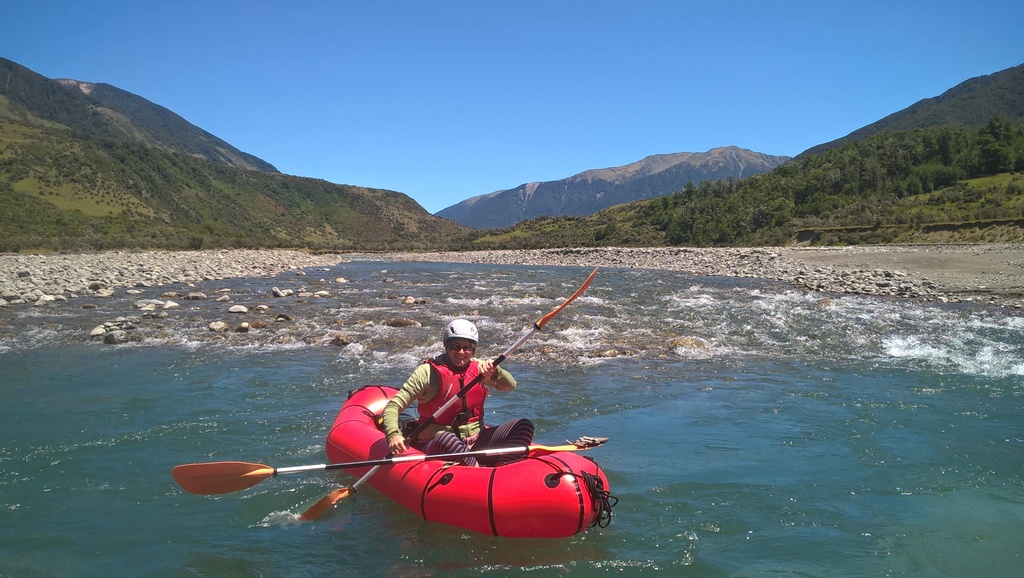
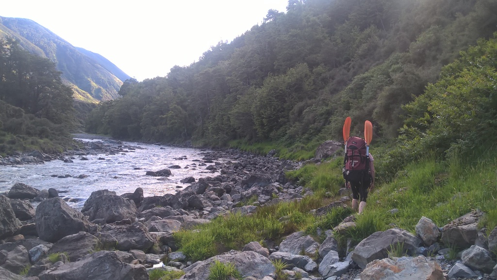
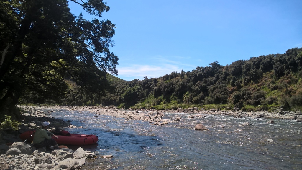
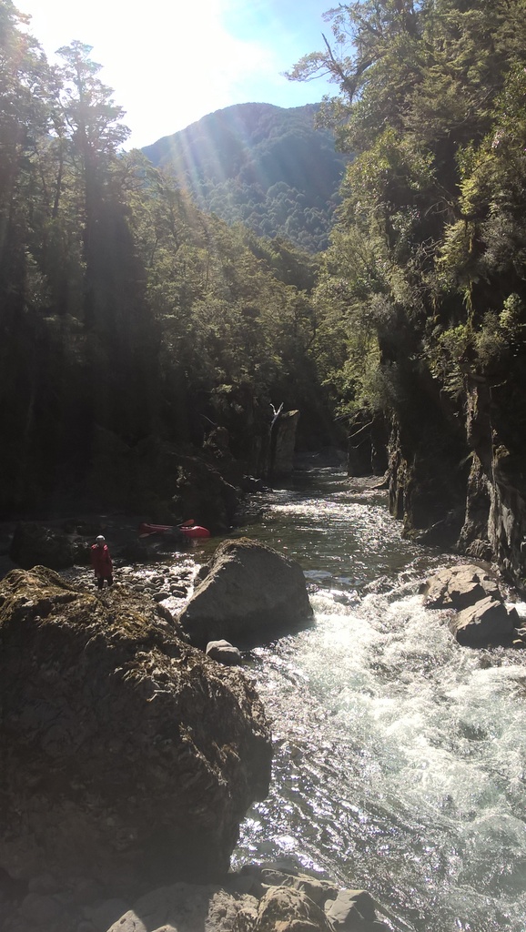
The paddle out down the Hope river is an enjoyable mixture of open river flats with a fun gravel races and some interesting class II+ boulder gardens. The highlight is a short scenic gorge section just prior to the confluence of the Kiwi and Hope rivers.
Thanks to Kate Lord for the photos and information for this trip page.
Shuttle
Depending on where you start and end, a short car shuttle may be helpful. State Highway 7 is narrow and busy; walking down the road or cycling is possible, but isn’t recommended.
Windy Point carpark is the normal starting point, though you could probably park by the Boyle/Hope confluence and begin your trip by walking on a 4WD track up to Windy Point. This has the advantage of finishing the paddling by your car, the disadvantage of an extra hours walk at the stat of the trip.
The obvious roadside take out point is the “Hope Bridge” where the highway crosses the Hope River.
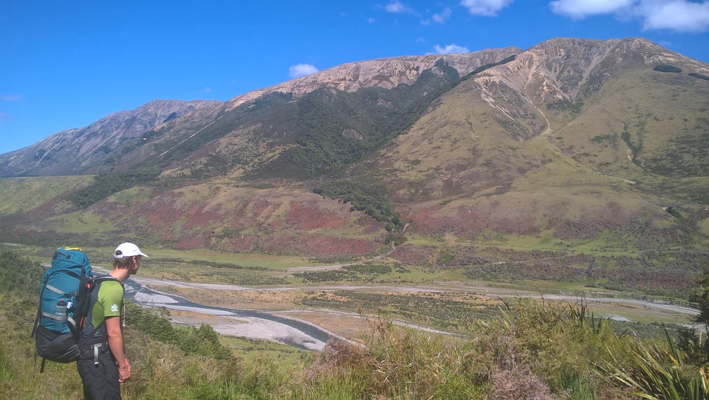
Hope Valley Track: Windy Point to St Jacobs hut 7.5hrs
From Windy Point, follow the well-marked Hope Valley track to the 6 bed St Jacob’s Hut – DOC walking time, 7.5 hours.
If you had a larger group, wanted a more spacious hut, or the river level was low- you could stay at the Hope Kiwi Lodge, walking back out to the river confluence the following day, or put in at the lovely gorge section which begins 15 minute’s walk above the swing bridge by Morris Tarn.
There are a number of other walking options that can be used to access the Hope river including going over the Doubtful range, via Lake Man Biv.
There’s more information about tracks, routes and huts in the area on the Hope Valley page on the DOC website.
Hope River (II/II+) St Jacobs Hut to the highway 4hrs
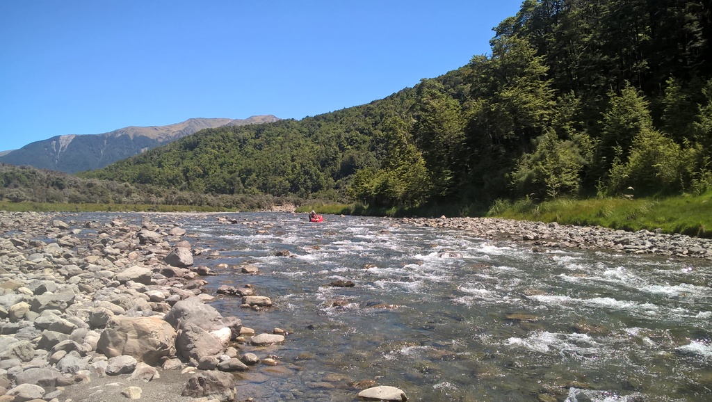
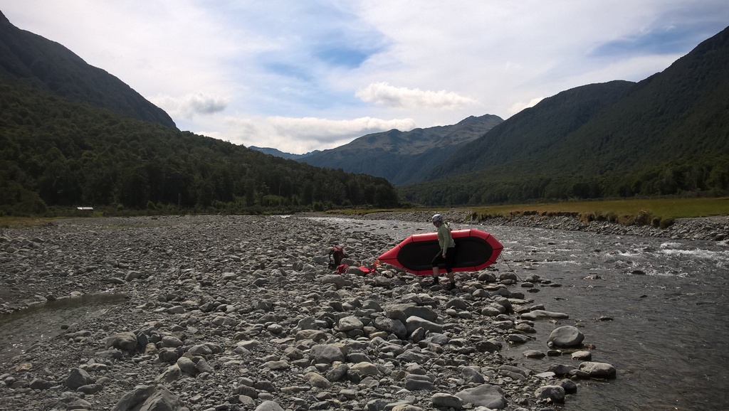
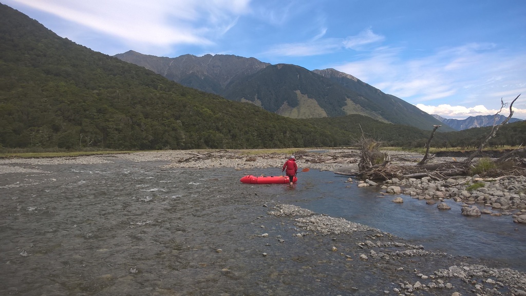
The Hope river from St Jacob’s hut is initially open river flats which in low water may require substantial walking/boat towing.
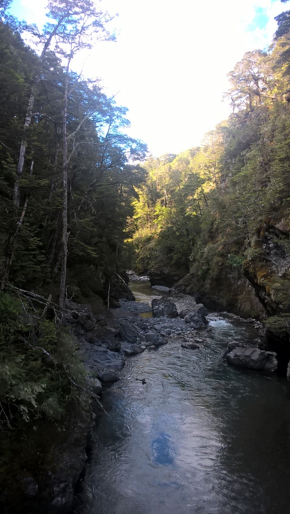
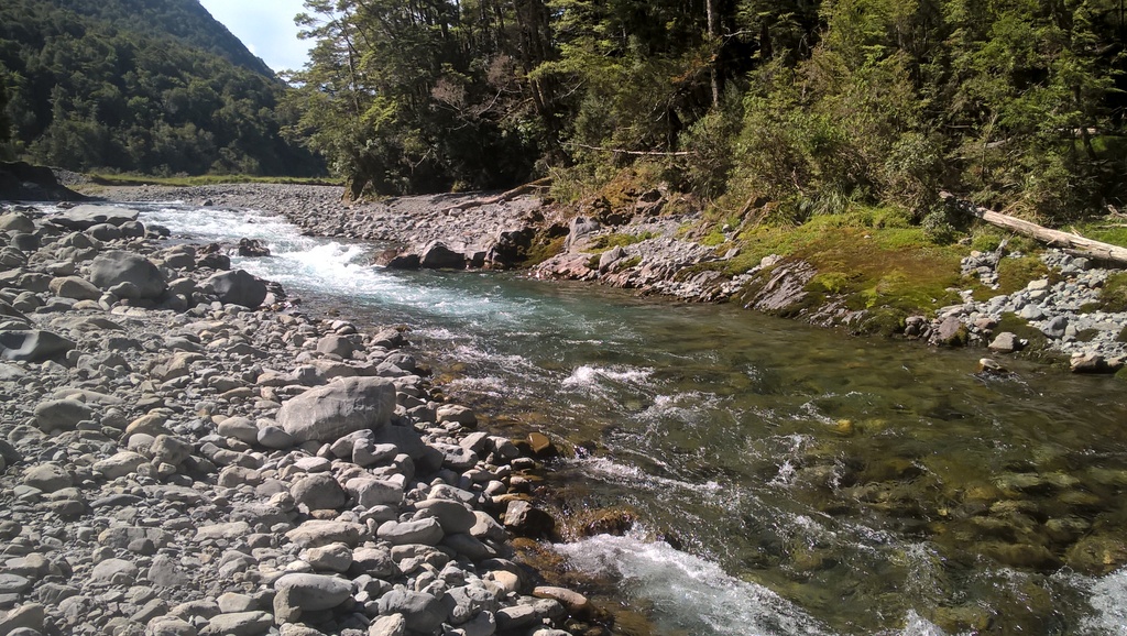
The valley then narrows to an obvious gorge. The gorge consists of class II+ rapids that can be portaged and scouted along the river bank at low water. At high water, the gorge can be scouted or portaged from the main track on the river right, which starts just above the top of the gorge. When you walk In, its worth heading down to the river above the gorge, so that you know how to access the track from the river if you need to portage.
Below the swing bridge where the Kiwi river joins the Hope, the river opens into braids which may require some extended walking in lower flows. At higher levels, there should be some fun wave trains. The river then rejoins above Hope Shelter, but due to gradual gradient remains mostly class I/II with a brief and easily portaged class II+ boulder garden.
Around the Hope/Boyle River confluence, there’s a fair bit of matagouri (a bush with fierce spikes) around, so if you left your car there, you may need to paddle downstream to find a suitable (mostly matagouri free) route to follow for a few hundred meters through to SH7 where your cars are parked.
If your car is at Windy Point, there is also an obvious 4WD track that meets the river just before the confluence on the left-hand side. This goes up to the Windy Point swingbridge and follows the track back to the cars, approximately a 1 hour walk from the river.
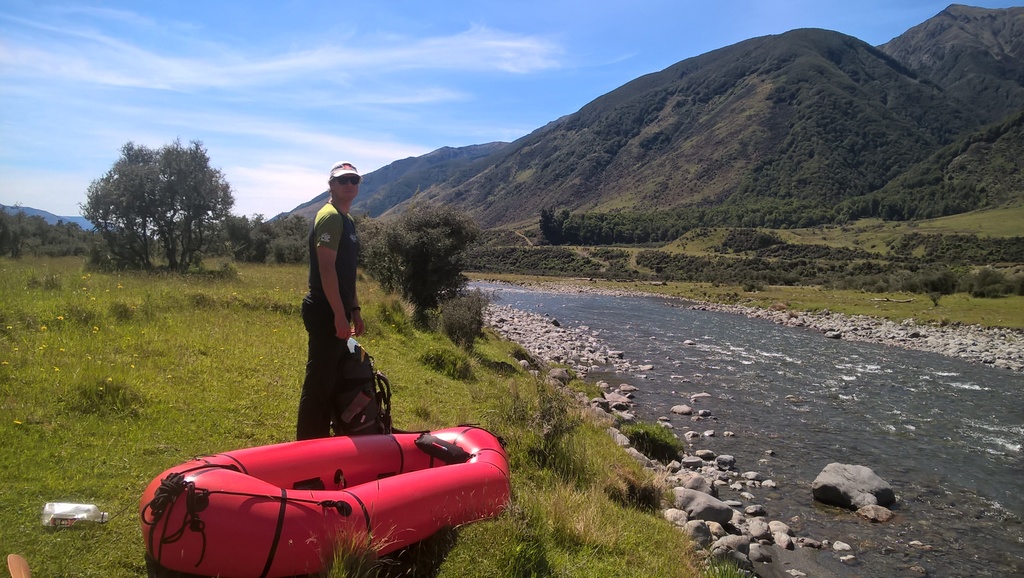
The laziest option is to float down to the Hope Bridge, to your waiting shuttle car.
The trip can be extended down the next section; lower Hope – middle Waiau (I/II) from Hope bridge to Handyside Stream
Although it isn’t particularly close (and is below the confluence with the Boyle), it provides somewhat of an indication. Kate paddled it at 0.5m, which was low but still enjoyable, she wouldn’t recommend any less water.
A lovely trip with perfect flow to avoid any scraping and lively wave trains. Hike in fairly straightforward (I’d say typical for NZ tramping), only a bit of tree fall and washed away track to negotiate. Paddled a short section above the hut on the first day, fairly pushy flow (~1.5 on gauge) so although only grade 2 some risk of losing gear during a swim. Great hut. Flow dropped overnight (~1-0.9 on gauge) to a more comfortable level, still playful but not as pushy. Gorge looked great but a bit quick at the start for an group of only 2 people to risk a swim so we portaged which was easy enough with inflated boats as the track through this bit is an old 4WD route. Water level too high to portage with the gorge itself. Put back in at the kiwi confluence. Great grade 2-2+ from here down to SH7 bridge. Some big waves and concentration needed to avoid some well disguised rocks just under the surface. Nothing high consequence but almost continuous rapids with minimal slower sections between. Fairly easy to hitch a lift back to car at windy point.
Walked up the Doubtful and over Lake Man saddle, with a night in Lake Man Biv. Paddled from the Pussy Stream confluence. Extra water in this river is highly recommended. The gorge above the Kiwi confluence (II) was lovely and would also benefit from extra water. Scraped my way through braids and took out at the SH7 bridge. A steep, continuous gradient makes this a quick run, I averaged about 6km/hr just floating. Great float and nice loop trip, definitely to be done with recent rain!