The Greenstone is a strong intermediate packrafter’s dream. Epic scenery, challenging whitewater and huge potential for creative approaches, the Greenstone has everything you could hope for in a packrafting river.
Located in the Glenorchy area, the river is suitable for paddlers comfortable and capable in grade III/III+ whitewater and can be paddled as a long day trip, an overnighter or as part of a larger mission.
The Greenstone and neighbouring Caples Rivers are both renown for thier trout fishing; a special licence is required to fish here. Fisher-folk generally avoid the gorges and rougher rapids, but if you see them in the river, eddy out and consider portaging quietly around them to avoid disturbing any fish they are trying to catch. A little courtesy will go a long way to ensure everyone gets to enjoy this piece of paradise.
Thanks to Nick Ozard for the information and photos for this page.
View Larger Topographic Map
Approaches
Sandwiched between the Thomson, Alisa and Livingstone mountains, the Milford highway to the west, Lake Wakatipu to the east and the Caples and Mavora valleys to the North and South, the Greenstone’s location lends to it an endless array of approaches limited only by your imagination and creativity.
Before you go, check for alerts about the track and huts on the DOC webpage about the Greenstone and Caples tracks .
Direct hike in
From the Carpark, head up the start of the Caples track and follow signs across the swingbridge and onto the true left of the Greenstone. The track is well defined and clearly marked, you will likely cross trampers on the way who will wonder why you’re carrying paddles and no kayak. There are a couple of spots where the track meets the river where it is possible to put in for a shorter trip.
About 2.5 hours walk will bring you to slip flat.
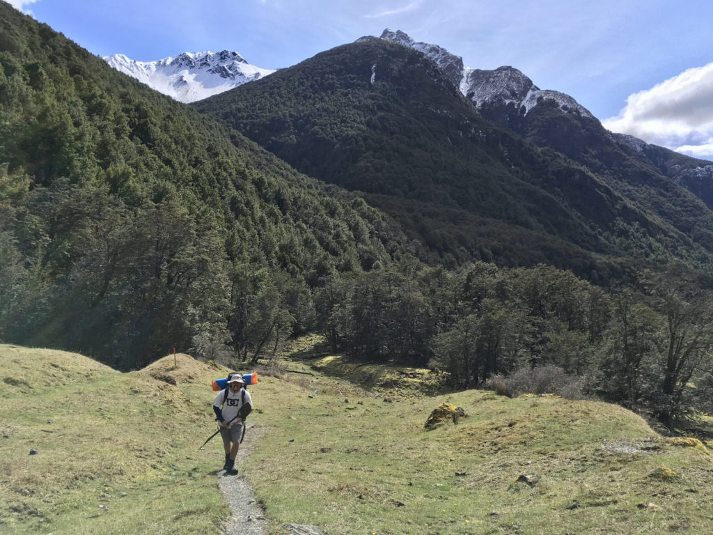
This could be an option for a cosy overnight stay in Slip Flat Hut (3 Bunks) or a put in if you wish to skip the Middle Gorge.
Another hours walk will bring you to the bridge over the Gorge that leads to Greenstone hut (20 Bunks), a more spacious option for an overnighter and a short walk from the Middle Gorge put in.
To put in upstream of the Middle Gorge from Greenstone hut, head towards the southern end of the clearing in which the hut stands, aim for the the sign marking the Mavora Walkway track. To the right of the sign, across the boggy patch, is an unmarked but well-trod track (see photo) leading down to the river.
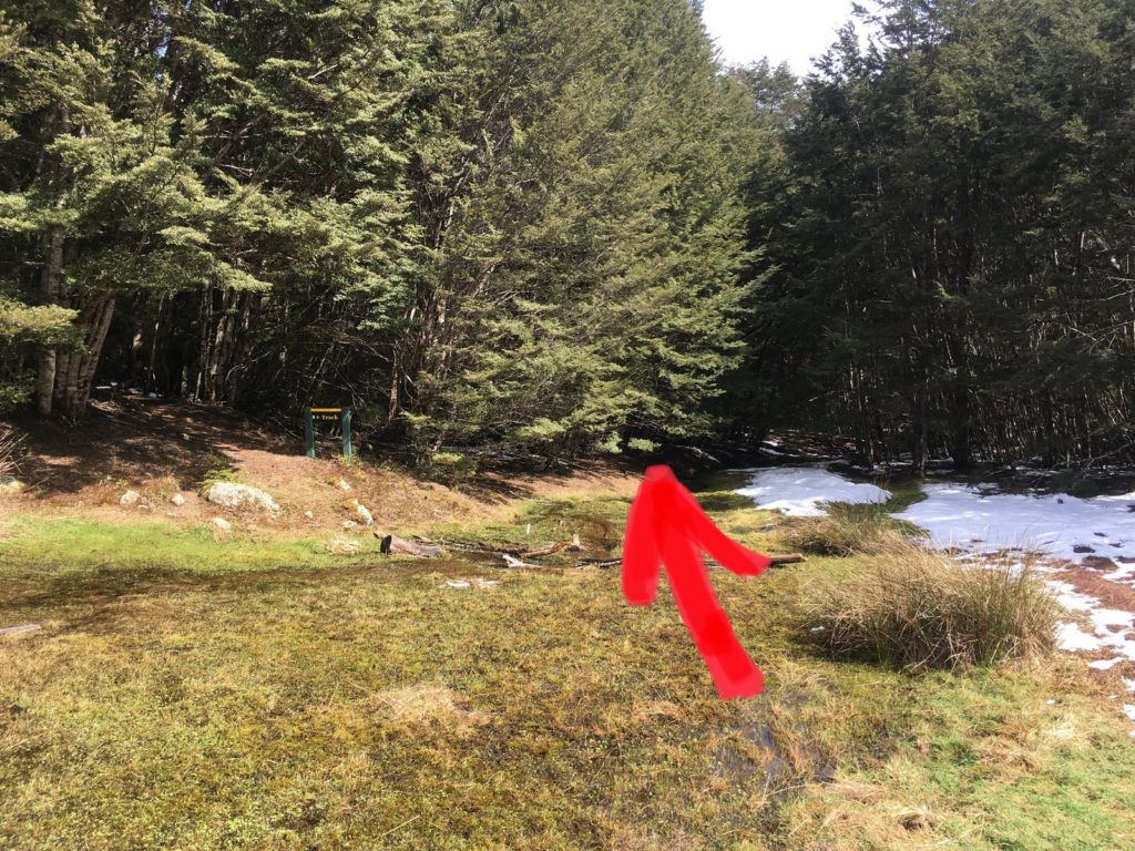
If you plan to head further up the valley or wish to put in for the Middle Gorge on the true left, ignore the turnoff for the bridge and proceed up valley.
Another hour and a half will bring you to the bottom of the Upper Gorge where a short bush bash will take you down to the river.
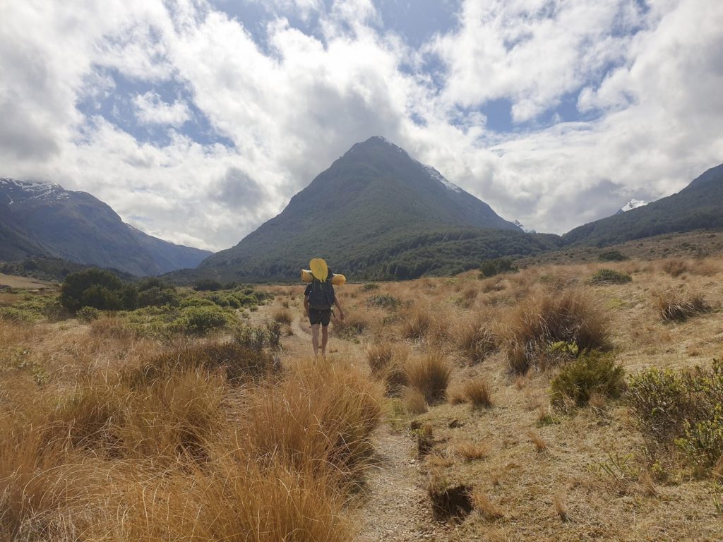
Upper Greenstone: Lake McKellar to Upper Gorge
As of yet unpaddled by the author. From browsing google earth it appears that from the outlet at Lake McKellar to just downstream of Rat’s Nest Hut the river is flat and slow. Below Rat’s Nest Hut there is a stretch of rapids but it is likely, judging by the river below the Upper Gorge, that these would need some rainfall to bring out the best in them, which would probably mean the rest of the river would be high, or in flood.
Upper Gorge
The Upper Gorge appears to be unnavigable. Scouting from above and by paddling up the gorge from downstream we found some pretty gnarly sieves caused by large boulders in the lower end of the canyon making it a bit of a no go in a packraft.
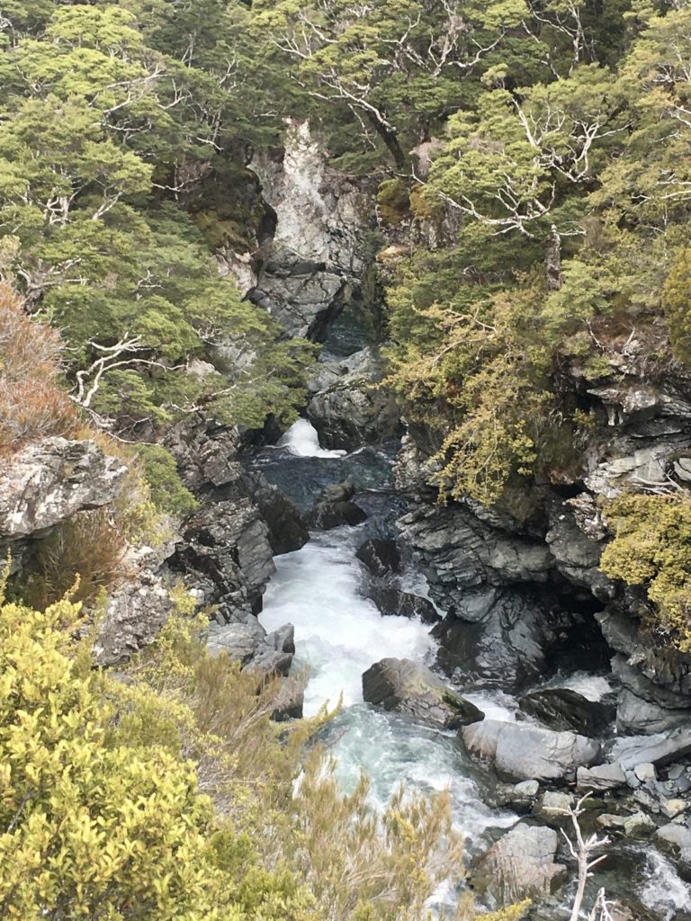
Between the Upper Gorge and Middle Gorge (I/II) ~1 hour
Immediately below the gorge is an easy grade II boulder garden which quickly gives way to braided flat paddling with the odd wave train. The river continues for about an hour cruising through some epic scenery until the valley begins to narrow as you approach the middle gorge.
If you want to portage the middle gorge you have two options, you can either take out on the true left before the track climbs into the trees or on the true right before the entry rapids and make your way along an unmarked track beside the river up to greenstone hut.
Middle Gorge to Slip Flat (III+/IV P) ~1 hr
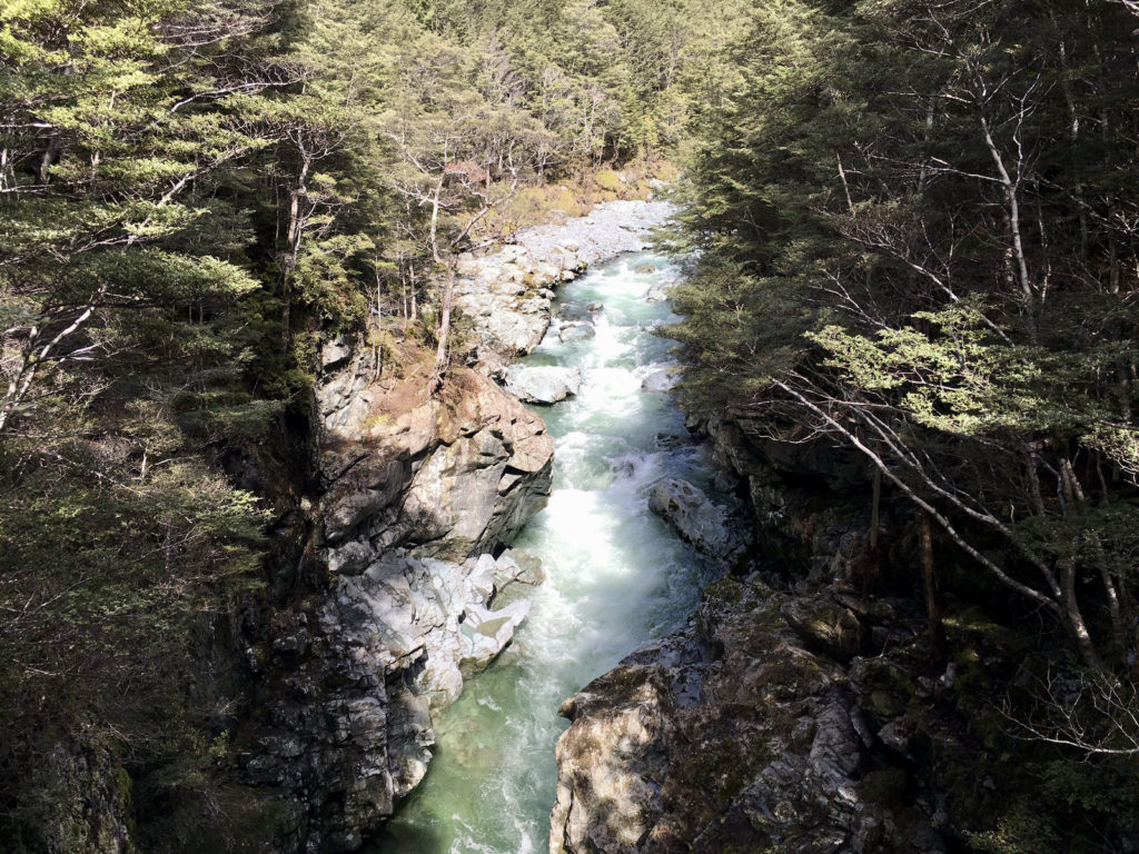
The middle gorge is a very committing and technical stretch of the river and good scouting, river running, rescue skills and a solid understanding of river features are essential to navigate it safely. If you are unsure it is best to portage this section, as there are few, if any, safe escape routes.
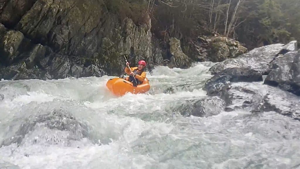
There is thick forest above the gorge; which means trees can easily find their way in, potentially causing dangerous strainers: be very very aware of this hazard, and always have an eddy in sight before running each pitch.
As the river approaches the middle gorge, it narrows and grows steeper. A set of fast and pushy drops leads up to the slot canyon beneath the bridge, look out for undercuts here.
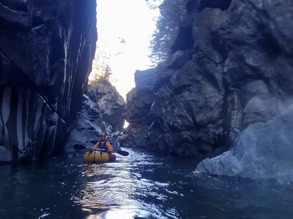
Some maneuvering to get through a tight squeeze is required in the canyon but the water is slower than the approach so it is not too difficult. Past the bridge the river leads into a series of drops followed by deep pools and then a boulder garden.
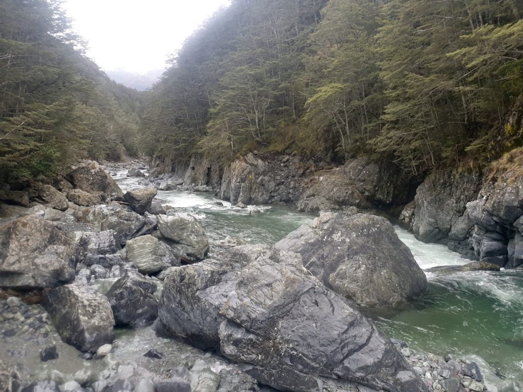
There is one compulsory portage halfway down the boulder garden where the river drops between tightly stacked rocks which would easily pin a raft or a paddler.
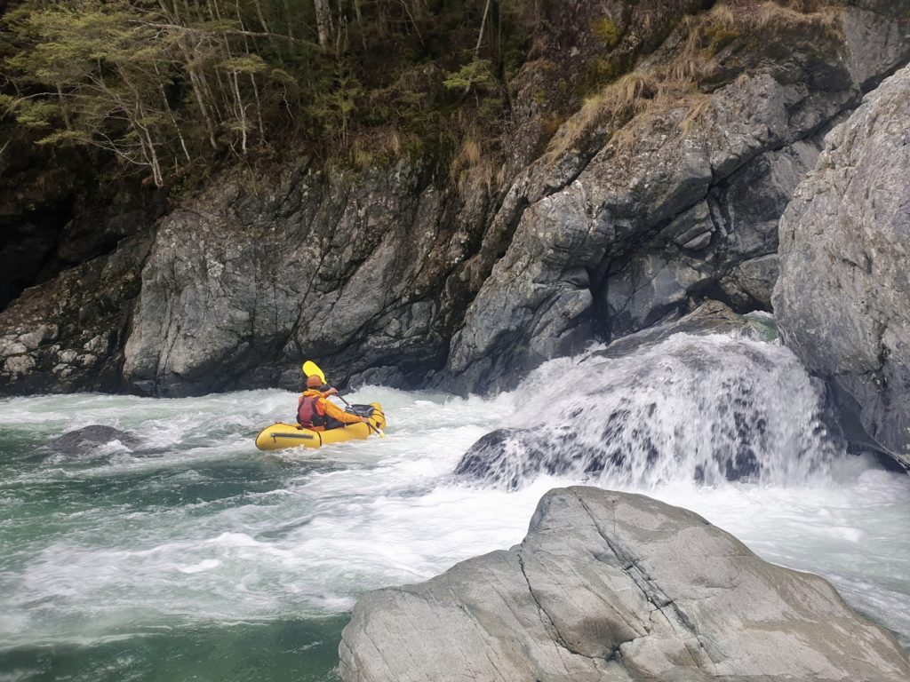
This section is grade III/III+ with one or two hazards pushing towards Grade IV. Scout at every horizon line and set safety where it is necessary. Beneath the boulder garden the gorge gradually eases into grade II rapids. It gradually grows shallower as it widens out onto Slip Flat.
Slip Flat to Lower Gorge to Greenstone Carpark- Grade (II/III/III+) ~2 hrs
At Slip Flat the river is wide and shallow with a small wave train along river right. Immediately below slip flat the river drops into a Grade III rapid, make a move between large boulders.
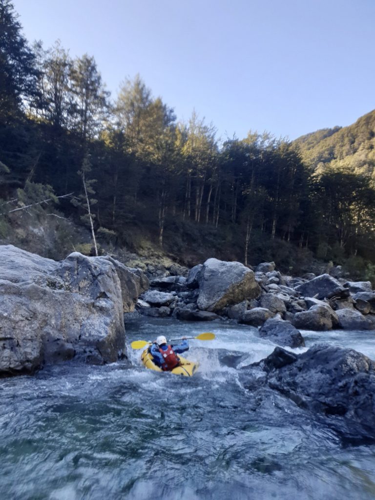
The river turns to the north and enters a long continuous grade III boulder garden. You must pick your line carefully here to avoid getting stuck on rocks.
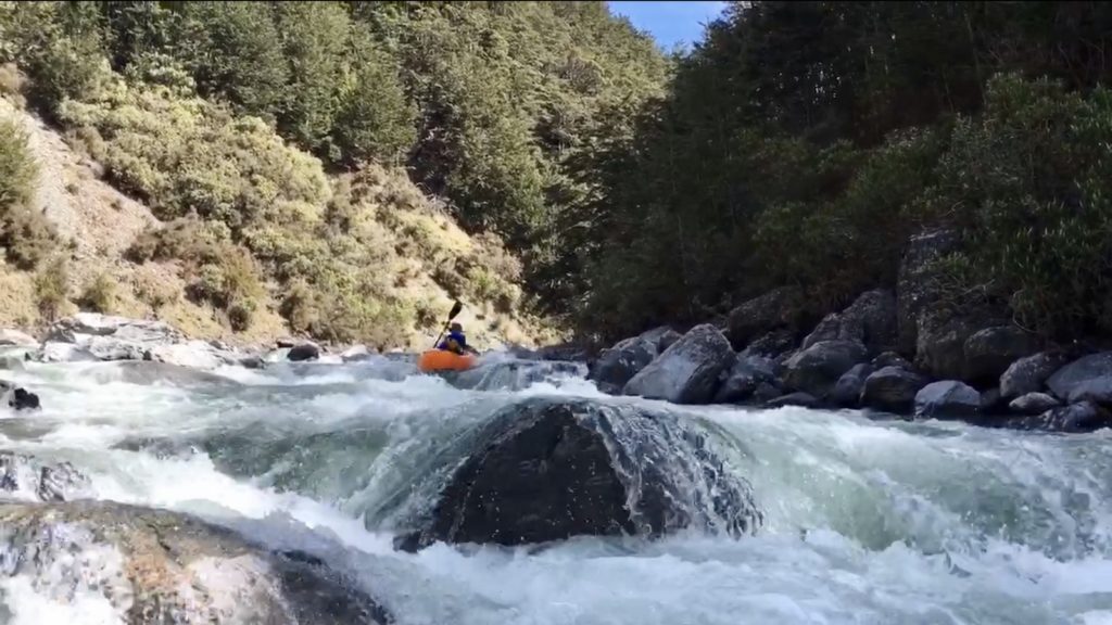
The river then eases once again into grade II with the occasional grade III feature. Eventually the river passes through a section of dead beech forest caused by a changing of the rivers course some time in the past. Look out for strainers through this section.
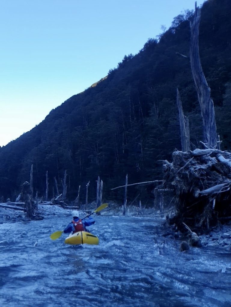
Past The Haunted Forest the river flows beneath the bridge of the Lake Rere track and then drops into a long steep grade III+ boulder garden ‘Every Dog Has It’s Day’ caused by a large slip on the true right. Those wishing to portage this rapid might consider using the Lake Rere Track to rejoin the main track and putting back in on the flats downstream of the Lower Gorge. Below ‘Every Dog Has It’s Day’ the river flows into the lower gorge where a deep pool is formed. Continuous grade II with occasional Grade III/III+ rapids follow from this point until the river flows out into the Caples valley.
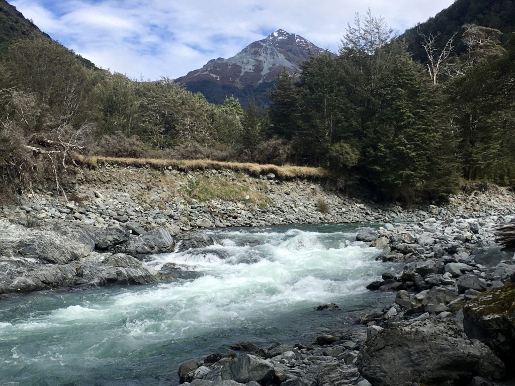
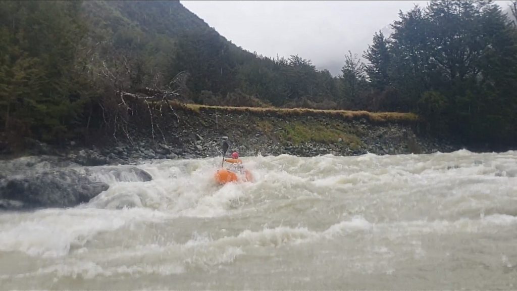
The river flows between large boulders before dropping steeply through two shallow rocky channels as it joins the Caples, take the channel on river right. At lower flows there is a risk of getting a boat pinned here if you were to get stuck on a rock, so pick a line carefully or consider a portage.
From the confluence the Caples is grade II+ until the take out. See the trip page for the Caples River.
Gauge
There are two gauges that you need to check for this run.
Dart River at Hillocks (Is it worth driving over?) + visual at the lower Caples swingbridge (go/no-go)
As with the Caples, the flow for the Greenstone can be approximated by looking at the Dart flow at the hillocks. This trip description refers to Dart flows between 50-100 cumecs. Nearer to 100 is preferable for the Greenstone as the bonier sections are a bit more filled in and there are smoother lines to be had through many of the rapids.
Remember: the Dart gauge is a different river, which is glacially fed (unlike the Caples/Greenstone) so it will behave differently to rain events..
A visual gauge of the flow should also be taken by looking at the water level on the rock beneath the stock bridge, right at the start of the Caples track (see photos below; )
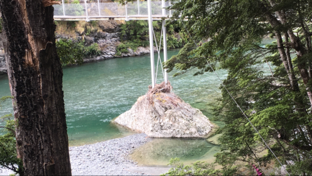
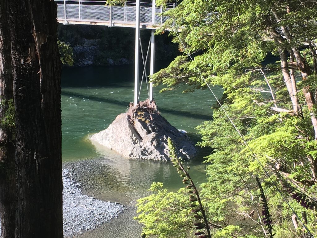
These shots were taken in 2020: the aim is to see the water level on the bedrock boulder, rather than look at the way the gravel beds are covered or not. (remember, gravel moves in floods, bedrock tends not to..)
The ‘low and bony but still paddleable’ shot will involve a bit of scraping and more portaging, but is a better flow for your first run.
The ‘ideal level’ means the lines on some of the rockier rapids are smoothed out beautifully. There is enough water at this flow for the line which is often portage in the middle gorge to be run. Catch the eddy immediately above the first drop then paddle hard to get on the left line over the second.
Higher flows: On one trip we ran the river from Slip Flat to the takeout after 12 hours of rain. With the Dart Gauge reading 300 cumecs and rising, the speed and power of the river increase significantly. Grade IV wave trains and holes dominate the channel and powerful eddy lines and boils appear in places that are calm water at normal flows. The river should only be run at higher flows by parties suitably equipped, experienced and capable of running continuous grade IV and should not be taken lightly.
Thanks to Brian Moore for the initial information and Tomas Whelan Henderson and Laney Johnston for coming on the scouting missions.


Liz and I paddled from Middle gorge out. The water level was low (similar to the picture at the bridge on this description) and we had to use all our NSW packrafting skills on some sections. The trip description is very good reflection of the river. The gorge is impressive.
Was pretty darn bony at 20 cumecs: we had to portage a few rapids in the gorge sections which would go with more water, plus we were scraping lots in the braided/flat sections (with more than a bit of boat-walking).
However, the trip was still really enjoyable, and it was great to see the gorges in low flow first. A previous trip by one of the guys was at 40 cumecs on the Dart gauge, and he reckoned that was about optimal low flow (no scraping/minimal portaging).
Years ago (2006) I ran the entire Greenstone from Lake Mckeller to the Caples Confluence in a packraft with my twin brother. This included the upper gorge, which i don’t really remember, and the middle gorge, which i definitely do. The latter had at least one 2+ meter waterfall at the time, through a narrow pinch of rock with a chockstone above. I’d come out of my boat and my boat got wedged between the rocks below the chockstone, I hung on and punched/squeezed the sides of my boat so it popped through with me. Yikes.
Two years ago we used the Upper Greenstone as part of a ‘low budget’ adventure race type event (WTF #2). There was torrential rain leading in and the river was heavily swollen, with heaps of water coming out of lake Mckellar, and many exciting GIII mini-gorges. We all bailed and portaged near the top of the upper gorge as it looked insane and we were in doubles. Anyway, it was exciting.
All in all an epic river with heaps of good paddling for those with the right skills.
Super sweet run.
Well worth a trip with the right level!
We walked in as the dart dropped from 100. Paddle out the next morning after staying at greenstone. Could have done with abit more water but everything was still good apart from the portage in the middle gorge. Dart was at 60 when we drove out.