


Cromel Stream overview
The Cromel Stream is a straightforward grade II/III run in the Southern Eyre Mountains/Taka Ra Haka Conservation Park. There are easy and moderate options for the approach both ending at a cosy hut. Combined with a upper creeking section (III) and lower braids and rapids section (II) there are several ways you can enjoy a weekend mission or long day trip.
Thanks to Sam West for the words & images, plus Blake Hornblow for additional pictures.
View Larger Topographic Map
Permission
There is private farmland in the lower reaches of the Cromel Stream, and permission is needed from the landowner to do this trip.
You will need permission to continue past the end of Selbie road, following a farm track, to reach the Cromel Bridge, which is the start/take out point. From here, you will be walking on private land for about 2.5 kilometers before reaching the boundary of public conservation land.
Normal country-code rules apply: Ask for permission courteously, respect any closures or restrictions, leave gates as you find them and leave dogs & guns at home. If permission is refused, be polite, because your actions will influence the landowners willingness to grant permission to packrafters in the future!
To request permission, contact the landowner the day prior to your trip, so the farmer knows the current farm operations/stock movements when considering your request for access. (Craig Drummond, 0274347121).
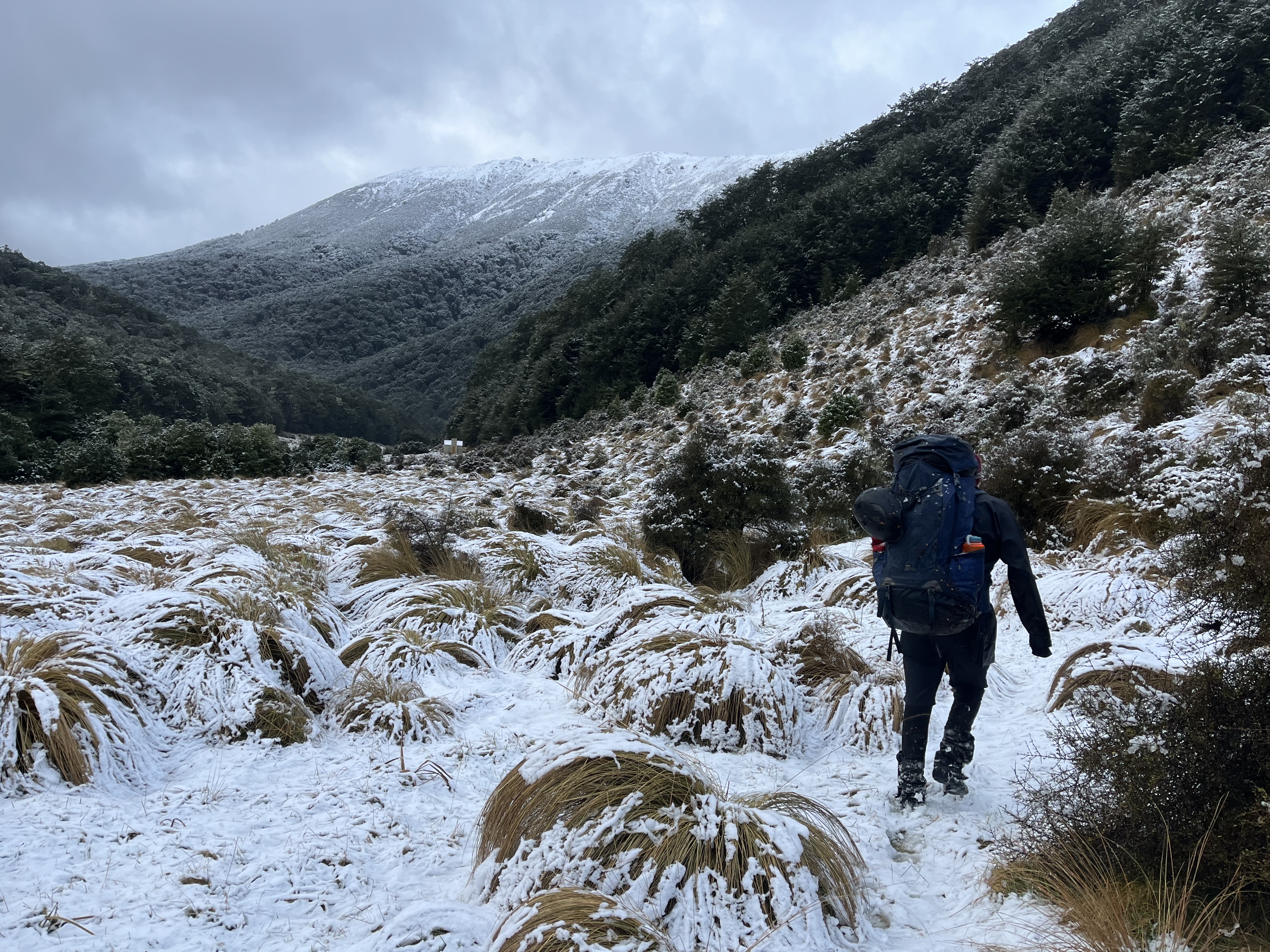
Approach on foot ~5-9hrs
After parking by the Cromel Bridge at the end of Selbie Road, follow the 4WD track up to Cromel Base Hut (1hr). The track follows close to the river for a while, which gives you a chance to check out the flows and look for trees and other hazards in the lower section.
The longer, harder and higher option. Beyond Cromel Base Hut, an old route, marked on some maps, heads up to the Mt Bee Bunkroom. This route continues north along the open tops, then into the bush by Irthing Stream. From there, you could stay at Irthing Hut if you wanted a longer second day, or continue south to Cromel Branch Hut. Do your own homework on this longer, more expose and challenging route before setting out.
The shorter, easier and lower route option. From Cromel Base hut continue up the track in the Cromel valley, up and over a bushy ridge to Cromel Branch Hut (another 4 hrs). At the time of writing the track was good, with only minimal windfall. Cromel Branch hut is a cosy 4 bunker with a good supply of dry wood, and plenty of flat ground for camping.
The put-in is a quick 10 minute walk from the front door, again following the track.
Cromel Stream gorge (III) ~1.5hrs
This grade III section has a low-volume creeking character, with a fun mix of clean drops, narrow chutes and small rock gardens. This section is tight, with fewer eddies and forest on both sides.
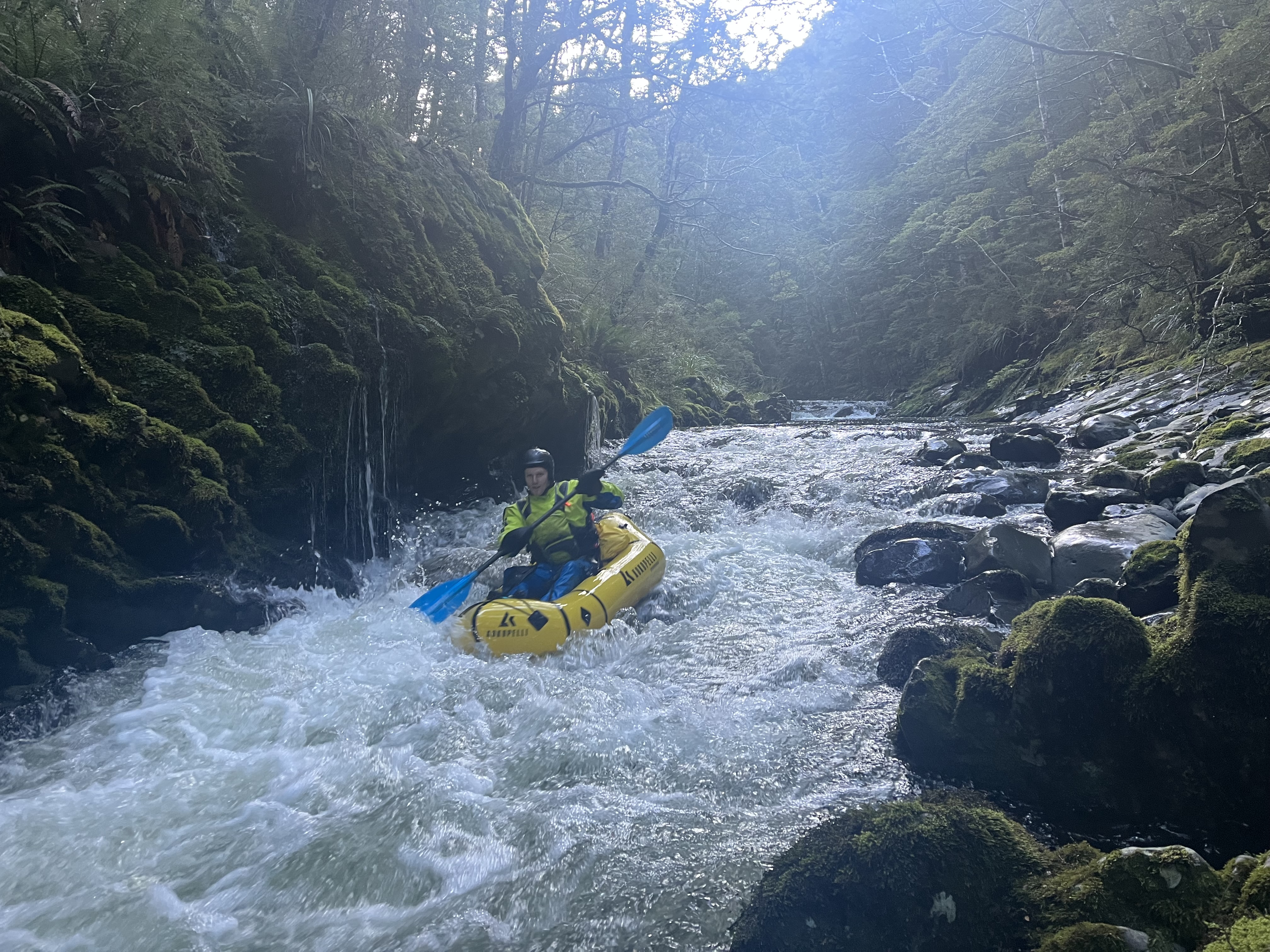
Grade III here equals micro-eddy catching skills. When there’s enough water to paddle, sections like this feel reasonably fast and continuous. Eddies can be very small and infrequent. Being able to very quickly catch a micro-eddy is a vital survival skill, as hazards like trees can appear ‘out of nowhere’ leaving you very very little time to avoid them or catch an eddy.
Most rapids can be boat-scouted, and at the time of writing, only one river-level portage was necessary around a drop with a tree wedged in the pool below. Any other portages would generally be easy at river level or in the bush. After roughly an hour and a half of paddling (to approx 1km above where the track crosses the river), the gradient eases off and the channel widens.
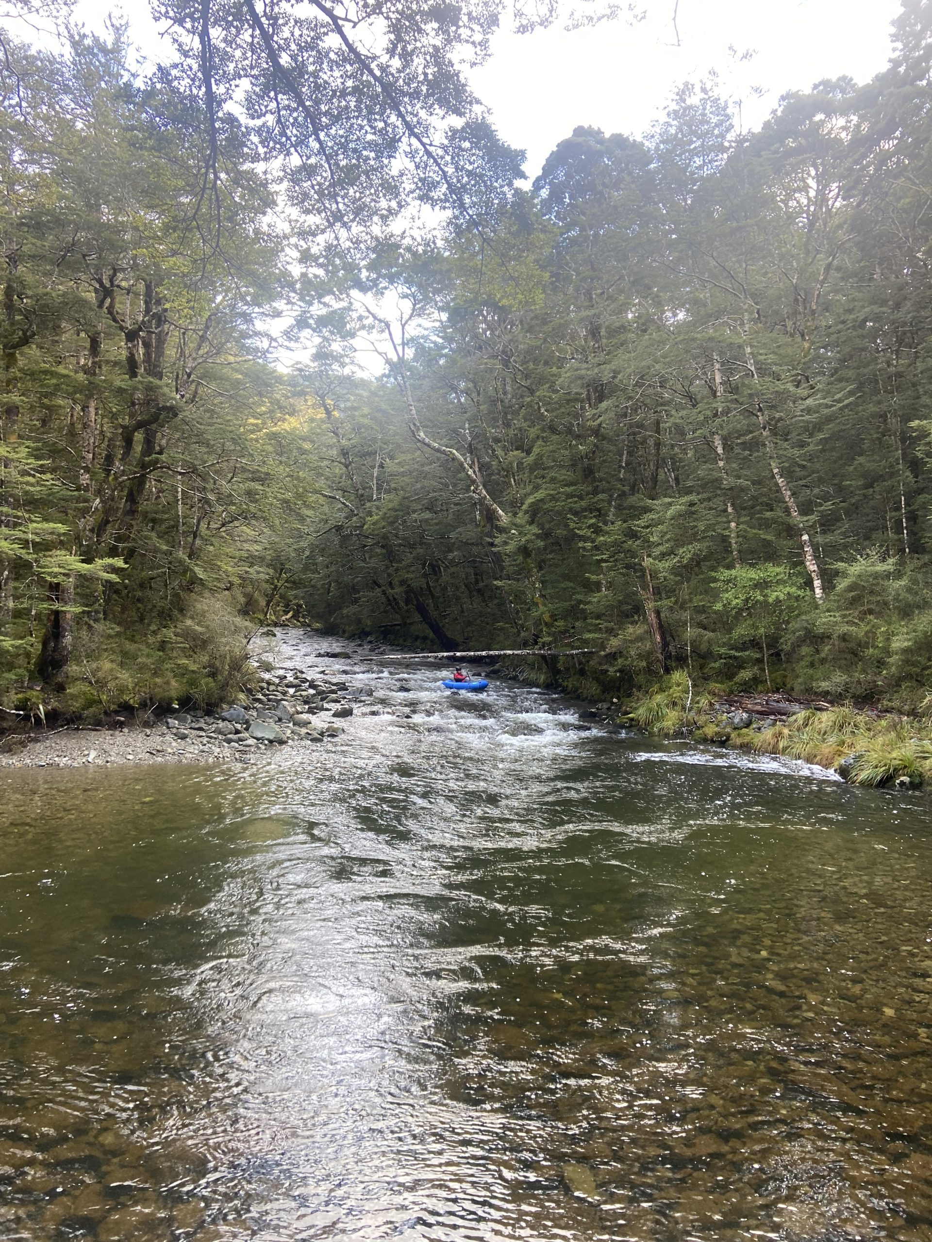
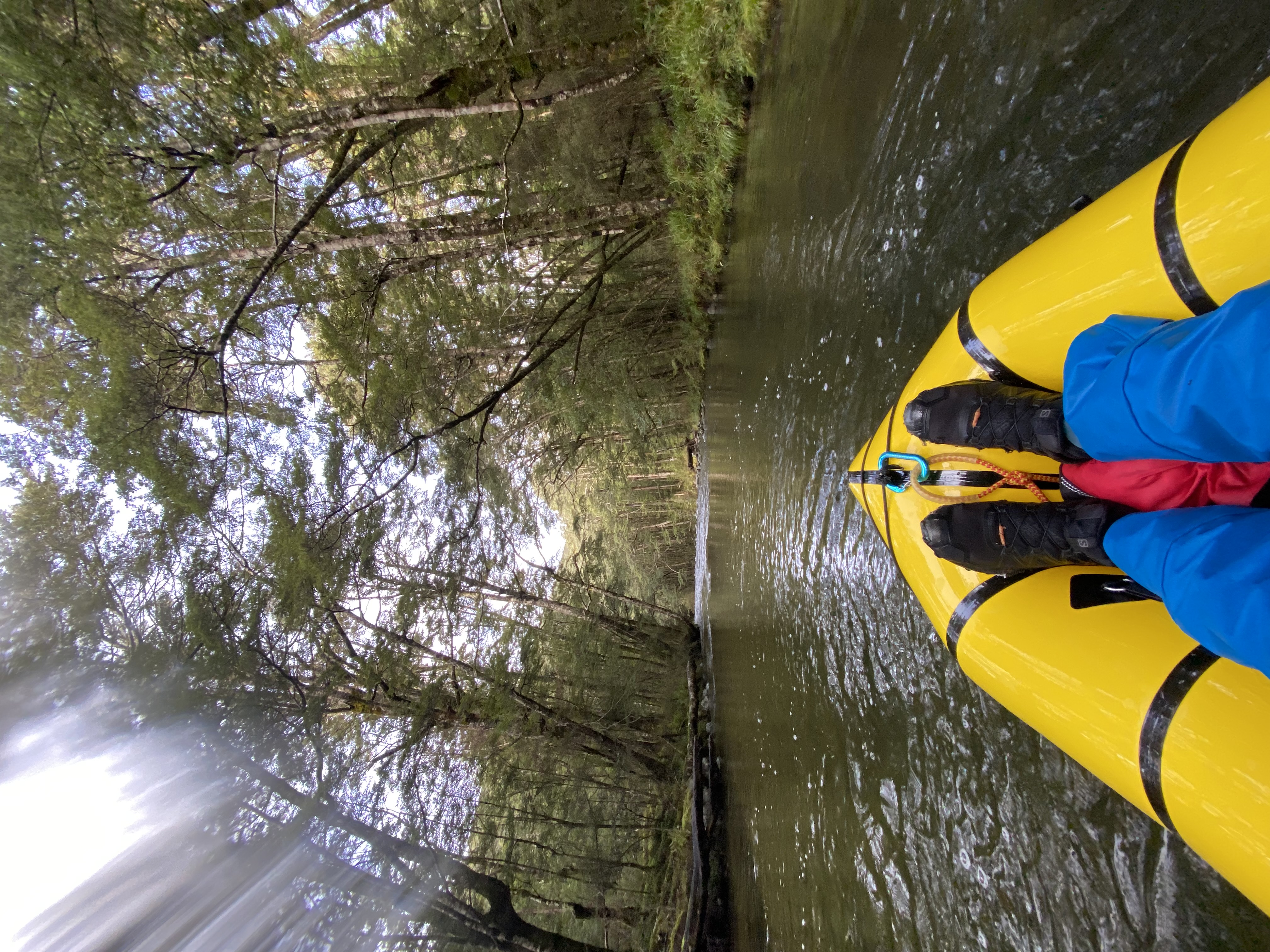
Cromel Stream lower section (II) ~3.5hrs
The Cromel is a river of two halves. Below the track crossing, the lower section opens to straightforward grade II rapids and braids.
The crux of this section is unfortunately woody in nature. Expect everything from the occasional submerged stick to full on river wide beaver-spec log jams.
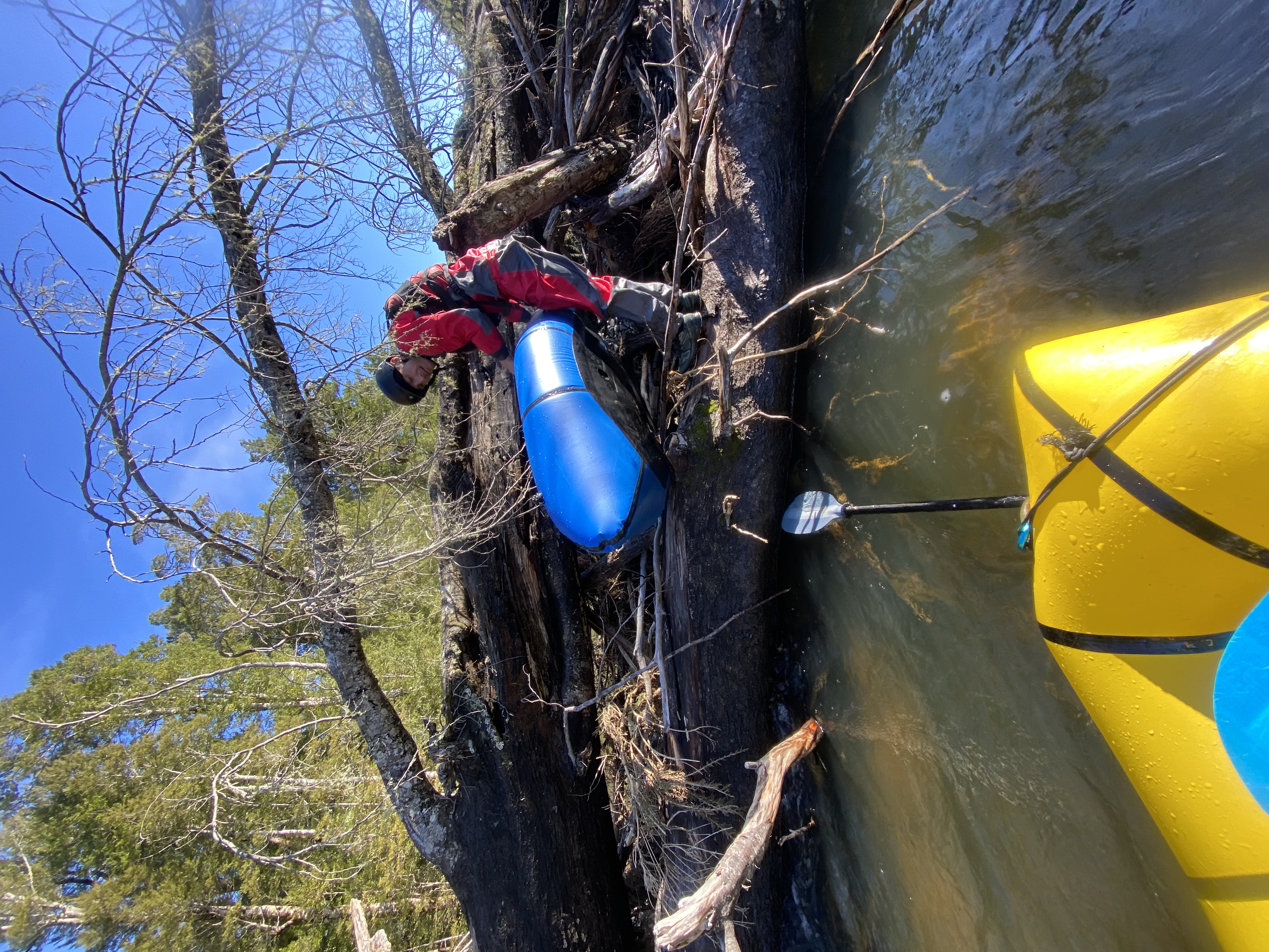
Don’t let this deter you however, as the trees are obvious and river slow moving. Portages were generally quick and easy. Take out at the Selbie Road bridge where you parked.
Gauge and flows
Similar to the Windley, a good indicator for the Cromel would be the Oreti River at Three Kings gauge. (Find the guage from the dropdown menus on the Environment Southland site. )
Sam and Blake had this to say about their trip;
We walked in during a howling June southerly, with the gauge reading 17 cumecs. Anything less than this would likely be on the manky side of good. Slightly more water would smooth the braids out, and in higher flows, rapids in the gorge section and trees in the lower section would come at you a bit faster.
Don’t be put off if the river looks very low as you drive over the SH97 Cromel River bridge – a geological quirk sees roughly half of the flow seep underground not far from the takeout to join the Acton Stream.
Upper gorge is fantastic – incredible paddling and one we will certainly return to.
Everything in the gorge ran at the flow we had, but a little more would make it even better. As the river flattens out / widens after the gorge it got pretty scrappy in places.
Lower section of river is completely choked with tree/flood debris that I doubt will ever be cleared, so plan to walk out from where the track crosses the stream.