


Overview
The Anatoki is another Golden Bay classic, with a middle and lower section that suits advanced packrafters, at medium to low flows. It is usually packrafted as a long-ish day trip, but there are pleasant camping options at the put in.
It is the ‘little brother’ to the nearby Waingaro River: the Anatoki has a similar character and catchment size, in a shorter round-trip.
Thank you to Martin Wilson and Tom Jerram for info and pictures, plus Deane Parker for peer-review.
Other sections of the river
The full Anatoki is well-known by kayakers as a long, hard paddle. They usually fly in by helicopter to Anatoki hut, then spend 1 very long day (or two long days) paddling out. The upper section between Anatoki Hut and Anatoki bend is solid grade V, and is described in the Whitewater NZ Riverguide. The section described below has become a classic ‘walk-in’ kayaking trip.
The Anatoki float is a grade I/II that is paddleable in all but the lowest flows. The most straightforward put-on is at the same swimming hole which is the take-out for the grade IV trip described below. The river continues as pleasant grade I/II all the way to the ‘One Spec Rd’ bridge near the confluence with the Takaka River. A great roadside run for newer paddlers.
View Larger Topographic Map
Preparation: hit the right flow
Because the river is quite steep and bouldery, it is extremely flow dependant. A bit too much water and it is continous serious rapids. A bit less water and it becomes a walk & portage fest. Watch the gauge and the rain forecasts and plan accordingly.
Indicative grades here only relate to the middle section described on this page (Above Anatoki Bend is a whole different trip…)
The gauge is Anatoki at Happy Sams
<6 cumecs Probably don’t bother, unless you prefer carrying your boat to paddling it.
6-8 cumecs (IV- with portages) Not quite enough water for all the runnable features, so expect to do a fair bit of portaging, especially in the first half of the middle gorge. The lower half of the middle gorge is mostly runnable by packrafters at this flow.
8-10 cumecs (IV) This is when the kayakers start to say the run is on. Enough water to make many of the features runnable, but proper grade IV creeking with consequences.
10-20 cumecs (IV+) At 20 cumecs, Tom Jerram’s team described “Proper grade IV; moderately pushy for the grade, and swimming ill-advised in places.”
Shuttle
The classic packrafting trip ends at a local swimming hole, about 500m past Anatoki Salmon Farm (serves chips & beer!) on McCallum Rd.
There is a fence which guides walkers from the road to the river. This corridor is public walking access, as an ‘unformed legal road’ . See the exact tenure on the Nga Herenga a Nuku / Walking Access Commission map site.
It is worth walking down to the take out, so you know what it looks like from the river!
It is 10km around to the start of the Anatoki Track. Along the road it only gains ~140m so it is a straightforward 20-30minute bike shuttle if you want.
Approach on foot
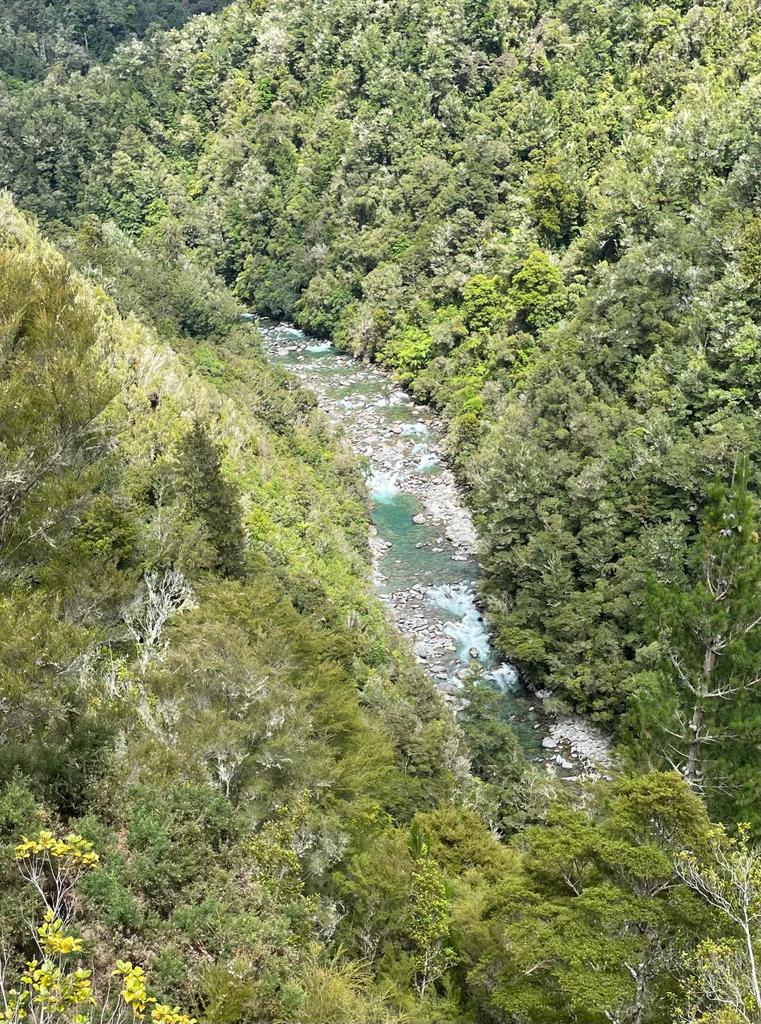
It is about 3hrs (9km) along the Anatoki Track from the car park to Anatoki Bend. Along the way, there’s a few spots where you can see the river and catch a glimpse of what lies in store.
At Anatoki Bend there’s a few nice camping spots, if you want to run this as an overnighter.
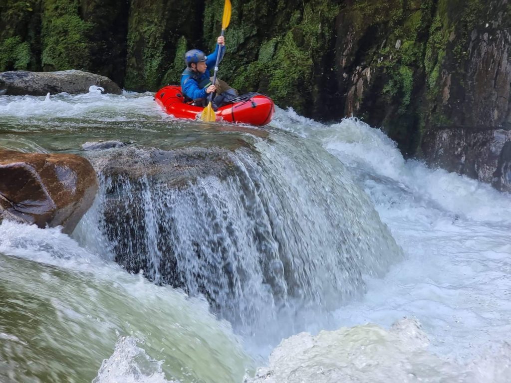
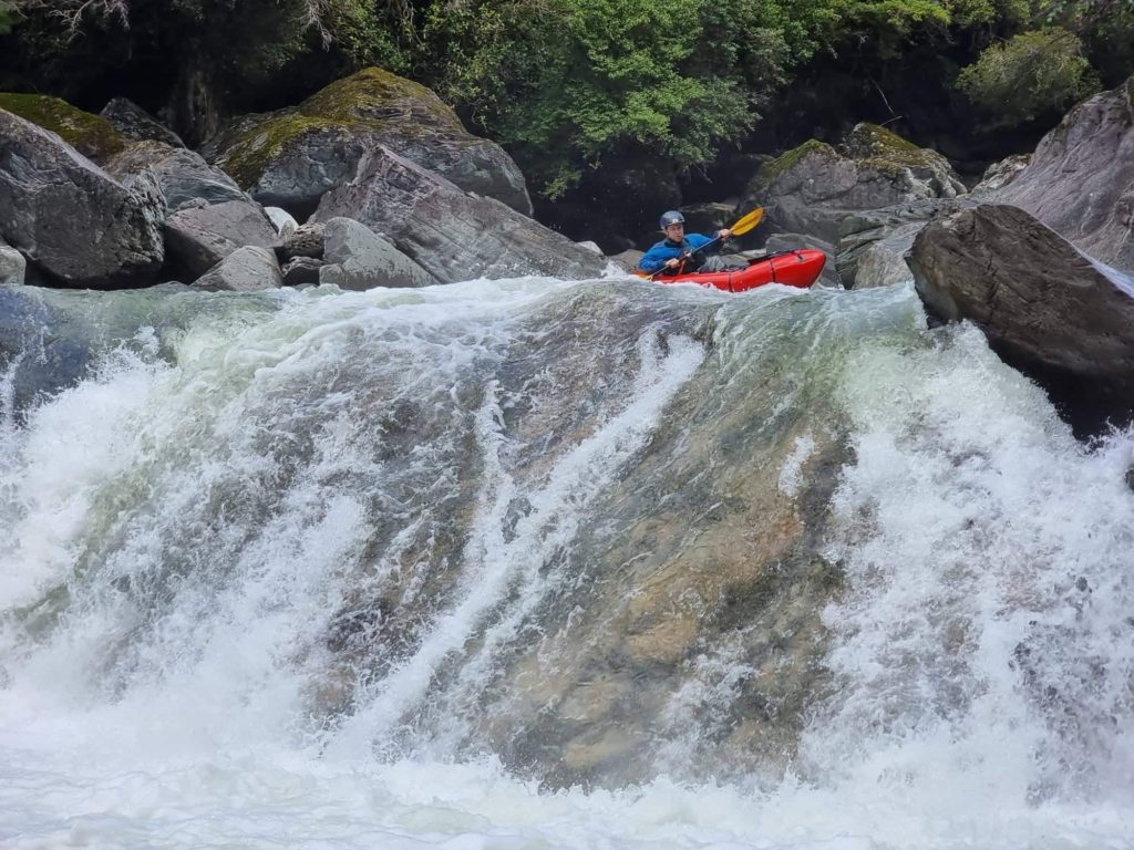
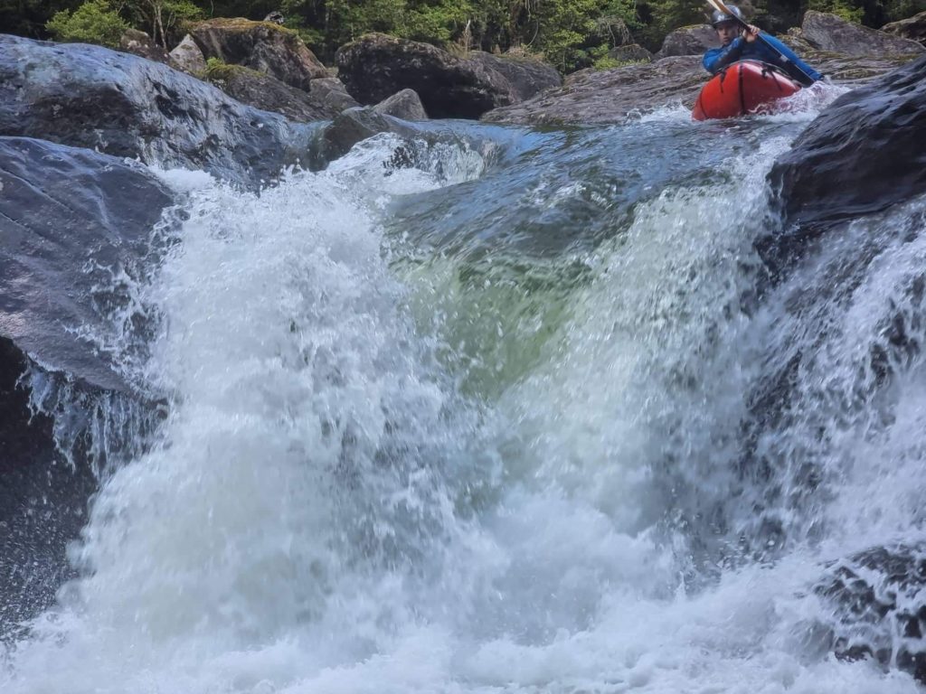
Bonus drops (IV+) just above the bend.
Tom Jerram’s team walked a few hundred meters further upstream of the bend, then bushbashed down for some bonus drops.
They enjoyed “3 clean runnable drops (2 of them quite sizeable) with must-make eddies afterwards and then some challenging portaging in between. Well worth the extra walk if that’s your kind of thing”
The photos below are of the bonus drops. It was 20 cumecs when they began walking, 16 cumecs when they got back to their car after the trip…
Packrafting the Anatoki below the bend (IV)
- River distance: About 10km from Anatoki Bend to the Salmon Farm.
- Indicative times: Martin Wilson’s team took 4 hours at 8.5 cumecs. Tom Jerram’s team took about 3 hours at 20 cumecs.
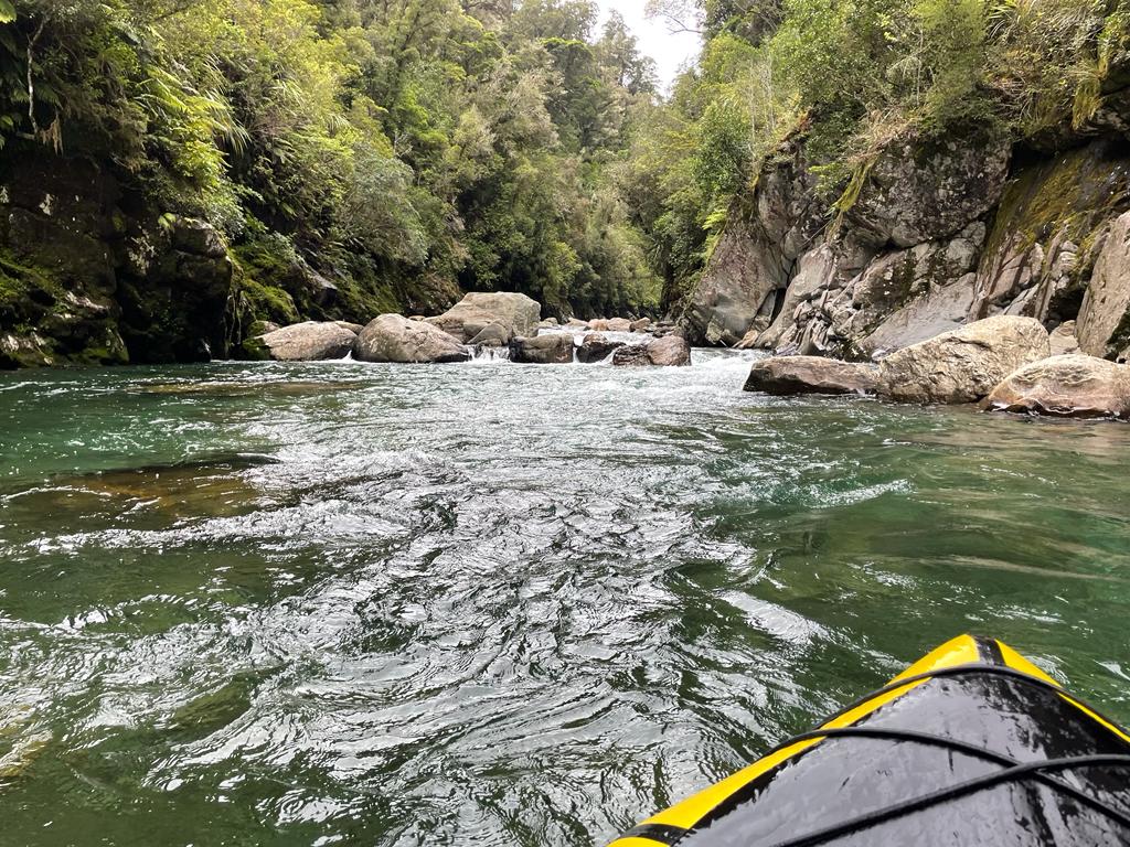
Anatoki bend is the start of the middle section. Difficulties start immediately with a big boulder garden.
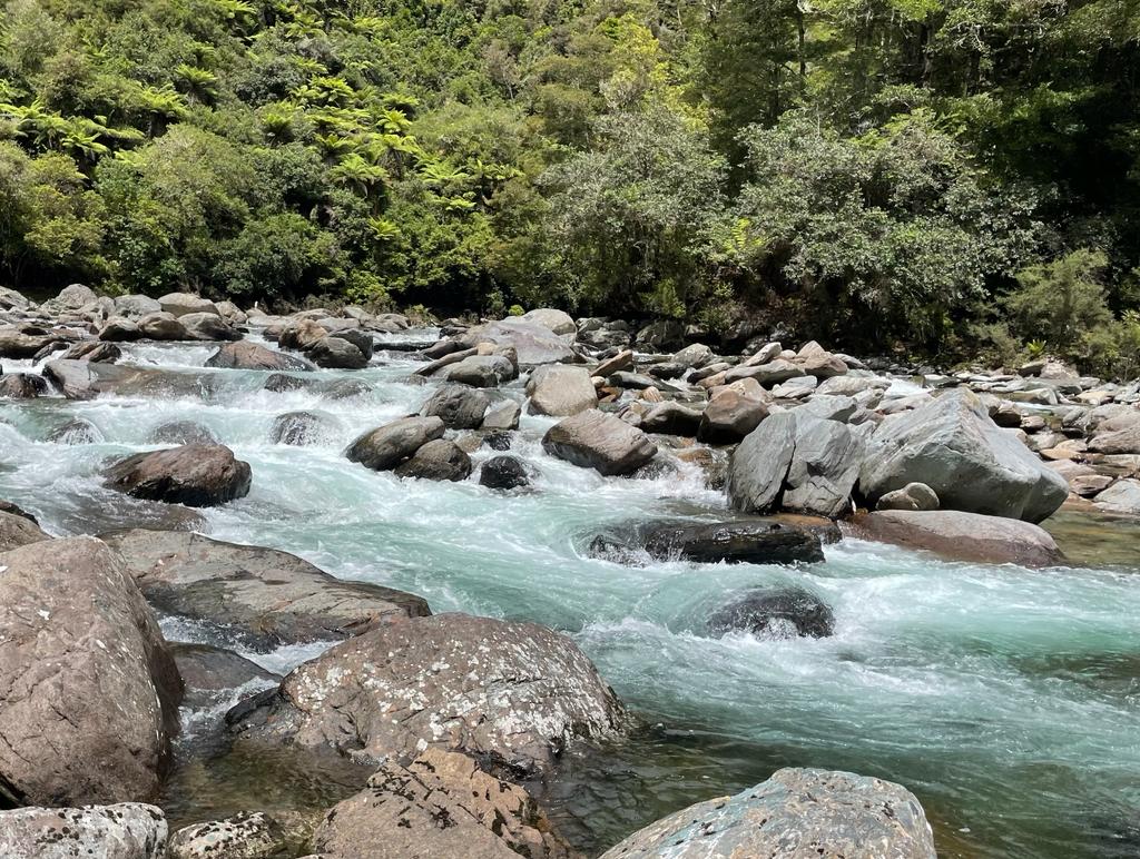
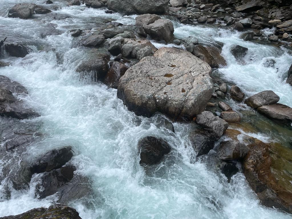
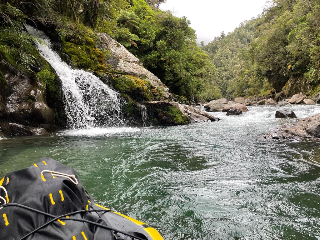
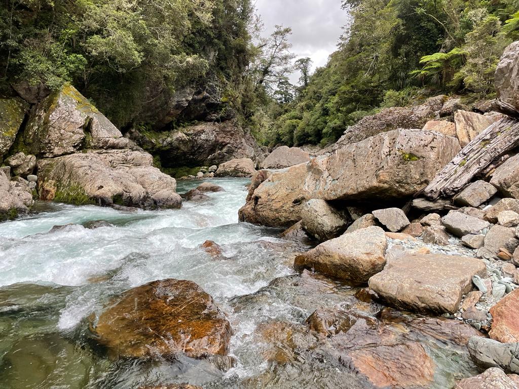
Soon, you’ll enter a narrow gorge, with 3km of small waterfalls and pour-overs. The gorge has some spectacular sheer bedrock walls.
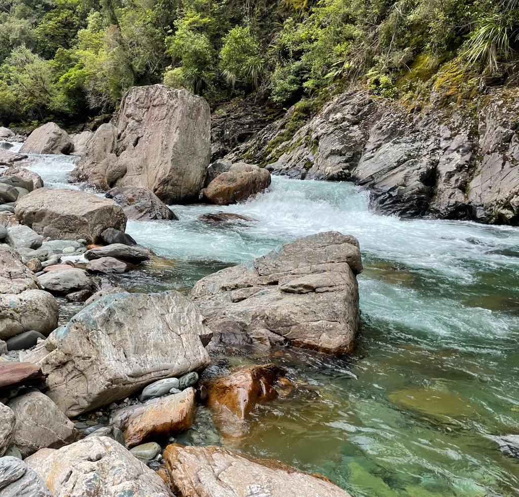
At low packrafting flows, you can expect some tricky portaging and low volume grade IV- paddling in the first half of the middle gorge section.
“Low volume grade IV-” means lots of boulders with sieve, entrapment and wrap potential. Just because the flows are low, this is still steep boating with many hazards. A good team, with technical rescue skills & equipment is still needed.
Sometimes you might be portaging river left, then have to ferry above hazards to continue portaging river right.
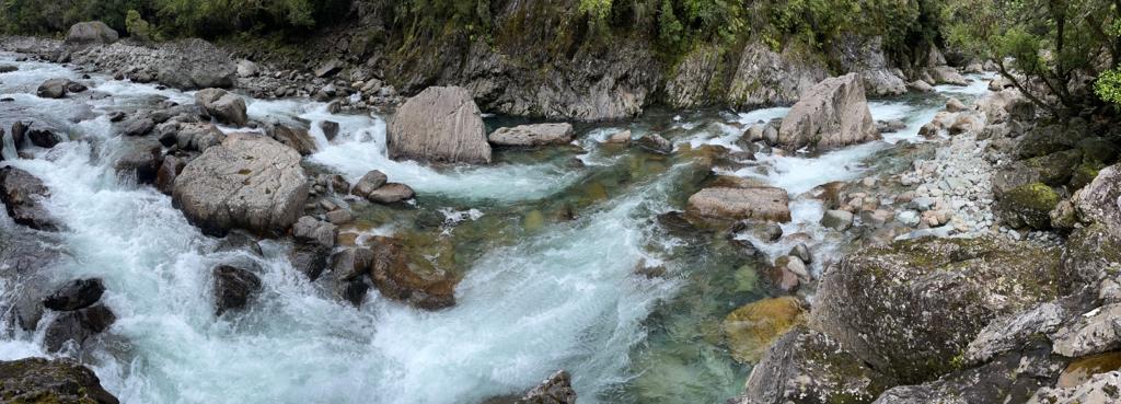
The difficulties ease slightly (III+) in second half of the middle gorge section, but there are still portages needed. Especially at higher flows, the rapids can be quite continuous. Remember the potential consequences of a swim increase dramatically when the whitewater is continuous. Good team and self-rescue skills are essential!
It’s a spectacular section of river, and Whio/Blue Duck are often present. If you do spot Whio, then try to avoid ‘pushing’ them downstream, especially if they are with ducklings!
When the middle gorge ends, you’ll probably see the site of the Old Sawmill referred to in the Kayaker’s run descriptions. Nowadays, this is the Rainbow Valley Community. You could try getting in touch with them if you want to take out here, or put on for a shorter, easier car-shuttle run.
Even though the valley walls close in again, the gradient flattens off, and the paddling eases to grade II wave trains and boulder gardens.
When the valley opens out, there’s just a few k’s of paddling to the swimming hole. Do yourself a favour and enjoy a beverage and some hot snacks at the Salmon Farm cafe!