


The Taipo below Julia Hut is already well known as a heli-kayaking run, with some detailed paddling information in the Whitewater NZ river guide book.
Taipo means ”devil” or evil spirit in Maori. It is interesting because Maori used it thinking it was English and the early English settlers used it thinking it was Maori. Taipo was the name given by European miners who had to cross the river on their way from Canterbury to the West Coast goldfields. Drowning was the most common way to die in those days and this river claimed more than a few lives. It’s always cold and rarely low enough to cross easily on foot. The Maori name was Hope oka, which means stab in the loins. i.e. it’s really cold and you’ll understand the appropriateness of the name as soon as the water reaches your ummmm, loins. It would be better for all if the original name was restored.
The whitewater guidebook says the first full descent was in 1993, and Ron Beardsley, Ed Reese and Hugh Canard ran the upper river in 1985 by kayak.
Thank you to Michael Batchelor for the information and photos. Michael and his party combined the access via the popular Harman Pass Route to make a classic three day packrafting traverse of the main divide. Hugh Canard provided a bunch more information about the river in other conditions which we used to flesh out this trip page.
DOC have an excellent web page with plenty of information on the Harman Pass Route. Anyone considering this trip should have a read of the information, especially if you intend to just paddle the Taipo as an ‘out and back’ style trip from the west coast side. Of note, there is a significant slip on the .354 feature by the cable way, making the track there “extremely steep and suitable for experienced users only”.
Day one: Klondyke Corner to Carrington Hut
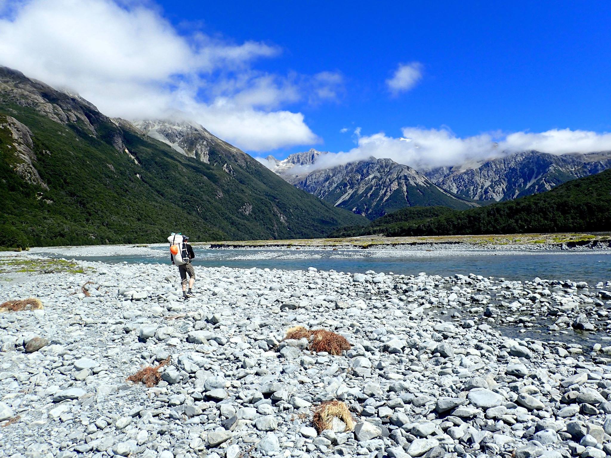
The Waimakariri Valley is a major route featuring in a number of classic Arthurs Pass tramping trips. Often it’s the start or end of a more adventurous trip, so often gets unlovlingly refered to as a ‘gravel slog’. However, it does have some nice scenery, as well as being a great starting point for lots of adventures.
The Carrington Hut Route guide on the DOC website has excellent information about access options in the valley. Essentially, when the river is low, you hike up the river bed, when high, you use the sidle track. About 4-5hrs from the road to Carrington Hut (36 bunks).
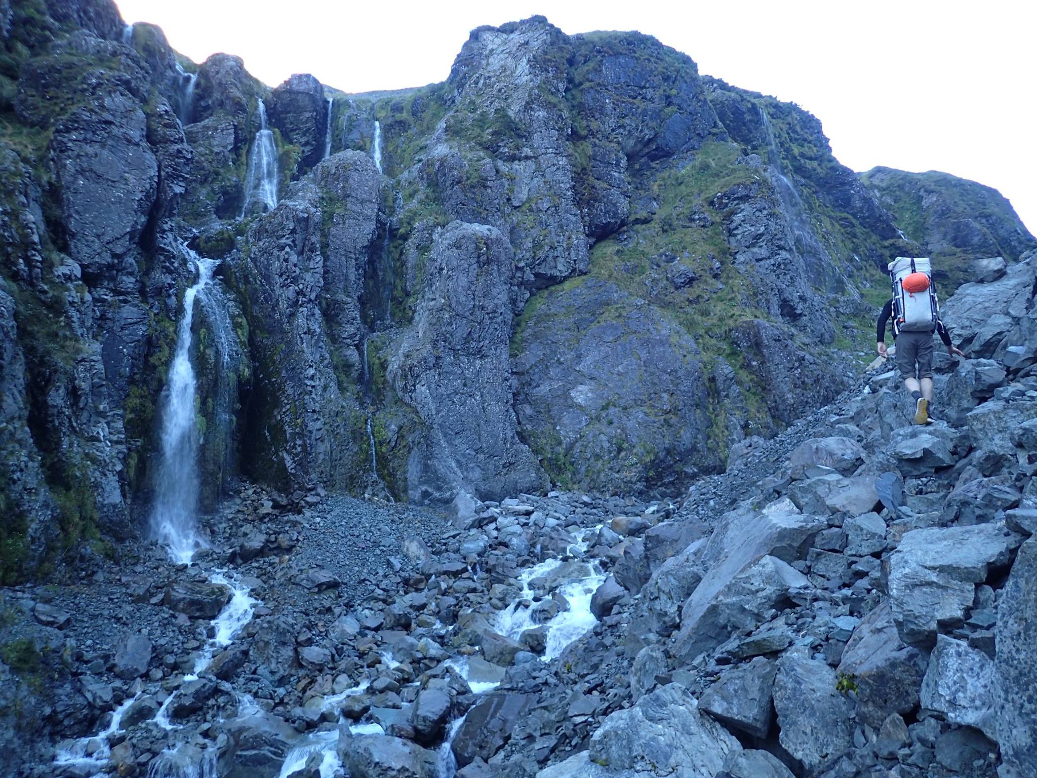
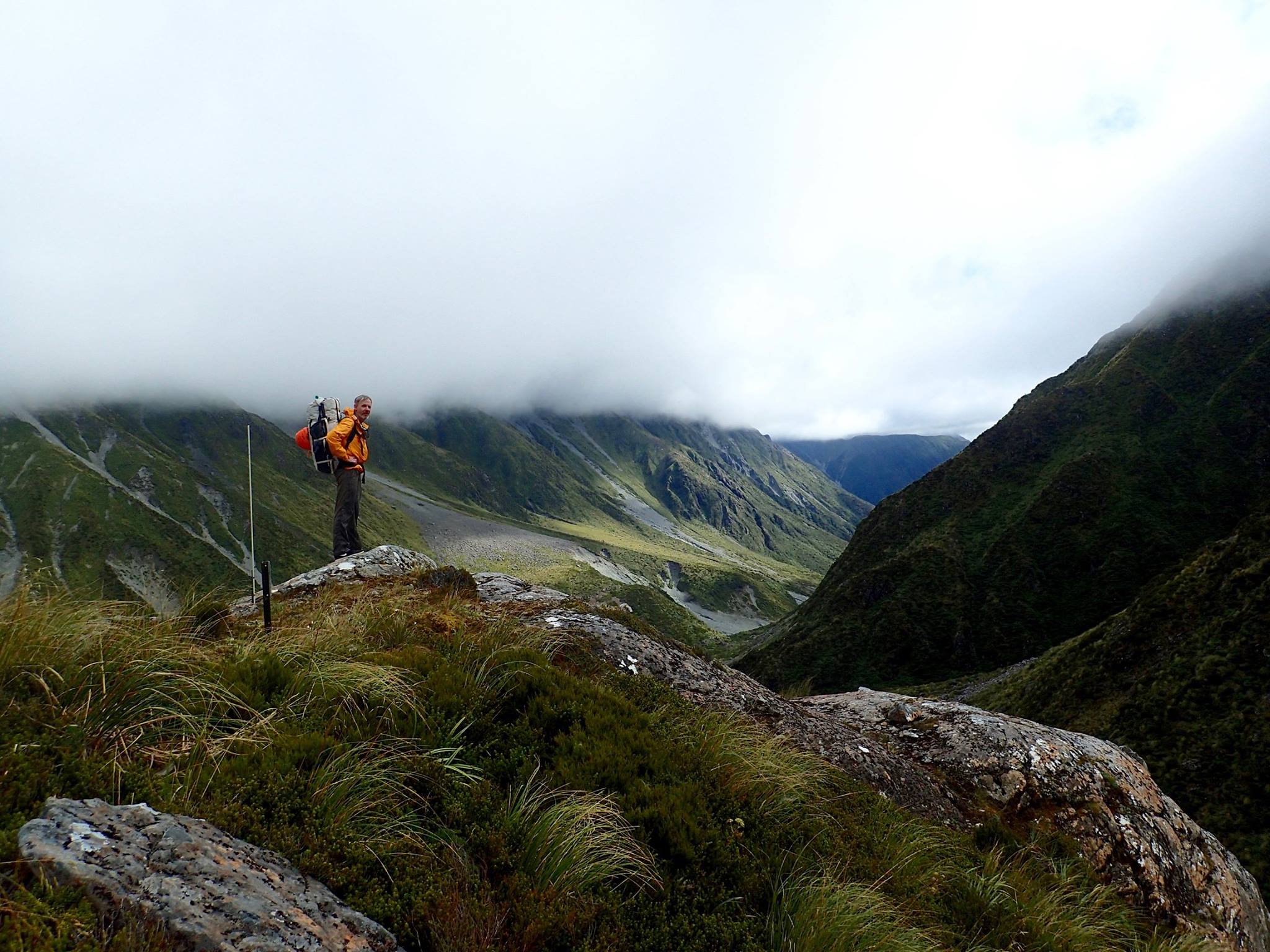
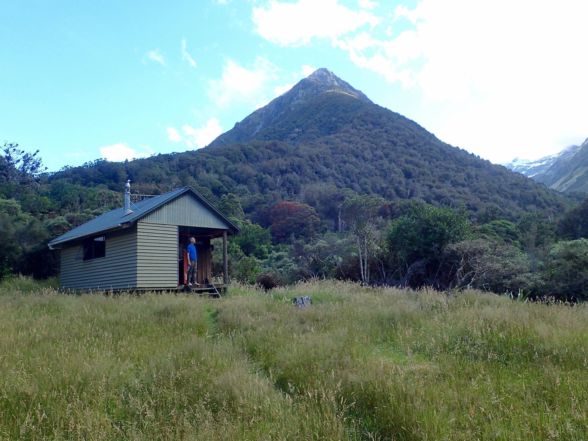
Day two: Carrington Hut to Julia Hut
The track up Taipoiti River is well marked with cairns and tags and is very pleasant. The track into Mary stream on the other side of Harmans Pass is well marked with poles. It’s about 7 hours to the Julia Hut this way.
There’s a good hot spring just downstream from the hut; there’s directions in the hut logbook.
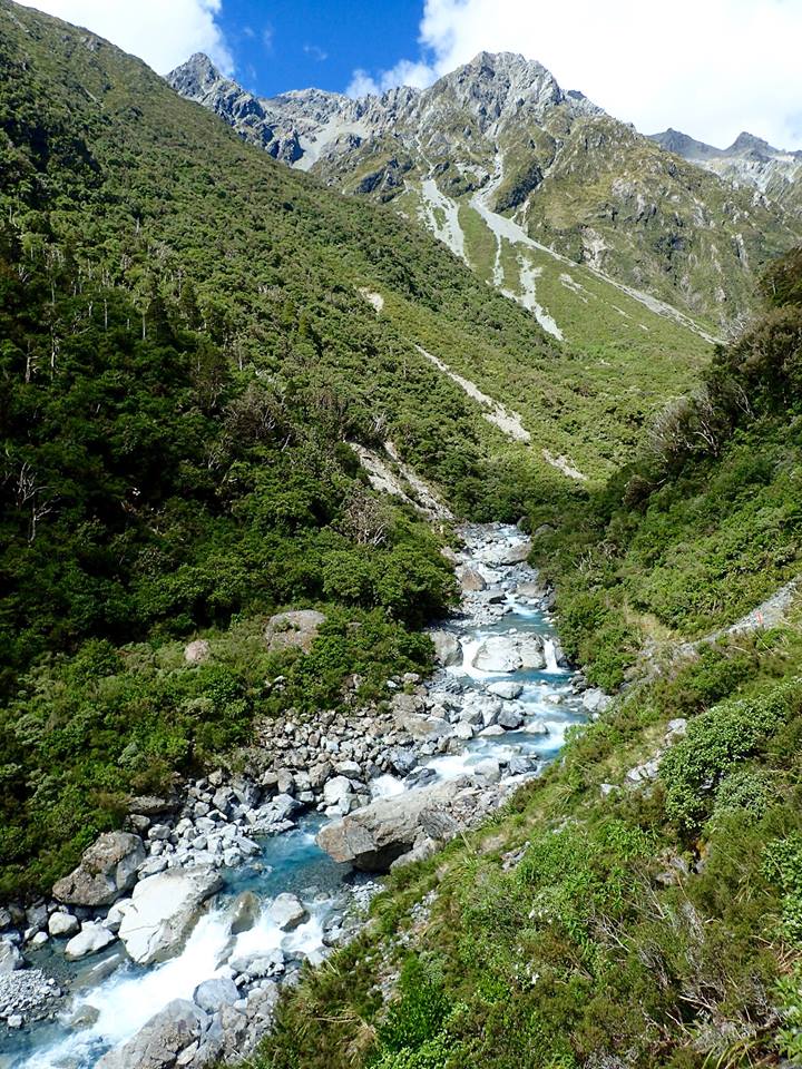
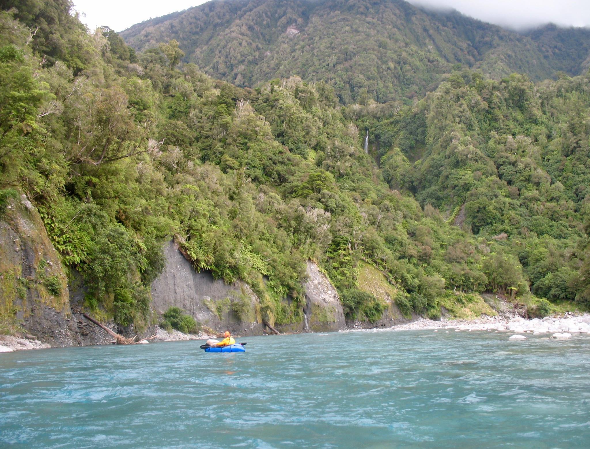
Day Three: Taipo River (IV/V) Julia Hut to the first swingbridge
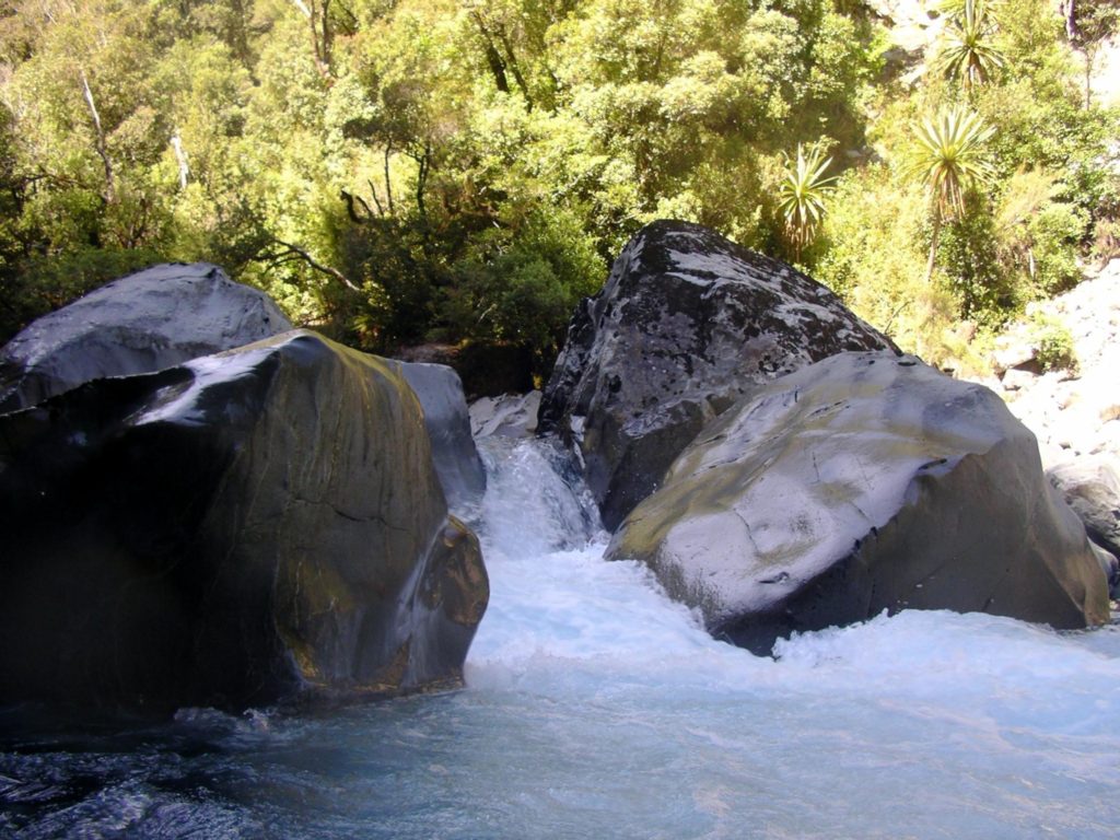
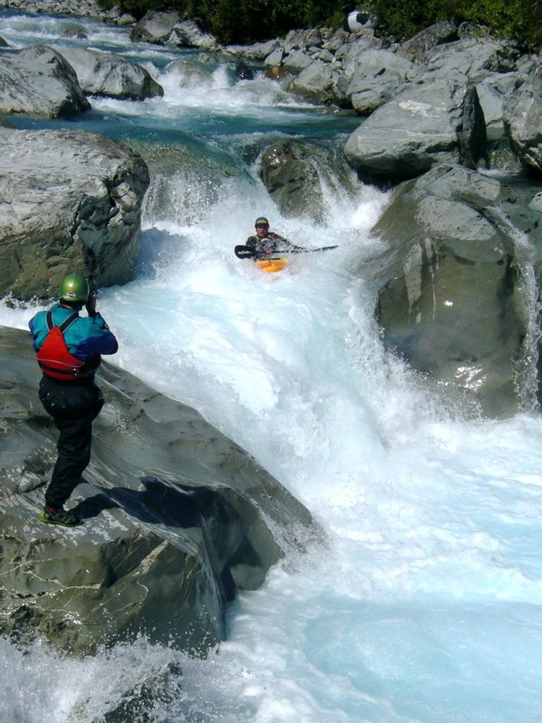
The river below Julia hut is steep and tight at low flows; at higher flows the rapids become very pushy. Its genuine class IV, with one rapid “Showcase” that is class V. For the right people, this section would have good packrafting at lower flows, probably below the flows that kayakers would prefer.
The Upper Taipo River on rivers.org.nz provides a more detailed description this section of the river.
Day Three: Julia Hut to the first swingbridge
Unless you’re an expert group of packrafters, continue about 2hrs downstream on the track, to begin paddling between the swing bridge and the Mid Taipo Hut. At the flows for Michaels trip, it looked too low to paddle in the open section above the swingbridge.
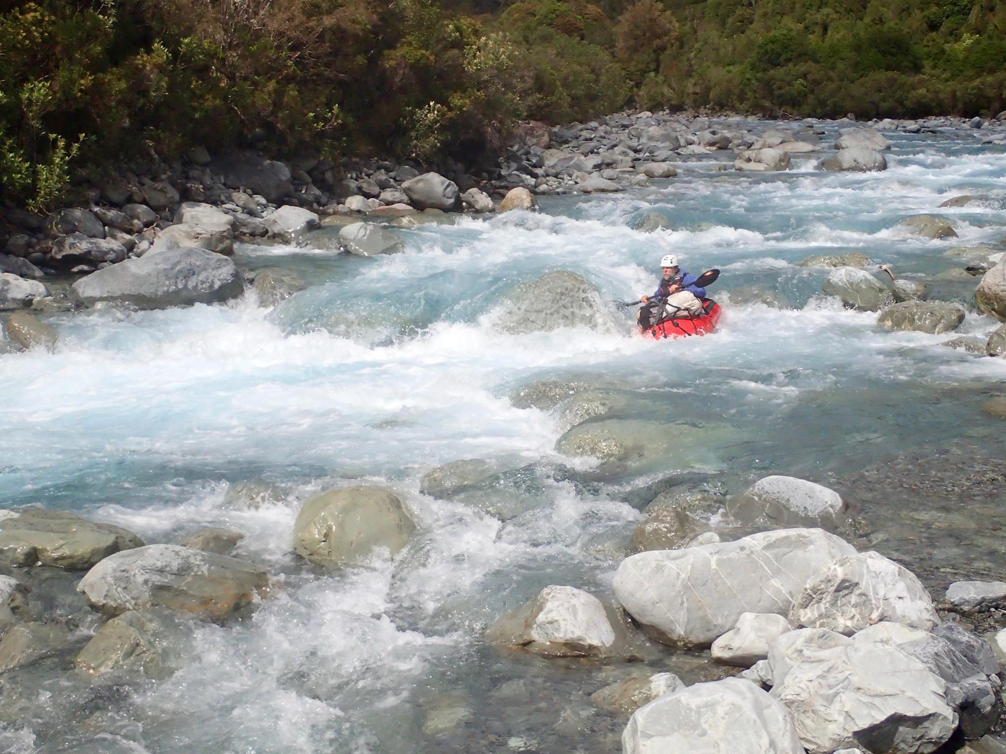
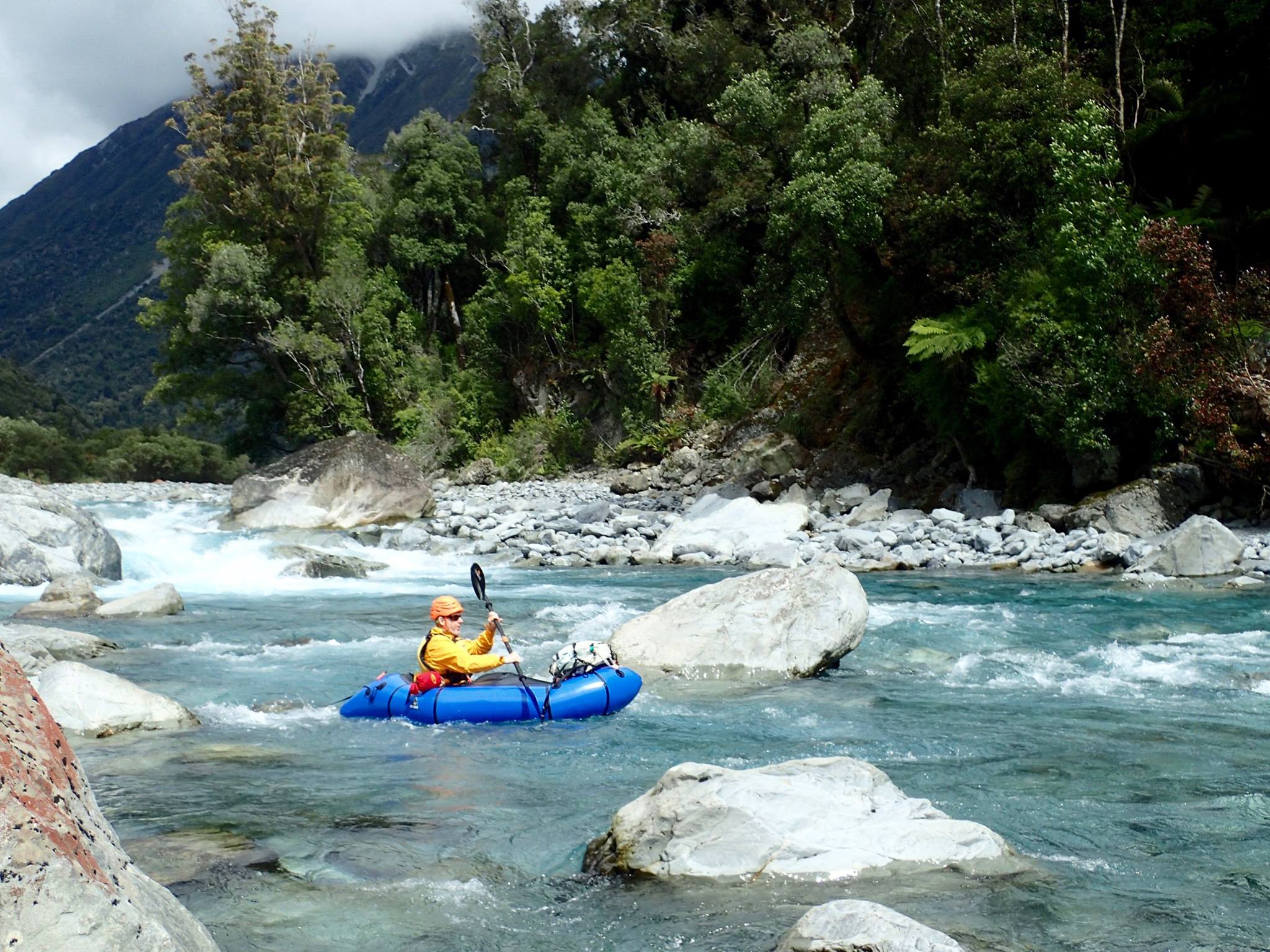
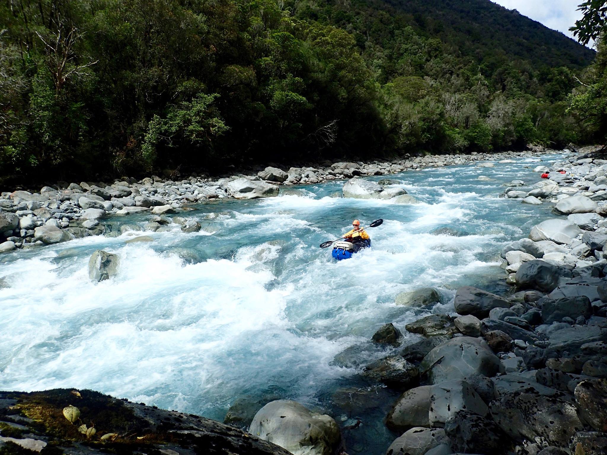
Day Three: Taipo River (II/III) from the swingbridge to the road end
Portaging is easy as the track follows the river where it matters. For packrafts there is no excuse for persisting and not taking the track when the river is looking like handing you out a lesson.
The paddling is fairly continuous and starts with a shorter sharper class III drops. When the river divided it was a bit shallow in places (at 2.3m on the gauge), but in the rapids it was all good. One rapid needed a portage due to low flows and lack of a clean line.
Lower down it gets a little easier with longer class II/III rapids. Some are really long and a swim may mean a long time in the water, which is always cold. Dress accordingly! (wetsuits/drysuits)
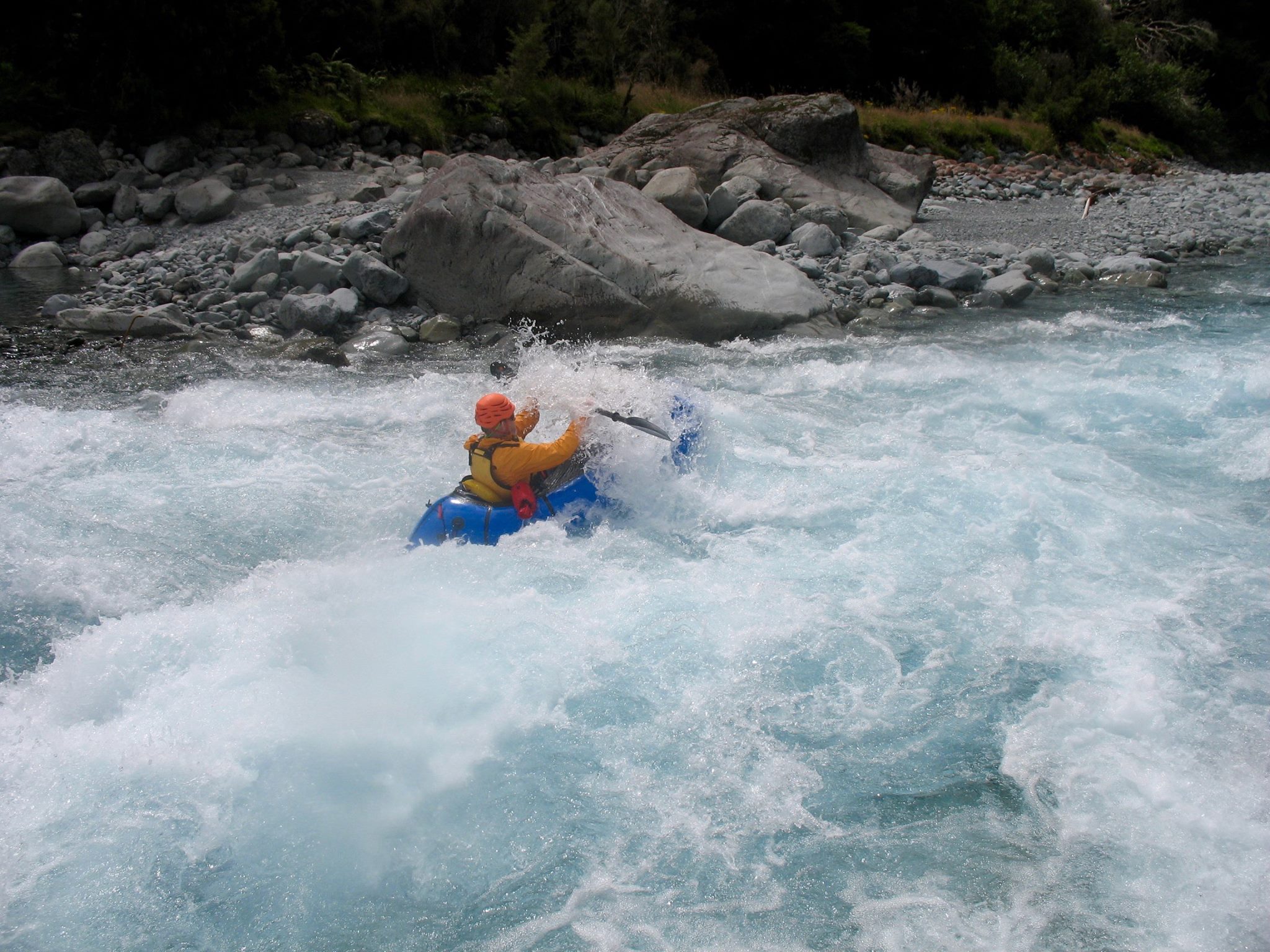
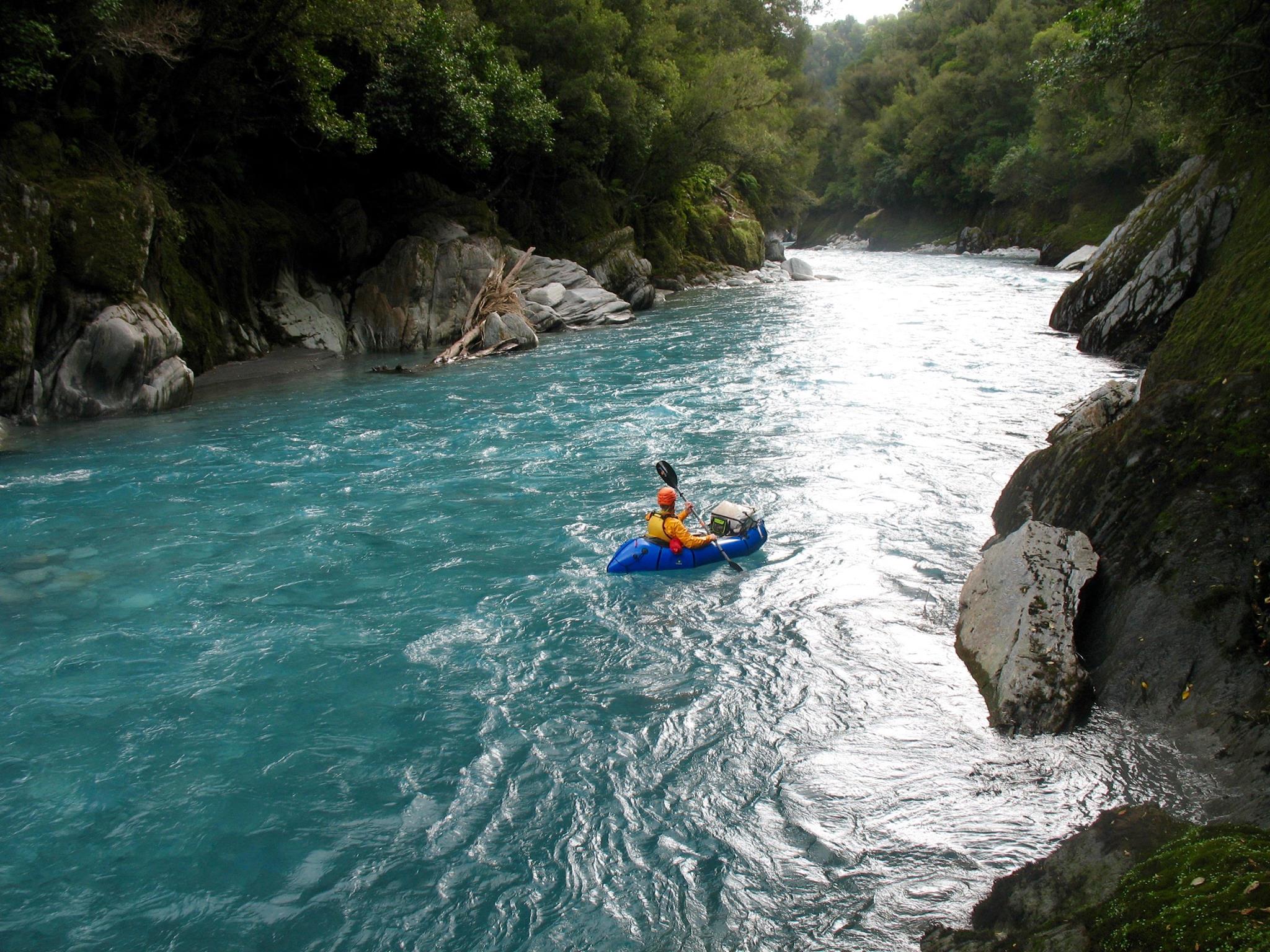
The final gorge has two class II+ drops at the entrance, and 3 or 4 rapids at the exit. These are easy enough at low flow but generate large wave trains at high flow. In flood (discoloured water) a full width hydraulic reversal develops at the gorge entrance. It is not portageable and it is a decent obstacle, possibly a back loop. In the gorge itself the flat water builds to form large laterals and it’s a case of staying in the middle and keep paddling. Don’t get separated from your boat.
From the put in to the road was about 5 hours for Michaels trip.
Gauge
There is a physical gauge at the State highway bridge over the Taipo.
The river gets some biblical floods and each one creates and destroys rapids. Be prepared for “new” rapids which are found where you see extra large (3-5m) boulders on the banks. Hugh Canard comments; “There is a house-sized boulder that I have seen move 3 km, and I’m terrified it will be in the final gorge one day.”
The Taipo doesn’t get dirty until it is in a full on flood. Clear water can still be high water. Be warned.
Michael had a reading of 2.3m for his trip, which was on the low end of paddleable for a packraft; some careful navigation was required to avoid hitting just submerged boulders, and some sections were boney or needed portaging due to low flows.
Its worth reading Roman Dial’s trip packrafting trip report of the Taipo River , when he had 2.4m, which seemed about optimum for floatability without being too full on. (There’s a good video to give you a feel for the river)
There’s a number of videos on YouTube (mostly from Heli-Kayakers). Hugh Canard’s video shows normal to low flows.
The rivers.org.nz page about the lower Taipo suggests a level of 2.8-3.2m, with the whole section becoming class IV at levels over 4m.
The following photos are a short selection from Michael Batchelor. The full album is on his flickr page
View the blog page of this trip on PackraftingTrips.nz.
Nice continuous section almost all the way to the last gorge.
We walked in 2hrs to Dillon’s hut in the afternoon with 2.4 on the gauge.
Continued up to mid Taipo the next morning, another 3.5hrs.
Was a little bony up below mid Taipo but runs in to a cool narrower section with clean lines before opening up above the swing bridge. Braided at some points around Dillon’s hut but still enough water to not get hung up.
Was 2.2 when we come out the lower gorge. Would plan to go abit higher next time or come over the pass but look at water levels closer to 2.6 for the best from the run.