


The Whirinaki River is a one of the main rivers draining Whirinaki Te Pua-a-Tāne Forest Park around 1 hour east of Rotorua. It is fed by a watershed the extends south and east from the Galatea plains past Minginui and into the forest park. With amazing bush, easy access at a number of points and a tempting looking gorge area on the topo map it makes an obvious choice for packrafting close to Rotorua..
Thanks to Thomas Reynolds and Joe Rea for the information and photographs. https://thomasreynolds.wordpress.com
Car shuttle option
The easiest was to the river is to utilise State Highway 38 to shuttle, which is done frequently by hard-shell Kayakers. At the get out park at the Troutbeck Bridge (cannot guarantee car safety, but there is a small grass area on the river right just over the bridge towards Galatea). You can then hitch around via SH38 to the bottom of the descent before Te Whaiti. There is a 45km corner with a large open area around it just before you reach the river. On the topo map this is adjacent to where the Hukanui Stream meets the Whirinaki River. You could also park your car here to start, but again not an ideal parking spot.
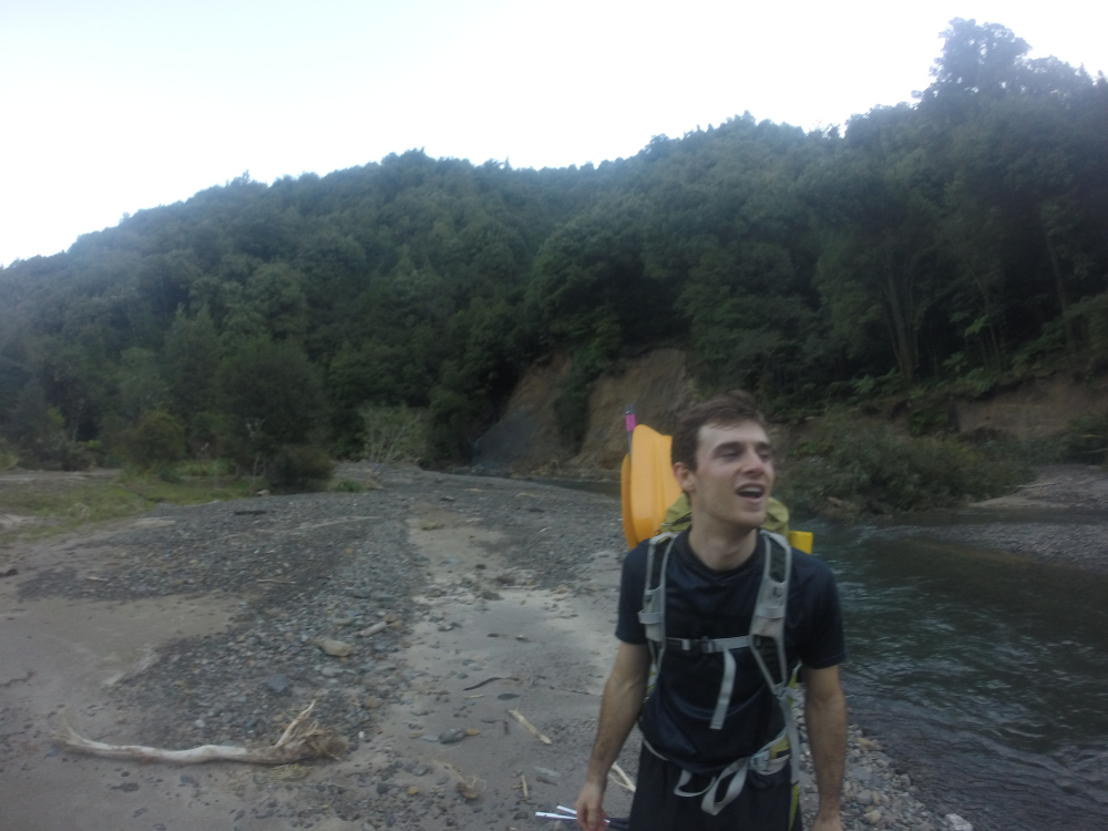
From the road there is a quad motorbike track heading along the river left into the bush. Head down here until you find an appropriate spot to put in. This varies depending on the flow in the river. For the next 5km the river meanders gently towards Okui Hut. Be aware of willows and wood in the river through here. You will know you are approaching Okui when a rather damaged footbridge crosses the river (shown on the topo). Being close to a 4WD road, Okui Hut apparently gets used often by people drinking and partying, its probably better not to plan to stay there.
Via Tawhiauau Trig, Horomanga Valley and Mangapouri Hut
There is a gravel road that leads up adjacent to the Mangamate Stream from Troutbeck Road to give access to the Tawhiuau track. Follow the (hard to spot) orange triangles on the river right of the Mangamate Stream until you see a sign pointing uphill towards Tawhiuau. This is a solid climb that goes all the way to the top. From the trig pull out your compass and head east towards the spot heights of 1050, 1058 and 846 before dropping into the Horomanga. There are a few steep pinches but no impassable bluffs (that we found). Travel is variable from glorious clear podocarp forest to patches of thick scrubby regenerating bush. The last drop into the Horomanga is steep in places and can be a little loose.
Once in the Horomanga head upstream. Travel is excellent in the valley with open river flats. The valley eventually forks when the Arowhana stream peels off. There used to be a sign here, however after some spring floods in 2017 the sign was last seen pointing towards the sky in a big pile of storm debris about 2km downstream. The track up the Arowhana varies but does carry the whole way up the valley to the Mangapouri Hut. This is a good place to stay the night, it has a fire and has 6 bunks.
From Mangapouri there is a steep climb up towards the west and onto a ridge track. This area has some of the best open mature bush as the track meanders along the main ridge line. The drop down to Okui Hut includes a few different options, the southern most is the most distinct, the others do still pass through to the river albeit with a little more overgrown vegetation.
Other walking options
As an alternative to the early bush bash over Tawhiuau, it is also possible to walk up the length of the Horomanga Valley from where the Horomanga River flows out on to the Galatea Plains. This is a good walk, with great river valley travel the whole way. Mangapouri Hut can also be accessed via the Pukareao Access Track from Ngaputahi (between Te Whaiti and Ruatahuna).
Whirinaki River (I) Okui Hut to Ariki Tuhoe Stream
About 30mins/1.5km of gentle floating before the valley walls narrow in and the rapids begin.
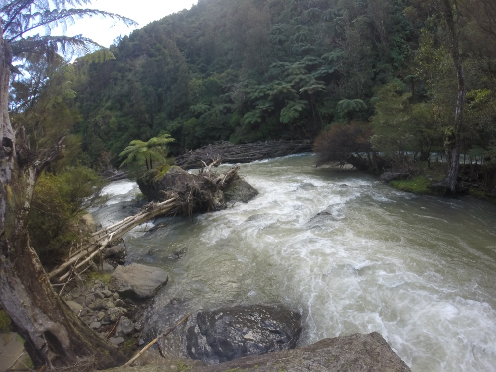
Whirinaki River (II/III) Okui Gorge
The rapids build into bouncy class II runs between small boulders. There are 3 or 4 class III drops in the gorge with bigger waves, boulders and holes. Although the gorge walls get pretty steep in places, there is always a portage option. One of the class III rapids is a right hander with boulders across the whole flow. We have run it on the river right in medium flows. In high flows river left looks good, but there is a submerged tree trunk hidden in the far left line. We have checked this spot every time and have portaged more than we have run it.
A little further on from here is the big left hander with the massive log jam. (Hawkes Bay Canoe Club call this rapid ‘Barricade’) It can be seen from far enough away to be able to eddy out. Both sides of the river have eddies that can be reached, river left is best as there is a generally dry flood channel that nicely bypasses the logs.
After the jam is one of the most fun rapids, it can be bony in low flows, heaps of fun around 2m on the gauge, with some cool wave/hole combos down the left of the flow. Like most of the river there is a good calm section afterwards to regather gear if required.
Whirinaki River (I) Below Okui Gorge to Troutbeck Rd
The last few kms wind slowly out of the hills. Eventually bush gives way to farmland. The get out is on river left just downstream of the Troutbeck Road bridge. Be aware of the old bridge pier just upstream with reinforcing rod sticking out of it. If in doubt, or if you haven’t looked from the bridge before starting, do check to make sure that you can miss the metal.
In theory the river could be run out past the bridge to join the Rangitaiki River down to Lake Aniwhenua and beyond. This would involve some slow meandering paddling along the Galatea/Murupara plains.
Gauge
Whirinaki at Galatea
Ideal level around 2m, have been through as low as 1.4m but gets pretty bony at this level.


Big day out taking on the loop and paddle. Started hiking at 6.50am and started paddling at 6.15pm with not much mucking around in between. Still paddleable at 1.4m but bony as expected. Had to portage a couple of drops which didn’t have a line for double packrafts (or any boat really). All wood hazard was fairly obvious so no nasty surprises.