


A stunning paddle with magnificent views of the Humboldt and Ailsa Mountain ranges along with beautiful sections of exquisite South Island crystal clear pools in majestic gorges with beech lined forest.
There’s plenty of straightforward paddling, plus a few very serious and completely committing gorges. The gorges are either impassable (due to log jams) or for experts after very careful scouting. Most people will paddle the moderate water, then use the easy portages to skip the narrow gorge sections.
Sadly, one of the gorges was the scene of an accident where a packrafter lost his life in 2021.
Thank you to Alan Swann for the information for this trip page.
View Larger Topographic Map
The trip can be done in a variety of ways:
- A 2 day trip with one day walking to the Upper Caples Deer stalkers hut and a one day paddle out from Fraser Creek.
- A half to full day trip with a 2 hour walk to the mid Caples hut and a 2 hour paddle out.
- A 30 minute walk to the Greenstone / Caples swing-bridge with a 20 minute paddle out.
- Or for a much longer trip you could arrive at the put-in from the Greenstone Valley or Routeburn track…
The river generally holds sufficient flow to be paddled all year although it can become low, especially in the upper reaches, mid to late in the summer. This results in some bum scrapping along the river bed or quick midstream portages.
All the main rapids can easily be portaged except in exceptionally high flows.
Please respect the fly fisherman in the Spring and Summer months and hopefully they will respect you. Keep to the opposite bank and pass quietly.
Approach by road
It’s a 35 – 50min drive from GY (Glenorchy) to the DOC carpark for the Caples / Greenstone track, the road has several fords to cross which can become quickly impassable in heavy rain. If you can`t cross the fords it`s probably best to give the trip a miss.
This is a very popular tramp in the summer months and its often possible to easily hitch there and back from GY.
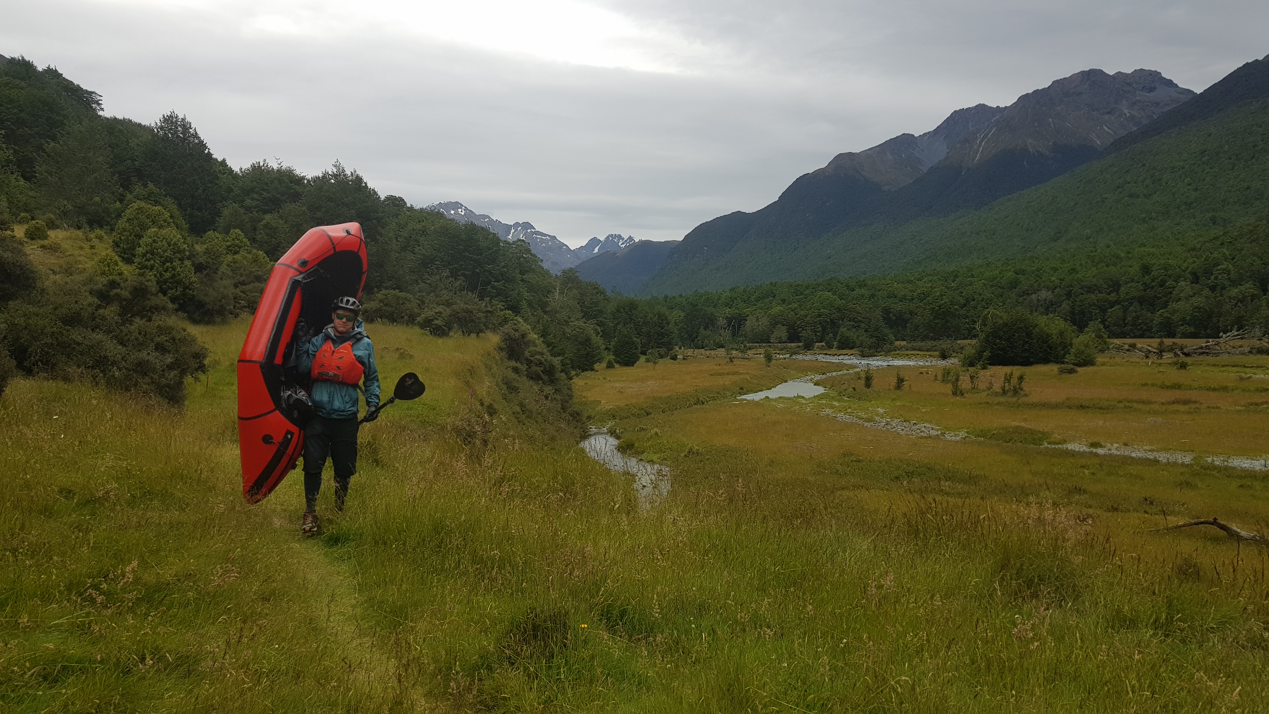
The tramp in
Follow the Greenstone/Caples track from the car park. After 2–3 minutes, a stock bridge over the river gives access to Lake Rere Track. Do not cross the bridge but keep to the true left of the Greenstone River on the main track uphill, which after 15 mins continues past the confluence of the Caples and Greenstone rivers and arrives at another swing bridge which provides access to the Greenstone Track. This is also a potential first entry point for a quick trip back downstream. The Caples Track continues on the true left of the Caples River along the valley floor and the track mainly follows the bush edge, but crosses an occasional grassy clearing. Just before the Mid Caples DOC Hut 24-bunk (2 hours), the track crosses a spectacular gorge; this is a potential second entry point at the gorge base. This would accomplish a 5 hour trip in total.
To access the gorge base as you hike up the valley, either walk directly across the paddock before entering the trees which climb up to the bridge over the gorge OR hike to the hut and then come back down on river right, crossing a small side stream and out onto an open paddock with a steep embankment. From the tree edge walk along this embankment for 200m and you will see a sheep track heading down the slope to the river. Head down this and turn left, then walk upstream to the gorge. This is also the portage if doing the upper section of the river.
Beyond the mid Caples hut travel up the valley through bush and grassy clearings, after exiting the first section of bush turn right and scout the top gorge. Then continue on and after entering the beech forest at the end of Top Flat, the track passes a junction with Steele Creek, turn right and head down to the Deer Stalkers hut, the old DOC Upper Caples Hut. (4-5 hours from the carpark)
Note: You can book the hut online, but the key for the Deer Stalkers hut must be gained from Small Planet Sports in Queenstown at a cost of $25 a night each. The hut is stocked with gas and cooking utensils, plus DOC style beds and mattresses. There is even some solar lighting. All you need is your sleeping bag. At Small Planet you can easily assess how many are booked in for the night.
You can easily enter the river at the hut or preferably walk back to the main Caples track and head a few hundred metres up the valley to the Fraser/Kay Creek track turnoff. Head down this to the swing-bridge but don`t cross it, follow the old Caples track in the bush (with orange markers) upstream on river right until you scramble down to reach the confluence of the Caples and Fraser creek. This is the best put-in with beautiful paddling through a stunning beech lined river.
Note – Even though the tramp is only 4-5 hours it can easily take all day if you stop to scout rapids and gorges, swim or fish. This is predominately why this is advised as a two day and not a one day trip.
On the water
Fraser Creek until the Upper Gorge (II-)
From the confluence of Fraser Creek the river runs through thick beech lined forest with easy class 2- low volume rapids in normal flows. After 1.5k the river passes the Deer Stalkers hut and 0.5k later meets the confluence of Kay Creek on river left. Some tree hazards obstruct the river and particularly just above the hut, but could easily be portaged or carefully avoided in low volume.
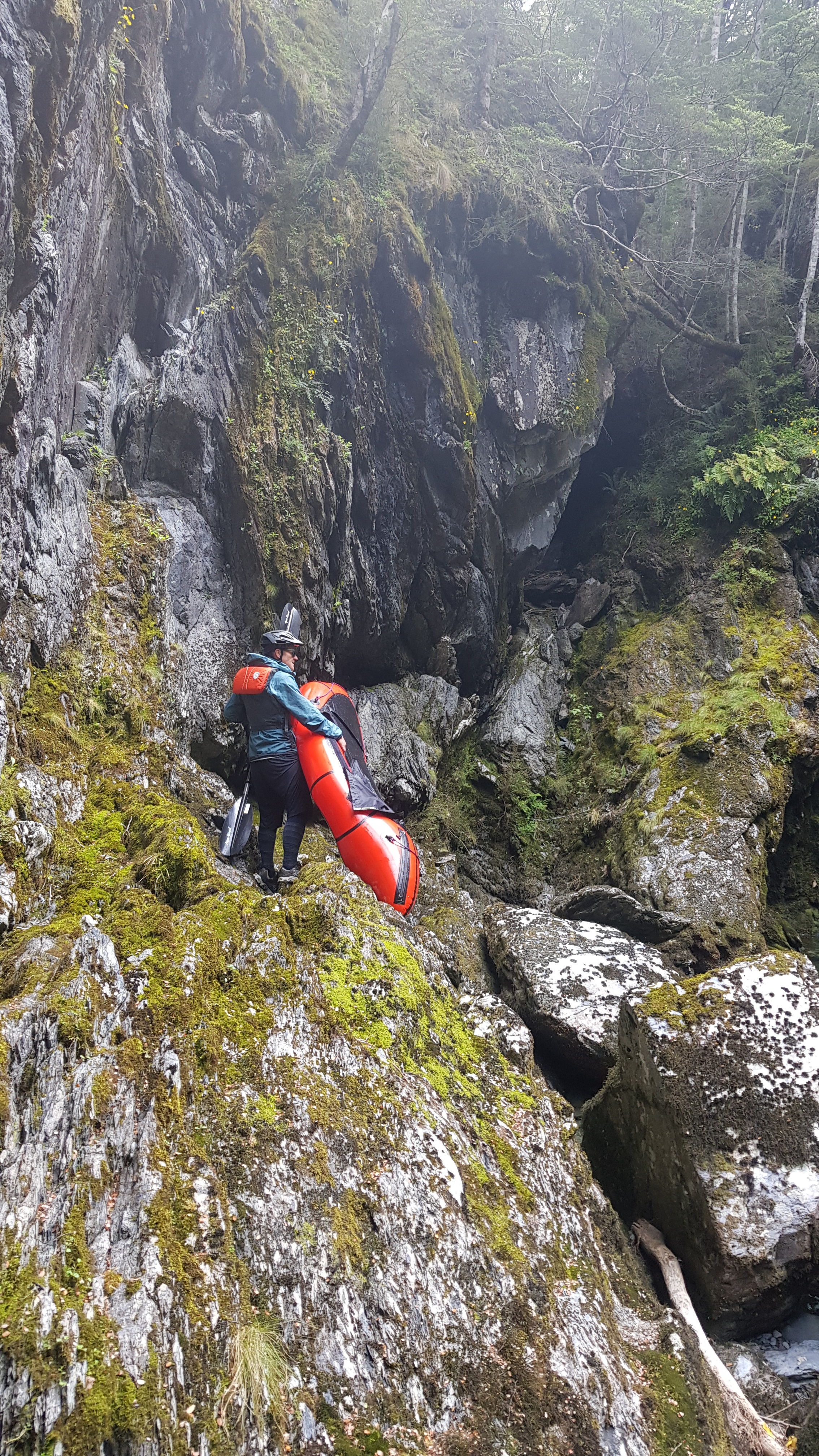
After Kay Creek continue for approximately 4km to the Upper gorge (IV,P) and prepare to eddy out/portage river right.
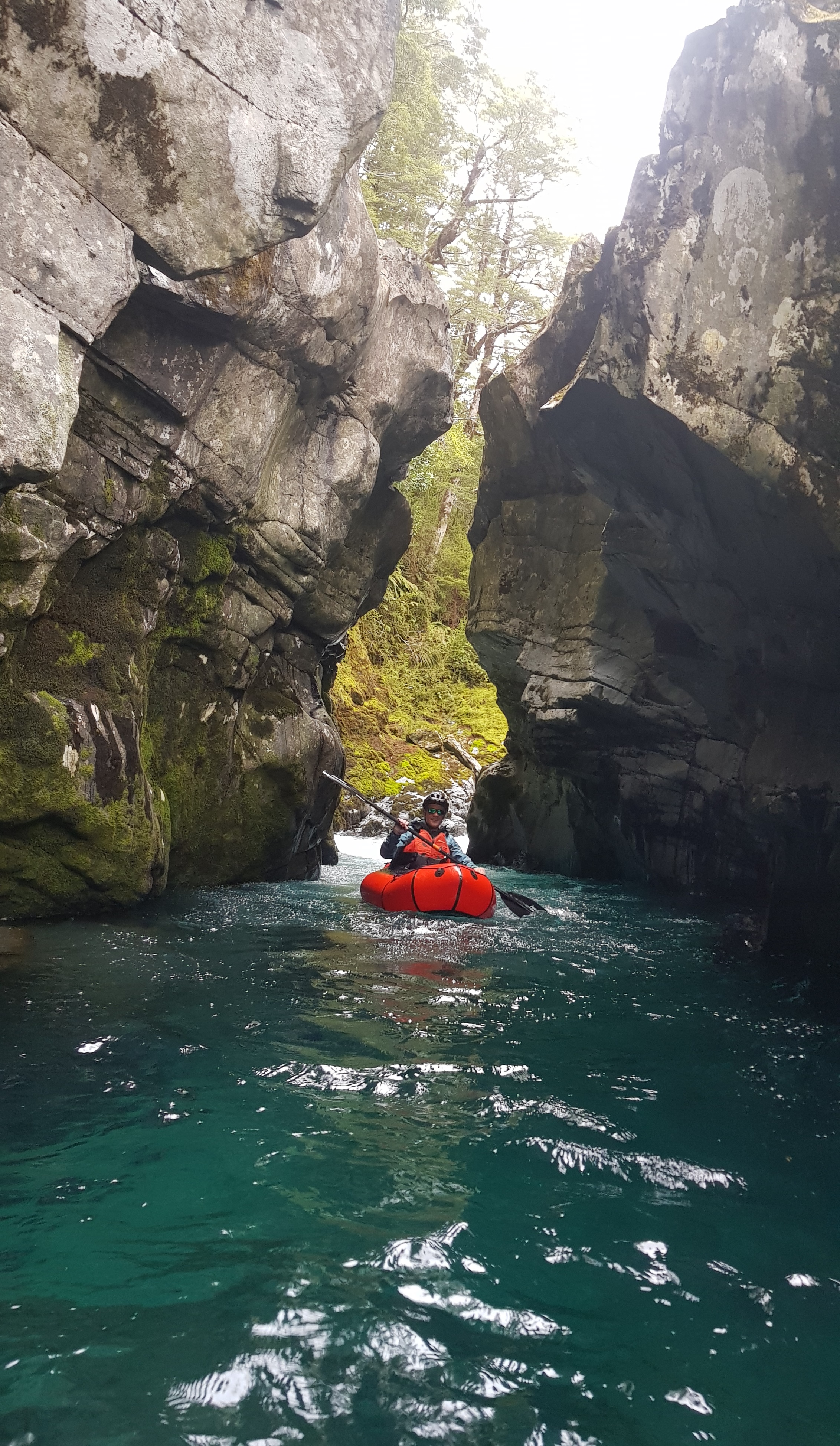
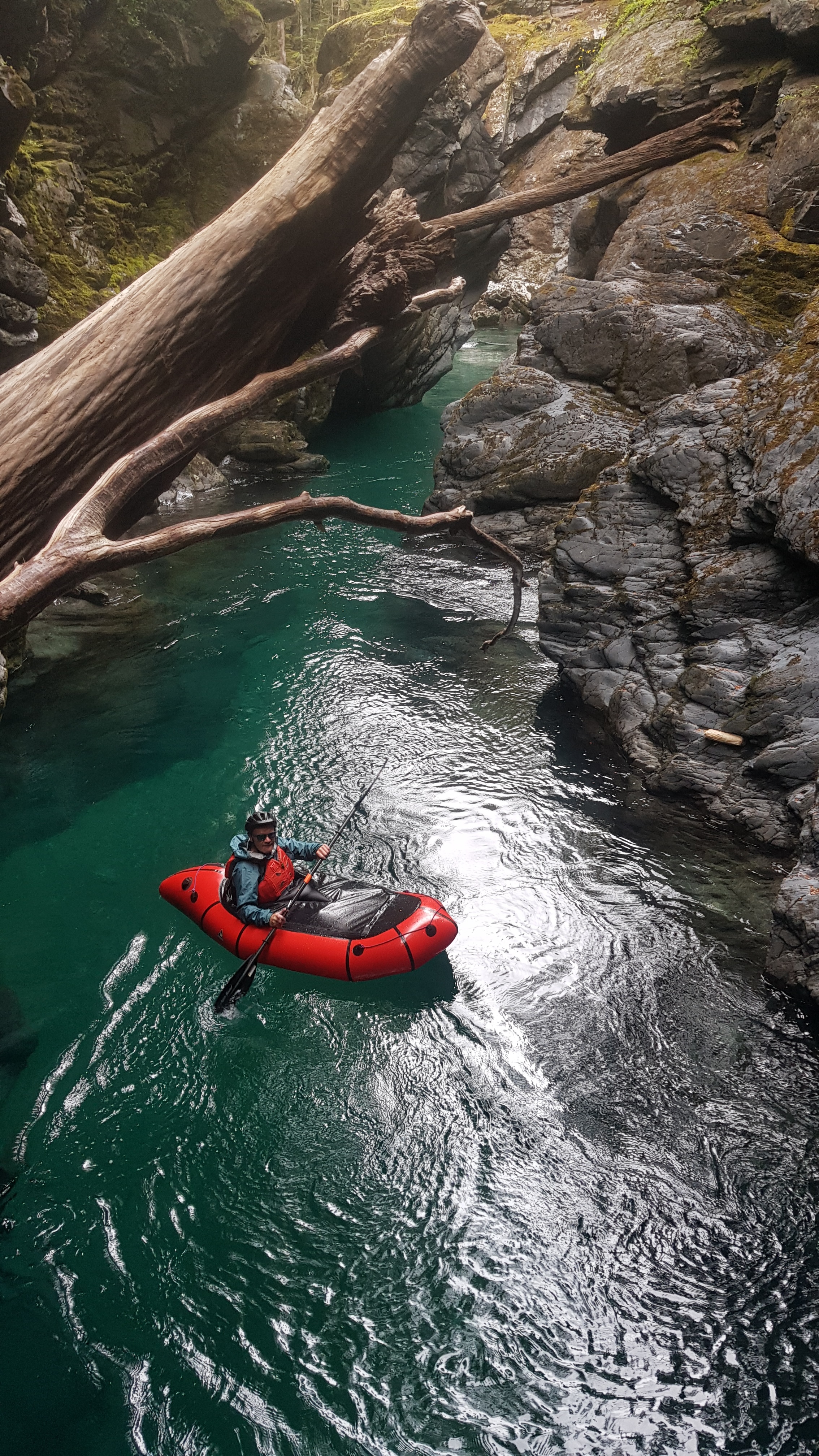
Upper gorge (IV P)
Make a thorough check for tree hazards before you enter: the gorge is narrow in places and logs tend to accumulate into nasty sieves here.
Most people portage, which is easy on river right. You can enjoy some of the gorge by re-entering the river at the end of the gorge base and paddle upstream.
It’s only about a kilometre further downstream to the Mid Caples Gorge.
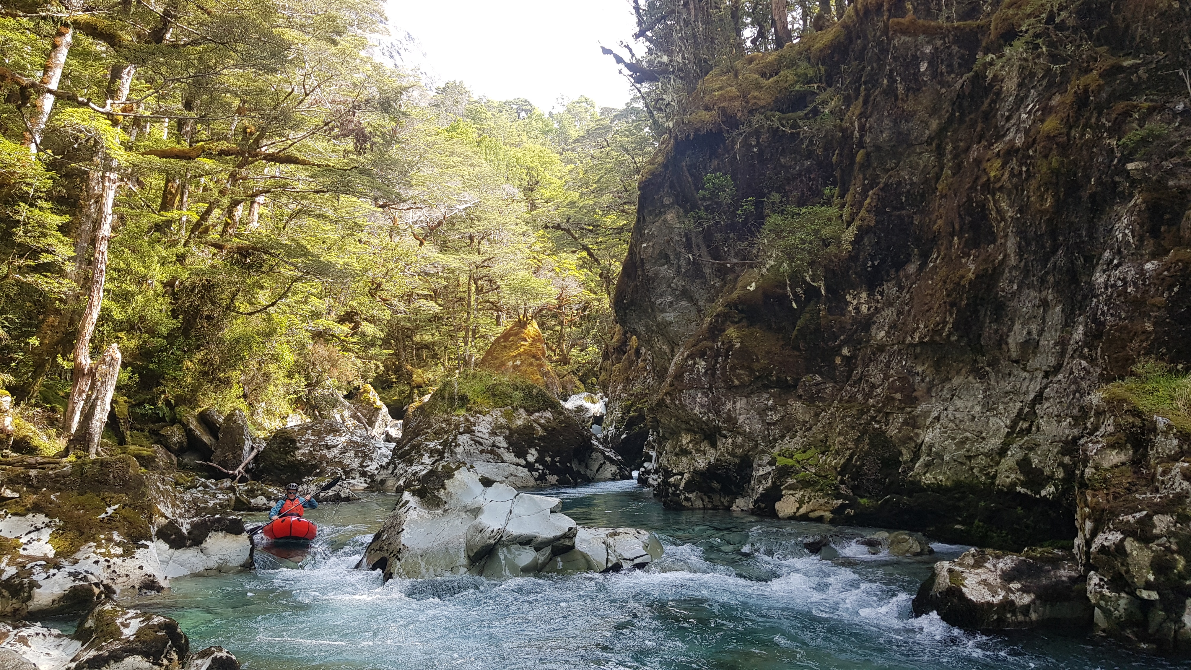
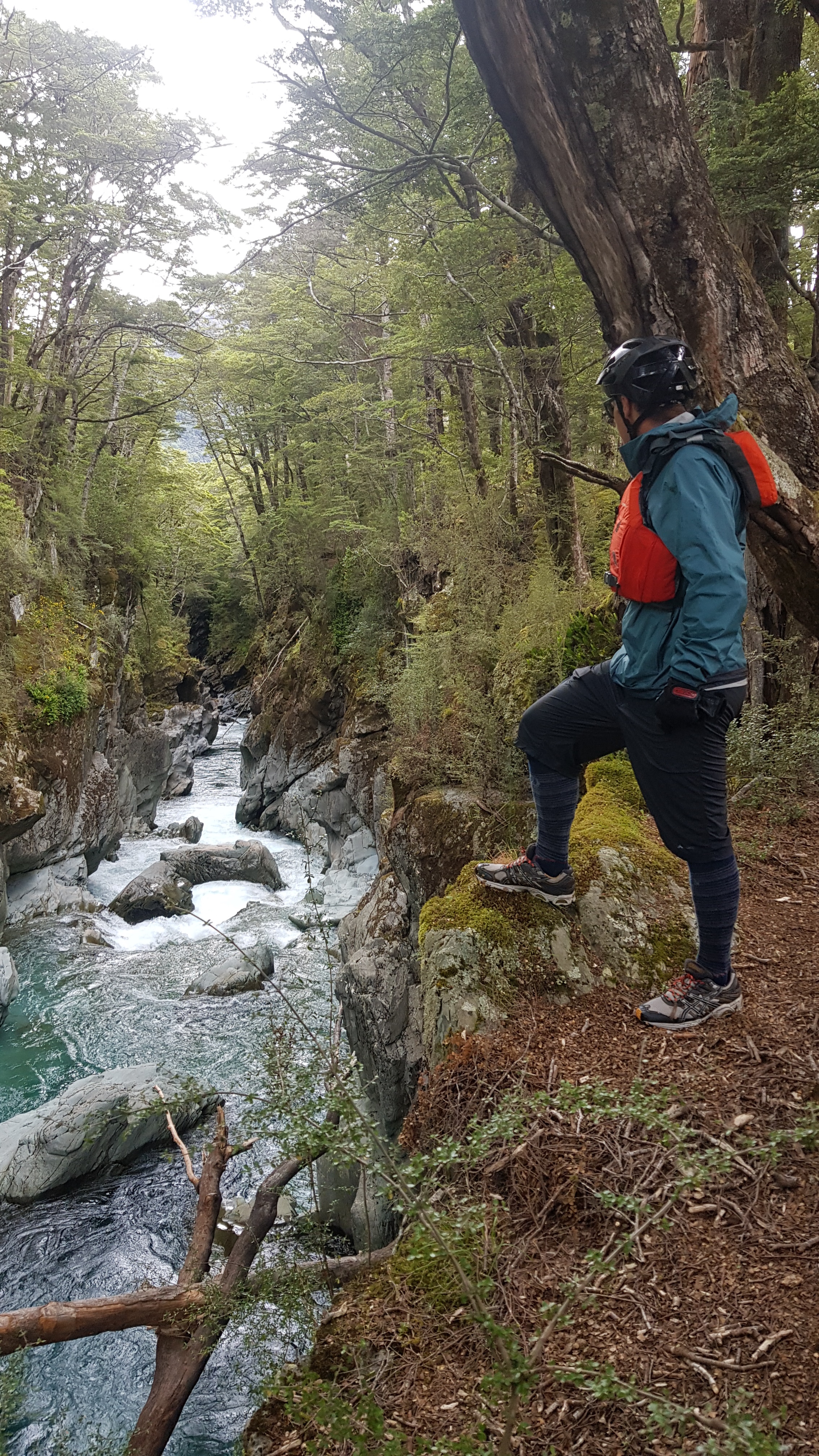
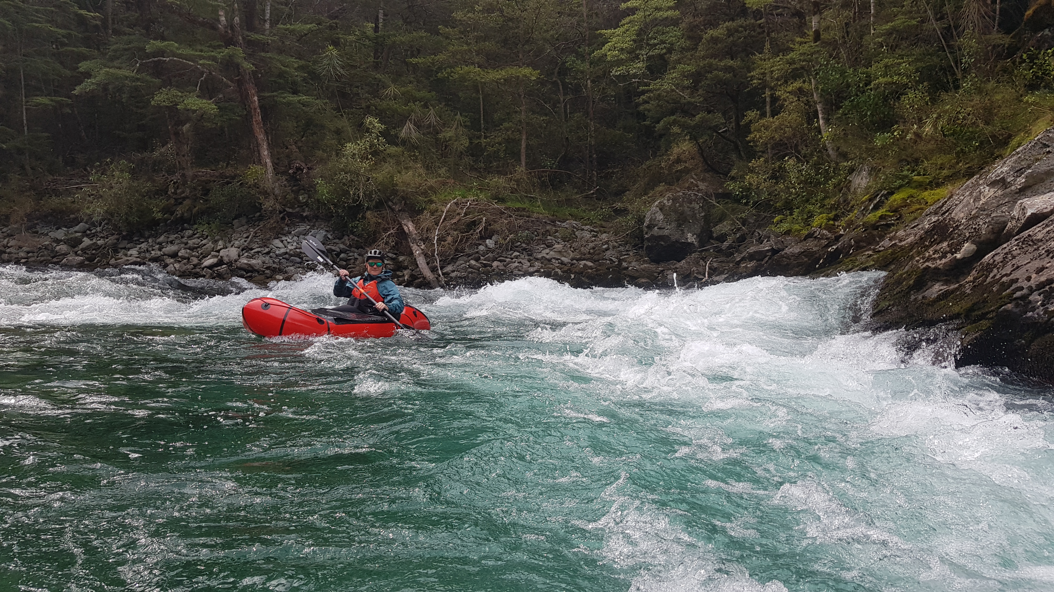
Mid Caples Gorge (IV/V)
As you approach, eddy out early on river right to scout the gorge or prepare for the portage.
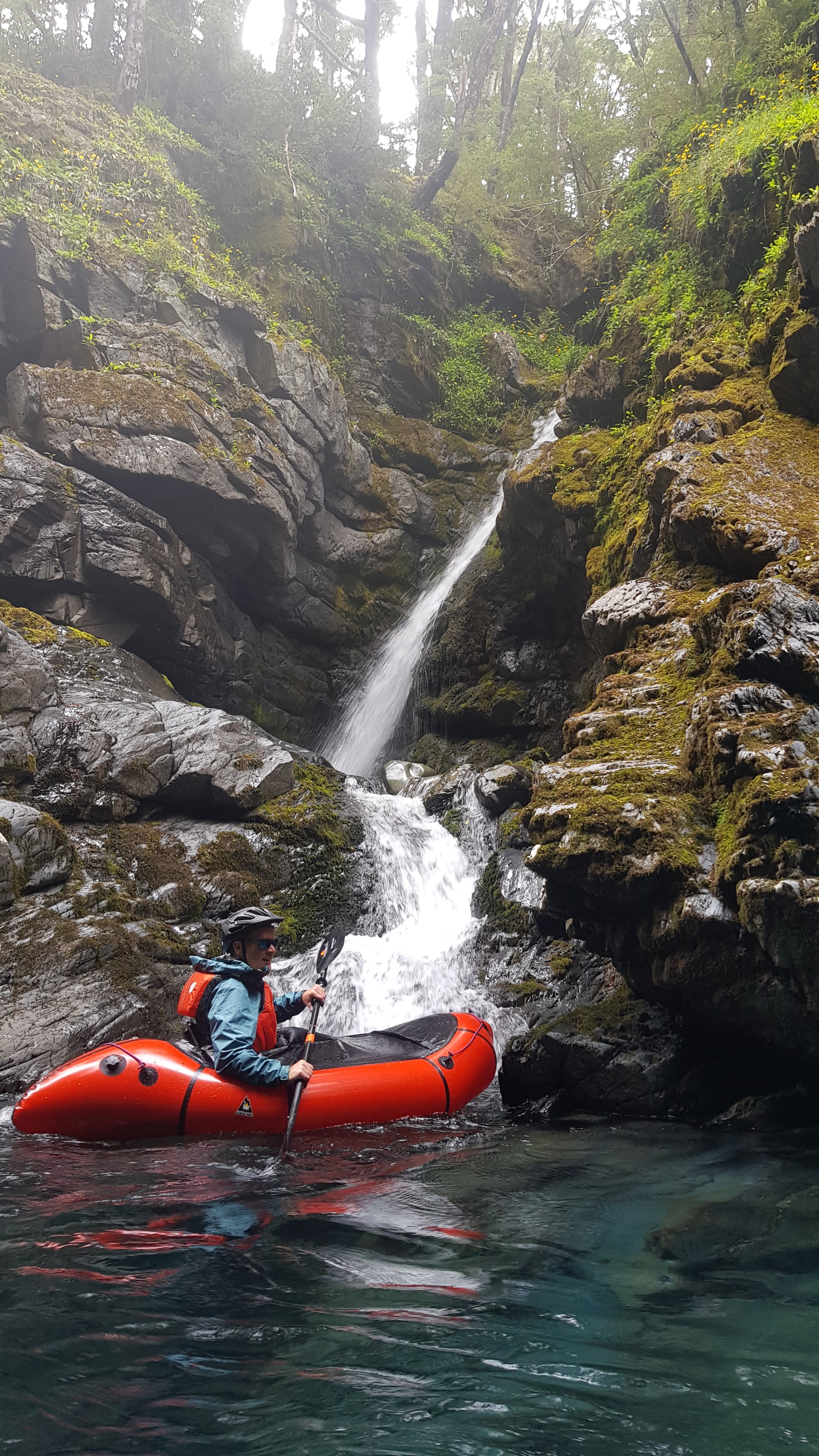
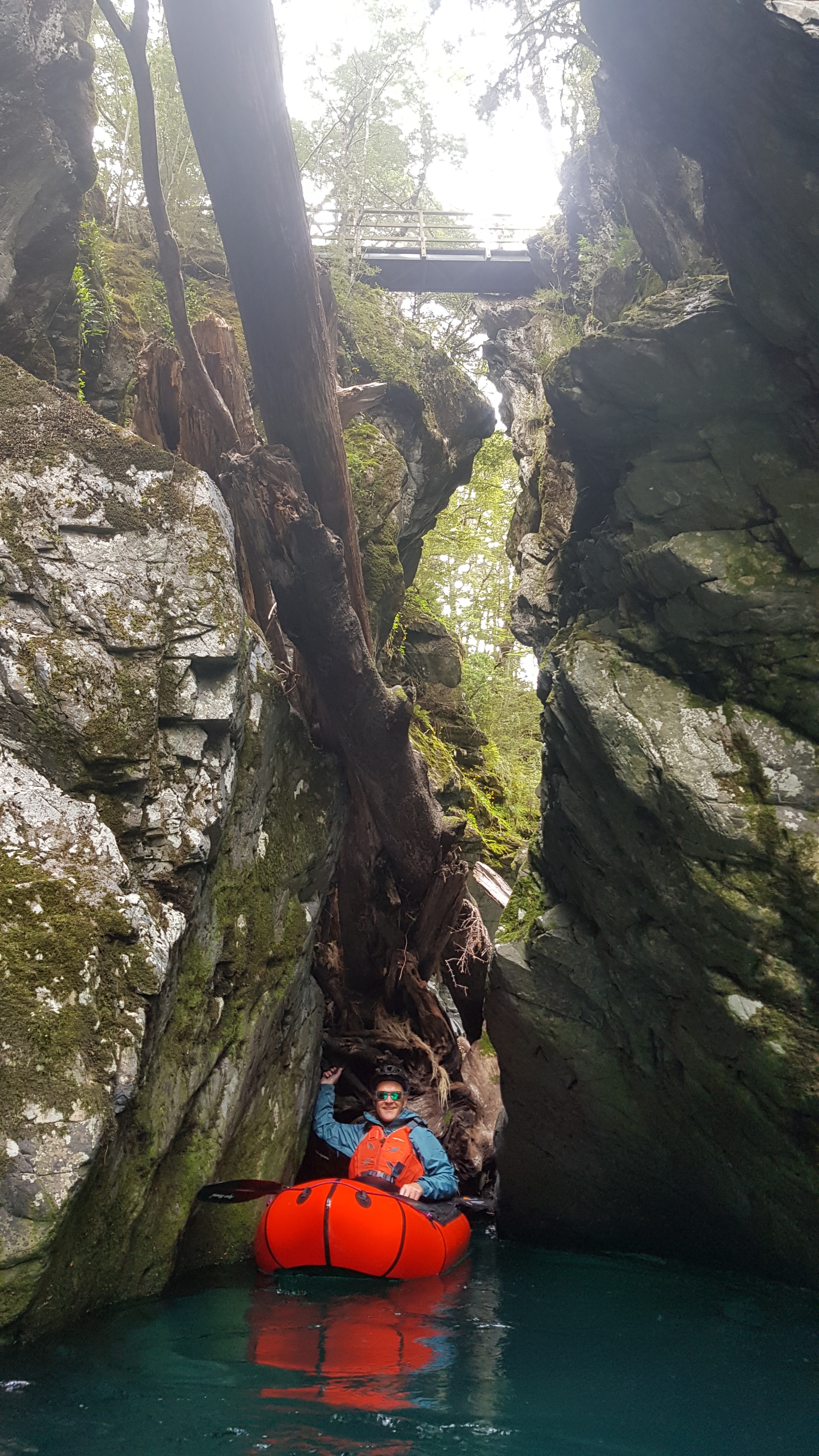
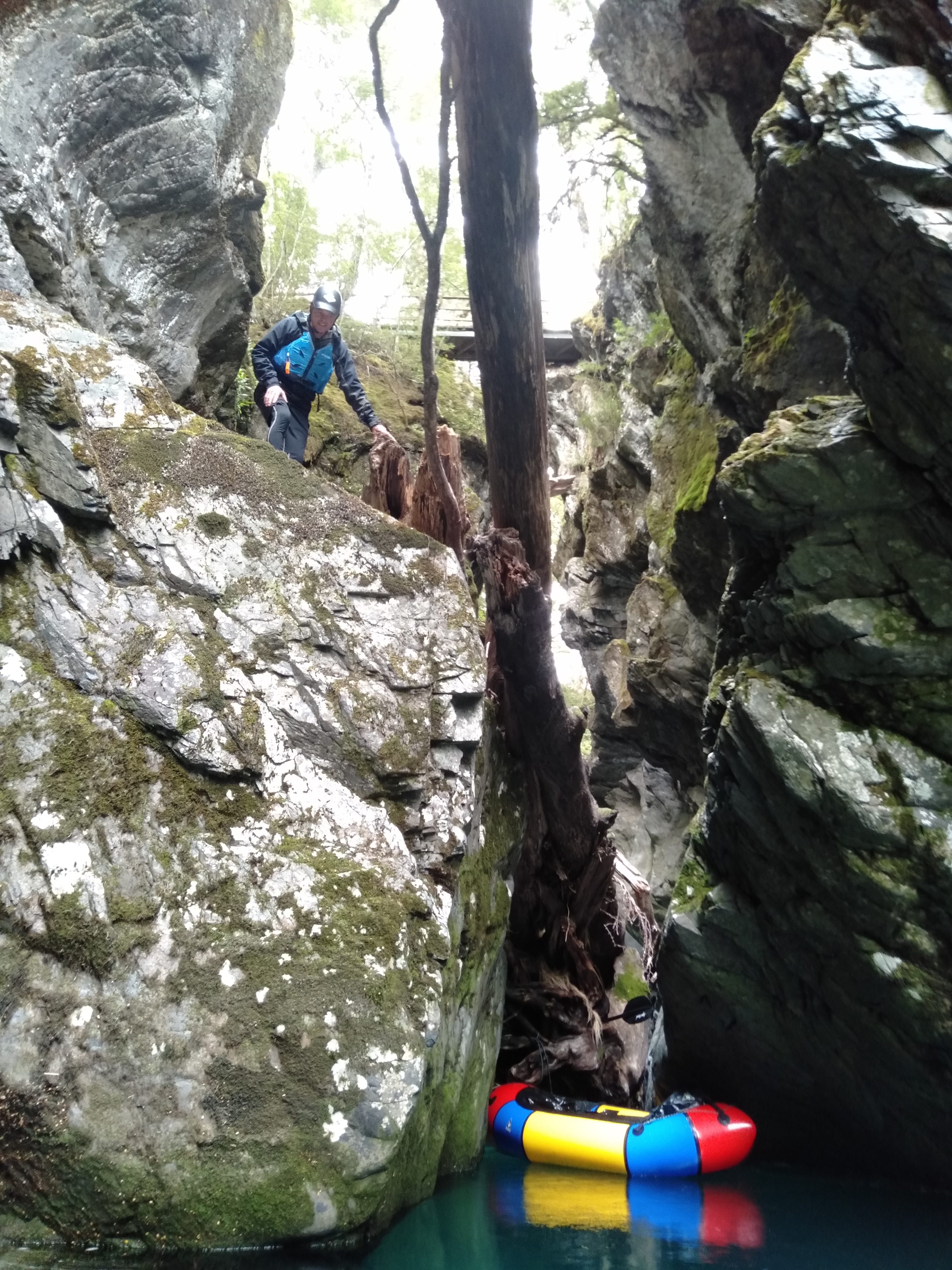
The mid Caples gorge is a dichotomy, with class IV/V water in the top half and class II water in the bottom half below the mid-gorge tree jam. The tree jam is easily visible from the bridge.
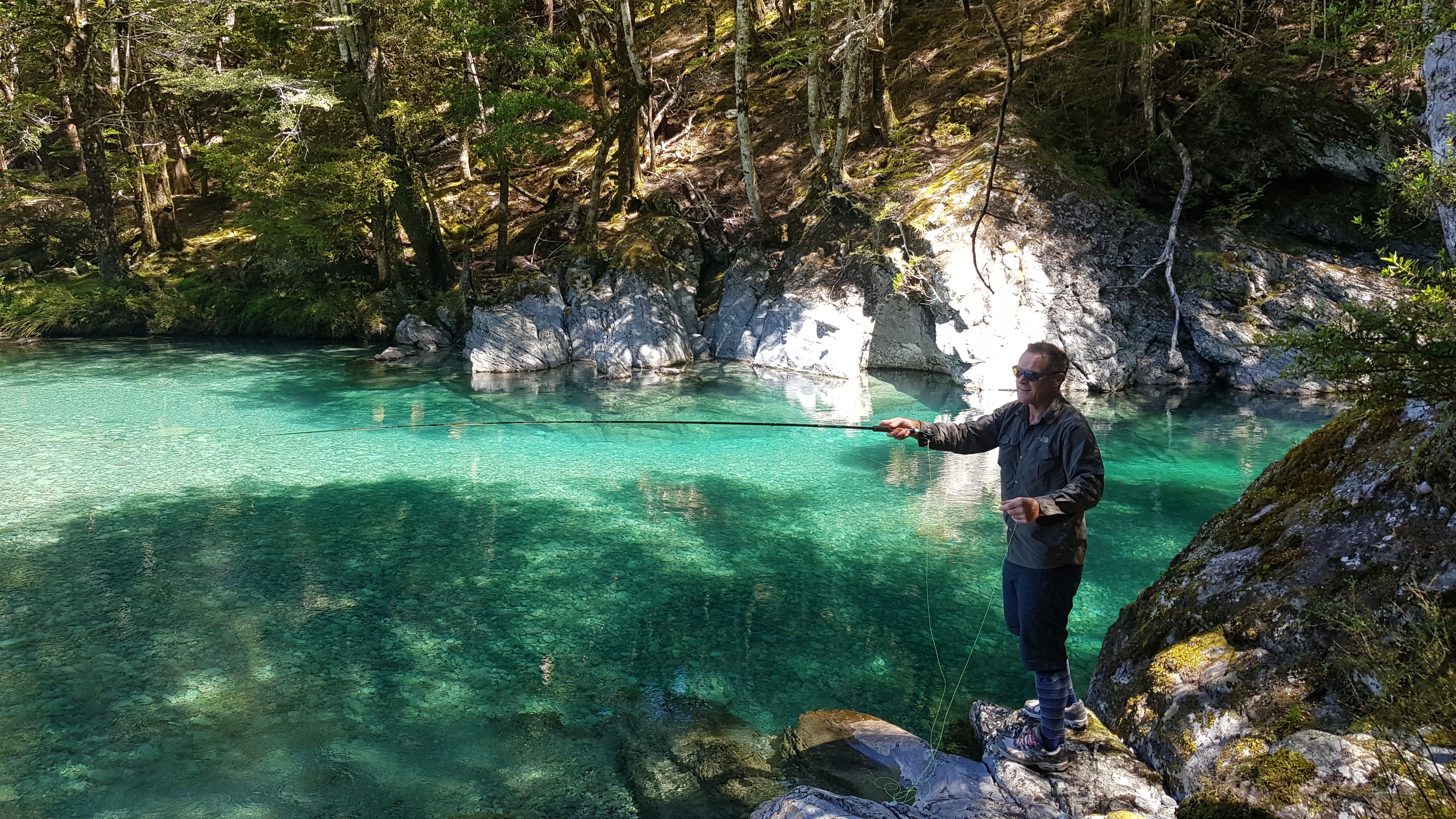
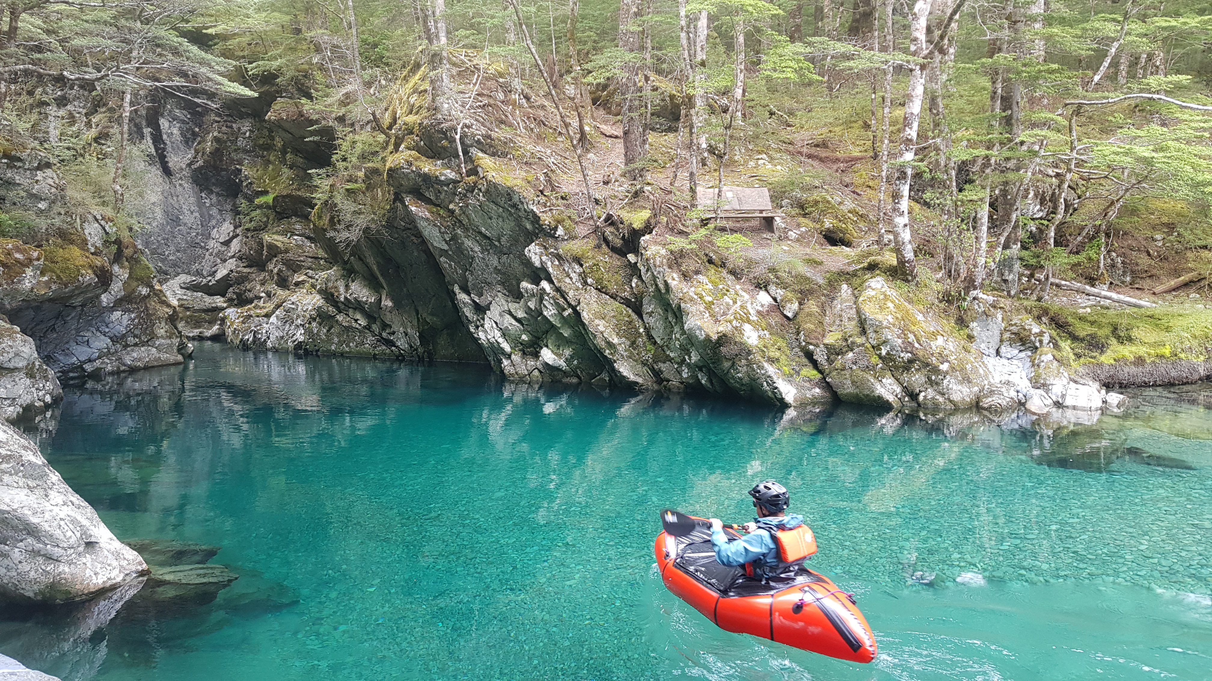
However for grade II paddling its best to portage river right. The base of the mid gorge on a sunny summer’s day is `Shangri La`. Enter the river opposite the bench seat and paddle upstream and see how far you can get. In low flows it is possible to eddy hop to the tree jam just downstream from the bridge, however in normal flows the first narrowing of the gorge is often as far as its possible to paddle upstream.
Either way it’s a stunner.
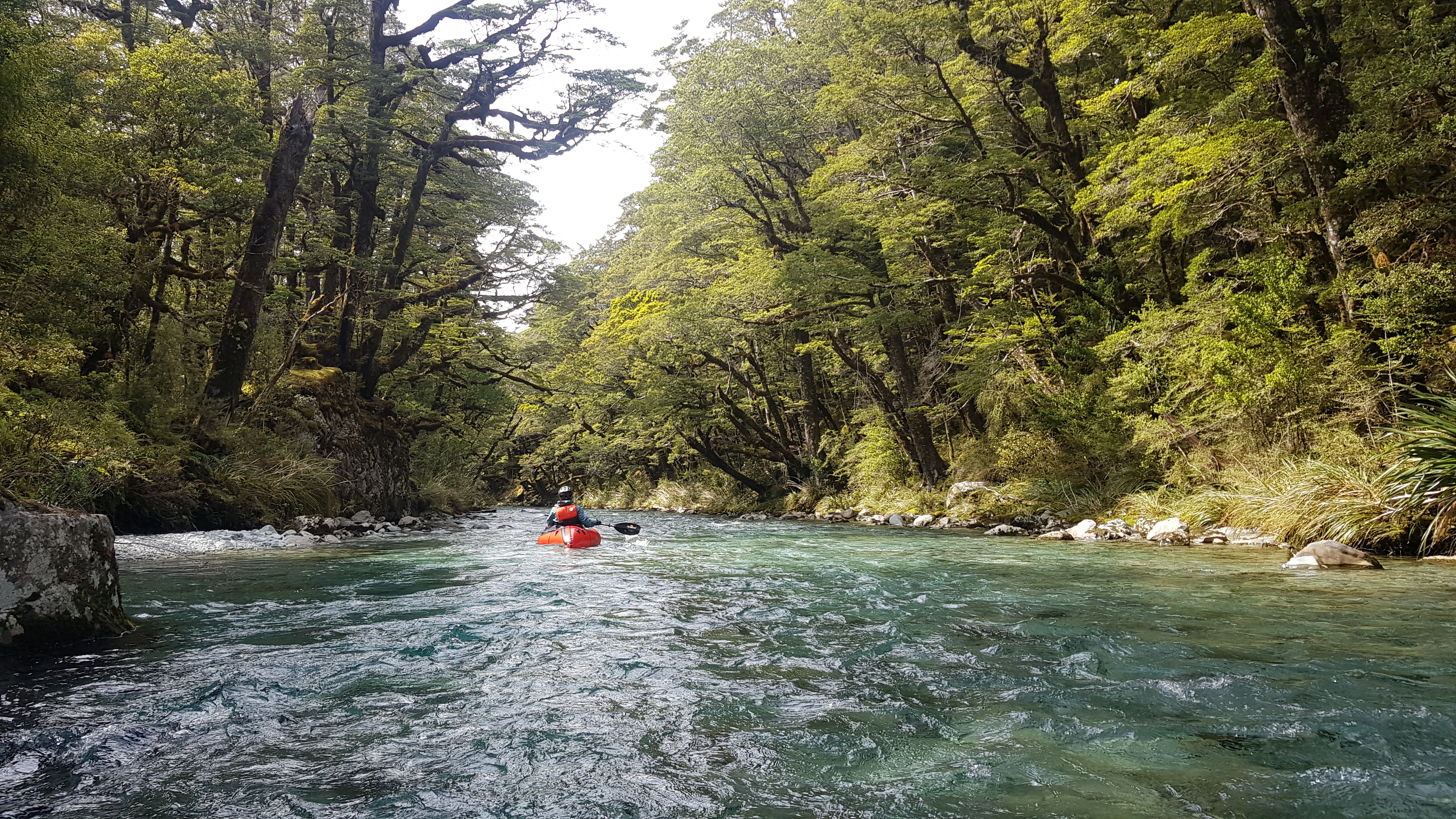
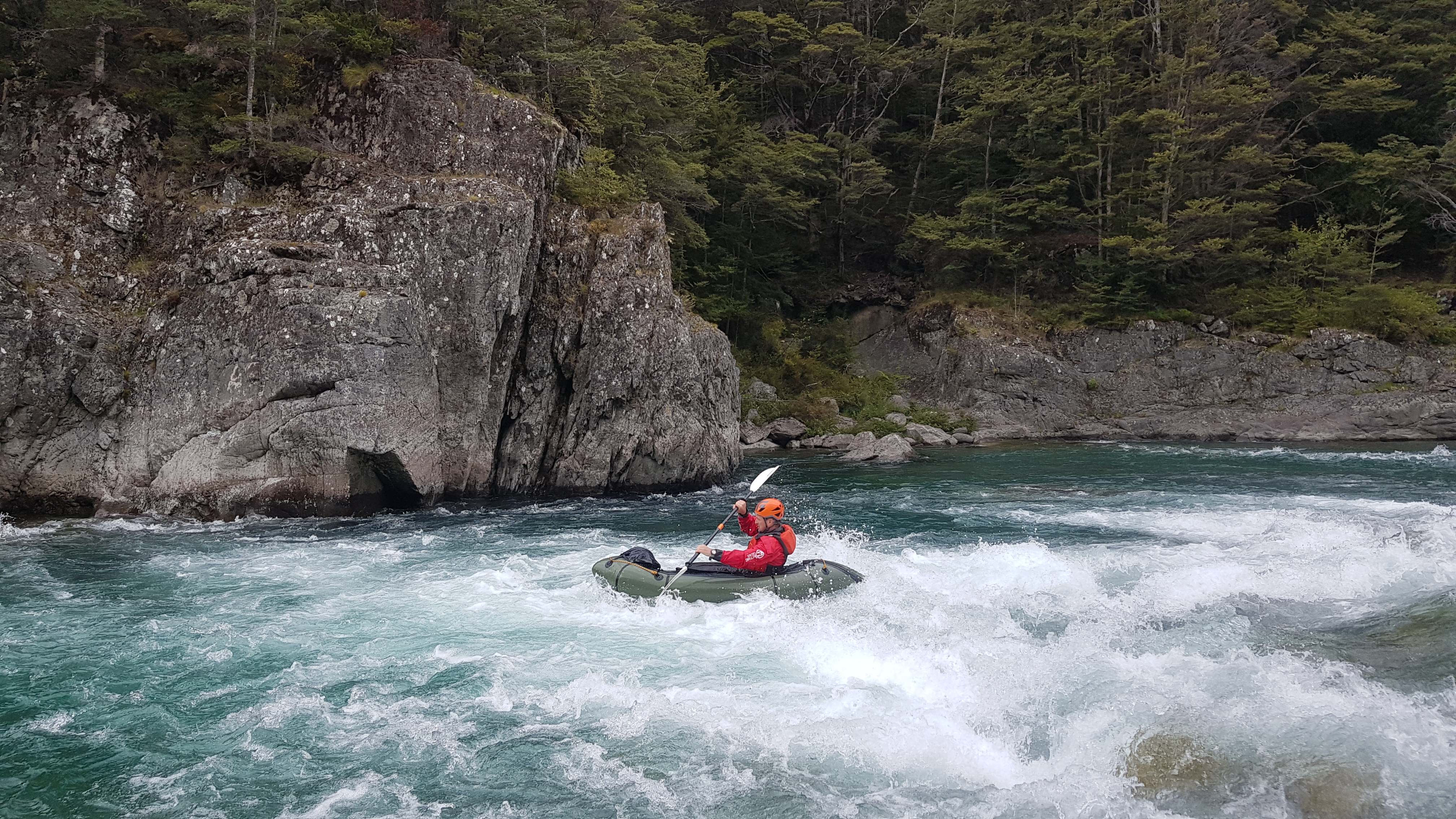
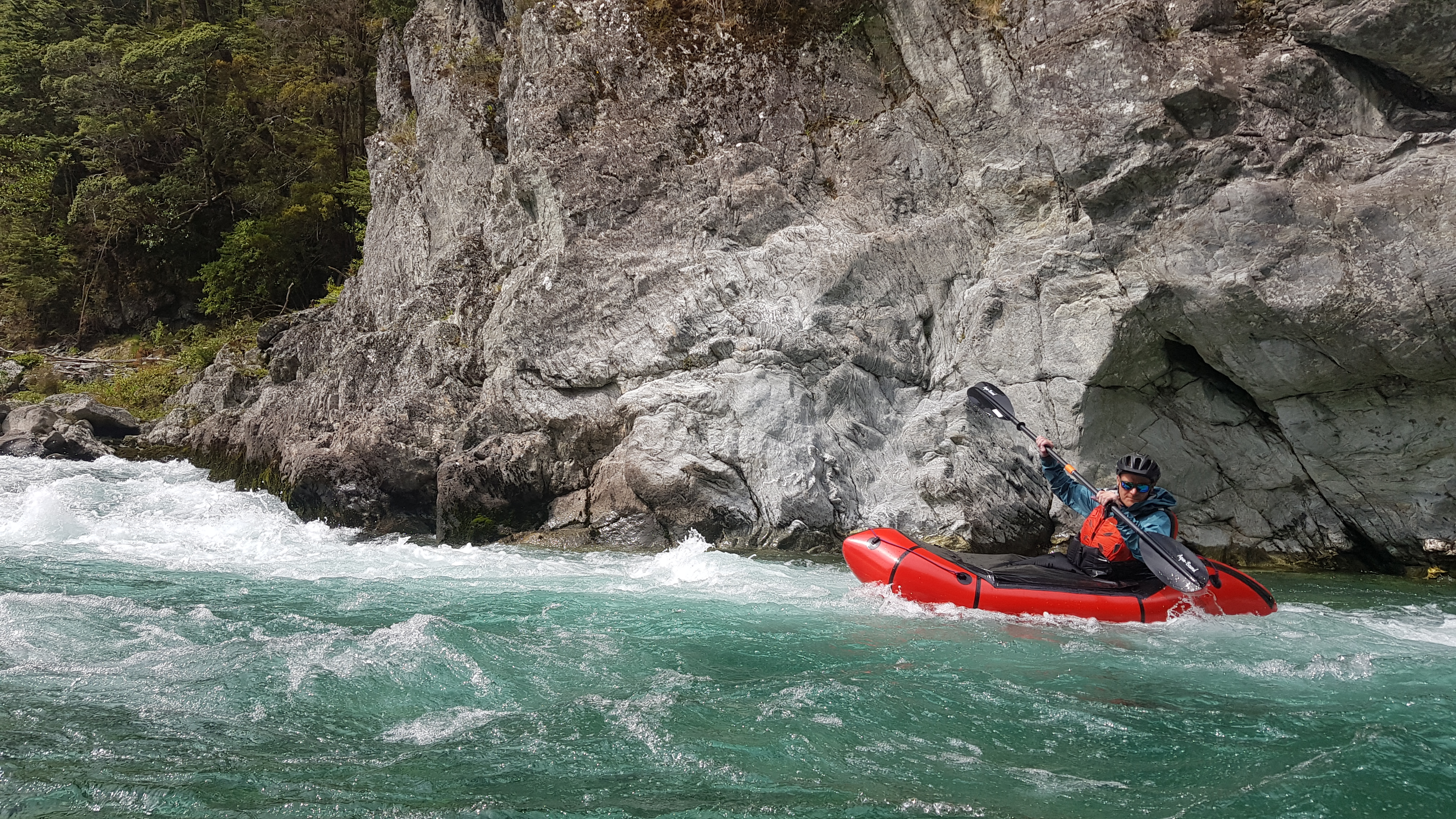
Base of Mid Caples Gorge to Greenstone swing-bridge (II)
From the base of the gorge down the paddling is classic open valley, almost braided river until it narrows and turns right a few hundred metres before the Greenstone swing-bridge. This section is 7km, class II with some small play waves and Eddies.
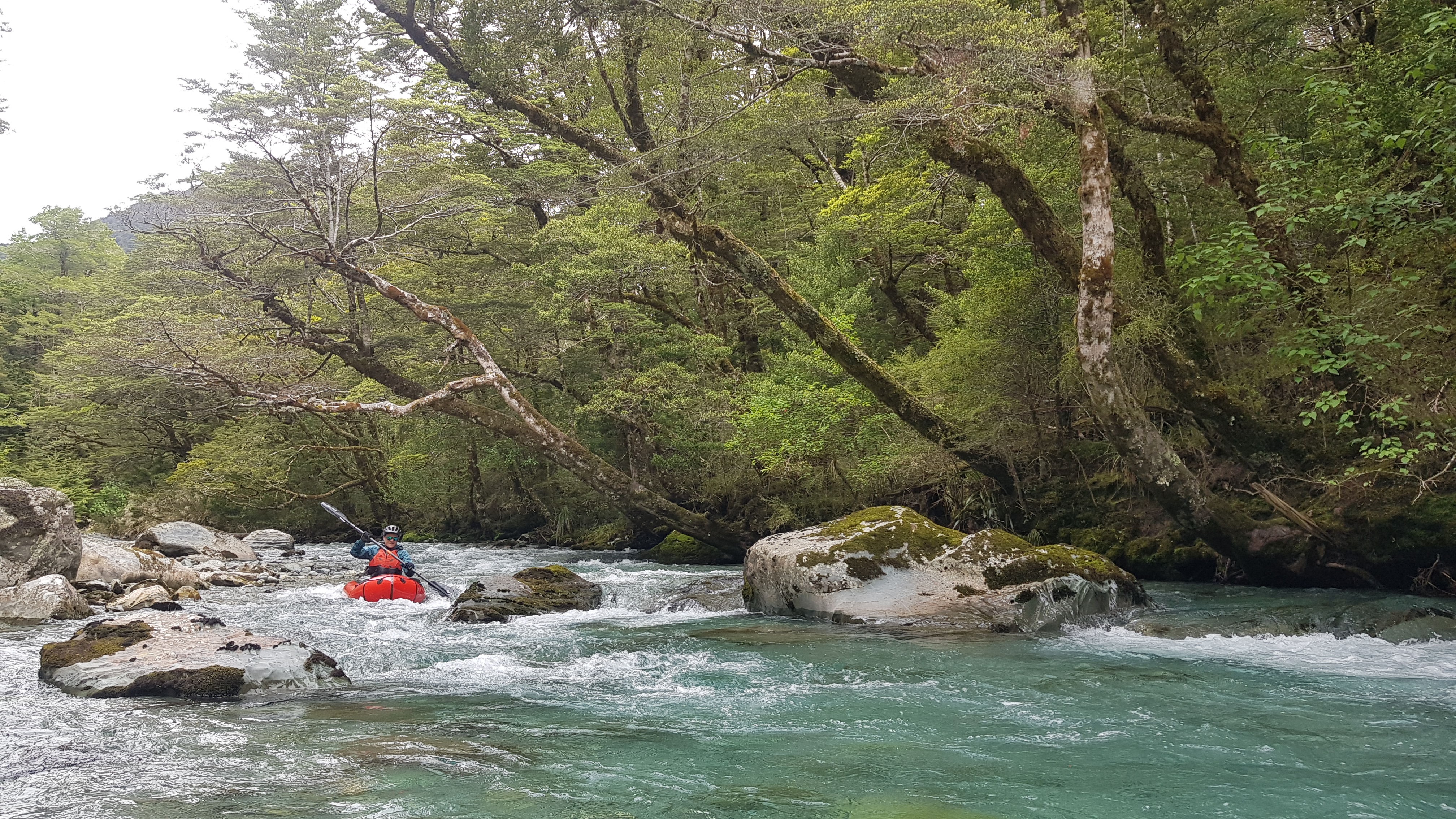
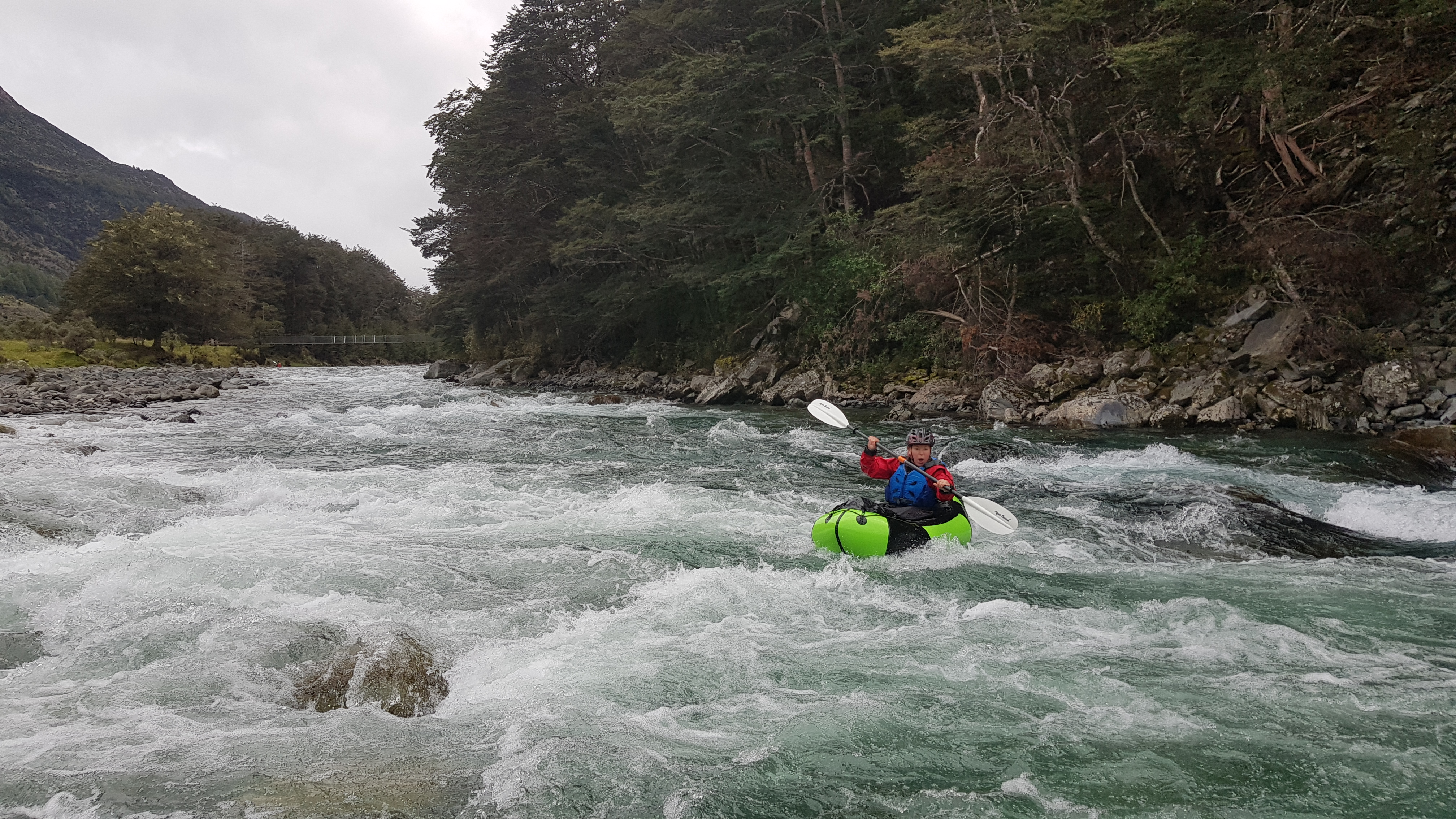
Greenstone swing bridge to carpark / Lake Wakatipu (II+)
Between the GG Bridge and the take out, 2km, there are 5 rapids of varying difficulty depending on flow levels. They can all be easily portaged in normal flows. The first just after the swing bridge is the easiest with some boulders to negotiate. The Greenstone confluence on river right then adds considerably more volume to the river. Just after this the second rapid runs directly into a large pool against a head wall and the river turns left. The third rapid has a tightening of the river again and runs along the left bank and into a headwall at its base where it generates a wave which flows directly into the last gorge. This gorge however is easy with flat water and deep pools in normal flows. The fourth rapid is an easy wave train between boulders which leads to the final rapid where the river again travels along the left bank and creates another wave impacting a headwall and pushing with constraint to the right. This last buffer wave is a great spot for eddy edging practice. (All these rapids can be easily portaged in normal flows). From here follow the river to the stock bridge and break out river left for the carpark OR continue to Lake Wakatipu and paddle across the lake via Pigeon Island to the GY road.
All info above is correct as of Jan 2020. (updated Feb 2022)
Gauge
Visual at the bridge. If the water is just surrounding the rock below the bridge station or below, this is normal flow. Check the pic on the Greenstone page. This is the best gauge.
Closest flow gauge: Dart River at Hillocks.
Median flow on the Dart gauge is 45-55 cumec, although it is a different catchment and much bigger it does give some indication to flow levels in the greater GY area.
After over 10 trips to the Caples and Greenstone we have noticed the Dart gauge does not relate well to these rivers. Depending on the direction the front has travelled from, determines if the dart gauge is a direct indicator to these rivers. We once travelled to the Greenstone at 200 cumecs and the Greenstone was clear and normal flow.
However If the Dart is at median flow, there is a good chance the Caples flow will be fine.
Gallery
Greenstone lower gorge 3rd rapid
A large tree was deposited in the bottom gorge during the rain cylce on the 26th and 27th Jan 2024. This tree is approx 40-50cm in diameter and runs bank to bank wedged in the cliff face. During low to median flows it is possible to paddle under the tree on river right. However in higher flows this tree would be a lethal hazard.
Suggestion is to scout the tree from the top of the rapid above the gorge.
There is a new fairly significant strainer around a blind corner in the easy gr1 section. The river has broken its banks and instead of following the traditional river left down the established braid the river now newly flows through farmland with grassy banks. This leads to a right hand bend and there is a significant sweeper/ strainer tree present at a blind corner. This new braid is maybe half way between the last hut and the swing bridge. If you are attempting this section, keep a keen eye out for this hazard!
I did this as a day trip, hiking from the car park up to Mid Caples Hut, and then paddling down.
I would suggest that the time up to Mid Caples is more towards 2h30min. DOC suggests 2-3h, but carrying a packraft it can weight a bit more down on you.
Then paddling down, 2h is probably too little time. On a day with high wind against the direction of the flow of the river, it took us closer to 4 hours.