


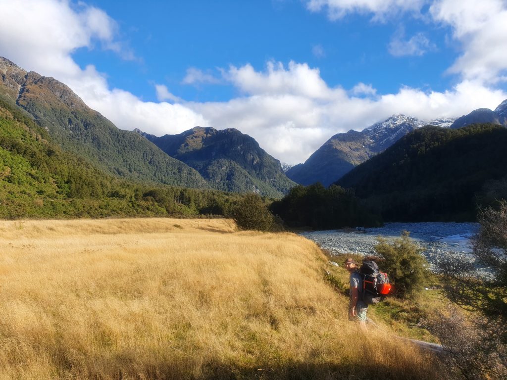
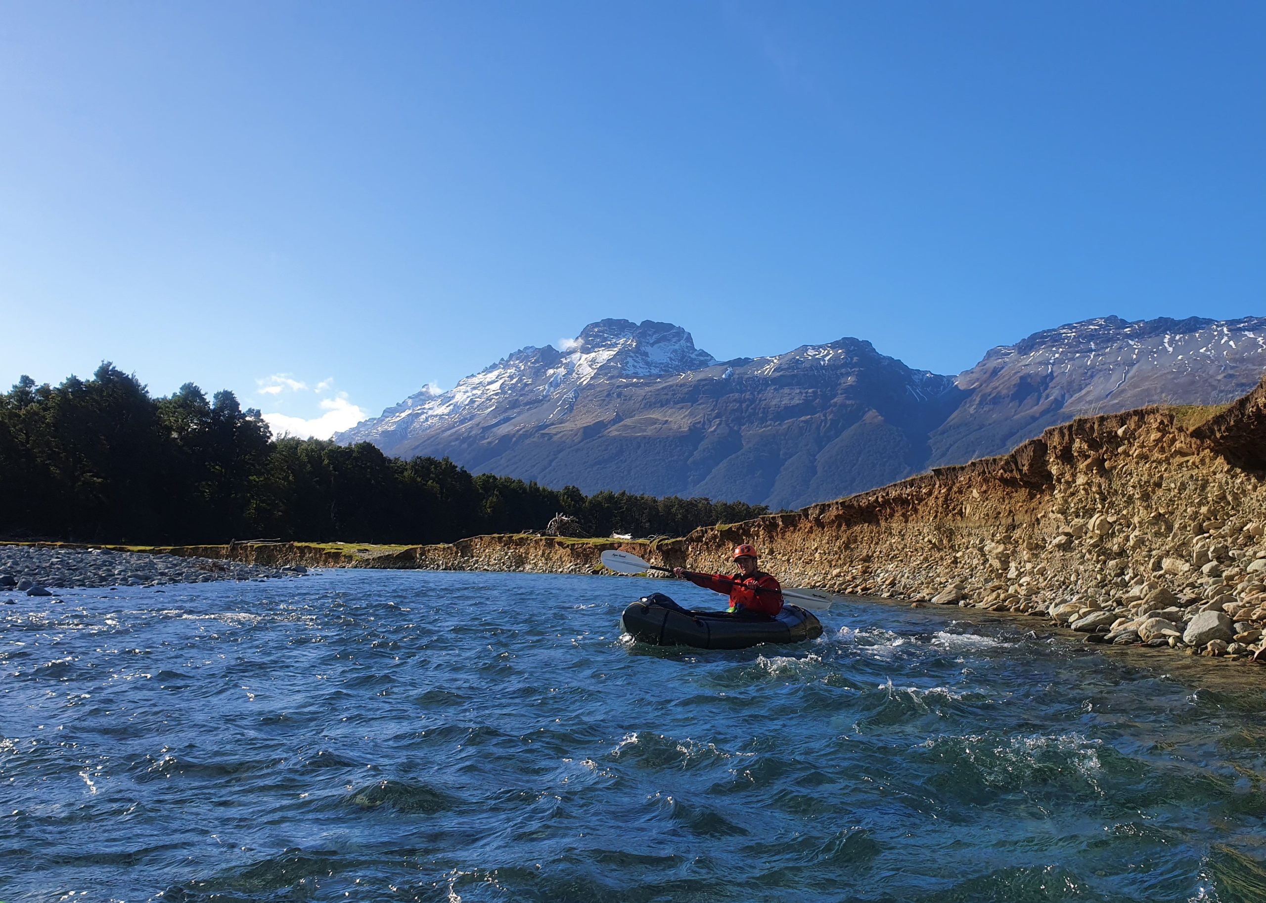
Another ‘GY gem’ of a paddle with beautiful crystal blue pools, cool boulder formations and beech lined forest, along with sensational views of the Humboldt Mountain range and Mount Earnslaw.
Originally described as V in Graham Charles’ Whitewater guide, but in low flows, the lower reaches of the run hold fantastic beginner/intermediate paddling.
Either car/bike shuttle, or hike in via a rough anglers track, either way its a great half-day adventure!
Thank you to Alan Swann for the information for this trip page, plus Dan Clearwater for edits and interactive map.
View Larger Topographic Map
“The Routeburn river has always looked like it fitted into the `too scary` or `too hard` box for the majority of packrafters. However while scouting this run from the Routeburn bridge down to the Lake Sylvan bridge it was noticed that from Weka Flat it was much more feasible as a classic grade II+ run. It is short, 2-3km, but very sweet. We headed in the next day after scouting and were blown away with the enjoyment this little section of river gave.” – Swanny
Getting to the car park
It’s a 30min drive from GY (Glenorchy) to the DOC carpark and campground for the Lake Sylvan tramp, turn right for Sylvan 3km before the start of the Routeburn track and head to the campground. It is a great place to camp the night before if your not from the area. This is a very popular tramp in the summer months and its often possible to easily hitch there and back from GY.
Walk in or shuttle
There are several options to get from Sylvan Campsite to the ‘put in‘
Trapline track. In 2023, the Sylvan Track swingbridge next to the campsite was destroyed in a flood – some older maps might show it in this historic location. It has been rebuilt about 600m upstream, at the exit of a bedrock gorge.
From the campsite, follow the Sylvan Track upstream on the true right to the new swingbridge. Ignore the main track, but look for pink ribbons marking a trap line, that continues up the true right.
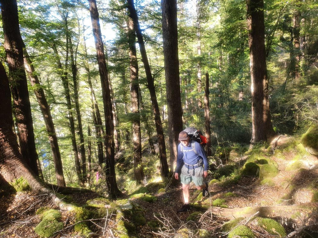
The track gets a bit steeper as it climbs over the gorge – try hard to follow the trapline markers as they take a good route around the steeper terrain. The trapline continues down towards Weka Flat, follow your nose from there to the western end of the flat.
If you want to hit the class III upper section, continue up the river bank to the bend below point 646m on the topo.
Gravel road: The second and easier route is slightly longer and less scenic. Its 3km, back along the road then turn right towards the Routeburn start. At the Weka flat sign, head down through the bush to the river.
‘Upper Peak Creek’. Un-named on the maps, this creek crosses the main road, and with a car or bike shuttle, should allow quick access to the start of the grade III.
On the water
Routeburn swingbridge V
Described in Graham Charles’ Whitewater guidebook, and Riverguide.co.nz
Upper Peak Creek section (III)
Tight boulder garden rapids down to Weka Flat.
Weka Flat to Sylvan Camp (III+) or (II+ with a portage)
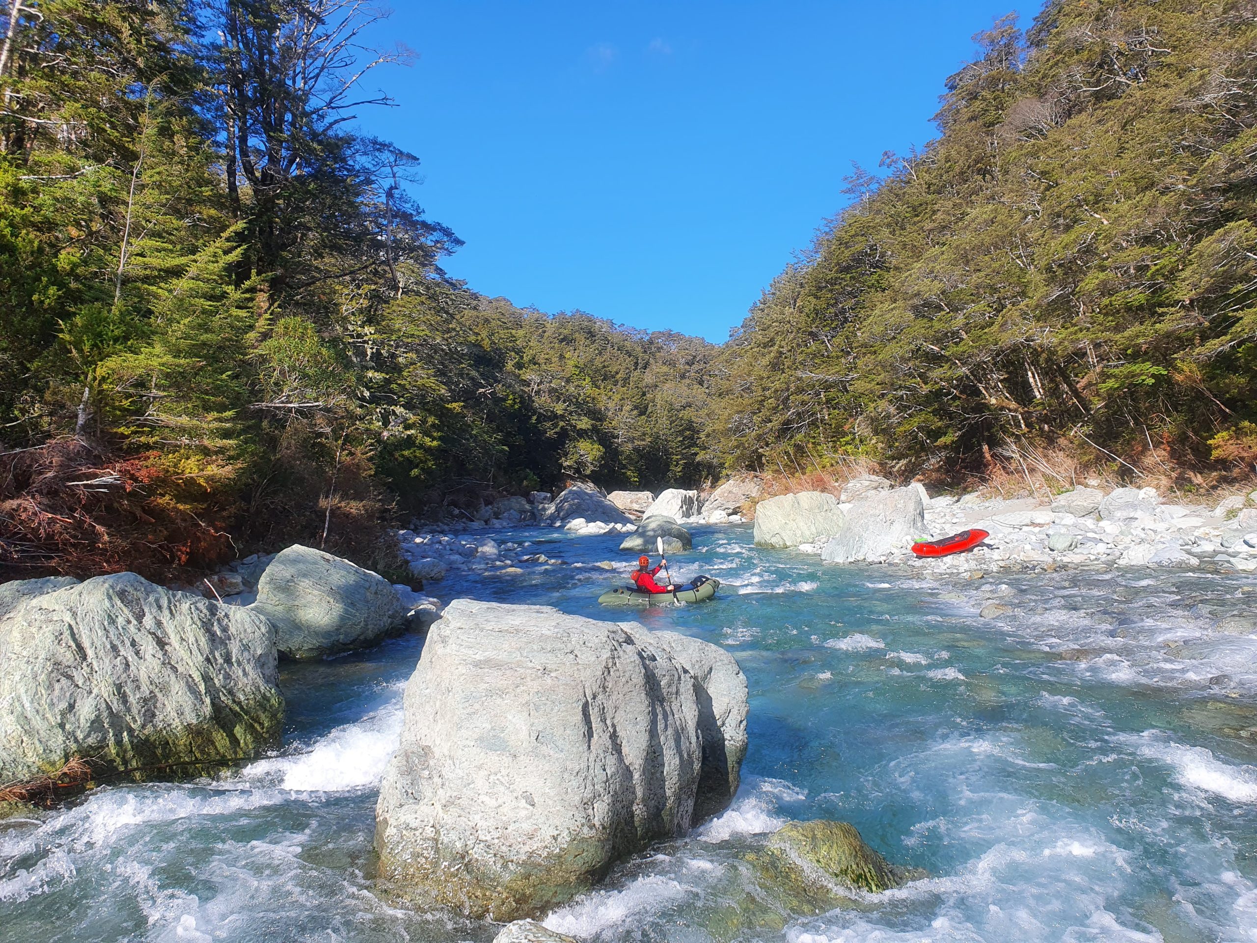
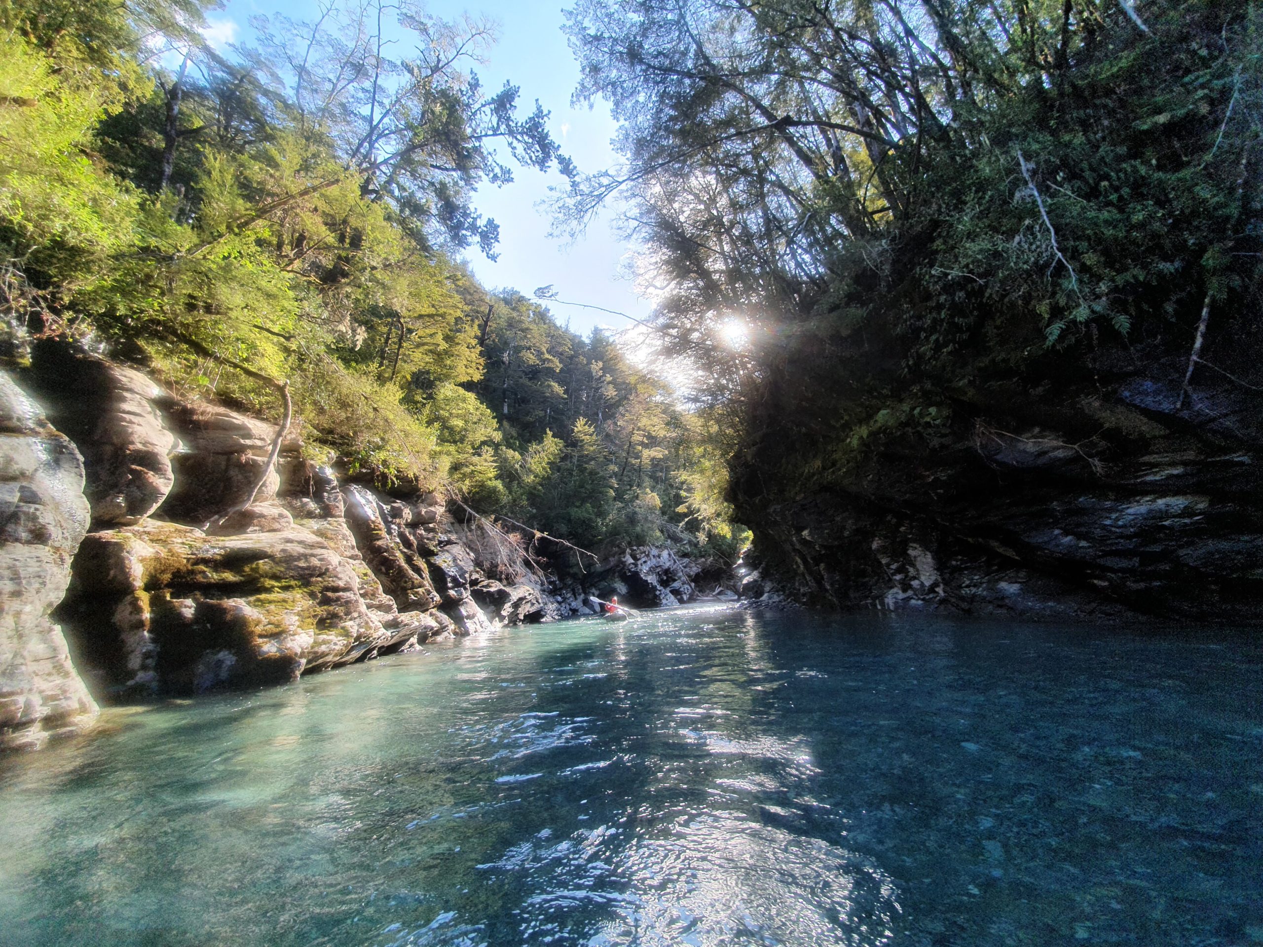
The river has several characters along this section and provides some great lines through the boulders. Check out the pictures below, they speak a thousand words. Scouting rapids for trees is vital in the main rapids, the river is prone to this hazard. There was however one tree that we had to portage over in low flow (check the pics). If in doubt, give it a scout.
Starting at the Western / upstream end of Weka Flat, in low flows, its tight squeezes between boulders. There are slightly steeper sections with class II wave train paddling along this section.
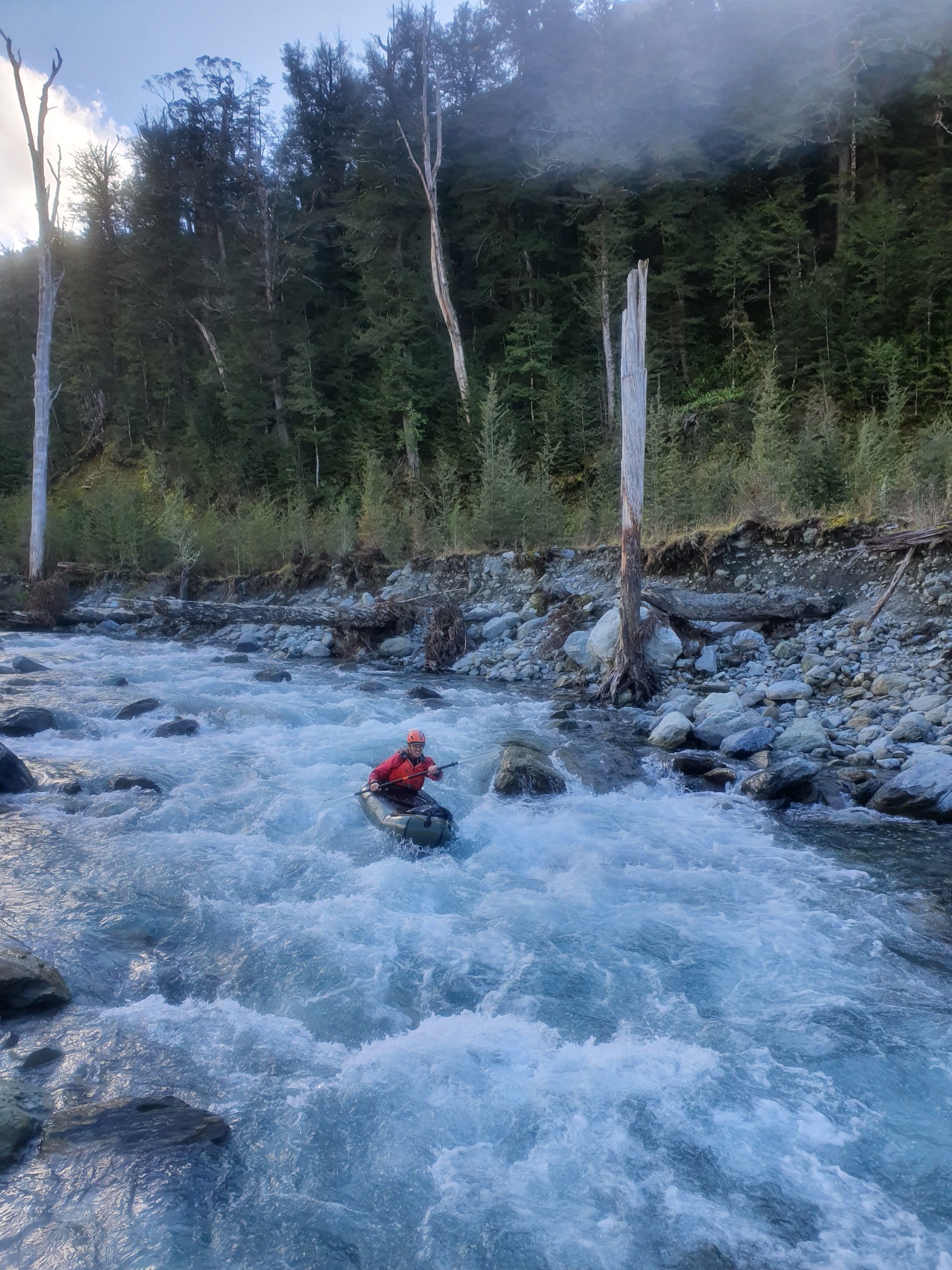
Then the banks start to close in, and the river drops through larger boulder gardens, which makes for some slightly more technical paddling.
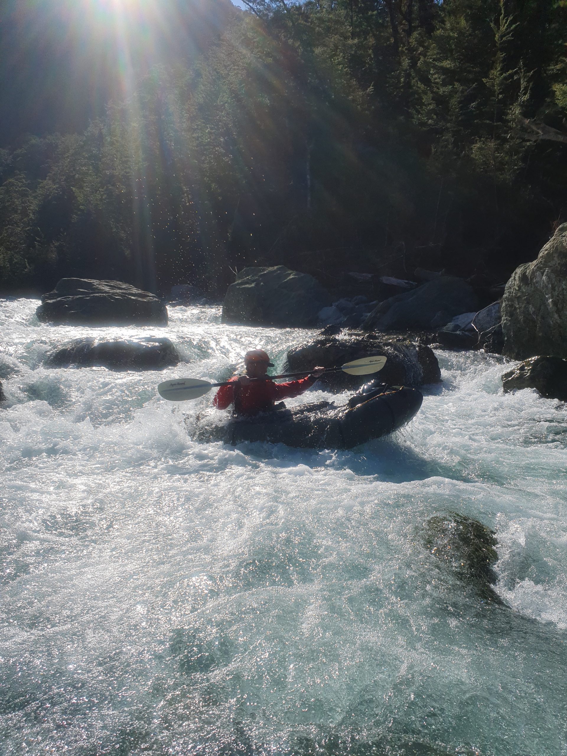
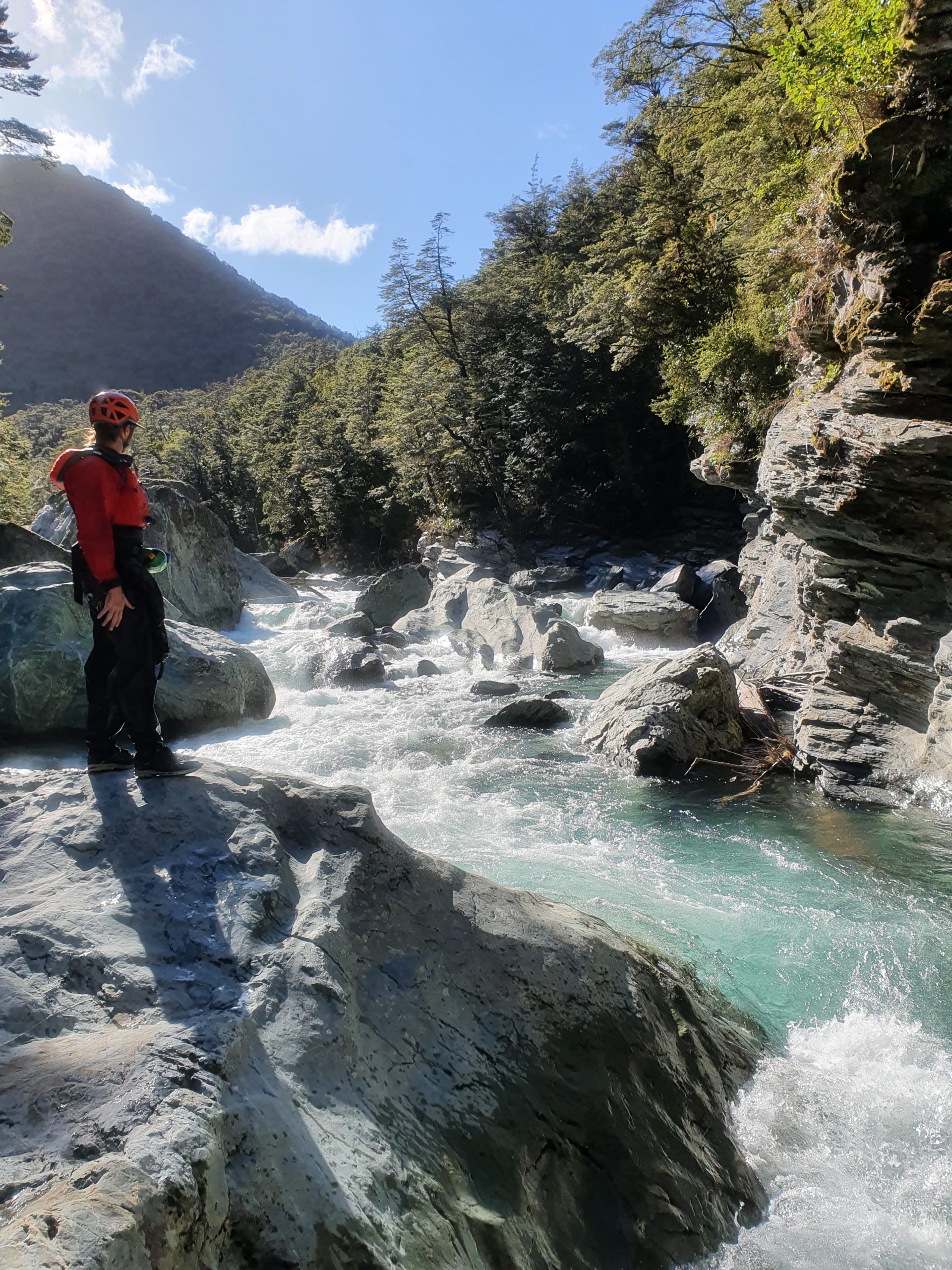
When the trees appear to touch one another, the III+ section is about to start. Portage easily on river right if you need to.

The gradient increases, with the largest rapid running into a stunning pool. Next comes a 200 metre-long three-drop rapid. These drops are roughly 1m in size and are great for a capable team.
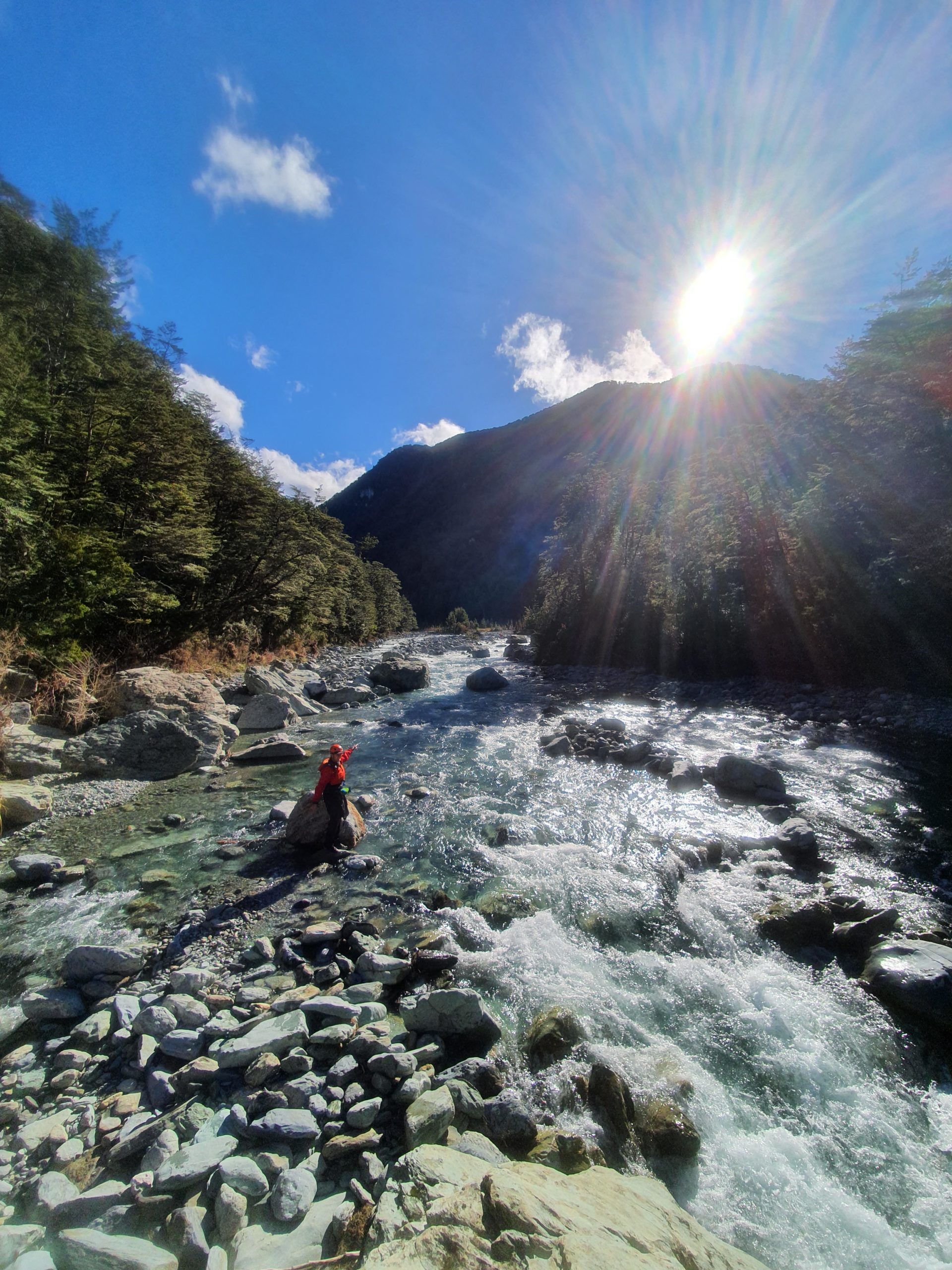
The gradient then eases as the river then runs into a beautiful gorge. Keep your eyes peeled for trees! At the end of the gorge you’ll float under the new swingbridge.
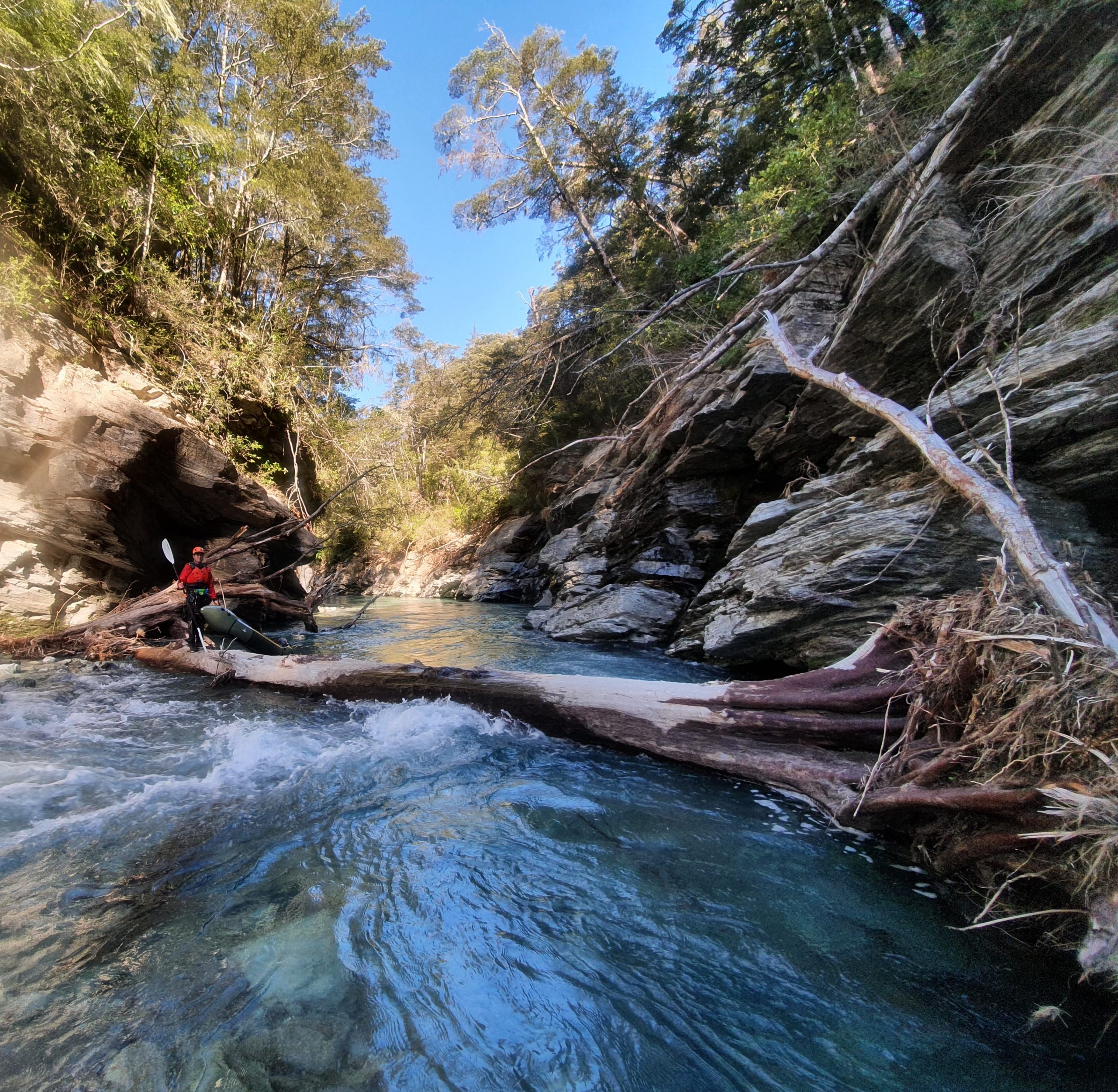
Beyond the gorge, expect class I or II with one more continuous rapid a few hundred metres before exiting at the Sylvan Campsite.
If you want to paddle ‘all the river’, you could continue for another 1.5k to the Dart confluence. With Permission from Stu Percy at Routeburn Station, you could walk accross the paddocks back to the campsite. Or continue down the Dart (I+) to the public road bridge to your car or bike.
Gauge
Visual.
At the Sylvan Camp takeout, if the river covers about a third to a half of the river bed, then this is ideal for a low flow class II run using the portage.
If the river is just bank to bank, it may be ideal for more experienced paddlers and conversely if you couldn`t paddle downstream from the campsite it may be too low.
If you’re not sure drive to Weka Flat and have a look downstream from the riverbank.
Nearby gauge : Dart River at Hillocks.
Median flow on the Dart gauge is 45-55 cumec, although it is a different catchment and much bigger it does give some indication to flow levels in the greater GY area. If the Dart is at median 50 ish flow to 100, there is a good chance the Routeburn flow will be fine. If the Dart is running at 150+ then some caution may be required. At 200+ then its maybe best to wait it out.
In Feb 2023 after a couple of days of rain, we walked up the Routeburn to Sugarloaf Stream, walked down to the Routeburn River and then walked upstream until hitting the massive waterfall. We were hoping to find some kind of glory rapid below the waterfall, but unfortunately this didn’t present itself, we did find some interesting looking gr 4 with some pretty powerful holes and while tempting, we decided to portage them and put in at the gr 2/3 rapids right at the end. After this we floated down some very scenic gr 2 until we hit the swing bridge. Around the swingbridge was really nice gr3 which then transitioned into grade 4 and then grade 5, which was really bony at our level (water was still running clear). A couple of the team paddled a handful of the easier grade 4 rapids within this nominally grade 5 section, however they were short and with some rough consequences from missing lines. The final section coming into the bend at 646m (described above), was a fun and long gr 3/4. The river after this eased a bunch until we got into the lower canyon, which was spicier than we thought it was going to be! There was a river wide strainer at the end of the gorge in the main flow, so we chose not to run it. Thanks to Swaney for the info above 🙂
In December 2022 we again paddled the upper section from the 90 degree turn in the River, 300m South of point 646m on the Topo map. The river was at median flow in Spring conditions. The classic 2m drop (around the intersection of the 420m contour and the River) had now changed significantly. A rock which now laid mid stream, made the entry much more technical and required considerably more skill to run at low to median flow. An easy portage however.
In April 2021 we hiked a further 300m upstream past Weka Flat to the 90degree turn in the river, 300m South of point 646m on the Topo map. The river was at low flow in late summer condition. This section to Weka Flat gave some excellent G3+ paddling with some 2m drops and was well worth the additional hike.