


Sievey, schisty and scenic – a great coast adventure
No doubt many packrafters have glanced upstream from the confluence of the popular Copland run and wondered what’s up in the gorge of the Karangarua. The answer is some epic whitewater, lots of sieves, some portages and stunning scenery. This is not a run for inexperienced paddlers, but if you are a solid Grade IV packrafter who can read-and-run big boulder-garden style rapids and can recognise when things are steepening up (ie, class V) and it might be time to take the dry line, (ie, portage) then this is a great adventure trip.
There’s also a one-day, class III option from McTaggart Ck – which still demands a good team who are all paddling strongly at the grade.
Thanks to Sandra Hyslop from West Coast Packrafting for the info and photos.
If you want a guide on the coast, ask West Coast Packrafting.
Unfortunately, they don’t offer trips on the Karangarua, but have concessions for guiding and instruction on a heap of other rivers from grade I to IV, 1 day to 6 days.
View Larger Topographic Map
Approach
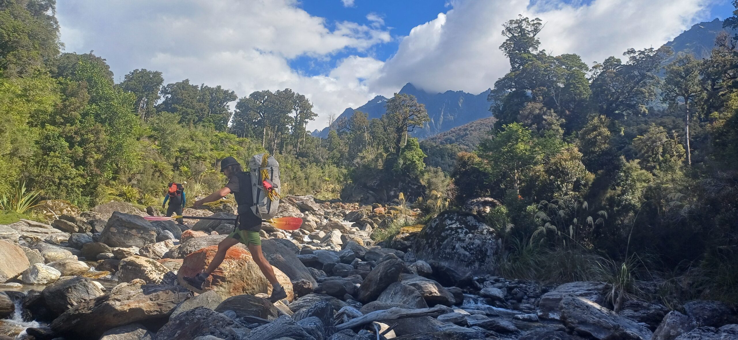
The Karangarua Valley route to Cassel Flat Hut is relatively easy for a West Coast bush track; 13km of well-graded track with a few creek crossings. DOC says 6hrs, a fit packrafting group used to the west coast would take more like 4-5hrs.
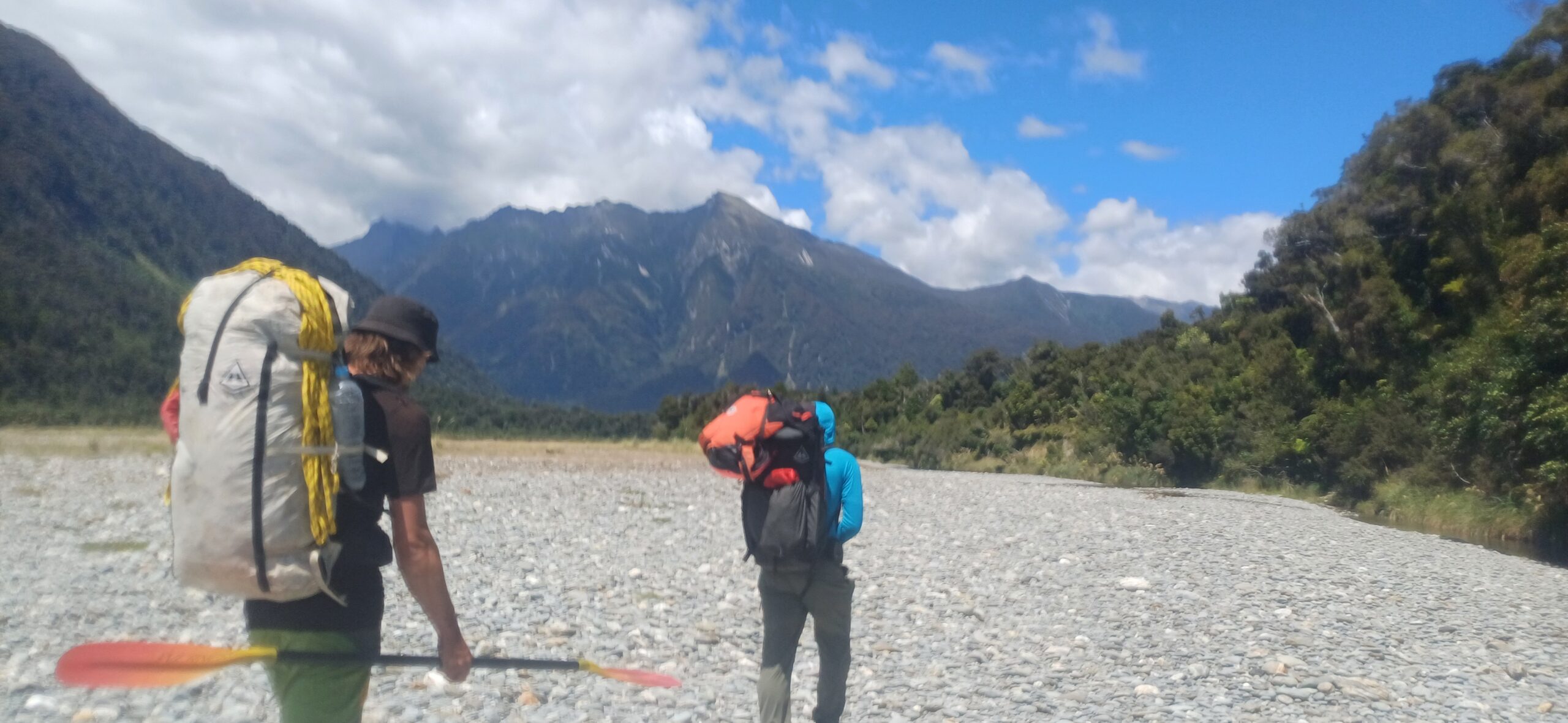
Cassel Flat hut is a 6 bunker with poor protection from the resident sandflies and mosquitos, so it’s not a bad idea to bring a tent! Its an incredible place with big, steep country all around.

Cassel Flat is the gateway to the Douglas and upper Karangarua – these two valleys can be linked together as a classic multi-day trans-alpine loop. If you’re just here for the night, exploring further up the valley is highly recommended. You could probably packraft from as high as Niblick Creek. Above here, it gets super steep – the upper section was first kayaked in 2016 by a very strong team. The video of their trip is worth a look..
On the river (IV if you portage the bits of V… )
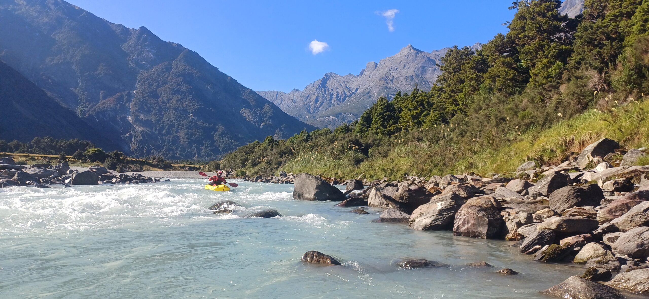
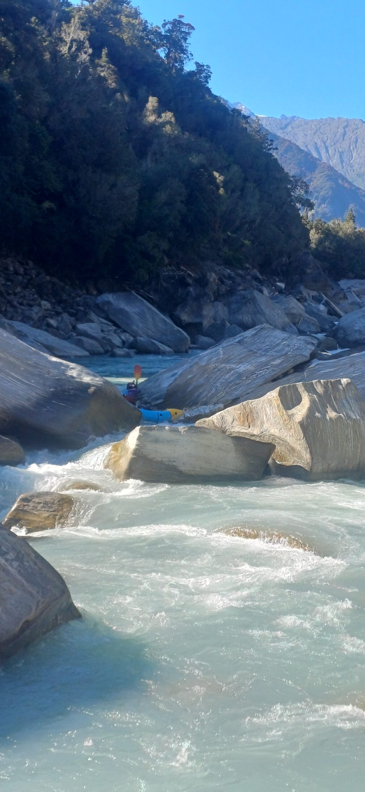
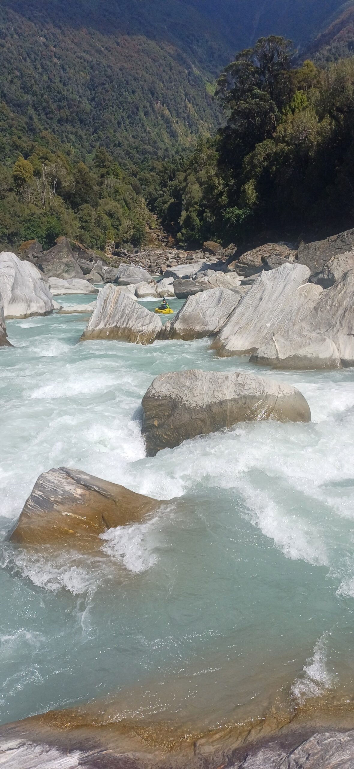
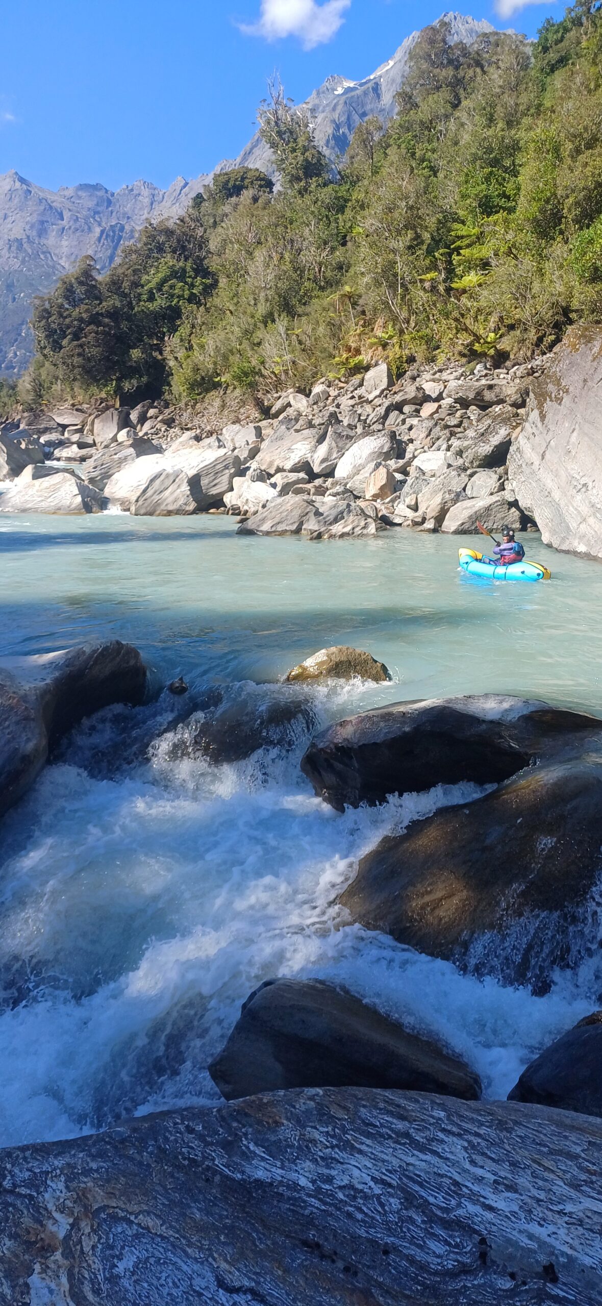
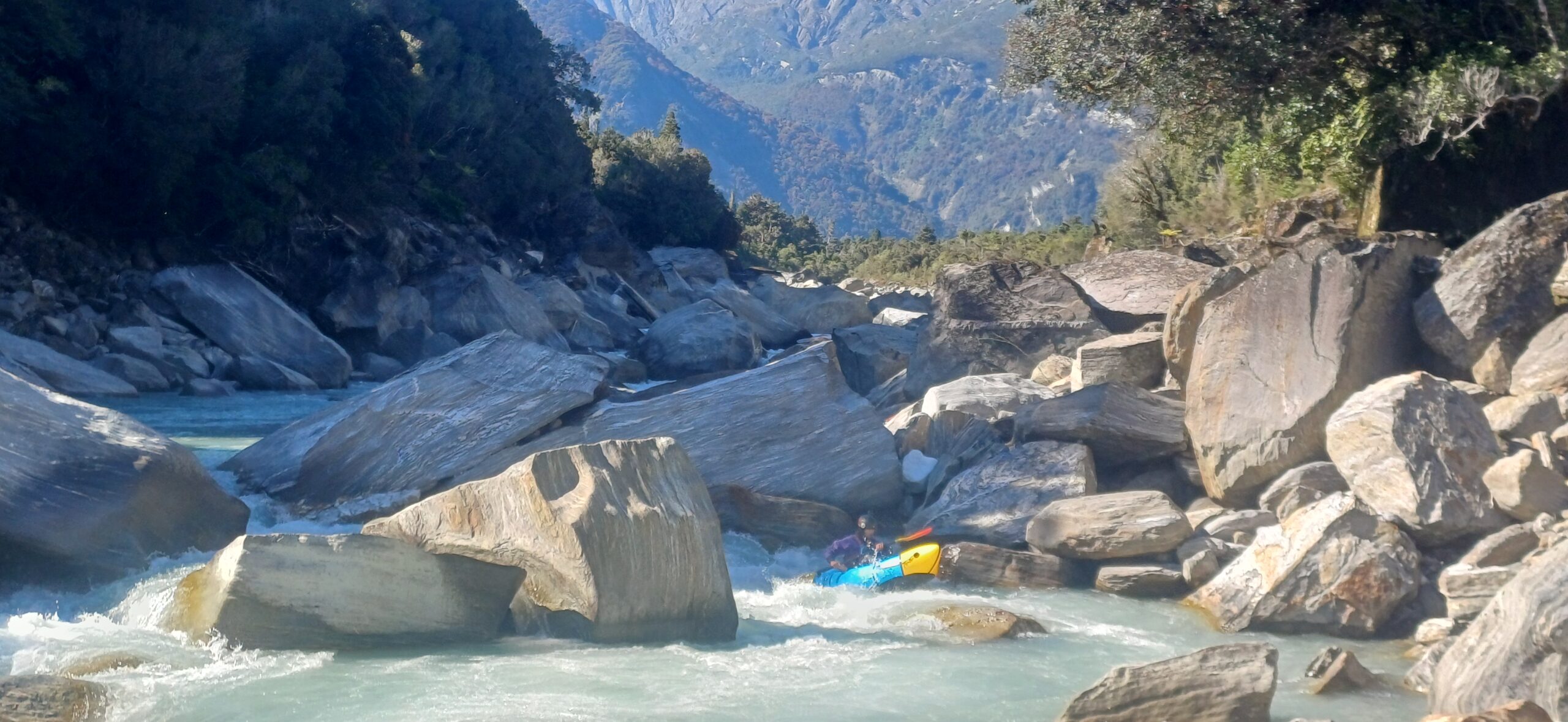
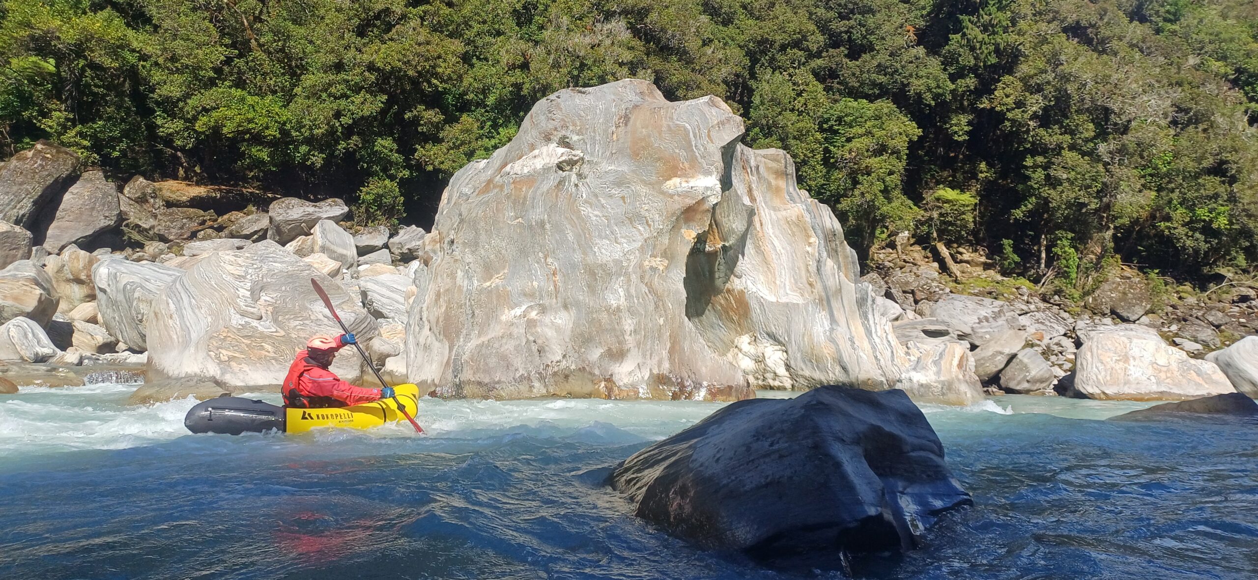
A short bit of easy water below the hut barely lets you warm up your paddling muscles. The action starts very abruptly around Bunker Creek, where you are navigating your way through channels created by giant schist boulders splitting the river. There are some epic boofs and chutes in here but also many sieves. So if in doubt, always scout and don’t miss any eddies! Like we said at the start, you need to be very aware of when things look like they are about to get steeper, which means portaging is probably a wise move.
When you need to portage it’s generally pretty straightforward either on the bank or boulder-hopping in the centre of the river. A self-bailer comes in handy here as there’s lots of in-and-out your boat for scouting and portaging.
The first 2.5km contains most of the gradient with the river dropping 40m/km. Around McTaggart Ck, it eases back to around 20m/km, paddling mostly in the class III range. Just before the confluence with the Copland, things really mellow out.
Gauge & levels
Visual.
If you are kept up by heavy rain during your stay at Cassel Flat and you wake up to a chocolatey-brown river, don’t put on! If you do you’ll probably find yourself taking some very chickeny chicken lines before deciding to bail out. At times the track is quite a long bush bash from the river…. Also, heavy rain can make the side-creeks become dangerous or uncrossable – make sure you check the weather carefully before you go in and if necessary, be prepared to wait for the river/creeks to drop.
But if you wake up to the classic West Coast blue river colour then you should be good to go.
Like most steeper runs, very low water levels can make it unrunnable, with nasty sieves where there used to be tight chutes and paddleable gaps.