


A pleasant half-day beginners run
Below the Insta-famous Hokitika Gorge, the river weaves and braids its way through farmland towards the coast.
This braided section from the Gorge to Wall Rd provides a pleasant, car-to-car trip for beginners. Because the riverbanks are steepish, you’d hardly know you’re passing through farmland – mostly the views are beautiful native forest and the rugged foothillls of the Southern Alps.
Thanks to George Booth for the info and photos for this trip page.
View Larger Topographic Map
Shuttle 15 mins / 15km
Take out: Head to the official end of Wall Rd (Google Maps pin). With a confident driver, a 2WD is fine.
Find a spot to park that doesn’t block the track, and leave any gates as you find them. From the pin, the vehicle track continues west through scrub to the river edge. Note the Fish & Game signs showing the river access route. Its usually wise to go down to the river’s edge to scout what the take-out looks like from water level. Maybe even save yourself a GPS waypoint ;0)
Put on: Head towards the main Hokitika Gorge carpark (Google Maps pin).
Slow down as you cross the Muriel Creek bridge – on your right a rough vehicle track heads down to the river. There should be enough room to squeeze a car in here. Otherwise continue up to the main carpark. Wander back down the road (beware of busy road!) and scramble down to Granite Creek from the bridge, and onwards to the Hokitika.
On the water 2hrs / 13km
There’s a couple of grade II- rapids not far below the gorge, but most of the paddle is grade I, with a few little wave trains here and there.
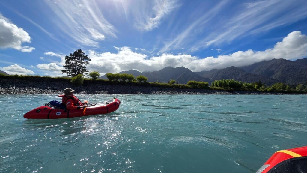
Every flood reshapes the braids in this section of the river, and the bigger floods also deposit trees in the river. Although it’s only’ grade I/II, you still need to watch for river hazards (like trees/strainers) and know how to actively avoid these potentially lethal traps.
Keen fisher folk might take a rod (& licence) and try their luck for Brown Trout and Salmon – see the fishing overview here.
When the forest of ‘The Camelback’ reaches the bank and the braids join to a single channel, it’s time to keep a sharp eye out for your takeout.
Gauge
The photos here show a trip at 110 cumecs
The Hokitika is one of the larger rivers on the coast, and with glaciers in the headwaters, there’s almost always enough water to paddle. The large catchment also means it can rise and flood quickly. We’d generally suggest that you avoid the river when more than ‘light’ rain is forecast.