


Classic west coast packrafting
The Taipo is a well-known heli-kayaking run with a colourful history. As with many moderate heli-runs, this river has become popular with experienced packrafting groups.
The overall flavour of the run is fairly continuous II+/III paddling with some III+/IV ending with a straightforward and very scenic bedrock gorge. All the serious water is portageable in normal flows, and the track is never very far away when you need it.
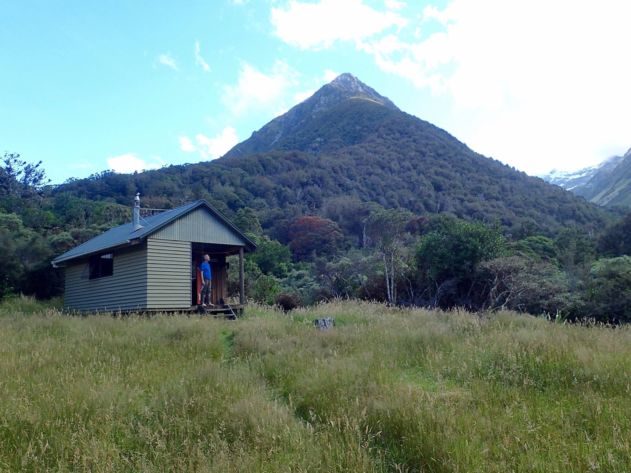
Generally, most packrafting trips hike into Mid-Taipo Hut for the night, before paddling out the next day. The simplest option is an overnight out & return from SH73, but if you want a longer hike or an aesthetic through trip, look at the map for multi-day approaches from the Waimakariri, Styx, Ahaura and Kellys valleys.
If you want a guide on this trip, ask West Coast Packrafting.
They offer instruction from beginner to advanced, plus guided trips from grade I to IV, 1 day to 6 days, on loads of rivers.
Thank you Michael Batchelor for the intial info and photos, Hugh Canard for additional input in 2017. Deane Parker and Jule Harle for updates and peer review in 2025. Dan Clearwater for extensive edits and formatting.
Video below by Deane Pakers taken from a trip at 3.0m stage (medium flow)
First, a bit of history
From Hugh Canard:
Taipo means ”devil” or evil spirit in Māori. It is interesting because apparently Māori used it thinking it was English and the early English settlers used it thinking it was Māori. Taipo was the name given by European miners who had to cross the river on their way from Canterbury to the West Coast goldfields. Drowning was the most common way to die in those days and this river claimed more than a few lives. It’s always cold and rarely low enough to cross easily on foot. The Māori name was Hope oka, which means stab in the loins. i.e. it’s really cold and you’ll understand the appropriateness of the name as soon as the water reaches your ummmm, loins. It would be better for all if the original name was restored.
The Taipo below Julia Hut is already well known as a heli-kayaking run, with some detailed paddling information and historic details in the Whitewater NZ river guide book.
Ron Beardsley, Ed Reese and Hugh Canard ran the upper river in 1985 by kayak, followed by successive heli-explorations from 1993 up to Julia Hut.
In 2010, Packraft pioneer Roman Dial paddled the Taipo from Mid-Taipo Hut. His trip report and video are a great window into the early days of packrafting here in NZ.
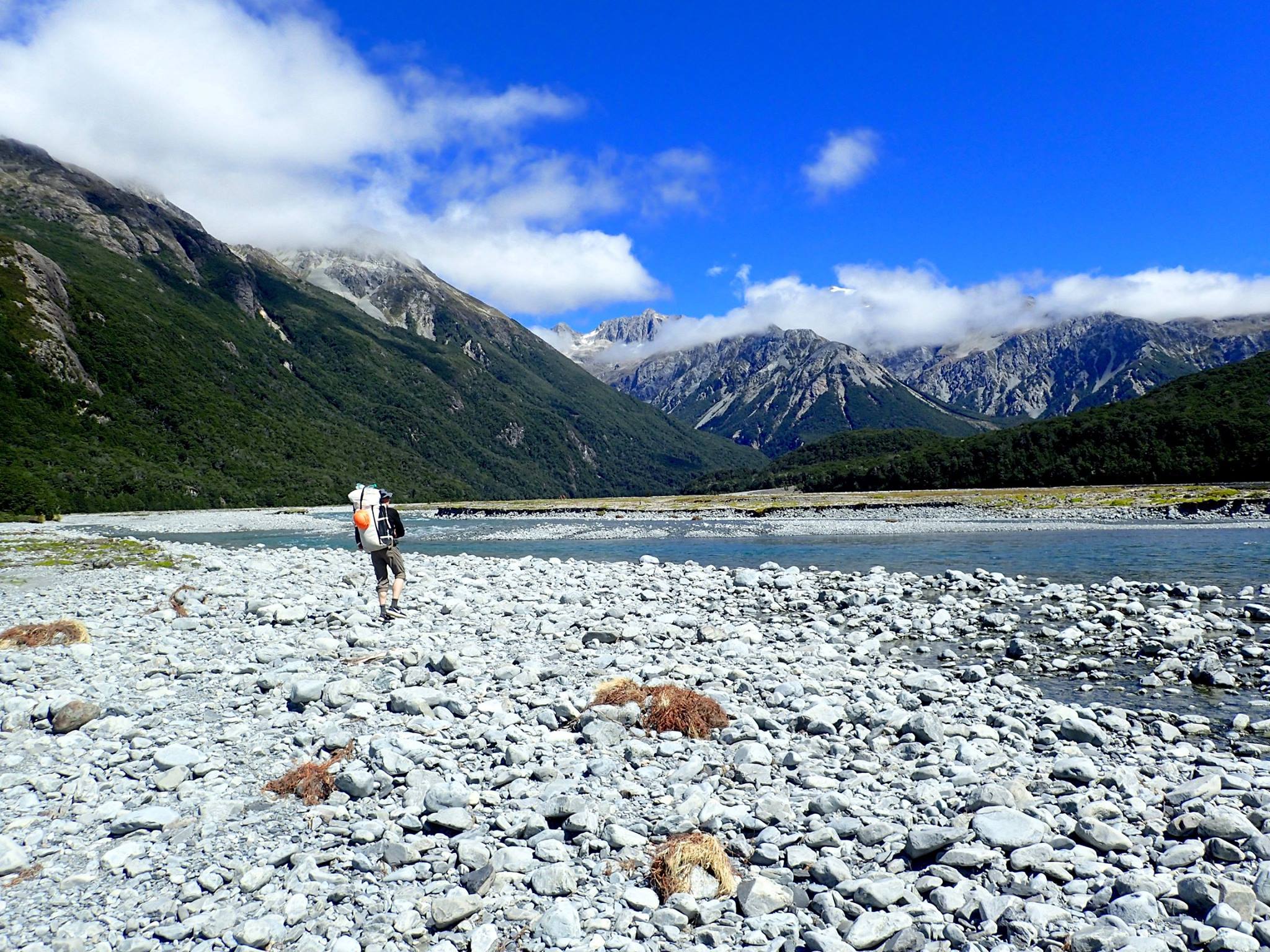
Approach
5-6 hrs from State Highway 73
This approach follows the western end of the well-known Harman Pass Tramping route. It’s worth reading that DOC route guide and taking notice of any temporary alerts, such as new slips, damaged tracks or bridges.
A good 4WD vehicle can drive the track up and over into the valley to save an hour or two. However, the float out the final gorge is very scenic – paper/scissors/rock for who has to drive the car back and miss out on the gorge!
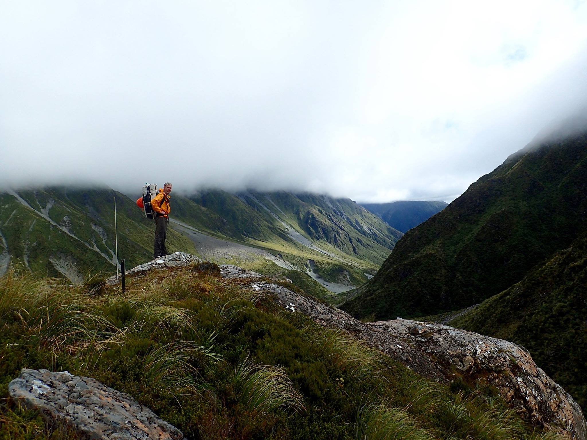
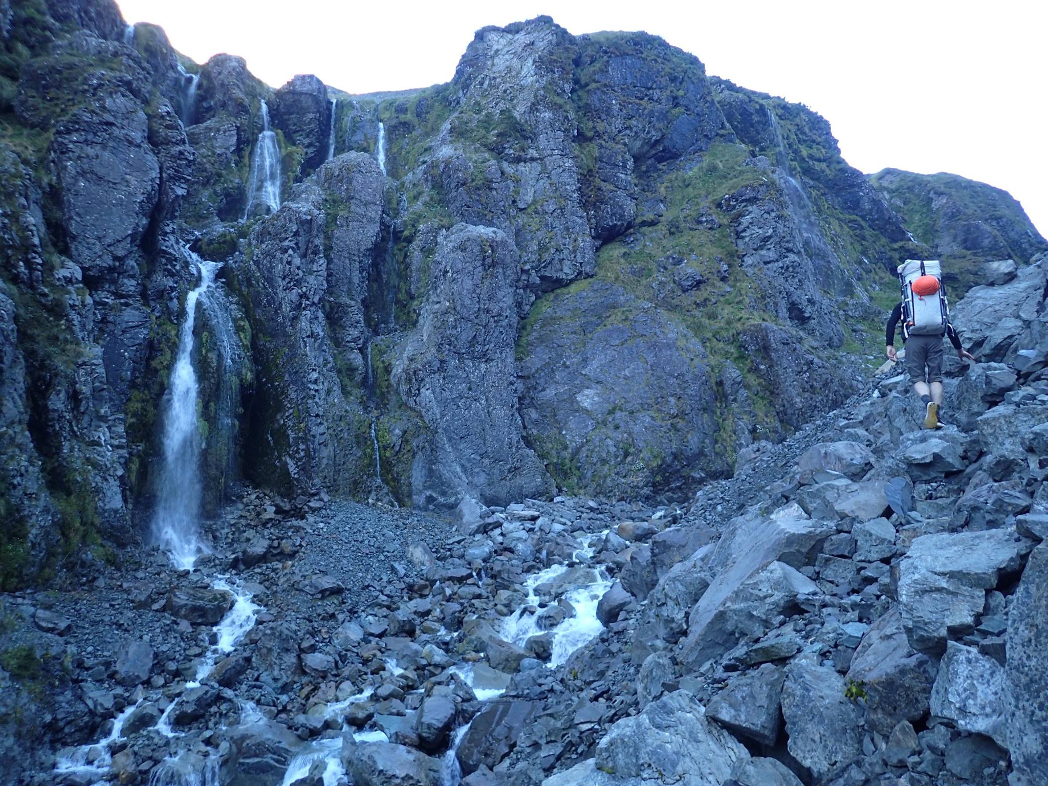
2 days from Klondyke Corner (near Arthurs Pass)
Approaching from the eastern end of the Harman Pass Tramping route, takes medium to hard tramping days. In good weather you’ll be rewarded with a spectacular and varied alpine crossing of the main divide, with cozy huts and a hotspring en-route!
Photos below all from Michael Batchelor, taken during the approach from Klondyke Corner
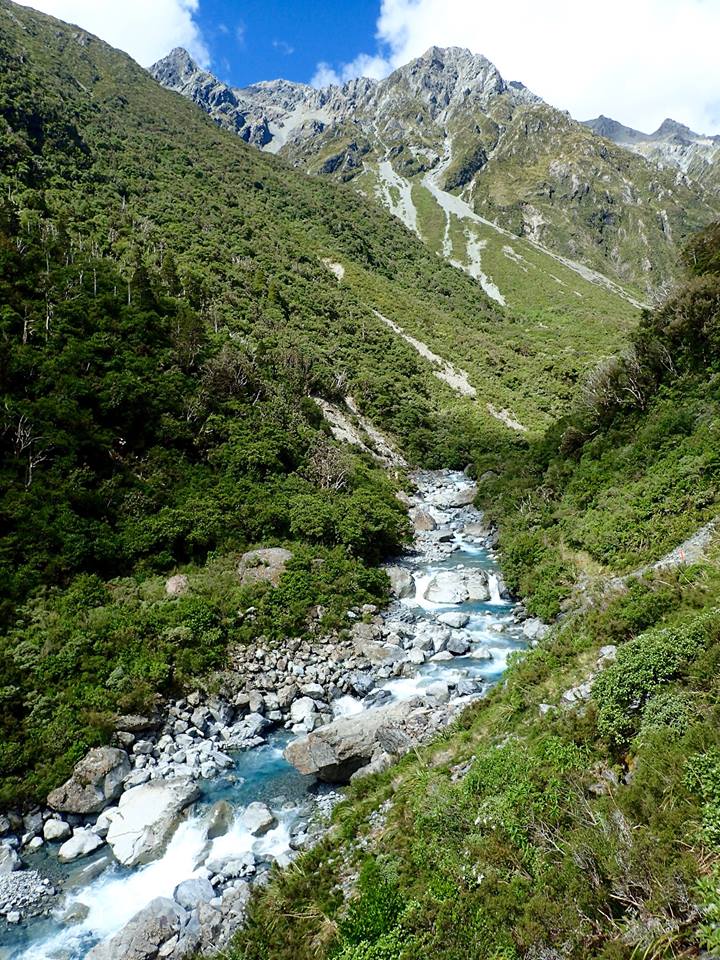
Taipo River – Julia Hut to swingbridge (IV/V)
If you’re approaching from the west, you can head upstream of Mid-Taipo Hut on the track for harder water. The track is fairly close to the river for a while, so you can keep an eye on the river, and put on where it suits the flows, ability and enthusiasm. Expect III+ between the Mid-Taipo hut and swingbridge, moving into IV water above.
If you’re coming from the east or intending to paddle above the Dry Creek tributary, you should be reading the Rivers.org website for the IV/V section below Julia Hut. Here’s a couple of pictures to show the flavour, courtesy of Hugh Canard.

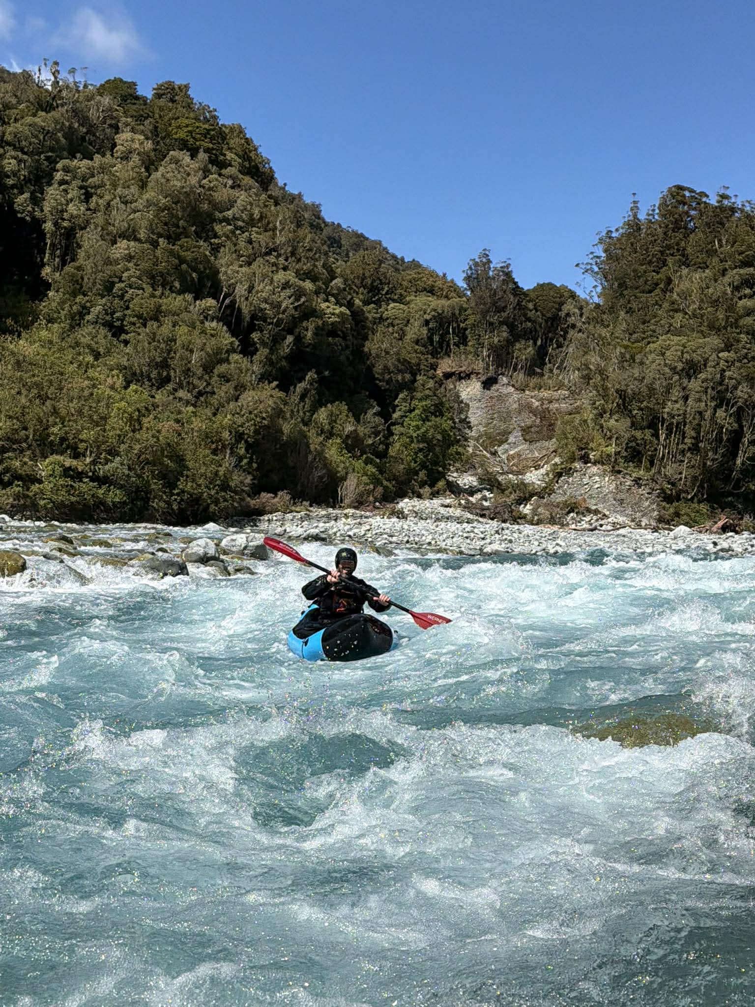
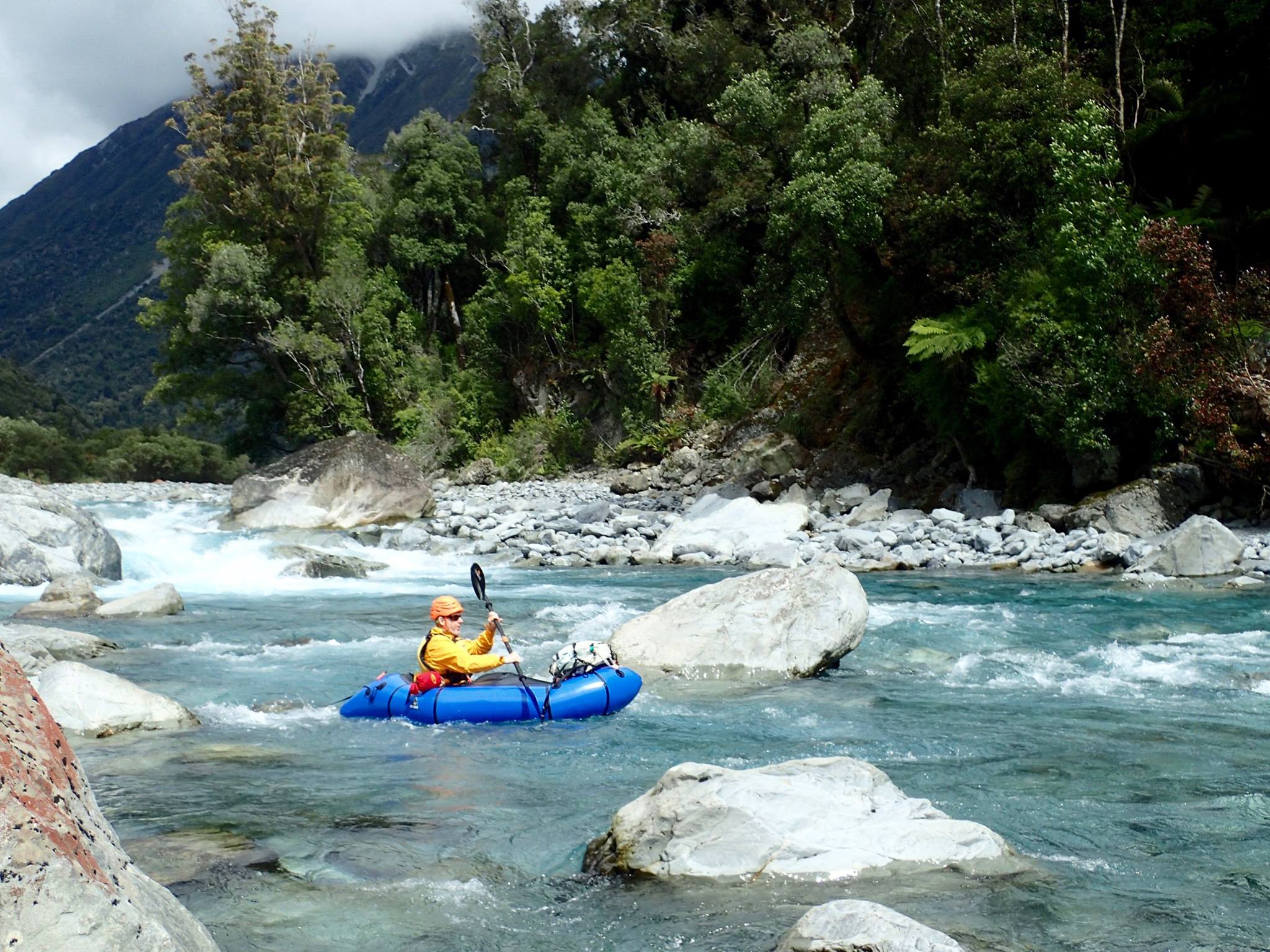
On the river (II+/III/IV) below the Mid-Taipo Hut.
Mid-Taipo Hut to SH73, is about 19km / 4-6hrs in reasonable flow ranges, depending on the exact flow and how much scouting or portaging you do.
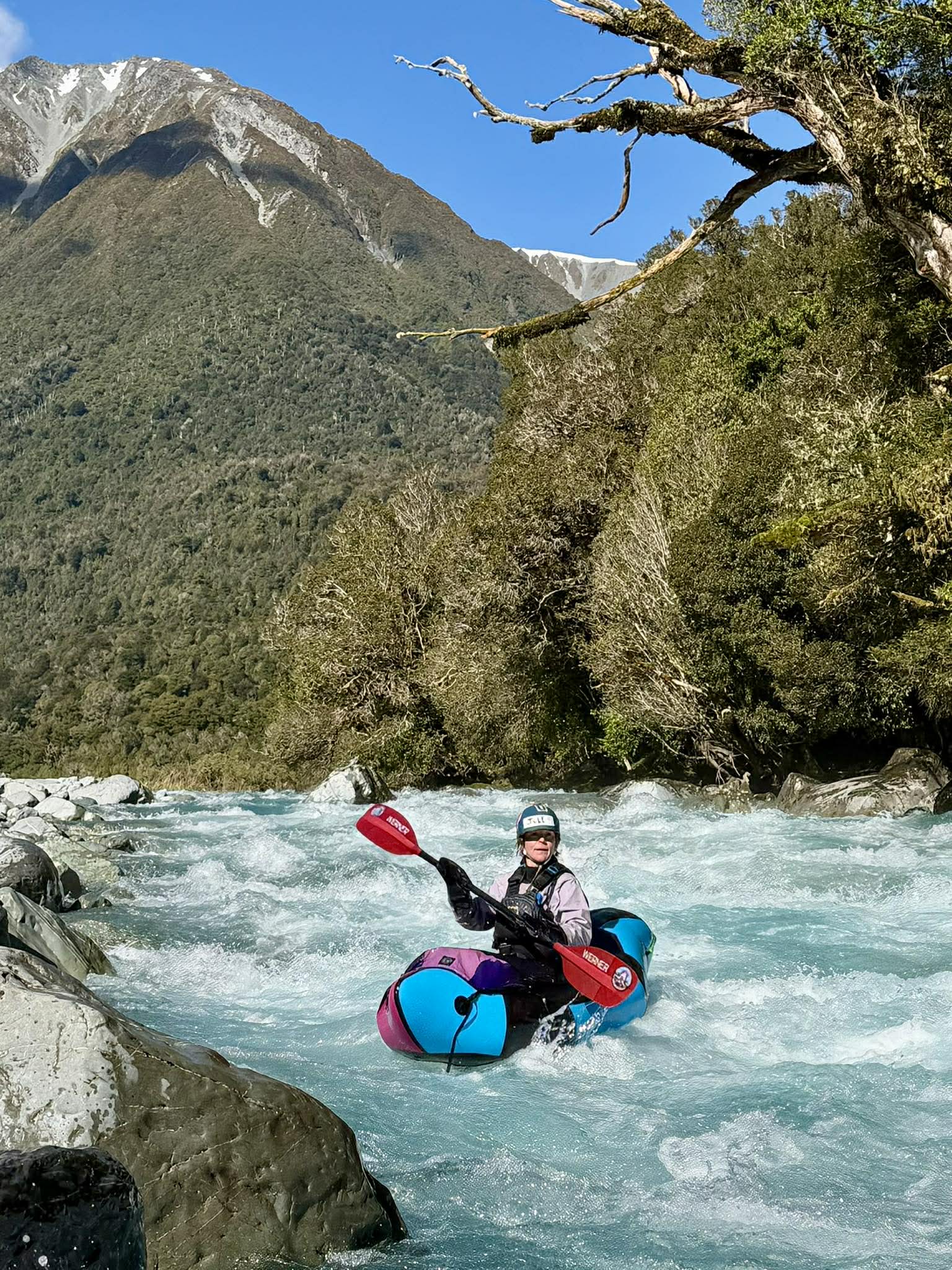
From Mid Taipo Hut expect some continuous II+ paddling as a warm up.
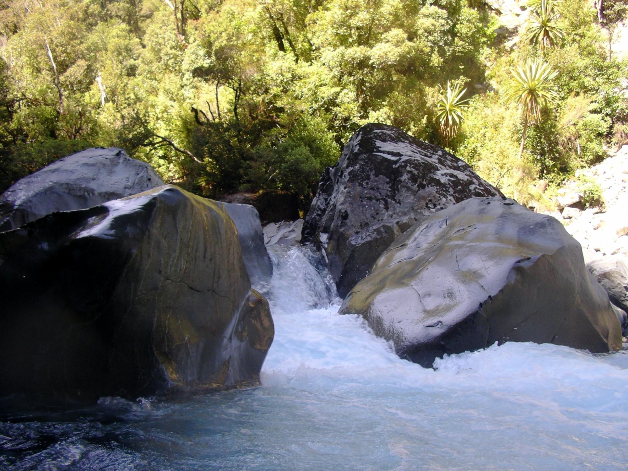
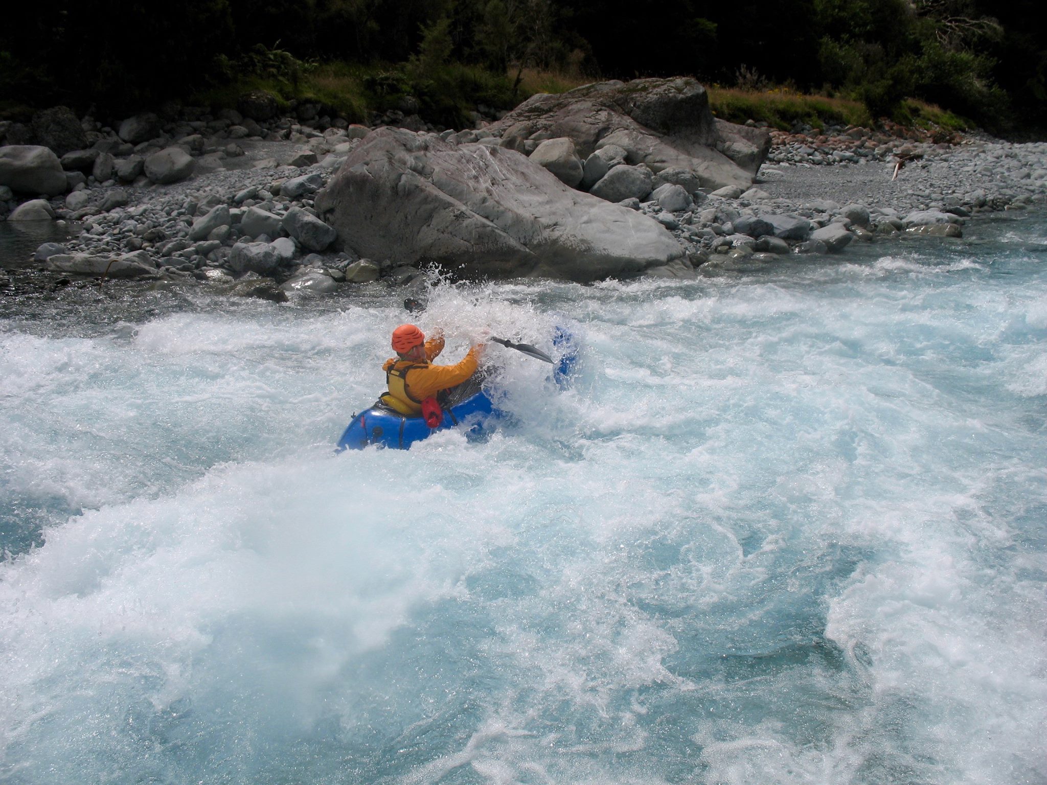
Almost directly east of the .824 high point, the valley walls close in and the paddling steps up a notch, with technical and continuous III/III+ paddling.
Shortly after the wallls relent, Dunns Creek comes in from the left and then there’s a IV- rapid. This rapid ends into a pool, feeling less consequential than the upstream features. Although it was pushy, there was plenty of recovery time at the bottom. You can scout or portage this feature on the left.
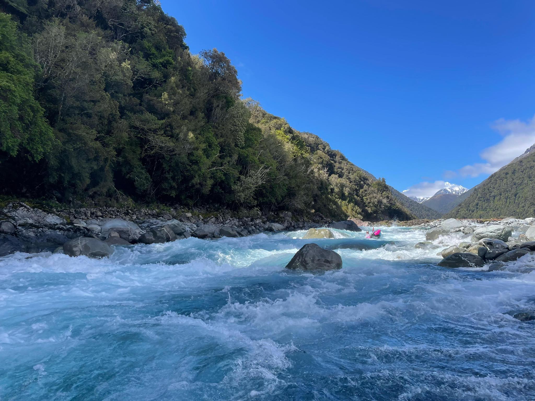
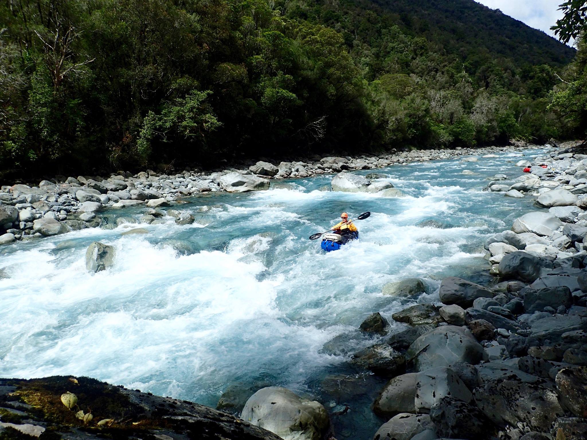
From here, its more ‘read and run’ II+ through until the valley narrow again, a few kilometres below Dillon Hut.
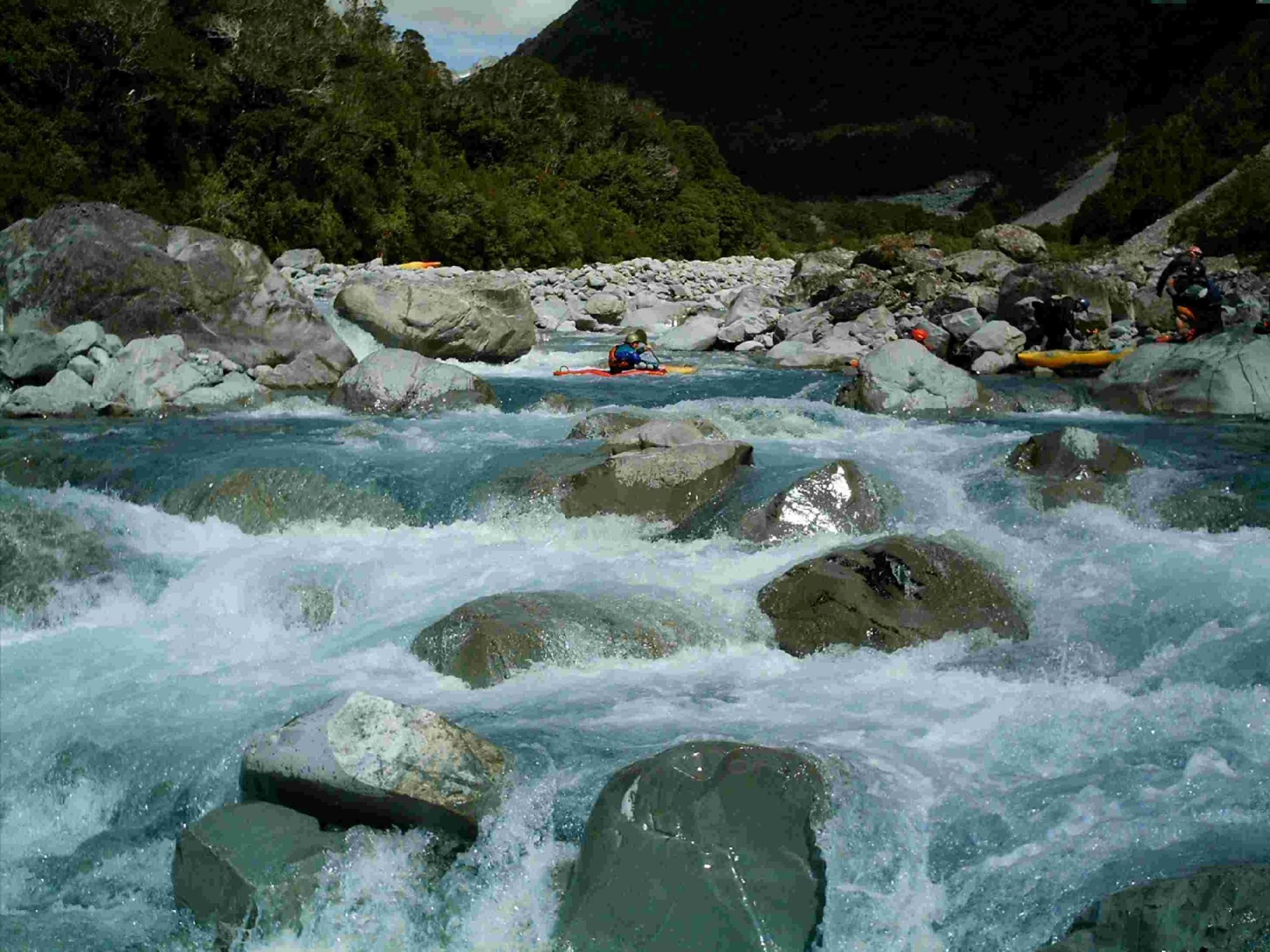
Here you’ll expect to encounter a bunch of fun grade III rapids, with noticeably more volume than the upstream rapids. Everything from the hut to here is portageable, and the track is never too far away when it counts.
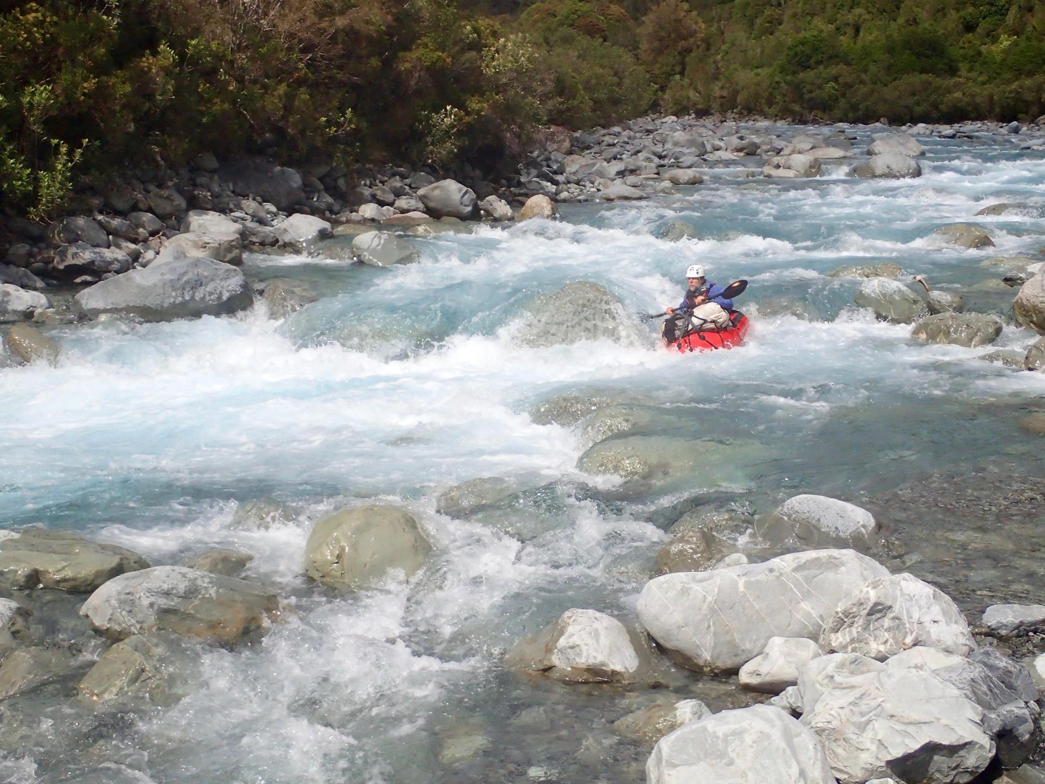
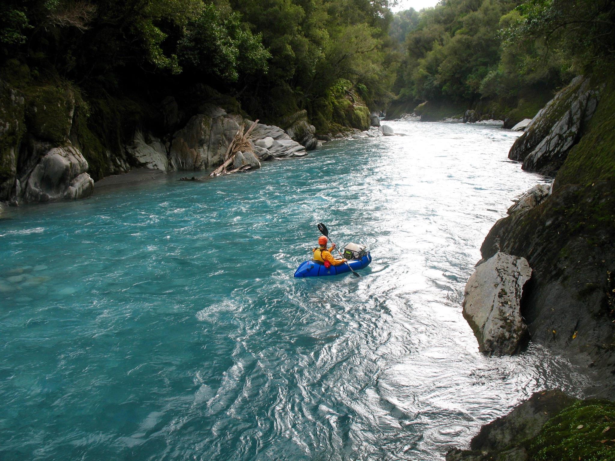
The final gorge has some class II+ drops at the entrance, flat water in the gorge and 3 or 4 rapids at the exit. Once you’re in, you’re committed to the end. The gorge is stunningly beautiful, with amazing rock formations and deep blue water, a fitting reward at the end of a solid day on the water.
Gauge
There is a physical stage marker, bolted to the pylon of the State highway bridge over the Taipo.
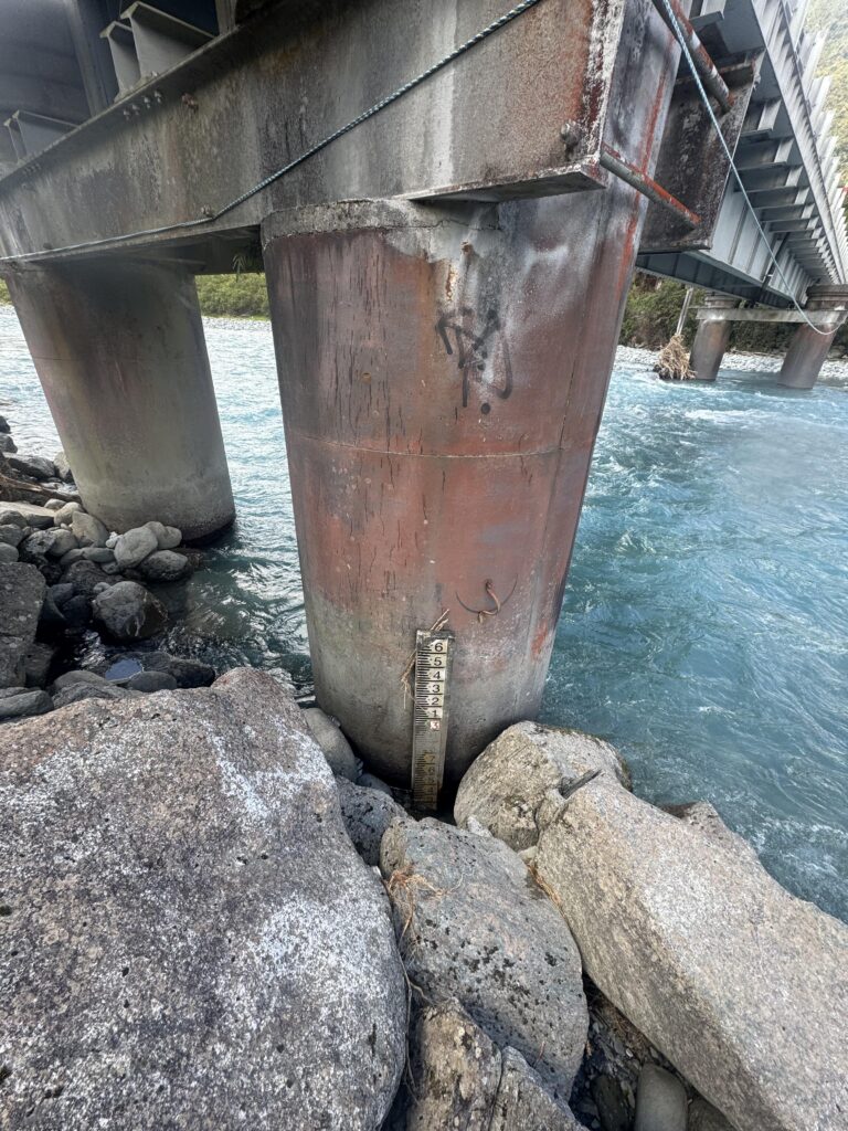
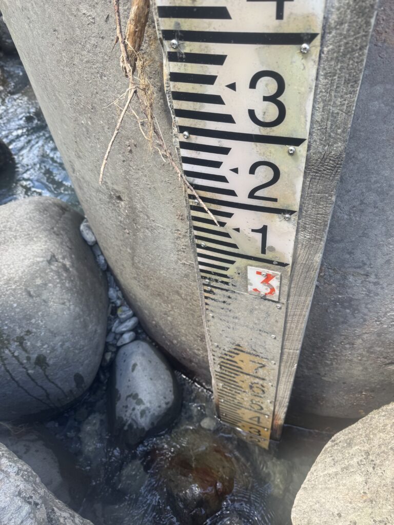
It is fairly hard to read accurately: the river surges can change the stage height by 30+ cm each pulse, so try to guess the average and be conservative about your reading if its at the higher end of suitable.
The Taipo doesn’t get dirty until it is in a full-on flood. Clear water can still be high water. Be warned.
- 2.3m at the low end of paddleable – expect some boney sections and some portages.
- 2.4m the level that Roman Dial had for his trip – which looks like optimum low flow.
- 2.8-3.2m reccomended levels in the Whitewater Guide for hardshell kayaks.
- >4m “Grade IV most of the way” according to the kayakers.
The nearby Kokatahi River gauge can be useful for general conditions (Ie, is it high, rising, dropping, low etc) since it is a similar size catchment, also rain fed, with headwaters not too far away.
The Taipo gets some biblical floods and each one creates and destroys rapids. Be prepared for “new” rapids which are found where you see extra large (3-5m) boulders on the banks.
Hugh Canard comments, “There is a house-sized boulder that I have seen move 3 km, and I’m terrified it will be in the final gorge one day.”
Nice continuous section almost all the way to the last gorge.
We walked in 2hrs to Dillon’s hut in the afternoon with 2.4 on the gauge.
Continued up to mid Taipo the next morning, another 3.5hrs.
Was a little bony up below mid Taipo but runs in to a cool narrower section with clean lines before opening up above the swing bridge. Braided at some points around Dillon’s hut but still enough water to not get hung up.
Was 2.2 when we come out the lower gorge. Would plan to go abit higher next time or come over the pass but look at water levels closer to 2.6 for the best from the run.