


A classic paddle, hidden in plain sight.
The Winton Burn is an unlikely rain-run tucked away behind the Mavora Lakes in Southland. Maybe the fact that it’s also called ‘Windon’ Burn on some maps and other official sources could contribute to the mystery…
Jeremy Platt was in the area on a biking trip and spied it running at spring flows. Together with Huw Miles and John Wycherley, they went looking for an adventure and in September 2025, found a new classic of the area. This trip needs extra water to work – you’ll need to keep your eyes on the weather and levels to hit this when its on.
The Winton is manageable in a weekend, the final hike-in has many different approach options, and on the water it’s a non-stop roller-coaster of continuous whitewater that perfectly builds from grade II to III and even a bit of IV, before progressively easing back through the grades to flatwater and a lake-paddle home.
Thank you to Jeremy Platt for the route information and images.
View Larger Topographic Map
Approach options
There are several ways to reach the beginning of the Forks Hut tramping route, which is the common leg of the approach.
With a bit more time, you could come from the north, either hiking in from the Mavora Walkway or floating down the upper Mararoa.
To achieve the trip in a weekend, it’s best to approach from the south. There’s 39km of gravel road from SH94 to the Mavora Lakes Campsite. From there, you could walk, bikepack or 4WD the Te Araroa Trail, or paddle or even power boat across the North Mavora Lake.
Bikepacking: road end to Mararoa Crossing 11km/2.5-3hrs
On Jeremy’s trip, it had rained a fair bit beforehand.

“The lake was full and he could only 4WD a km or so from the official carpark. So we disembarked and biked with our packs up to the Mararoa crossing. It was another 10km of muddy road with a nice stop at Carey’s hut for Lunch.”
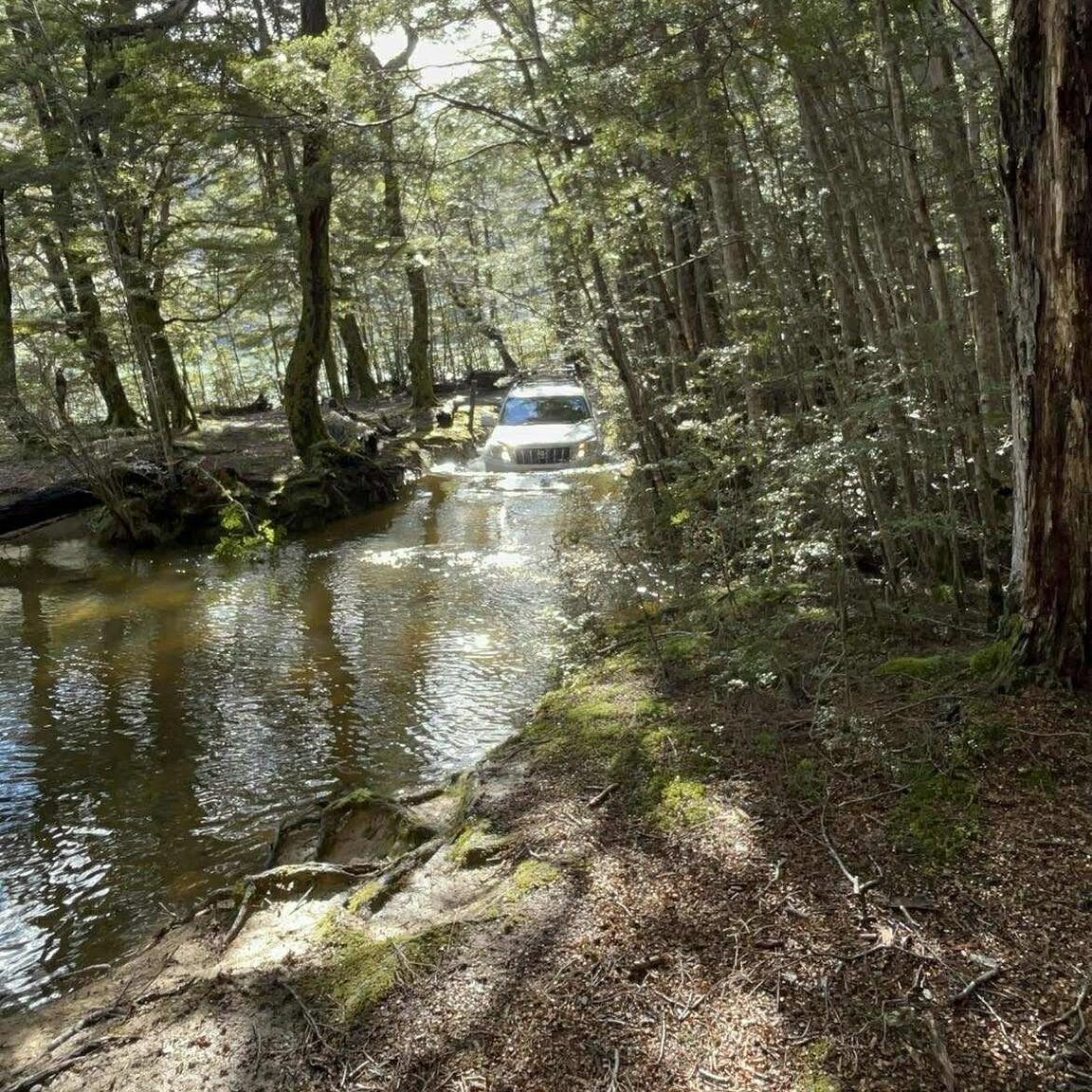
In suitable paddlings flows, expect to inflate your boats to get across the Mararoa River Crossing.
Stash your bikes somewhere near the crossing – although it’s rideable upvalley, we reckon the time saved isn’t worth the elevated risk of paddling serious water with a bike on board…
Walking: Forks Hut Track 8km/4hrs
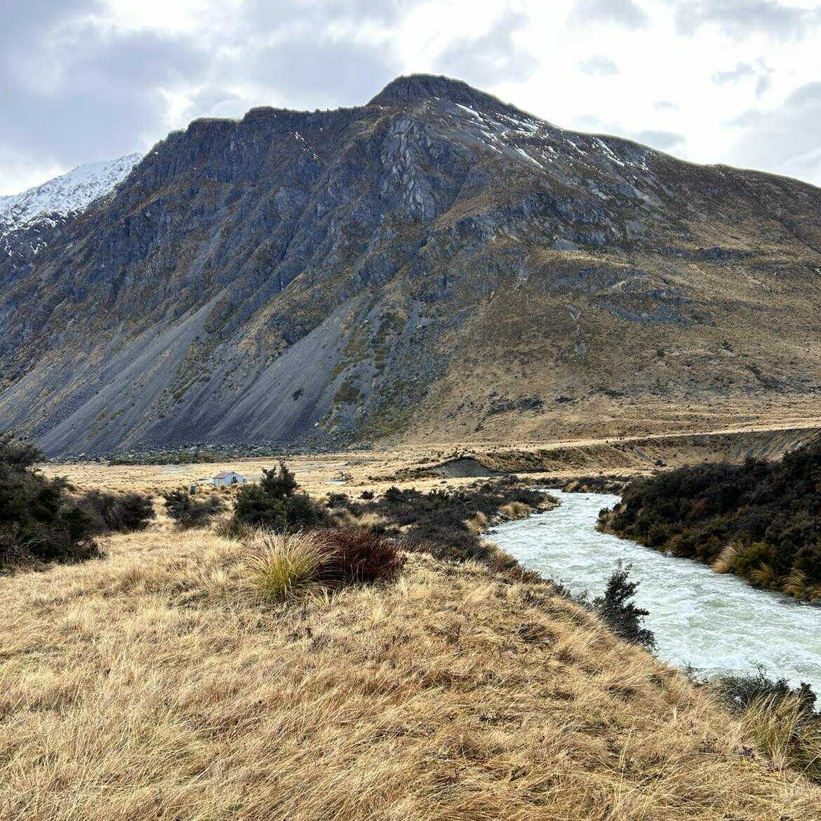
After crossing the Mararoa, the hike up Forks Hut Track is an easy and picturesque old 4WD trail with views down onto the river and up to the peaks on all sides. There are quite a few side-stream crossings. The final one before Forks Hut is a major tributary – expect it to be quite powerful when the levels are suitable for paddling the Winton.
“The three of us linked arms and found it pretty spicy, so you may need to inflate a boat to get across or go down to the confluence with the main river and cross there and hike back up to the hut.”
Forks Hut
The 4-bunk Forks hut is very basic and not in the greatest condition. Although it is drafty, uninsulated and has a cold concrete floor, you’ll be glad to know it also has a fireplace. However, you’ll still be freezing because there’s no nearby wood source anyways. Pack wisely – having something so you can avoid wearing poogies on your feet or sleeping in your drysuit is a bonus.
On the plus side, there’s plenty of good spots to camp around the hut; but since you’ll probably be heading up during or shortly after a storm to get good water levels, you’ll probably prefer a chilly hut over a soggy tent…
Let just say its a good thing the paddling is fantastic ;0)
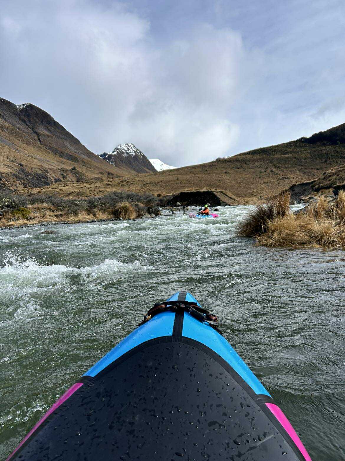
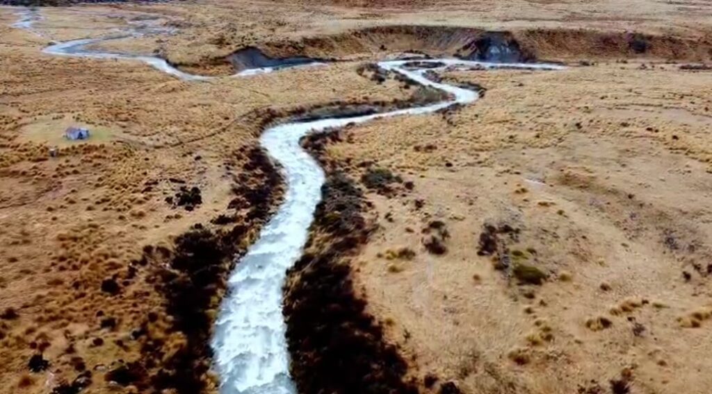
The Winton Burn (III/IV) 8km/2hrs
The Winton Burn falls at an overall gradient of 25m/km, making for an action-packed 8km ride out. There a tons of boofs, holes and a couple of rather large boulders.
“We started paddling the unnamed tributary just to the southwest of the hut. It was tight and technical grade II and had just enough water to get us down into the Winton Burn.“
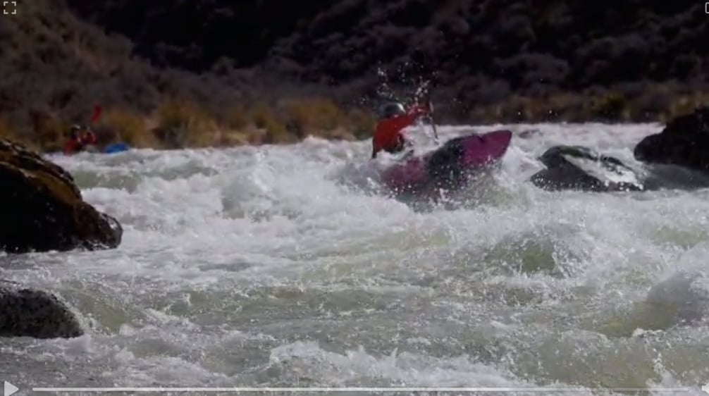
The paddling on the Winton Burn builds almost perfectly from grade II to III, then crescendos with a tiny bit of grade IV continuous bouldery fun.

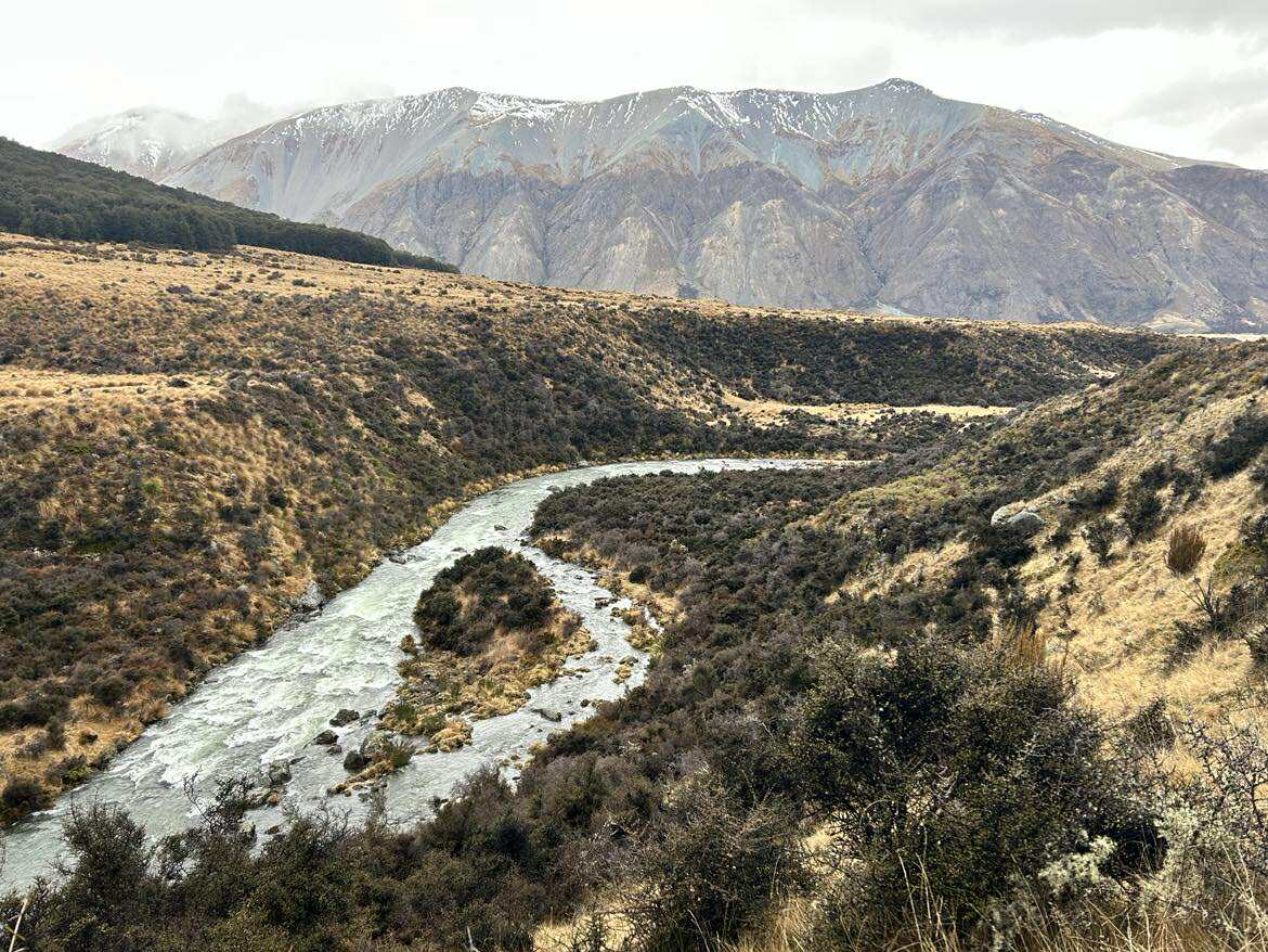
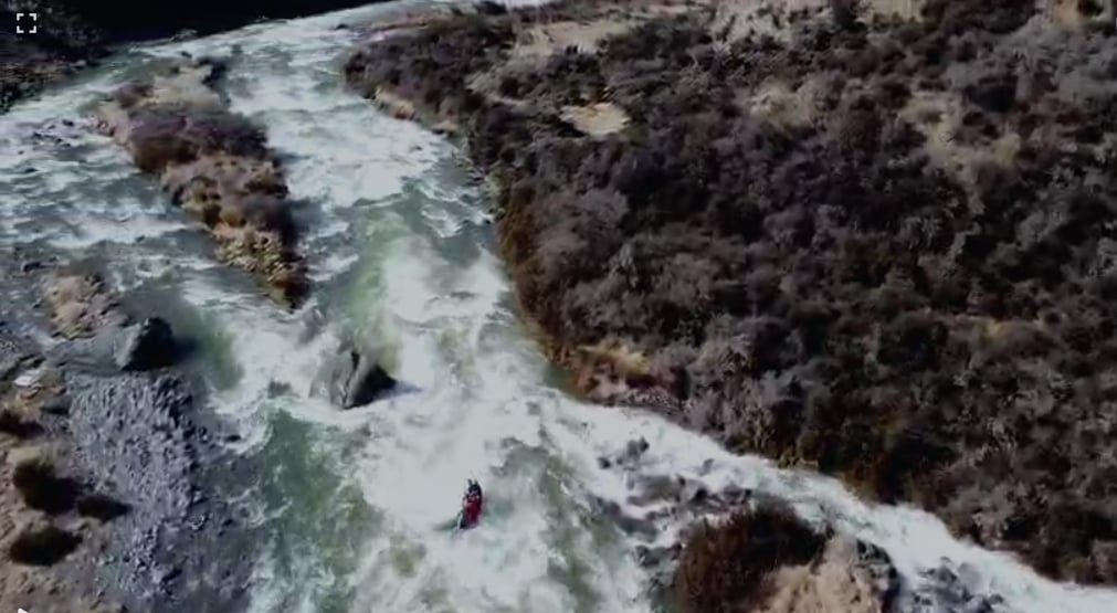
On the other side, the paddling eases back to grade III, then gradually grade II again before flowing gently into the Mararoa.

At these flows, the Winton Burn has very few eddies and is incredibly continuous. This means that the team needs to be rock-solid at the grade – a swim here could be long and hazardous.
On the plus side, the team found no strainers of sieves during their trip (*your experience may differ), and there were only a couple of sections that weren’t read and run.
“We already can’t wait to get back into it! We did this section in about 2 hours while taking video. It could be done very quickly, but it would be absolutely awesome to lap it!“
Openwater paddle on the North Mavora Lake 10km/3hrs
“At the Mararoa crossing, we put our bikes on our boats and paddled back across the lake. There was a strong tail-wind, which kept us vigilant, but increased our forward speed.”
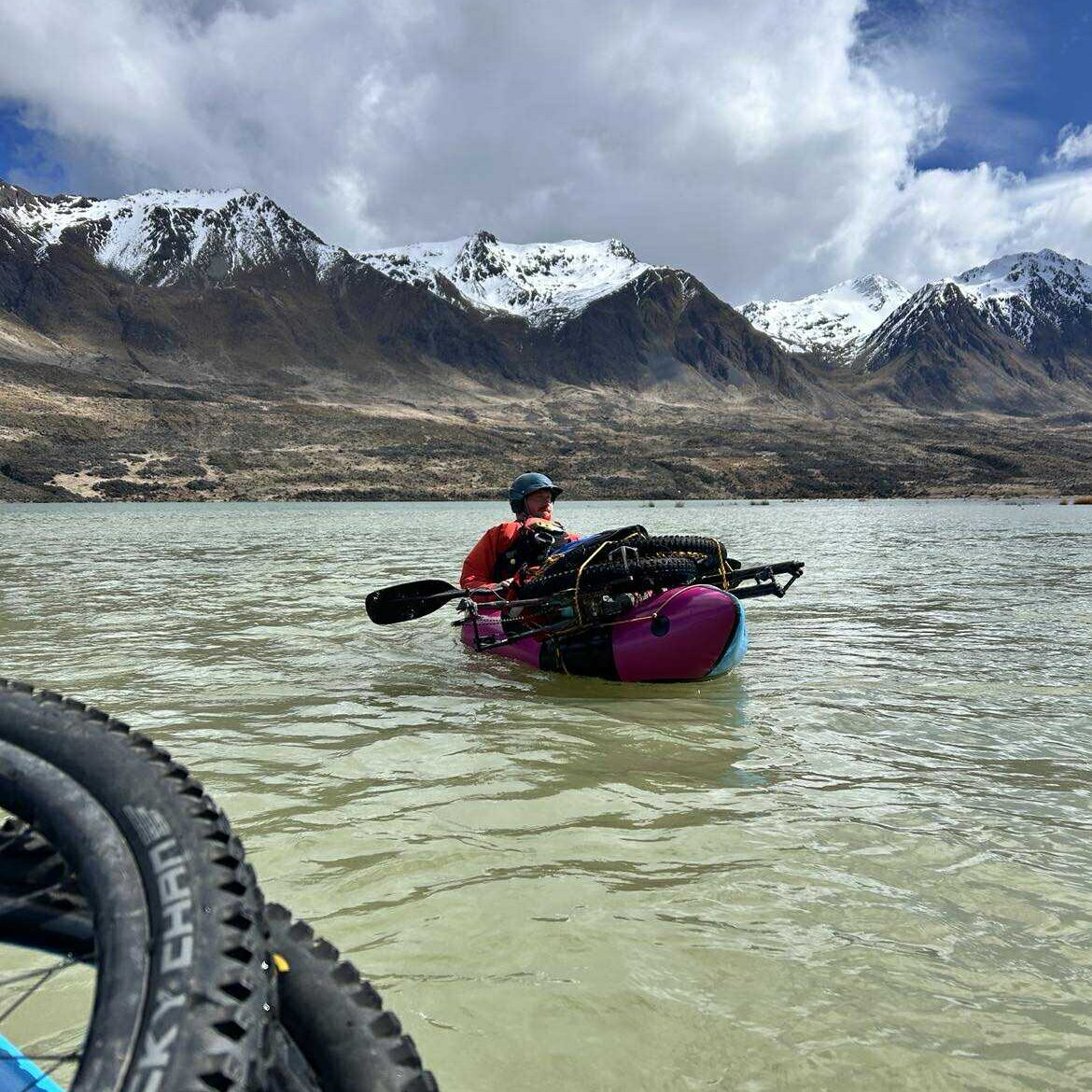
The lake is long and narrow, which channels the prevailing north-westerly winds. The normal open water considerations apply.
- Consider a boat leash to mitigate the risk of capsize and boat separation.
- Stick together in your group to assist others,
- Keep your PLB on a tether to yourself, and stashed in a place you can reach to activate it if you find yourself floating alone in the lake…
Gauge and levels.
This is definitely a ‘rain run’ which requires you to head in during a moderate storm, or shortly after a fairly big storm to get the right level.
For a paddling river, the Winton catchment isn’t huge (94 sqkm, compared to the nearby Greenstone at ~190sqkm), and the gradient is reasonably steep. That means that it’ll drain from flood levels very quickly once the rain subsides.
There’s no gauge on the Winton, but downstream, the Mararoa at Cliffs gauges can give some info about general flows in the wider catchment, but remember that the Mararoa has a huge catchment, some big lakes to store water, so will remain comparitively higher for longer than a small, steep tributary like the Winton.
“We did this trip in early spring after a decent amount of rain, and I’d estimate the flow on the Winton was roughly 20 cumecs. I’d guess it could probably go between 10 and 40 cumecs.
Just before we headed out of phone coverage, there was 200cu registering on the Mararoa gauge.“