


Wilderness vibe on Wellington’s doorstep
Nestled among the maze of mountain bike and 4WD trails in the Akatarawa Forest, is the Whakatīkei River, a small but pretty river that probably deserves a little more attention. Once on the water, it has quite a wild, untouched feel.
Flows are everything for this small catchment (see gauge & flows section below!) – kayakers regard the lower section as a flood run, and in summer, you could walk down the middle of the river bed in most places.
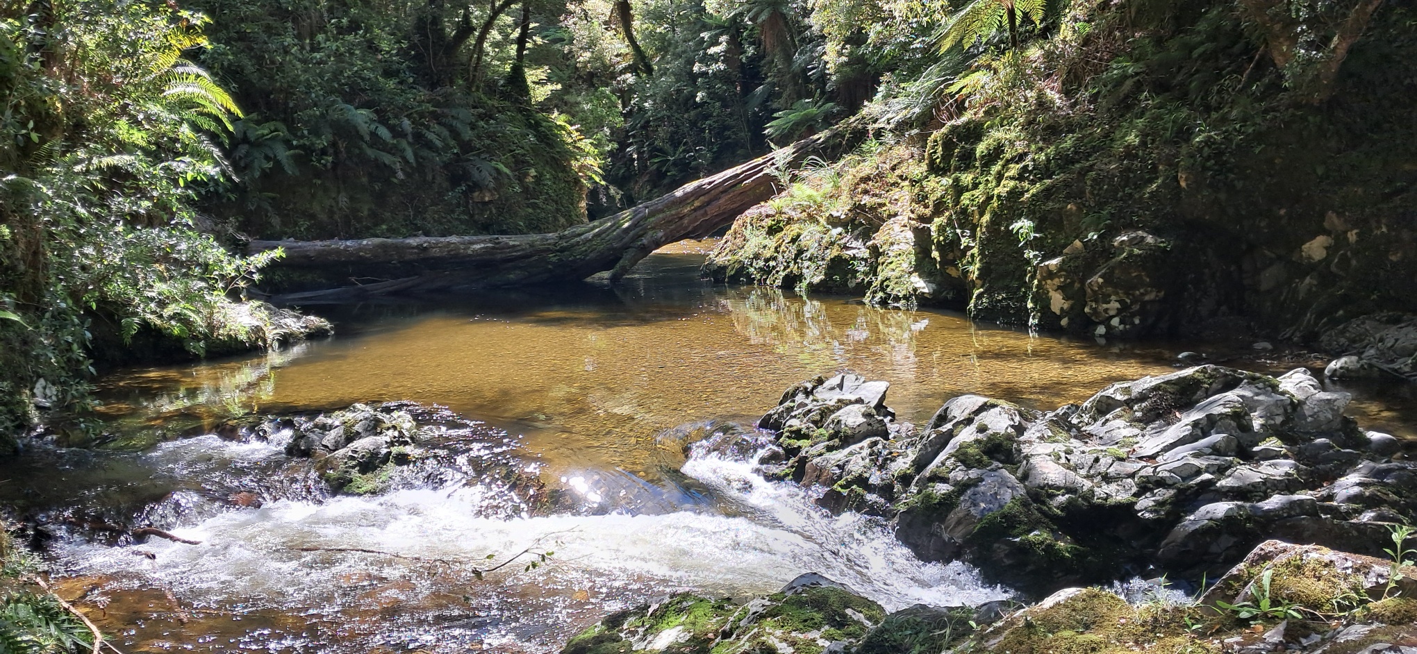
Paddled shortly after a bit of rain, the upper and middle sections have some pretty gorges which will appeal to packrafters and trampers.
There are a few trip options – either a full day traverse from Paekakariki to Upper Hutt, (I/II/III) or a short lap of the lower gorge (III), which only needs a little walking depending on the flow.
This trip page is just a starter – to encourage others to check out this run and make suggestions for which access points make most sense, and what flows might work well.. Drop us a line to upgrade this page!
Thanks to Andrew Crane for the info and photos, plus Martin Robertson for peer review and additional information.
View Larger Topographic Map
Gauge & flows
The Whakatīkei River doesn’t have a publicly accessible gauge – the neighbouring Akatarawa River is the best approximation. Because its such a small catchment, the river rises and drops fast. To catch it in a paddleable state, you’ll need to get there fairly soon after a decent storm.
- <8 cumecs – Probably don’t bother – more scraping than paddling.
- 8-10 cumecs – ‘Low packrafting flows’ – expect to be scraping in places – lower gorge will feel quite bony. (Unless stated otherwise, images on this page correspond to 8 cumecs.)
- 10-20 cumecs -Probably good flows for solid grade III packrafters. We haven’t any reports from these levels, but we’re guessing they’d probably be about right to fill in the bones and make it feel about right for the grade III section.
- >20 cumecs – Kayaking flows. Crux rapids become III+
- ~40 cumecs – ‘Sweet spot’ for kayaking – according to Graham Charles | Riverguide.co.nz
Check out this video of kayaking the river in flood – we don’t know the exact flow when they put on, but the storm cycle peaked the flow at over 150 cumecs….
Please log your trips at the end of this page, and send us more information to upgrade this page!
Getting to the take out
You can take out at a footbridge just before the river meets the Hutt River, or continue down the Hutt a short distance for a few bonus rapids and easier driving access. – Google maps links below.
- Whakatīkei / Hutt Confluence footbridge: park at designated spots at the end of the cul-de-sac of Cory Jane Grove, River Stone Terraces.
- Hutt River / Poet’s Corner.
- Hutt River / Moonshine Bridge
Getting to the put in
Any of these approaches traverse a maze of walking tracks, 4WD routes and biking trails. We can’t stress enough that excellent navigation is required to pick the right ones to end up where you want to be! A bit of extra research and preparation will go a long way. We strongly recommend apps like TrailForks (Mountainbiking) and downloading the brochures for the Akararawa Forest Park, and Whareroa Farm before you head out.
Lengthy 4WD access from Maungakotukutuki Rd
This route isn’t shown on our map – but its possible to drive to the put in if you like 4WD more than walking. From Maungakōtukutuku Rd, head up Perhams Rd, then onwards via various 4WD roads to your chosen put on. This approach will take a while and is for experienced 4WDers only. A permit is needed for vehicle access from Greater Wellington Council.
For the through trip – from Whareroa Farm (near Paekakariki) – 8.8km | 2.5hrs
Check out the Whareroa Farm brochure to help you navigate your way from the carpark, via ‘Farm Race’, ‘Intake valley Track’ and ‘Catchment View Track’ up to Campbell’s Mill Rd. Remember, these are shared-use trails – watch out for bikers!
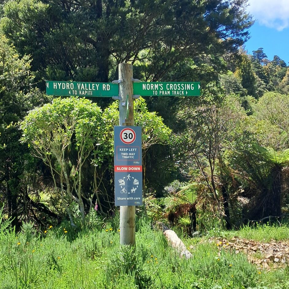
Next, watch out for 4WD vehicles, as you head head south. Continue, following signs for ‘Hydro Valley Rd’. You’ll cross the Whakatīkei River – but its probably too small to try putting on there. The road follows the river through to ‘Orange Hut’ (4WD accessible and apparently not so nice to spend the night in). From here, follow signs towards ‘Norms Crossing’, which is where the road meets the river, just downstream of the confluence of the Titi and Whakatīkei.
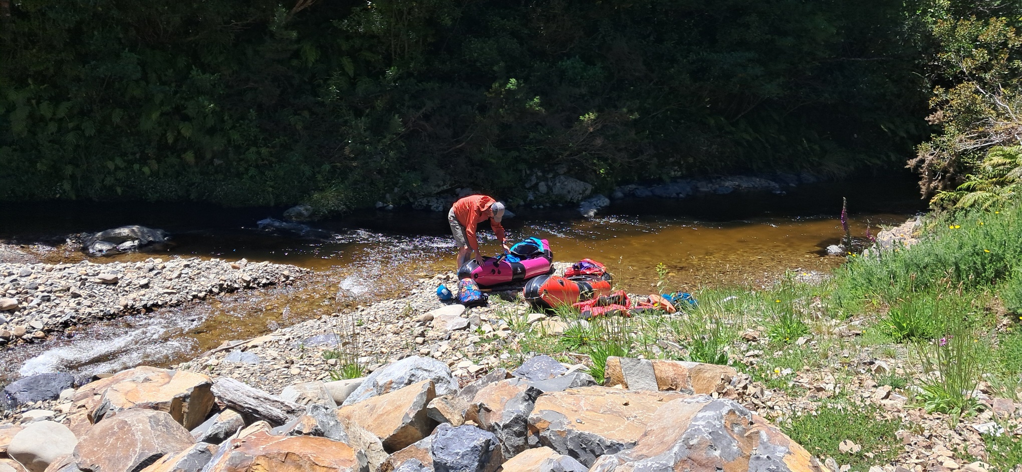
Hopefully there’s enough water to blow up near here – by now you’ll be looking forward to getting on the river, away from all the tracks and trails.
To the lower gorge put in via Bulls Run Rd
Follow Bulls Run Road past the Kapi Mana Motocross track to this intersection (pin on Google Maps). Take the left hand fork and drive for about 300m to cul-de-sac and park there by a locked gate. The road continues over a ford – watch out for the human-made ‘energy dissipation’ boulders just below this ford.

If the flows are up, you could probably paddle the Wainui Stream from there, or in lower flows inflate and ‘walk the dog’ with your boat floating as you walk down to the Whakatīkei confluence.
If you prefer to avoid some stream walking, cross the ford, then take the right track just beyond it. A grassy vehicle track heads down valley and into the forest towards a bach (house). Keep left of the batch, and continue 100m past the ‘road closed sign’ to a spot where you can drop down to the Wainui Stream. Its a few hundred metres of stream walking before you reach the Whakatīkei.
Another option would be to continue walking south on Bull’s Run Rd (aka ‘Rallywoods’ MTB track) to the bridge just above the Duckpond. But that’s more walking and less paddling.
On the river 17km | 5hrs @ 8 cumecs
Upper Gorge (I/II-) This beautiful river starts off quite gorgy. Being a narrow waterway, expect the occaisonal fallen tree or strainer. Mostly class I with some slightly bouncier II- rapids from time to time.
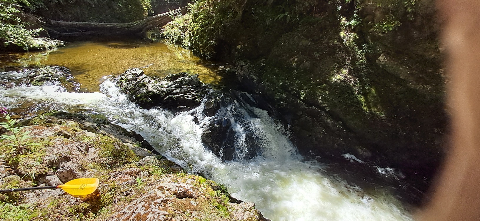
Keep an eye out for where the river drops suddenly over a 1.5m bedrock drop – portage easily on the right, or if you’ve got the water scout and send!
Middle section. (I/II-) More open but with similar bouncy class I and II- water. Overhanging trees remind you to keep your eyes peeled for strainers – be ready to portage when needed.
Lower gorge. (III) Below the Duckpond, the river starts to steepen and busy boulder garden rapids begin to appear. There’s a handful of longer/steeper rapids too.
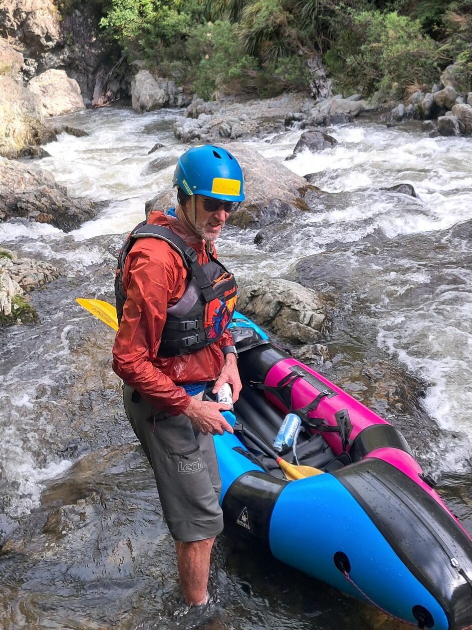
At lower flows, this gorge is an unlikely technical creek run, with a real wilderness feel.
All too soon, you round the bend and spot the first takeout – the foot/cycle bridge and a track that leads west onto Corey Jane Grove (road). Depending on time/logistics etc, you may like to continue into the Hutt River or a few bonus rapids, taking out at Poets Park, or the Moonshine Bridge.