


Tataraakina Bridge to Mohaka Confluence & Bridgets Clearing
Overview
The Waipunga River is a short, scenic tributary of the Mohaka River, accessed off the Napier–Taupō Road (SH5). This trip offers a mix of mellow floating and full-on technical paddling through a dramatic greywacke gorge, making it a great half-day adventure for intermediate packrafters. Seek recent intel as it can collect wood after floods.
By Road
Put-in – is at Tataraakina Bridge a short distance off SH5.
Take-out – is at Jock Suttons road or Bridget’s Clearing (down Auroa Road (a forestry road) down Waitara Road off the state highway (turn left a few km south of the Mohaka bridge).
On the Water
The usual rain run is 18km from Tataraakina Bridge to Bridget’s Clearing over 4 hours.
- Upper Section (4.5 km, II):
From Tataraakina Bridge, the river begins with a gentle float through open terrain. This section is ideal for warming up and enjoying the surrounding bush and farmland. - Gorge Section (4 km, III):
The river narrows into a steep-sided gorge with sheer escarpments. This is the highlight of the trip, offering technical paddling through bouldery rapids and confined channels. The gorge is short but intense, requiring solid Grade III skills.
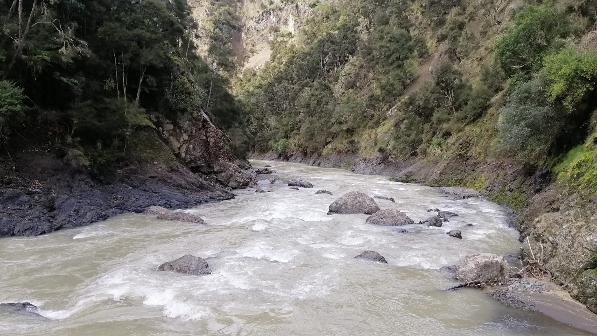
- Lower Section (9.5 km, II):
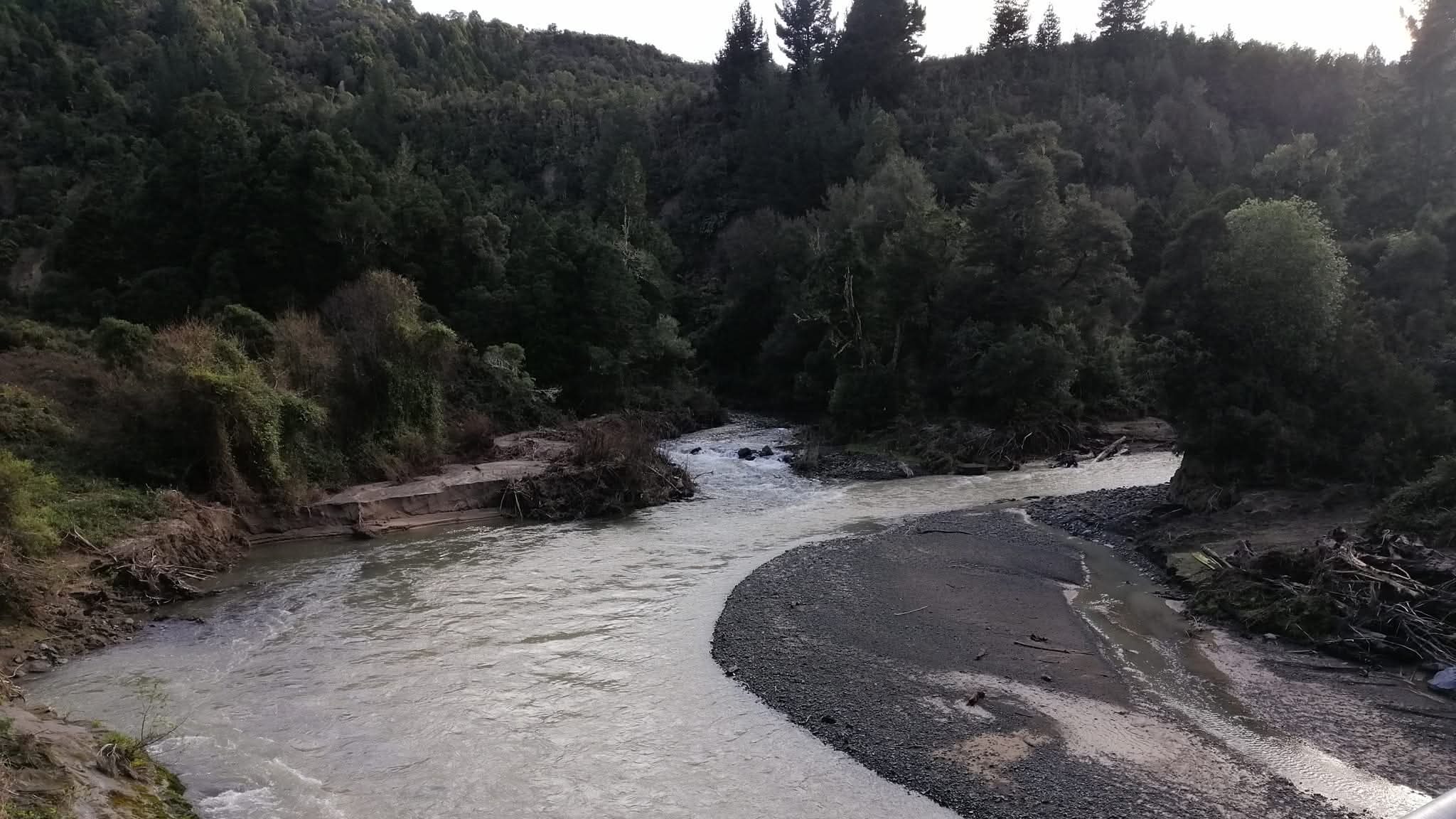
Below the gorge, the terrain opens up again. The river meanders through bush and DOC reserve land on river right, eventually joining the Mohaka River at a distinctive oxbow. From here, it’s a cruisy float down to Bridgets Clearing.
- Mohaka Lower Glenfalls section (6km, II) – either cross the Mohaka at the confluence to access Jock Sutton Road or paddle on down to Bridgets Clearing.
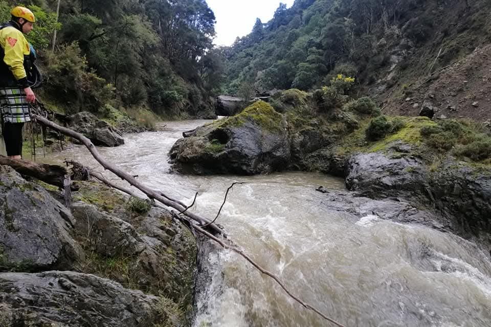
State Highway Roadside Section (Grade III at high flow):
Above the usual run there is a section that requires even more flow to be runnable. This short, tight section begins at the bridge near the Okoeke Stream and is highly rain-dependent. It features narrow channels and technical drops, including Hukawai Falls, a small drop around the first corner. Hukawai is usually too tight for packrafts and may require portaging. This section should be scouted carefully.
Hazards:
The gorge section is committing with limited egress. Be prepared for technical paddling and scout if unsure. Logs and debris may be present after storms. The roadside section near Okoeke Stream is especially tight and may require portaging.
Land Tenure
A DOC reserve exists on river right in the lower section but the rest is private land. Respect private land boundaries and use public access routes.
Flows
The Waipunga is a rain-run river. It’s best paddled after recent heavy rainfall. The shingle rapid visible from the bridge is a useful visual gauge.
View Larger Topographic Map
Credits & Thanks
Thanks to Mohaka Rafting for local insights and rapid names and to Lloyd Struthers and Matt Stout who’ve shared trip notes photos and flow gauge info.