


Trip Overview
Access 13, or the Pillars of Hercules Run, is a very scenic run that can be scratched through at residual flows in a packraft. It is generally only kayaked on scheduled release days. The tracks in and out are tricky.
Warning!
Above this run is Tree Trunk Gorge (V+) and below it Waikato Falls Gorge (V+). Both have been part paddled by expert kayakers, but both have claimed lives. If paddling below the Pillars of Hercules Bridge, you must know where to take out to avoid heading unwittingly into Waikato Falls Gorge.
Thanks to Martin Robertson for this trip page. Additional edits and formatting by Dan Clearwater Oct 2025
River access
If you base yourself at Urchin campsite off Kaimanawa road you can walk to the put in. A car shuttle is easy.
Shuttle
Drive back to SH1 then head south to Tree Trunk Gorge Road. Take a moment to check out the spectacular view of the Tree Trunk Gorge beneath the bridge. Leave a car at the Bridge on Kaimanawa Road near the True Trunk Gorge Track.
If hitching convince your ride they must see the Tree Trunk Gorge view from the bridge (or walk 4 km from the highway).
On Foot
From the Urchin campsite follow the well-graded tramping/mountain bike track towards Tree Trunk Gorge Road (one hour max). Immediately before the track begins to climb up towards the road, there is a signposted access to the river.
Use this if you don’t mind missing the spectacular paddle upstream into the bottom of Tree Trunk Gorge (don’t miss it). Carry on up the track until it approaches the cliff-edge. There may be a spike in the ground used for lowering gear (present in Feb 2020). Work your way carefully down to the river. If it’s wet and slippery rig a safety line with your throw bag.
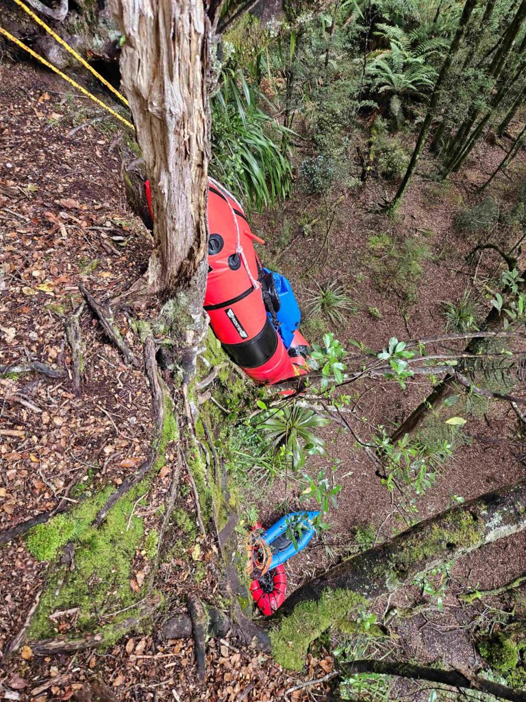
The best access, used by kayakers, is on river left at the Tree Trunk Gorge bridge. An obscure entry leads to a well defined track to a cliff edge where boats are lowered. A track marked with ribbons winds around to the left and then steeply down to the river. There are some ropes to assist (test them before you trust them).
On the River
Paddle upstream a few hundred metres on flat water through an overhanging gorge to the base of the last drop on Tree Trunk Gorge. This Tree Trunk Gorge above this last drop has claimed the lives of a number of paddlers including some who were unaware of its existence. Don’t get too close to the base of the waterfall, view it from a safe distance.
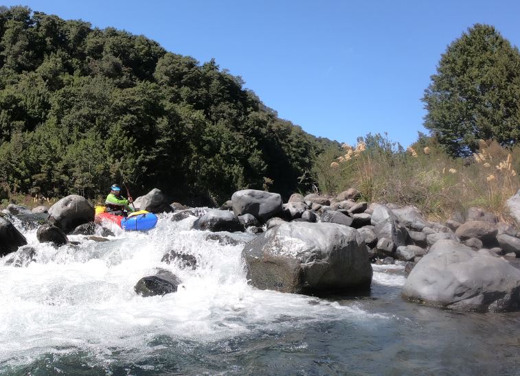
From the gorge down it’s pretty straight forward Class II+ or technical III at low flow. In places the channel splits and it’s a guessing game. Be wary of pins in the steep boulder banks.
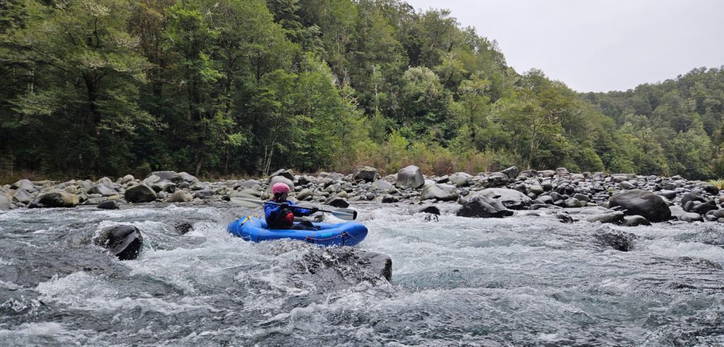
Most rapids are boulder banks. At higher flows of say 10m3 after rain it can be solid Class III or during a release Class III +. We ran it in June 2023 (Rangipo gauge said only 0.6m3) with the sidestreams generating a good flow. There was a lot of technical Class III and some rapids are better walked due to their steep bouldery nature with potential for pins and wood.
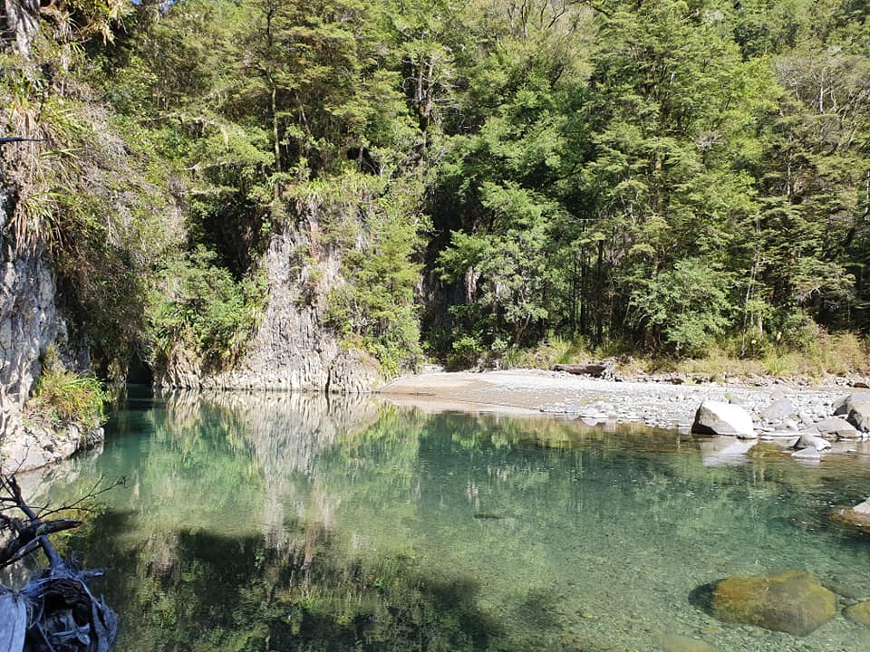
After an hour the river meets a huge cliff, the Pillars of Hercules, with a narrow flat-water gorge cut through it.
Here you have a choice – exit and take the track back to the Urchin Camp, or continue down for fun paddling, and a mandatory bypass of Waikato Falls Gorge
Exit at the Pillars
Stop at the entrance to the Pillars of Hercules with the bridge visible above you.
If the flow is low, It may be possible to head into the Pillars mini-gorge for a look then back upstream to take out.
From the entrance to the Pillars mini-gorge pack your gear and walk back upstream on river left about 300m, then cut across the terrace to a sheer bluff wall. You will find a spot where the bluff yields slightly and you can scramble up a gut in the face. It can be slippery and a little exposed. At the top hang right and you’ll find the track.
If you end up paddling through the Pillars and out the other side there is a stream on river left that you can ascend to the same track.
Paddle on and exit before the Waikato Falls Gorge
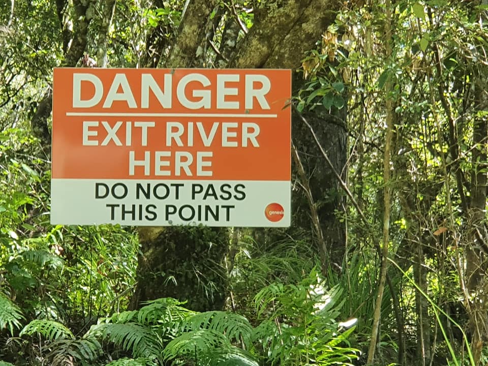
After some more Class II/III below the Pillars, watch out for overhead transmission lines. There is one rapid after these and then a stretch of flat water before a Danger sign indicates the take-out for the by pass of Waikato Falls Gorge (V+). Remember, this section has claimed paddlers’ lives so don’t miss the take out…
Warning!
You must be watching on river left to notice the ‘Danger – Exit river here’ sign.
From the sign head west, perpendicular to the river until you cross a small stream or wet gut. From this point a rather precarious track leads up the cliff angling to the north. Halfway up you may see ropes that are used to pull kayaks up. The difficulty of this portage means it is run a lot less than it might be. But for Packrafters it’s an easy 15 minute walk to the bridge where you can look at the gorge or walk on 5 minutes to the access 10 put in.
Some parties abseil into the pool immediately above Waikato Falls to take the drop. Do some research before even contemplating this.
Flows and Gauge
The nature of the river that is visible from the road is quite different to the wide river bed between the gorges so it needs more water than you would think. We ran it at a couple of cumec in February so it should be do-able for much of the year. Release days are scheduled and the river is a mighty Class III+ on those days. The Tongariro at Rangipo gauge only shows what passes the dam and this is usually less than a cumec. This is because the river is part of a hydro scheme which takes much of the water through tunnels around this section and then dumps it back in the river below Waikato Falls. Water is then removed again at the Poutu Canal intake.
The flow in the Pillars of Hercules run is mainly residual flow from the Waihohonu and various Desert Road streams (the ones that make the road wind around their gullies). Have a look at how much water is flowing through Tree Trunk Gorge and then decide. The flow of the Waipakahi (which becomes the Tongariro River after Rangipo Dam) is probably indicative of whether the Desert Road side-streams will be up.
In summer it may have only a couple of cumec. This means sliding down wet boulders in some places and walked in others but it is still a nice trip. As the flow increase the difficulty rapidly climbs. Apparently the gauge should be above 10m3 for this trip to shine. We ran it in June 2023 with the gauge at 0.6m but a lot of water was coming down sidestreams and it felt like 5-10 cumec. This made for pretty full on Class III on the boulder banks. So it’s not a place for Class II paddlers.