


Trip Overview
The Tongariro Access 10 run is one of the North Island’s most iconic roadside whitewater trips: a sustained, bouldery Class III gorge with reliable year‑round flows and more than fifty rapids packed into roughly fifteen kilometres. It’s widely considered both a perfect stepping‑stone for developing Class III paddlers and a perennial favourite for experienced boaters thanks to its pool‑drop structure, bluff‑wall moves, and its uniquely central volcanic plateau character.
Flow is regulated by the Tongariro Power Scheme at a steady ~16 m³/s most days, with scheduled releases letting the river run closer to its natural volume of ~30 m³/s or higher. The character is rhythmic and confidence‑building at lower flows, becoming faster, more continuous, and more exciting with less exposed boulders as flows rise.
The river corridor cuts through classic central North Island volcanic landscapes—andesite bluffs, pumice cliffs, mossy banks, all fringed with beech and manuka forest. The lower half of the run is through production pine forest but this character is less obvious from the incised river channel. Clear, cold water tumbles through turquoise pools framed by dark volcanic boulders, giving the river an atmospheric, almost alpine feel. Native birdlife is common: tūī and karearea patrol the treetops while whio bob about on the water. Trout are abundant throughout this reach, and anglers are frequent in the lower kilometre approaching Blue Pool. Though the river is easily accessed from SH1, the gorge feels surprisingly secluded for a roadside run.
Note the page is currently in editing
Shuttle
The put‑in is at the Poutu Intake 4km down Kaimanawa road off SH1(turn left before the bridge). The road crosses the dam and there is a large parking area. Walk down a short gravel access track to the river.
There are campgrounds near the put-in. The more distant Kaimanawa campsite is more pleasant. The closer Urchin campsite has become a gravel carpark overcrowded with campervans (although post Covid perhaps not).
Leave a car at the Red Hut or Blue Pool access (2.3 km down a gravel road from SH1 just past the Poutu Stream bridge) about 6km south of Turangi. Leave nothing of value visible. Taking out at Blue Pool annoys a few less trout fishermen but Red Hut (downstream) is right beside the Highway. Having said that, experienced fishermen know that rafts barely disturb the fishing.
There is plenty of traffic for hitching. Talking up the Pillars of Hercules and Waikato Falls gorge will hopefully result in your ride coming down to the river to see the marvel of nature you have described.
On the River
This is a great reliable Class III run. Most rapids are boulder banks over smooth rounded boulders firing into bluffs. Most have (trout filled) pools for a safe run out. After Cyclone Gabrielle there was extensive damage to pine forests resulting in a lot of pine logs in the second half of the run. Many were cleared by Tongariro Rafting. Remaining logs move from time to time in floods and are added to in storms. There are also a couple of active rockfalls – avoid loitering below unstable cliffs.
We recommend you have at least one person in your party who knows the run if considering a personal first decent. Tongariro Rafting have bailed out a good few packrafters who didn’t follow this simple safety rule. Check facebook groups for recent intel on hazards or drop in to Tongariro Rafting for the latest intel. Taking a raft trip through with Tongariro Rafting is a great way to size up the run if you are unsure.
This write up is based on residual flows – features will change with the release and flood flows.
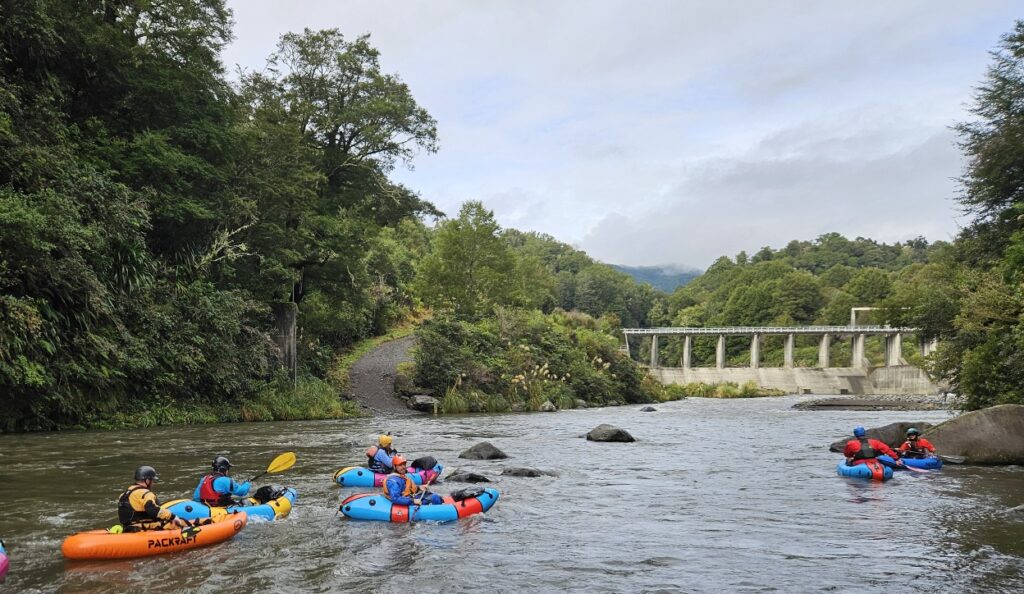
Gearing Up at the Put-in (photo Martin Robertson)
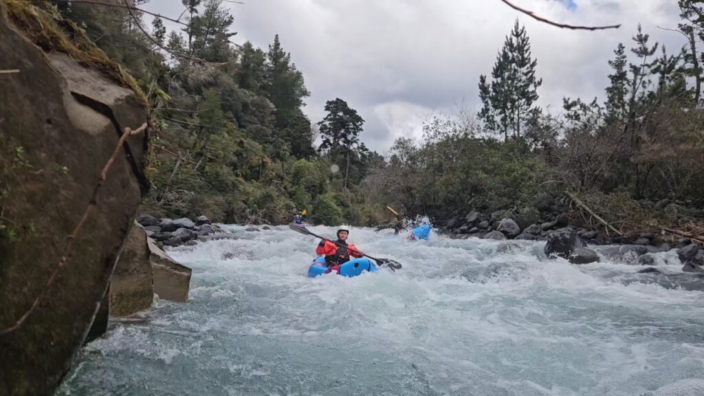
Once on the water it’s rapid immersion in Class III goodness! After a short calm stretch to adjust your thigh straps and top up your boat the fun begins. The first rapid arrives quickly: a graveyard‑style boulder garden that tightens into closely spaced features requiring more energetic active moves and finally bouncing between larger rocks and small holes and spilling into a wall followed by a calm pool that gives a chance to regroup. This is often the first decent Class III that paddlers do. Watch the expression on first-timers faces as they exit the first grunty Class III and tell them there’s more than 50 more where that came from.
The river settles into its characteristic rhythm—rounded boulder banks giving way to pool‑drops that often push toward bluff walls. Just as you’re finding your rhythm the river delivers another long rapid to test you. – about 150 m of continuous Class II+ and III fun.
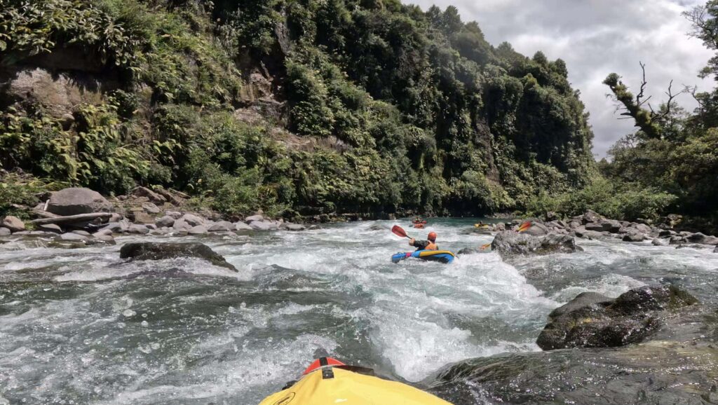
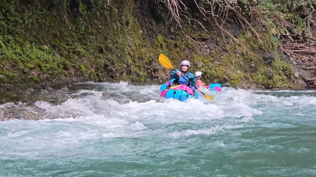
Continuous Class III Fun (photo Lisa Lee-Johnson)
Here the current threads through boulders and down a boulder bank into a rock garden (Earthquake Gully rapid). Lots of eddy hopping will allow you to pace and respace your crew to avoid a traffic jam in the hectic final section. Enjoy weaving the tighter features; small holes and boulders.
After a large pool there is a boulder bank with a rocky horizon line on a left hand corner. This is the Bitch. The low flow preferred line is just left of a prominent midstream boulder (presumably the Bitch herself). Follow your nose and time your strokes for a nice boof or two before powering into the buffer wave on the wall. As is typical there is a nice recovery pool if things don’t go to plan. This is also the best photo opportunity of the trip. With release flows a line on the right is available.
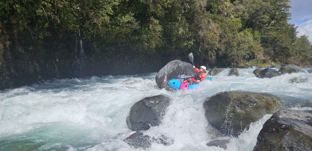
The Bitch Rapid (photo Martin Robertson)
After this comes classic read‑and‑run fun: a steady chain of rapids and wave trains. Another seemingly straight forward boulder strewn channel rapid suddenly pushes hard left into or onto a large rock (McGyver’s Mistake) creating either an exciting boof or a stranding for those that don’t dig in and avoid it to the right. In typical Tongariro fashion it ends with a buffer wave against the wall and a pool.
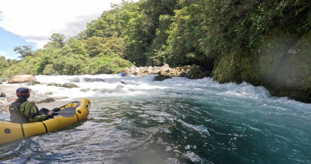
McGyvers Mistake Rapid (photo Lisa Lee-Johnson)
The tempo continues with playful combinations of boulder banks, walls and wave trains, with rafting names like Grandad’s Green Undies and Corner Pocket. Just before the river divides into two channels around a large island, Air New Zealand rapid unfolds in several parts: an upper boulder‑garden approach leads into a bouldery, fast‑moving right channel after the river splits, followed by a steep drop over stacked boulders into a small pool.
Air New Zealand Rapid (photo Martin Robertson)
But there’s no respite as the current immediately swings left around a large boulder into the confused water of the converging channels below the island. The swirling, confused water keeps you busy dodging boulders as the channels reunite. At release and higher flows it’s a particularly exciting conclusion.
More read-and-run goodness follows with names like Sheep and Ski Jump before a quiet mini gorge heralds the Rangipo Prison access road bridge.
Below the Rangipo Prison access bridge, the river eases into softer Class II–II+ water. But there are still some fun features ahead. Pink Floyd rapid precedes a short calm gorge. The mini-gorge ends in a neat little elevator rapid, where a rock ledge in front of a bluff creates a thin, fast sheet of water that elevates the boat onto a conveyor belt ride that splits left and right. A great place to pause for some play. More read-and-run fun follows but gradually eases.
Onto the Conveyor (photo Martin Robertson)
Nature walk rapid is near where the track up the true left bank from Blue Pools ends. This is the Packraft put-in for the Blue Pools run described in a separate write-up. There are three fun rapids before the usual take-out at Blue Pools. For a longer trip carry on down to the Red Hut footbridge. Anglers become common in this lower stretch, and courtesy is important on what is an internationally renowned trout mecca. The Red Hut take‑out is river right just down-stream of the bridge, with a short walk to the nearby carpark.
Other trip options include:
Poutu to Turangi – running all the way to the State Highway Bridge north of Turangi.
Below Tree Trunk Gorge to Blue Pools – putting in on Access 13 (Pillars of Hercules run) below Tree Truck Gorge (not runnable) portaging Waikato Falls gorge (not runnable) and walking to the Poutu dam to run A10. Note both these un-runnable gorges have claimed lives due to logs. drops and retentive features.
Gauge
The Put-in is at a key point in the Tongariro power scheme where water harvested from the headwaters of a most (if not all) of the rivers draining the eastern side of Ruapehu exits a tunnel and enters the Poutu Canal. Once upon a time the mean flow of the Tongariro below this point would have varied and the bed of the river is capable of dealing with larger flows than it receives. It runs at a steady 16m3. On scheduled release days it can run between 30m3 and 60m3. Only strong, coordinated teams should be on the river during higher flow events.
Release days and gauges are here:
https://www.genesisenergy.co.nz/assets/rivers-lakes-rainfall
Tongariro d/s Poutu intake Gauge
Title block image Lisa Lee-Johnson
Original updated in Dec 2025
Nice job Martin. However just to clarify, Access 13 is not downstream of the Access 10 run. Access 13 is from downstream side of Tree Trunk Gorge to upstream of Waikato falls.
misread i think – it says connect with the upstream A13 run.