


The Tokomaru River is a rarely run gem tucked into the northern end of the Tararua Range. It is a small, steep catchment that only becomes viable a few times a year after significant rain. It rewards good timing with an engaging run that builds from easy water into consistent pool‑drop whitewater. While the river starts with 10 km of friendly Class II–III, the following 6km of mostly Class III contains several grunty Class IV drops that justify the effort of catching it in a fresh. Wood, limited beta, and infrequent descents mean this river should be treated as a first‑descent mindset trip, with diligent scouting and conservative decision‑making.
ACCESS
Put‑in – Burttons Track / Tokomaru Valley Road
From State Highway 57 (between Palmerston North and Shannon), turn east onto Tokomaru Valley Road at Tokomaru village. Follow Tokomaru Valley Road until it becomes gravel and ends near forestry land and DOC signage for Burttons Track (Te Araroa Trail).
Park at the Tokomaru Valley Road end. From here, walk down Burttons Track, following the track as it drops into the Tokomaru Valley. There is no fixed put‑in — enter the river once there is clearly enough flow to paddle. At low flows the river is bony and not will barely float a boat on the pools!
Take‑out – Horseshoe Bend Reserve
Horseshoe Bend Reserve is the take‑out. From State Highway 57, turn east onto Tokomaru East Road and follow it to Horseshoe Bend Reserve (signposted). The reserve has parking, toilets, and easy river access.
ON THE RIVER
The Tokomaru starts gently. For about 10 km the river trends NNE and is mild Class II. Whilst it is straightforward read‑and‑run water be mindful of unexpected wood. A change in gradient and character occurs when the river swings NNW through a tighter gorge. For about 4km river settles into the crux section with consistent Class III pool‑drop rapids, offering over ten distinct rapids with good recovery pools. This short section forms the crux of the run and should be scouted carefully as it will be prone to wood hazards. It includes a few steep Class IV rapids, which are short and powerful, but are portageable.
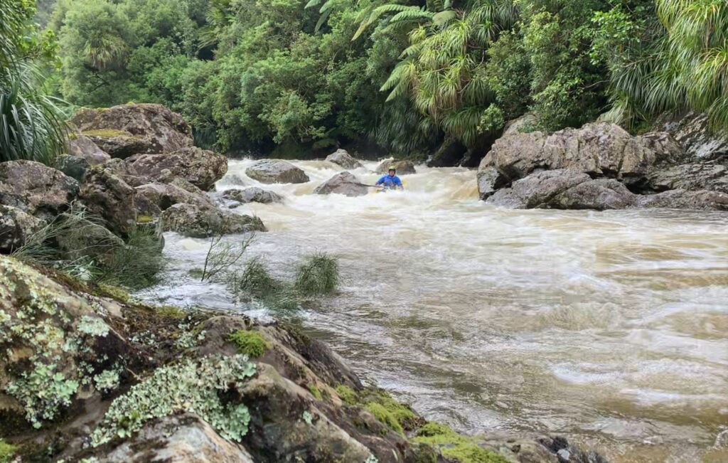
Typical rapid
The crux rapid is Craig’s drop (Craig Martin being the first to paddle it that we know of) These are the defining features of the trip and must be scouted carefully.
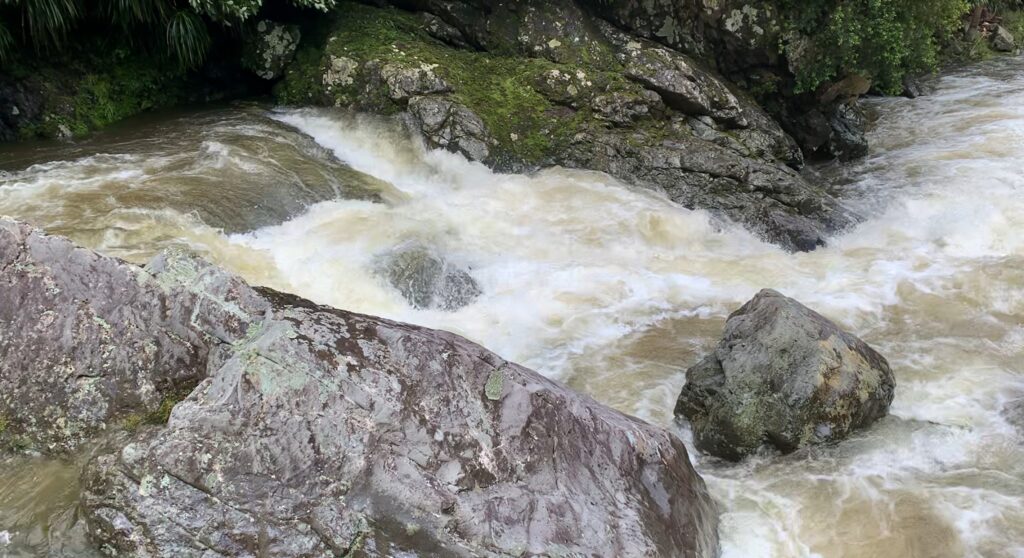
Craigs Drop
Another rapid that may go Class IV at high flows is Big Rock rapid.
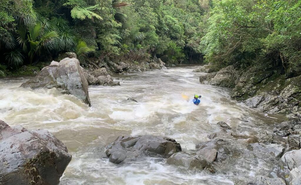
Big Rock rapid
After this the rapid eases off for a few km to the obvious take-out at Horseshoe bend.
GAUGE
The gauge needs to be over 10m3. It may be possible to packraft at slightly lower flows but the Class II section would get scratchy. The video below is 13m3 on the gauge.
- The Tokomaru only flows after heavy rain (2 or 3 times a year)
- Requires significant and recent rainfall to be viable
- Visual inspection is essential — if it looks marginal at the put‑in, it will not improve downstream
View Larger Topographic Map
LAND ACCESS & PERMISSIONS
- Public access via Burttons Track (DOC / Te Araroa Trail)
- River right is generally public land for the Class II section.
- The Class III/IV section passes through private land — there is not much scope to leave the river early so stay within the riverbed and use established access points only
Sources
Warren Cheetham kayaked this in 2025 and provided photos and info. It awaits a packraft first decent.