


Mohaka River overview
From the headwaters in the Kaweka Forest through farmland to the forestry blocks, the mighty Mohaka is a magnificent river for paddlers. There’s something for everyone along its length: to avoid confusion, here’s a list of the sections, from top to bottom.
- Mohaka River (II+/III) “Upper run” 2 Days with a hike, from Poronui to SH5
- Mohaka River (I/II) “Beginner’s run” 1/2 Days car to car, SH5 to Bridgets Clearing.
- Mohaka River (III) “Te Hoe” 1 Day car to car from Bridgets Clearing to bridge just above Te Hoe River confluence.
- Mohaka River (III+/IV) “Te Hoe to Willowflat” (on Riverguide.co.nz) 1 Day car to car.
Mohaka River (I/II) “Beginner’s run”
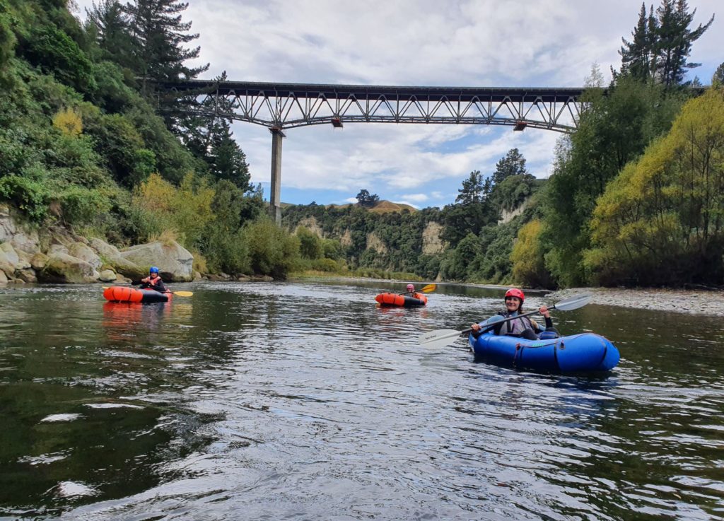
A great introduction to packrafting can be had by camping near the Napier Taupo Road (SH5) bridge and running the road-accessible sections nearby.
Camping options
Mohaka River Farm, is a fantastic place to stay. It has A-frame cabins, a bunk room and lots of campsites. There’s also a small conference room. It is located at the end of McVicars Road.
Glenfalls DOC Campsite is a basic, riverside camping area. It was badly damaged in Cyclone Gabrielle – check the website for updates before planning to stay there.
Bridgets Clearing campsite. (Also known as Everetts Ford Campsite in some sources). An unformal camping spot, with no toilet.
River access points
There’s 5 access points nearby, giving options to shorten or extend your trip. From upper to lower, these points are:
- Mohaka River Farms At the end of McVicar Rd.
- McVicar Rd Bridge – About 4km from SH5. Walk down the 4wd track to put-in river right.
- Opposite Pungahuru Falls (a few hundred metres upstream of SH5 bridge)
- Glenfalls Campsite – From SH5, drive 8km down Waitara Rd.
- Bridgets clearing / aka Everetts Ford camp From Glenfalls continue 5km, then turn left onto Auroa Rd and descend through the pines to Bridget’s Clearing.
Suggested weekend
The water above Glenfalls is I/II, which is a great introduction for day one.
The following day, you might like to paddle the section below Glenfalls, which is a step up in difficulty with more II water. It’s got a consistent flow right through the year and will have water when everywhere else is bony.
View Larger Topographic Map
Mohaka River Farms to Glenfalls Camp (I/II)
The river is easy Class I with occasional Class II rapids through a deeply incised channel. Willows are prevalent and can present hazards for learners. It’s a really cruisy run.
It’s 19km in total if you start at Mohaka Farms camping area. Choose one of the lower put ons if you are short on time.
Glenfalls Campsite to Bridget’s Clearing (I/II)
From the Glenfalls campsite to Bridget’s Clearing campsite is about 11km (allow at least 3.5hrs, more if you are playing ).
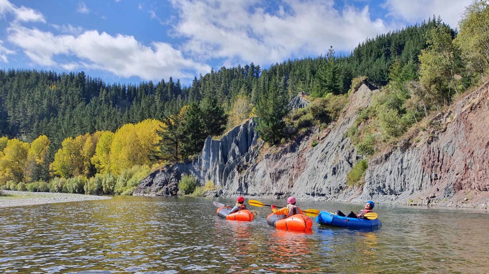
There is a great play-spot at the downstream end of the campground (“Camp Corner Rapid”) and also about a kilometre downstream (“Holey Heck”)- note unofficial names are used in this writeup to help identify them). After the Waipunga Confluence watch out for willows river left and in the channel river right a little further on. After this there is a big oxbow shaped bend. Halfway around the bend the geology changes to highly sheared greywacke that has formed a unique landform known as the Organ Pipes. This is followed by a large active slip delivering pine trees into the river.
A kilometre on is a great wave train to practice throw roping and whitewater swimming (“Swimmers Chute)” but be wary of log hazards from the slip. The biggest rapid (“Last Rapid” II to II+) is around the next corner before the Bridget’s Clearing campsite.
Gauge
The gauge is here – any flow above 10 cumec is fine.