


Short, steep and needs some rain
Mistake Creek is quite a steep creek run that needs some extra water, similar to the upper Eglington (II/III) run .
There is an excellent day out to be had by combining the two, just remember to think about biosecurity! Whilst the Eglinton catchment is full of people, Mistake Creek hardly gets any visitors. Start your day with a clean & dry boat, and go to Mistake Creek first. Clean your gear before heading into the next waterway.
Thanks to Shane Orchard for the pics and info for this page.
View Larger Topographic Map
Walking in
From SH94, follow the Mistake Creek track, which crosses the Eglington at a walkwire and snakes its way along the river edge through the bush.
The track reaches Mistake Creek about a kilometre above the Eglington confluence. After sidling through the bush for while, the track comes out on an open section of river flats. The upstream end of this flat is where there good paddling begins (more on that below).
Keep following the track further upstream to the crossing point marked on the Topo50 map. Cross here then continue following the track, now on the true right. Within the next few hundred metres the creek becomes even steeper and it can’t be seen from the track. After passing the first side creek choose a likely looking spot to sidle through the bush to the creek, aiming for near the 600 m contour (or a little lower if you wish). This creek may also be paddleable from higher in the catchment with similar steep character throughout.
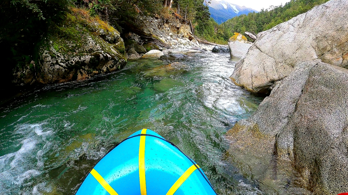
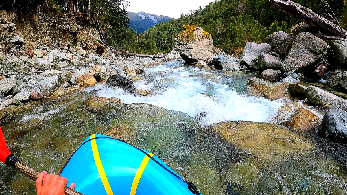
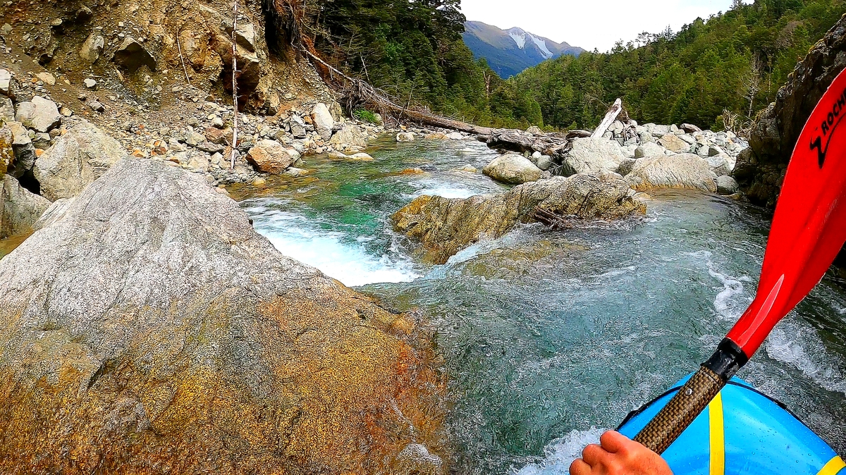
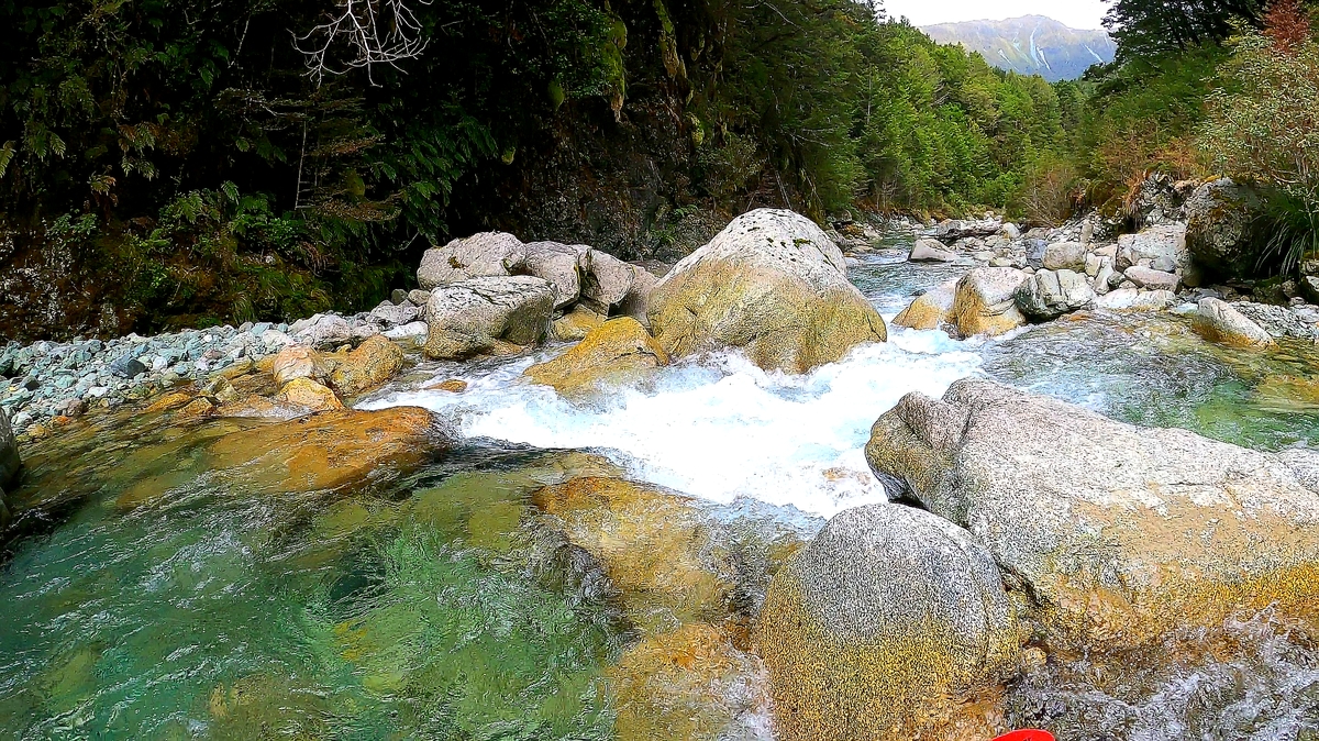
On the water
From the ~600m contour put in, the creek has a steep bouldery character that is surprisingly runable and mostly boat scoutable, but it is worth scouting at least the upper few hundred metres from the bank as you walk in. In this upper section you’ll find a nice 4-metre rockslide feature as well as several relatively bony drops. Despite the steep gradient most of the rapids twist through a staircase of small chutes and pools. In lower flows (e.g. just runnable after 1 day of steady rain in Te Anau, as was the case for Shane’s trip) the grade would be III+ but with high flows this would quickly ramp up. Many of the rapids can be seen on the way in and portaging is possible throughout the run.
As the name suggested there had to be some kind of mistake involved, and it turned out to be an apparent lack of water below the point at which the track first meets the creek. This drier section is not immediately obvious, so it is worth checking out the flow at the bottom end of the open river flats on the way up.
The main problem results from several braids starting up here which split the flow, and there are also several tree-falls in this area too.
If there is sufficient water expect class II/II+ in this lower part of the run, with some scrappy sections down to the Eglington confluence, then class I and II down to the takeout point on Te Anau Milford road.
If its too dry and boney, it may be quicker to pack up and walk out via the Mistake Creek track, and/or put in again on the Eglington at the walkwire and continue downstream from there.
Scoping the takeout
The Te Anau Milford road is also quite difficult to see from the river, so it is a good idea to pre-scope the takeout point and place a temporary marker on the bank there so you know where to get out.