Full length of the Harper – an overnighter flood-run.
The trip links the iconic Lagoon Saddle tramping route with an exit by packraft via the Harper River from as high up as flows and skill allow, giving a watery twist to a classic kiwi tramping trip. The line is aesthetic, the track is well-marked, and only 500m of vertical separates the start from the put-in.
However, with the steepest and narrowest sections of river high in the catchment, you’ll need to time this trip just right with weather and high flows for it to be paddeable. Normal flows will be much too low.
As an ‘up and over’ through-trip, it does require a car shuttle, but several hut options make timing logistics easier.
What is the first rule of a flood run? – Never swim….
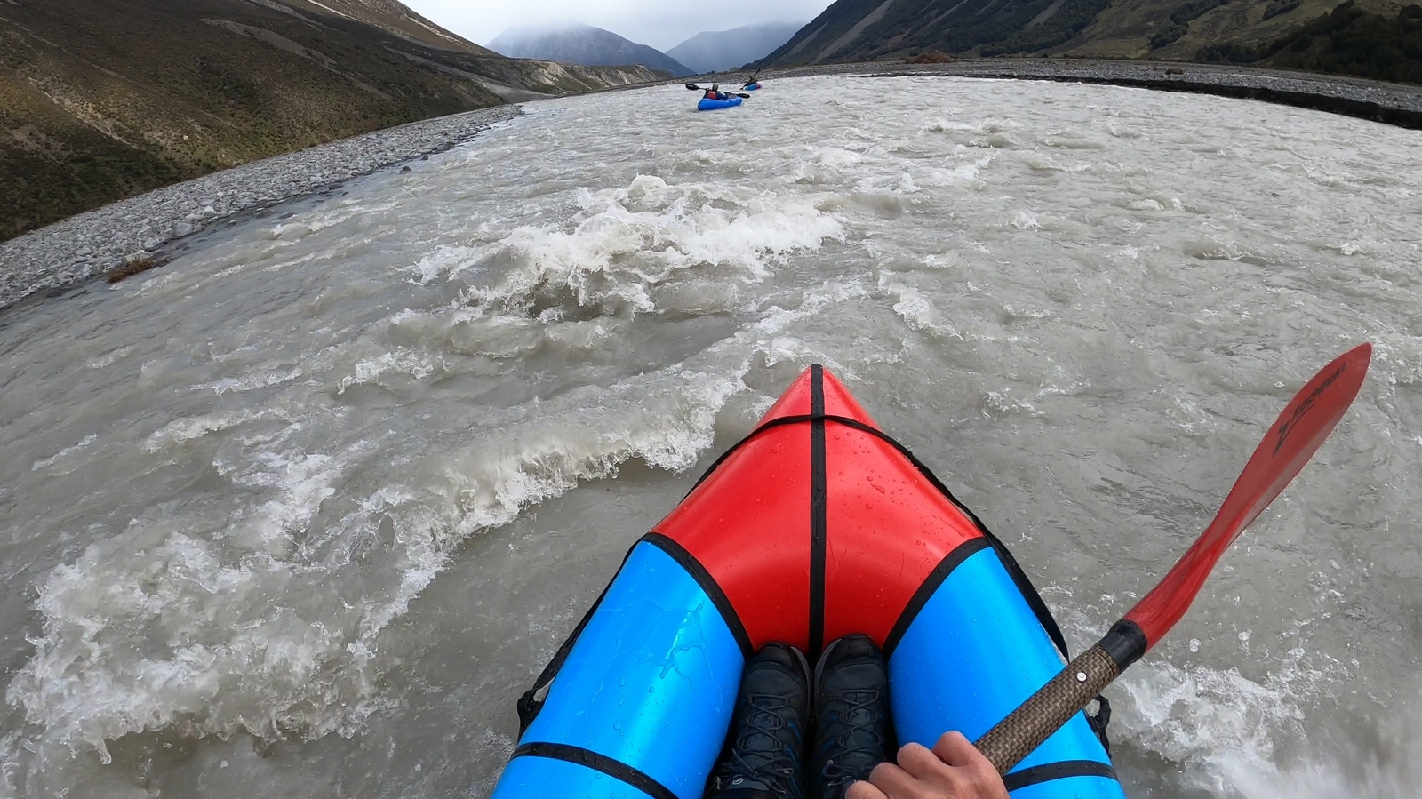
Because it’s a flood run, when it’s on, the river will be fast-flowing, discoloured and likely have new log jams and other obstacles to avoid, particularly in the upper section. This will keep all groups on their toes, and tight team management is essential. Although the gradient and character of the river result in a grade II/III flood run, groups should be paddling very well at the grade. Flooded rivers aren’t for people ‘getting into’ a certain grade.
For a fun article about what it means to paddle flooded rivers – check out this great story from Keith Riley – a veteran kayaker on the west coast.
Thanks to Shane Orchard for the info and pictures.
View Larger Topographic Map
Planning & preparation – hitting the right flows
With the steepest and narrowest parts of the run being situated high in the catchment, you need to time the run just right to catch a suitable flow in these sections. The best setup will likely require the ground to be reasonably soaked from previous rain and then ideally followed by a top-up storm with a clearance afterwards.
For reference, on the day of this trip report, the Rakaia was running at 550 cumecs coming down from a high of 4000 cumecs three days prior, and the Waimakariri below Otarama was 500 cumecs. There had been 100 mm of rain at Castle Hill two days prior, and there was a small amount of additional rain (around 20 mm) on the night before we got on the water (plus a little snow!).
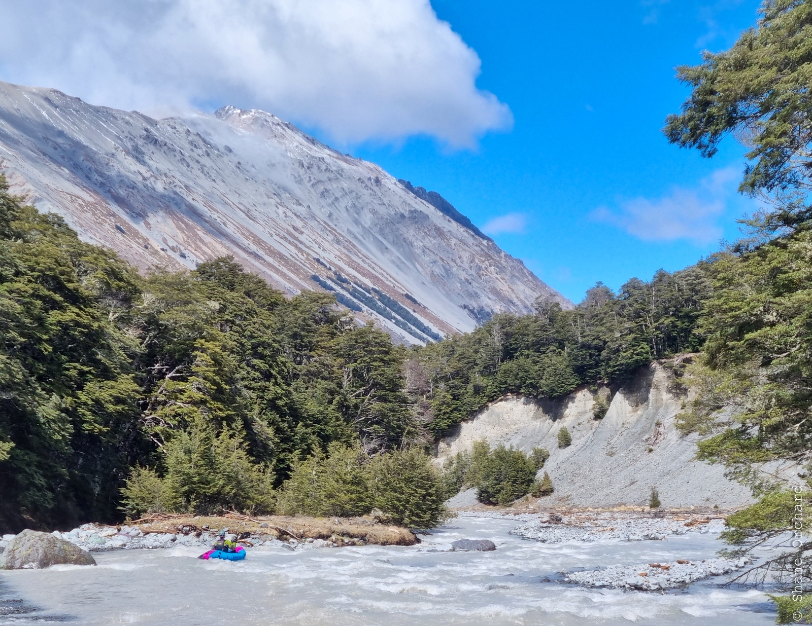
Ideally, we would have been there one day earlier to catch a slightly higher flow. Strand lines on the riverbanks showed that the peak flow in the previous rain event was at least 1 m higher than shown in the photos from the section above Hamilton Creek.
However, too much water is likely to be unmanageable around some of the blind corners, especially in the upper gorges above Tarn Creek. Therefore, you want these sections to be runnable but not too high. Also, bear in mind that the flow increases quickly with inputs from the side streams. Starting from the flat at West Harper Hut or the next flat upstream is likely to offer a good compromise between water depth and manageability.
Timing & accommodation options
Depending on the exact timing and intensity of the weather event, you have a few options to consider.
- Perhaps you’d make an early start on the day of the clearance, go for a longer day and aim for the very comfortable Hamilton Hut (20 bunks) for your first night.
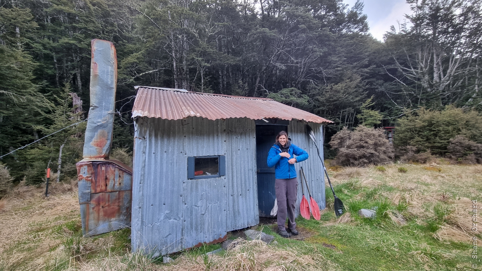
- Starting a bit later might mean you spend the night at the rustic West Harper Hut (5 bunks), with a longer second day.
- Maybe you’d walk into one of the huts before the rainfall, with a good book and plenty of food and wait for the perfect flow.
There are also two basic bivvies near Lagoon Saddle – the Lagoon Saddle Hut (2 bunks) and A-frame (2 bunks).
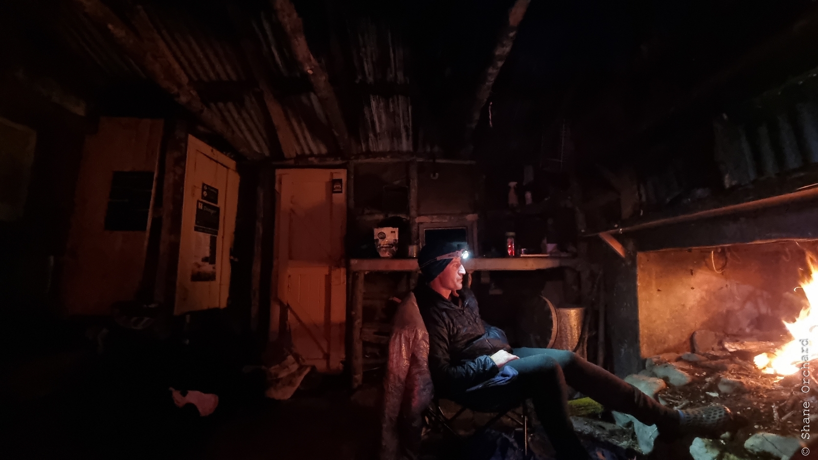
We stayed at the iconic and incredibly original West Harper Hut. This option comes complete with open fire, dirt floor and hand-hewn sapling bunks upholstered with patchy canvas. Expect a true dirt bag paddler ambience and pack accordingly!
Setting the shuttle 85km | 2hrs
Drop a vehicle (or arrange a pickup) at the take-out point, which is just upstream of the bridge on Harper Road near the top of Lake Coleridge.
Be sure to scope out the intake structure for the Harper River Diversion and eyeball a takeout point a good distance upstream. Take a mental note or picture of the area for reference. At the same time, you’ll get an initial idea of the flow in the river. All going well, it will be wide, brown and extremely fast flowing!
It is about 85km back to the start point, about a third of which is on gravel roads. Allow at least 2 hours for the shuttle.
Approach
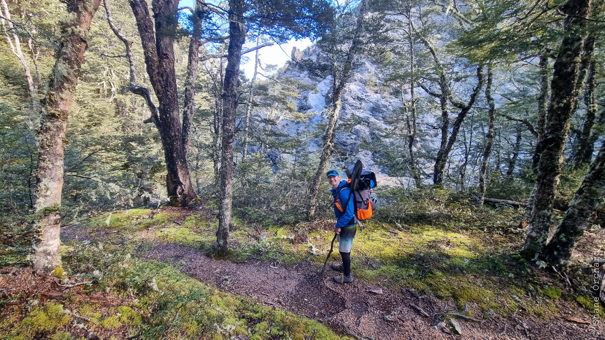
Cora Lynn Road to Long Creek via Lagoon Saddle 8.5km | 2-3hr
To get started, head around to the Cass-Lagoon Saddle track, to the good carpark at the end of Cora Lynn Road. There are plenty more details on the Cass-Lagoon Saddle track on the DOC website. It’s a well-marked track, initially through beech forest, then a long, open, traverse across the face of Mt Bruce to Lagoon Saddle – plan accordingly if you’re intending to be there during the storm!
At high flows, the paddling can generally start where Long Creek doubles the flow. Below here, the tramping route is via the river-bed until it resumes on the opposite (true right) side.
On the water
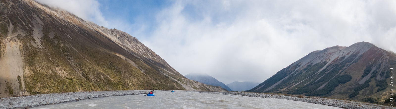
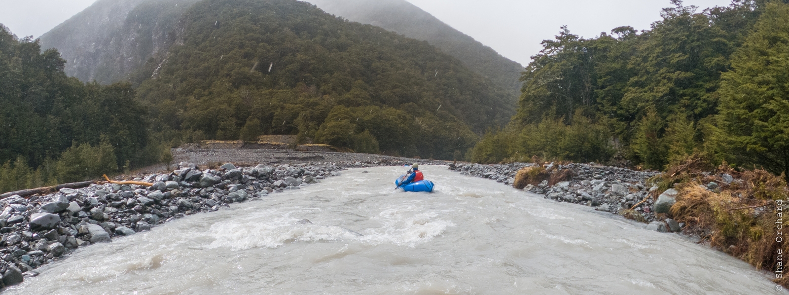
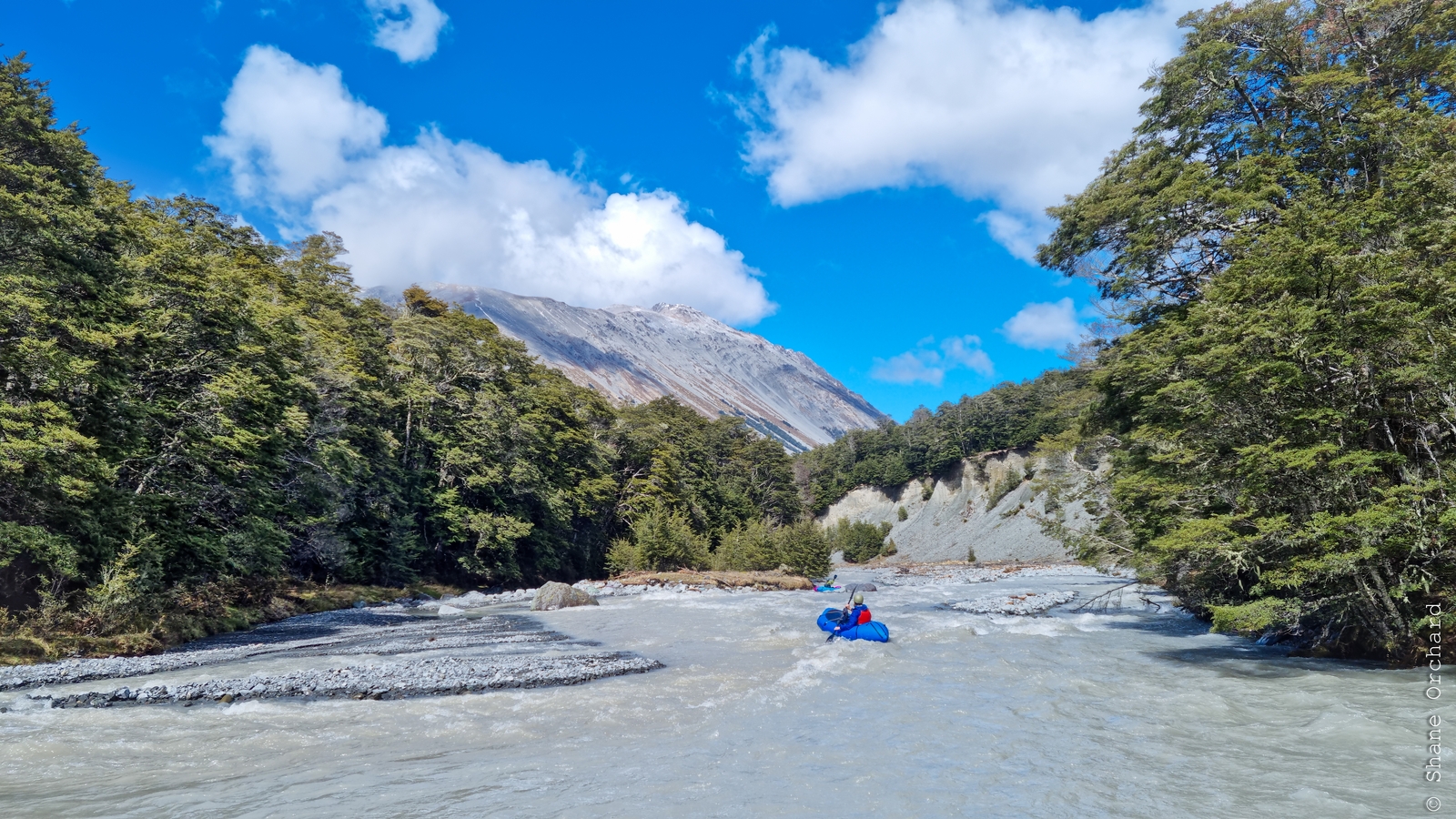
Long Creek to Hamilton Creek confluence (II+/III) 4.5km
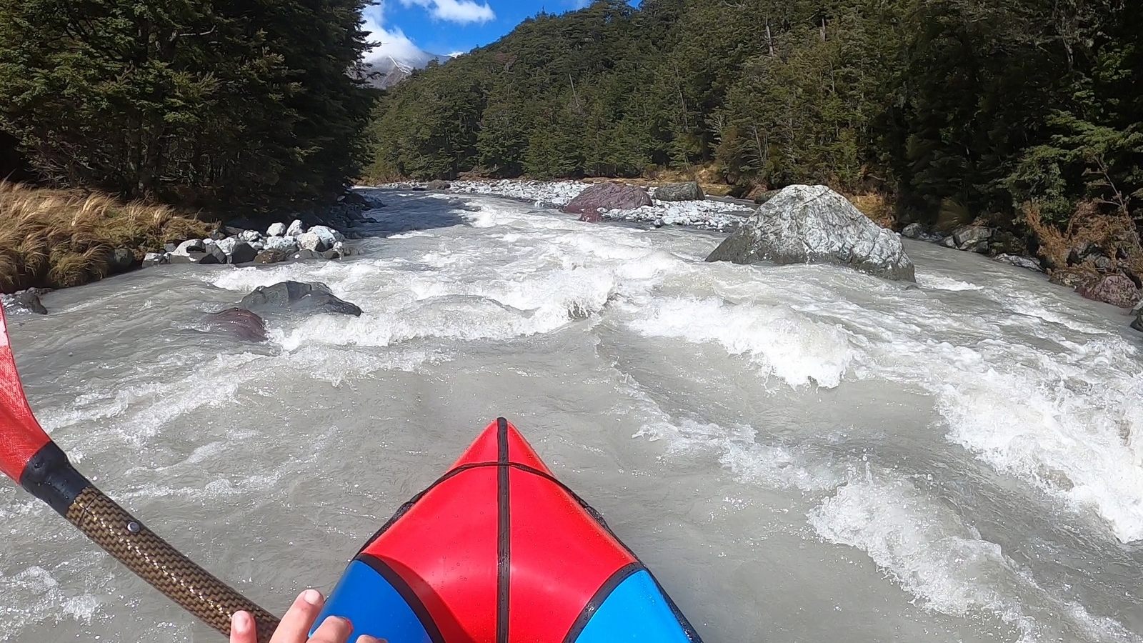
At the flows we observed, the paddleable water generally starts at Long Creek but is initially shallow and fast-moving until the gorge section adjacent to Pt 959 on the Topo50 map. Continuous class II+ / III rapids then become the dominant character, interspersed with some quieter sections.
For the most part, look out for shallow ground, which can be very difficult to see given that the water is discoloured. Also, be sure to scope well ahead downstream for hazards and line choices. Keeping the group together is also key in this section, as there is a fairly high potential of encountering woody hazards. The water will be moving very quickly, and you’ll be on them before you know it.
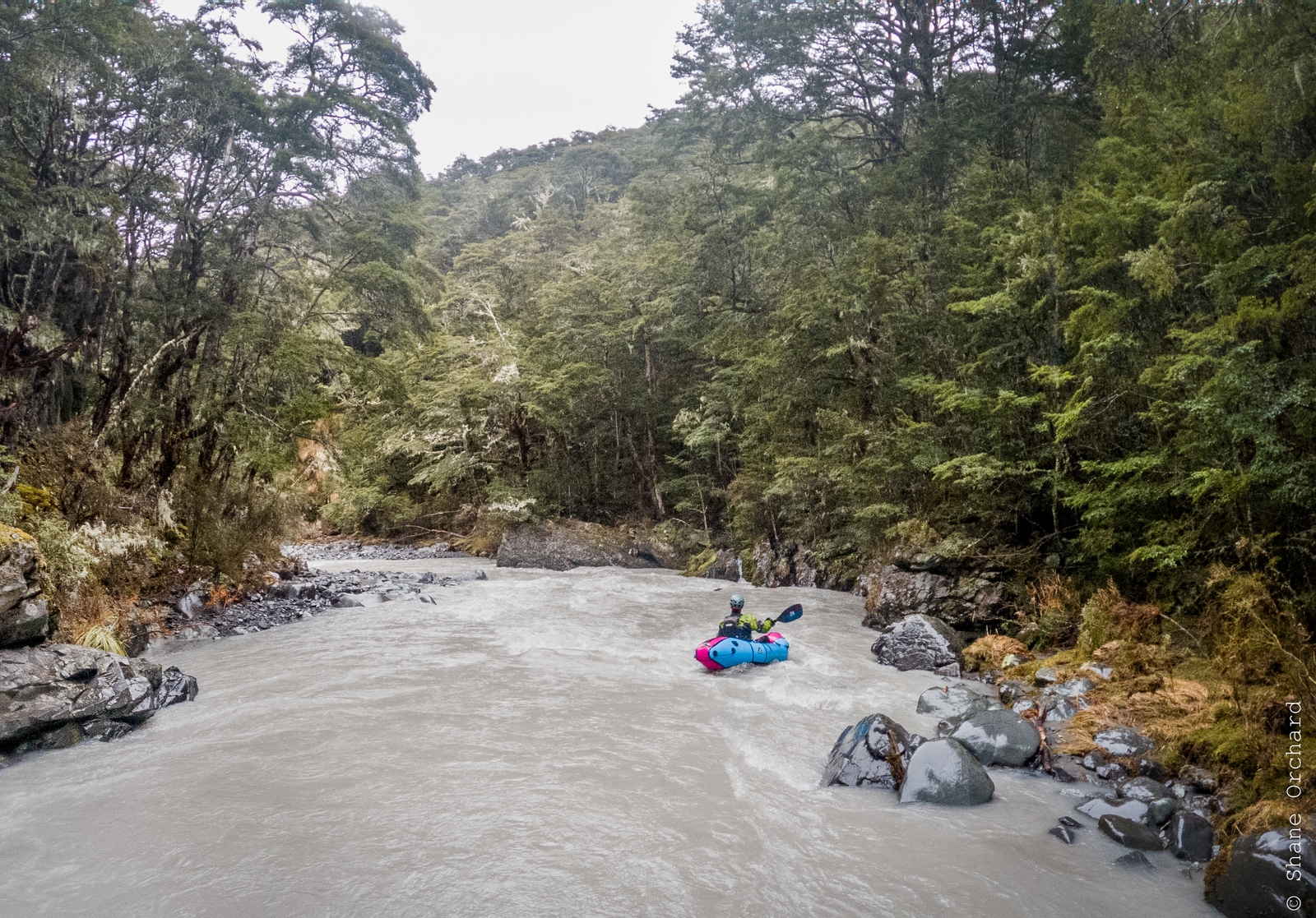
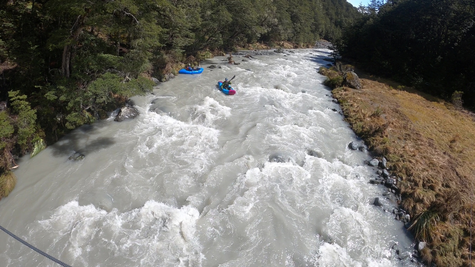
Below West Harper Hut, there is a short but beautiful gorge where the river narrows for around 1 km and bedrock features become more prominent.
After this, the river resumes its open boulder bed character. The gradient also reduces gradually throughout this section, and the technical difficulty eases to mostly class II wave trains. Less experienced paddlers have the option of walking further down the track to put in somewhere along this section (e.g., opposite Fall Creek).
The last set of more difficult (class II+/III) rapids are located in the short gorge ~1 km above the Hamilton Creek confluence, but can be readily scouted and portaged.
Hamilton Creek confluence to take out (II) 15.4km
After this, the remainder of the run is class II with very few surprises. Newer paddlers may relish the idea of a lengthy class II opportunity, and the Harper has this in abundance!
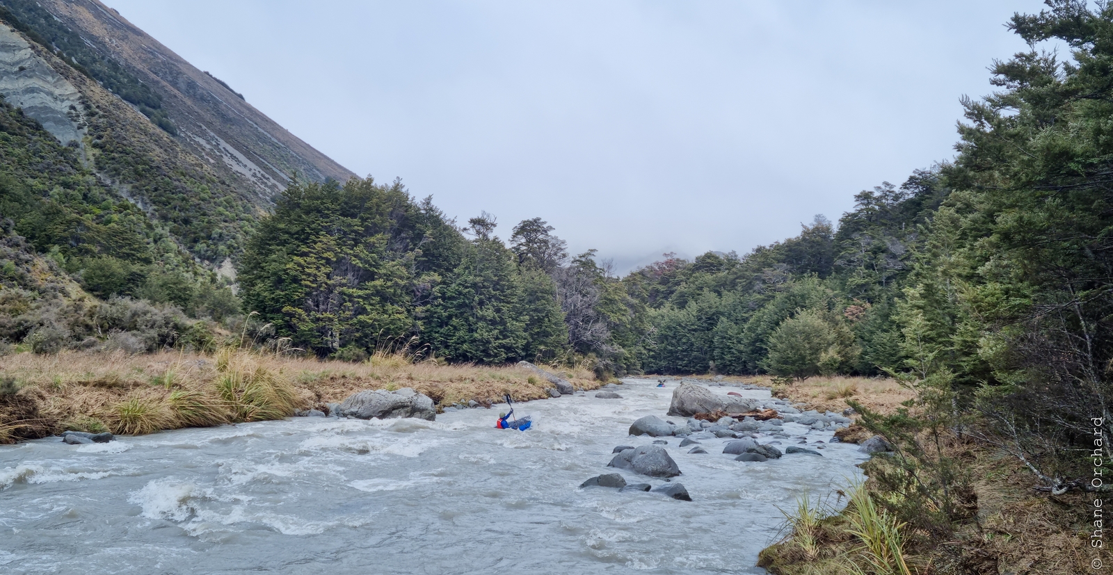
Fairly continuous roller-coaster style rapids continue all the way down towards the Avoca confluence, after which the river becomes wide and braided. Despite this, you’ll still be travelling surprisingly fast, which makes for a rather enjoyable sightseeing tour of the lower river and a chance to reflect on the fast-paced adventure. Keep an eye out for the Pinnacles – a group of unusual gravel spires on a slope above the river on your way down. As you near the takeout, be sure that everyone in the group is aware of the location. Hopefully, the weather will also cooperate in this final section, as it is exposed to wind gusts from most directions!