


Mataura River – Source to sea in seven days
This is a great week-long journey through Southland, suitable for paddlers with modest technical skills. It stays interesting the whole way with a steady current, a variety of rapid styles and little towns to resupply.
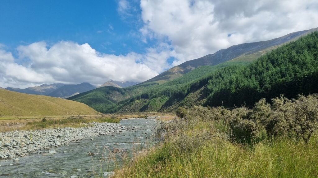
The Mataura River starts in the Eyre Mountains near Lake Wakatipu and Kingston and runs about 280 km to the sea near Bluff. The first couple of days would be more fun with a bit of rain to lift river levels (above say 27 cumecs on the Environment Southland “Mataura at Gorge” gauge).
The river keeps moving steadily with a gravel bed nearly all the way to the sea.
The main danger and challenge is willows and they occur the whole way down, not normally blocking the whole river, but fast flows over gravel bars into the trees are common and require care and good judgement.
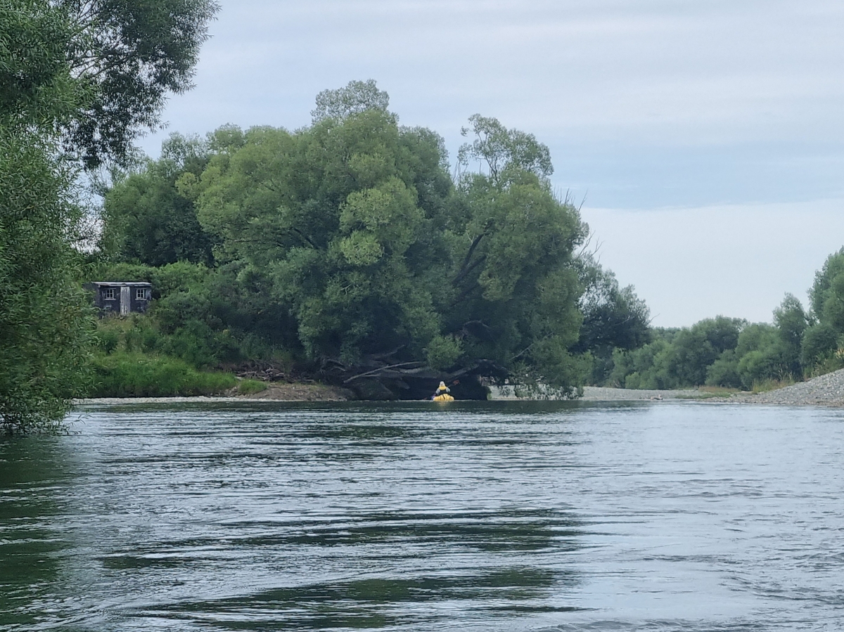
This river is internationally famous for its brown trout and sometimes we saw hundreds in an hour. Please show courtesy if you encounter fisher-folk – If you do spot them from a good distance upriver, catch an eddy and wait for them to wave you on. If you spot them too late, its better to float through quietly, than make a bit splash trying to eddy out! It should go without saying to begin this trip with a clean & dry boat to avoid bringing unwanted freshwater pests to this fishery – besides the environmental impact, fishing tourism and guiding is a major source of income in the region.
Itinerary & logistics
The days can be split up in many ways; flows, headwinds and paddle fitness all come into play on a ~230km journey!
Accommodation is available in towns along the way. There is ample riverside camping, however, that sometimes requires permission from landowners. Carefully research the location of public lands via the Herenga a Nuku Walking Access Maps before you plan your overnight stops.
In January 2023, Stu’s group put in a little above Robert Creek, in low flows. His schedule was
- Night 1 – Athol
- Night 2 – Public land next to beech forest at Cattle Flat below Nokomai Gorge.
- Night 3 – River bank (there are abundant gravel banks and riparian reserves in this area well away from the road)
- Night 4 – Gore (short day)
- Night 5 – Bush reserve at the Makoreta confluence (lovely spot)
- Night 6 – Waituna lagoon a short walk from Mataura mouth (take fresh water)
- Night 7 – Bluff
Drinking water
As the river passes a lot of farmland, towns and industrial plants, drinking water can be a challenge. Take enough water storage to see you through, stocking up in towns along the way.
Thank you to Stu Bilby, for the information and photos December 2023
View Larger Topographic Map
Getting to the put in
It’s about 45mins drive south from Queenstown Airport to ‘Fairlight Station’ and the turn off onto Cainard Rd. The best spot from here depends on the flow…
Gauge
Environment Southland “Mataura at Gorge” gauge
In low summer flows <25 cumecs
Sections in the upper catchments can almost completely dry up, but unless it’s a total drought, it should be ok to start at the Fairlight Rd bridge, just off SH6.
If levels are up a bit
Drive up Cainard Rd, keeping an eye on the river. The bed here is all gravel, and in lower flows, the water can flow beneath the surface, even when the upper reaches are paddleable. Bear that in mind if it looks dry as you drive up the valley!
Continue up the road, and leave your car at the Robert Creek ford. If there’s still enough water, you could walk up and put in at Cowshed Hut. There’s a pleasant little gorge just to the south of ‘Homestead Hill’ which is usually paddleable even if it looks too bony above the Robert Creek confluence.
Little towns and coffee
Garston, about a 500 m walk from the river, offers coffee and accommodation.
Athol has a lovely camping ground with showers and lodge at the end of East St. This is only 250 m from the river but not obvious from on the water. Make a GPS mark where the paper road extension of East St hits the river for the takeout and walk across the paddock. Athol also has a superb café for those willing to walk a kilometre.
Below Athol the river leaves the main road and goes into the Nokomai Gorge with some pleasant Grade II rapids, fishing baches and beech forest. The river then slows down into flatter country through farmland. The Waikaia River confluence is welcome, it doubles the flow and increases the grade.
Just when it feels like things might become boring, a river-wide natural bedrock weir appears. This is marked on the topo map. It is about a metre high and difficult to scout from upstream. We found a way through on the left.
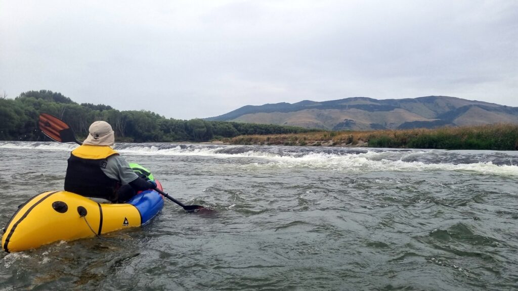
These rock formations appear regularly for the rest of the river and create zig-zaggy rapids with complex routes that prevent you falling asleep. Jump out of the river at the bridge in the middle of Gore. Café Ambience, the Oven Fresh Bakery and the Stable Kitchen cafe offer great food. The motor camp is worth avoiding (at least in 2023).
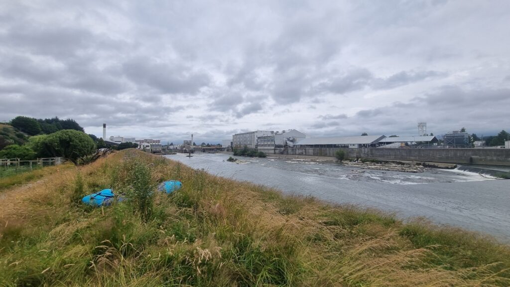
Mataura Falls
A few hours paddling sees you in Mataura. Mataura has a post-apocalyptic industrial charm. In the middle of town between the abandoned paper mill and the freezing works is the Mataura Falls. These have been paddled but should probably be avoided in a packraft.
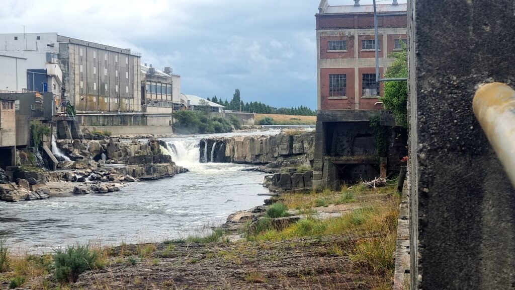
Upstream of the falls is a concrete u-shaped weir which is a bit difficult to see approaching from upstream. I suggest taking out just above the weir on the true left at the last side street on the topo map. Scramble over the stopbank and walk the highway into town.
About 400 m downstream from the main bridge on a little side street is a park with a good put in on the true left of the river. The rapids abate from here down, into class I water.
Flee Mataura and head down to the Mokoreta River confluence.There is a reserve with a patch of native forest well away from any roads. There is a pleasant grassy spot to camp at the edge of the forest a few metres up the Mokoreta River. Fresh water can be scarce below here so stock up if you are going to Bluff.
The last day’s paddle to the sea can be a bit tedious. Liven it up with party games, get the tide right and pray for a tailwind. A sail can add a bit of amusement here. It is possible to cut off some of the meanders by walking but this is unlikely to be worth the effort.
River Mouth to Bluff
For the energetic, a couple of days travel along the wild south coast and into Bluff is a pleasant way to end. From near the Mataura River mouth, cross the sand bar and it is 4 km along a rough 4WD track to Waituna Lagoon. The lagoon is pleasant packrafting if the tide is right. It is rarely calm enough to paddle on the ocean. From there another 4 km walk will put you at Awarua Bay. Getting the high tide and finding a way through the dense coastal scrub is critical here or it is a long dry walk to Tiwai Point.
Tidal currents and southerly swell through the harbour mouth can make crossing Bluff Harbour tricky at times. Good judgement and open water safety protocols are important. Hitching into Invercargill from Tiwai Point is always an option if the harbour crossing is impractical.