


A classic run, great for packrafts at low flows
From its catchment in the Lees Valley, the Ashley River / Rakahuri cuts a wandering meander through the Canterbury foothills. Rakahuri means “entangled and turning” in Te Reo Māori – and that’s exactly what it does.
For a very long time, The Ashley has been paddled and floated by just about every type of vessel – and now Packrafts are getting their turn.
The Ashley is mainly known as a kayaking ‘rain run’, done at high to flood levels.
This post aims to show packrafters that at low flows, there’s fun to be had for suitably skilled and experienced groups.
There are two distinct sections, separated by the aptly named ‘Middle Bridge’ of the Lees Valley Road. This is the rough gravel road that crosses the river roughly halfway between the Canterbury Plains and Lees Valley.
Both sections are described on Riverguide.co.nz, and the ‘Ashley Gorge’ section has been in Graham Charles’ NZ Whitewater Guide for many years – read below for the details of the run.
Riverguide.co.nz descriptions & vehicle access points.
Lees Valley to Middle Bridge
- Take out just after Middle Bridge on the true left.,
- Put in at Lees Valley, on the true right, downstream side of Gillespie Bridge.
Ashley Gorge
- Take out at Ashley Gorge camp ground.
- Put in Just after you cross Middle Bridge to the true left, turn right and drive down to the river.
View Larger Topographic Map
A quick note about the map
These interactive map lines are an indication only of where the harder parts of each run are. The colours represent grades at Packrafting flows. The lines were placed by analysing satelitte imagery and are to give a a general impression of the location and amount of ‘harder’ water. Take them with a grain of salt, and make your own judgements on the water!
Ashley Gorge section (III) supplemental notes for Packrafters
These notes are aimed at packrafters, and are intended to supplement the riverguide.co.nz description
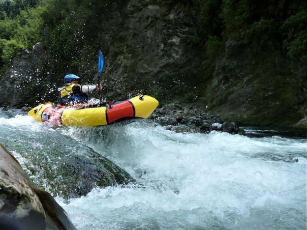
The crux section is about midway down the gorge, with about five rapids back to back.
Once the grade III rapids start, there is continuous action for 4 km. These rapids are interesting enough for packrafters and will require you to be constantly boat scouting and maintaining momentum.
The first rapid of note is on a left turn after a long straight section. Packrafters are advised not to bomb this. Instead, catch an eddy and scout the line – at present a large rock requires a particular line.
The long rapid leading down to Big Eddy has pinning potential in midstream. If this occurs rescuers might need to be creative to get a rescuer out via a tethered boat.
Gauge & flows
With a large catchment backing onto the Southern Alps, The Ashley rises quickly with rain. This means put on when the rain has stopped and the flow is dropping.
| Flow in cumecs | Lees Valley to Middle Bridge | Ashley Gorge (Mid bridge to Campground) |
|---|---|---|
| 5-10 | II/II+ Packrafting | II/III Packrafting. preferred packrafting flows |
| 20-50 | III Kayaking – preferred flow for most kayakers | |
| 60+ | III+ Kayaking expert kayaking flows. |
Notes on the flows for Ashley Gorge – by Hugh Canard
In lower flows of 5-10 cumecs, the river is safer for packrafts. There are pools between the rapids, but they soon flush out over 20 cumecs.
In higher flows of 30+cumecs, rescues become more difficult, as the banks become inundated and what eddies there are in the crux section become very small and retentive.
Most walk outs and SAR call-outs are due to paddlers getting separated from their boats. As the flow increases into the preferred kayaking zone (20-50 cumecs), parties must have rock-solid group rescue skills. You need to be close enough together to promptly assist any swimmers – lost boats flush quickly here and are rarely recovered.
Throw ropes are only useful if the rescuer arrives from upstream, because in most places you can’t clamber back up the sides.
At above 60 cumecs kayakers have been in an eddy in their boats but have been unable to get out of it.
At these flows, the grade III boulder drops flush out and powerful holes develop. Places which are placid pools can develop really big laterals and are unscoutable and unportageable. Higher flows demand a bombproof roll.
‘Packrafting grade III’ versus ‘Kayaking grade III’
This is a great time to remind us packrafters that paddling a ‘grade III’ river in low flows is very different to paddling a grade III river in ‘kayaking’ flows. (Which is one of the drawbacks with the grading system, but that’s another debate for another time ;0)
Although the river gradient is the same, and you’ll still need to have good manoeuvering and boat scouting ability, at low flows the river is less pushy. You can also expect more exposed boulders to avoid and probably some scraping on the bottom. Some drops may not have enough water to paddle, so you’ll need to assess and portage as required.
Low flows usually mean more exposure to sieve and foot entrapment hazards, more exposed rocks to hit and less water between you and hazards on the river bed.
Remember, just because it’s lower, doesn’t necessarily mean it’s safer…
Turn up with good hazard awareness, self-rescue & team rescue skills – you’ll have a blast and probably won’t see any other paddlers on the river ;0)
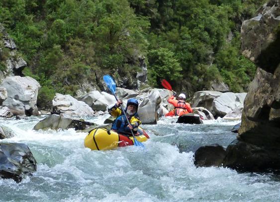
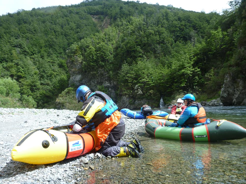
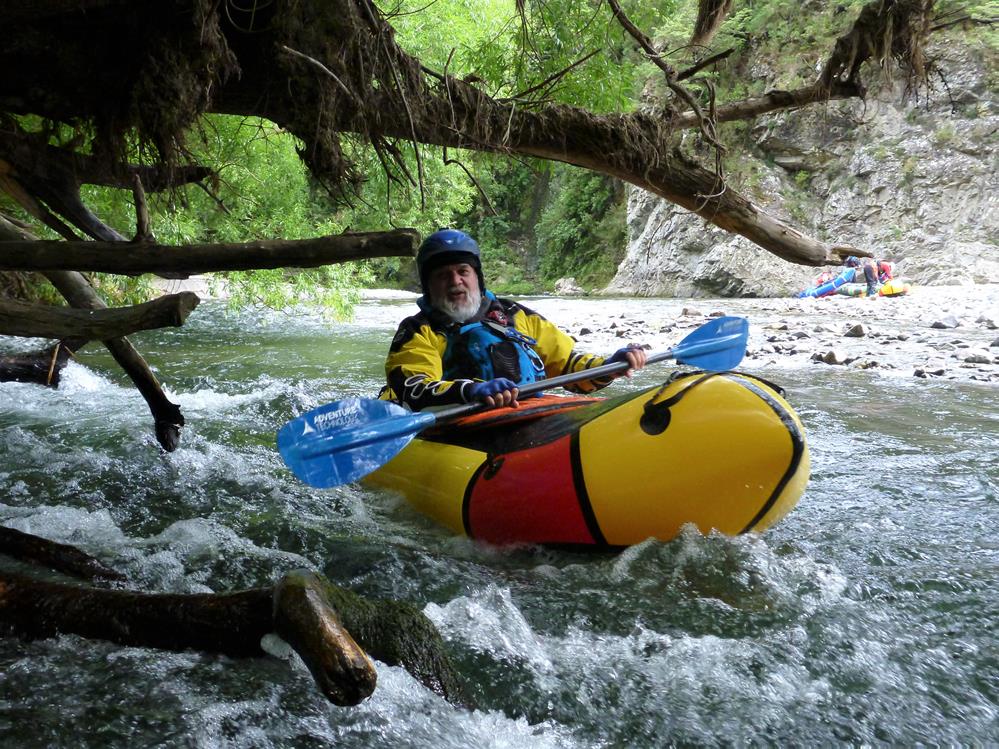
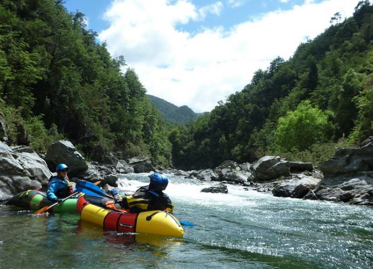
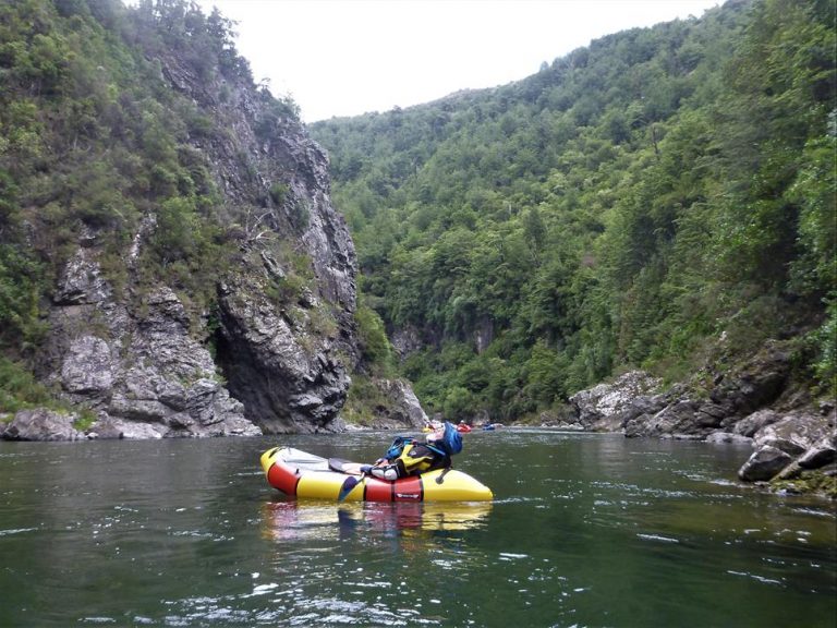
Inspiration at 5.5 cumecs
The videos and images on this page are courtesy of Richard Sutton, from the Ashley Gorge section at 5.5 cumecs.
Thanks to Richard for allowing us reproduce them from his blog post of his trip. Also to Hugh Canard for peer review of the post and Dan Clearwater for the writeup and interactive maps.
Below Ashley Gorge Campsite (I)
The Ashley is navigable between the campground and the sea, but its pretty much all grade I with willows and dead tree hazards to contend with. It is not commonly paddled.
“I ran it in 1964 in a canvas boat and again in 1973 in a GRP boat and I haven’t been tempted since.” – Hugh Canard
18 cumecs is a great flow for packrafts. Everything is pretty mellow and there’s plenty of time to make all the moves. It’s not pushy at all.