


A classic day trip, with straightforward access, amazing views and just enough rapids to keep intermediate packrafters entertained but not terrified. Can be run even at summer flows, but a bit of rain brings out the best in it.
Thanks to Dan Clearwater for the images and words.
Planning
Jetboats: Be aware that Wanaka River Journeys (as well as recreational jet boaters) regularly operate on the Matukituki River. These jet boats have legal authorisation to boat up the East Branch to the National Park Boundary at Junction Flat. This means you could theoretically encounter them at any stage during this paddle. There’s not a huge amount of space in that section of river, so be sure to read the Jetboat courtesy code for safety tips before you head out, and give them a call!
Drinking water: Farming operations in the valley below Glacier Burn mean that its worth taking drinking water for the first part of the walk-in.
Shuttle option: If you prefer to avoid carrying your boat on your shoulder, you can leave a car (or bike) at the Glenfinnan Stream ford, (about 2km downstream from Cameron Flat). Its easy to spot your car at this take out from the river.
Approach on foot: Cameron Flat to Junction Flat
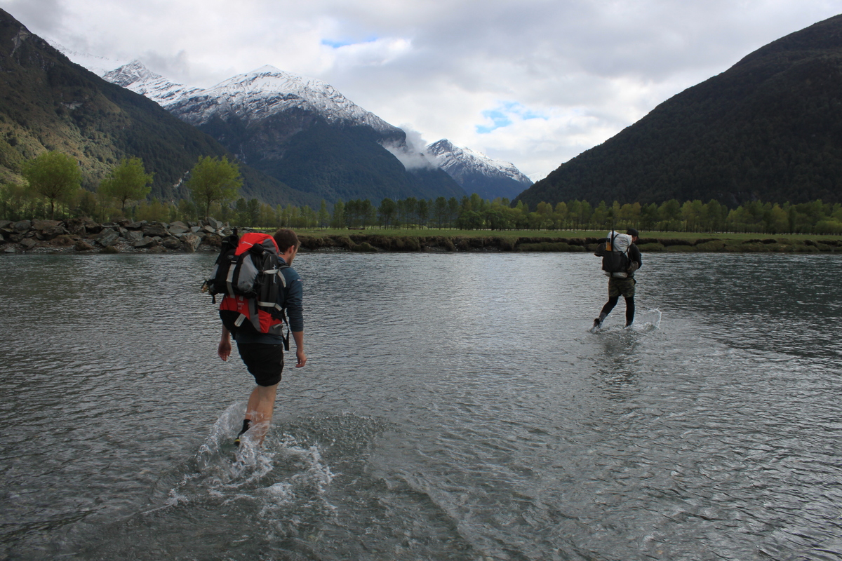
There’s a DOC sign and small carpark at Cameron Flat. From there, find an easy crossing of the west branch of the Matukituki. The braids here change a lot, so you might have to do a bit of a search to find a decent spot.
Follow the farm road and then DOC triangles up to Glacier Burn, about 1-1.5hrs from Cameron Flat. This is Aspiring Station, run by the Aspinall Family. The Aspinall family have welcomed and supported recreational access across the station for many generations. Please return the respect by leaving your Dog and firearms at home, avoiding bothering any stock and leaving gates as you found them.
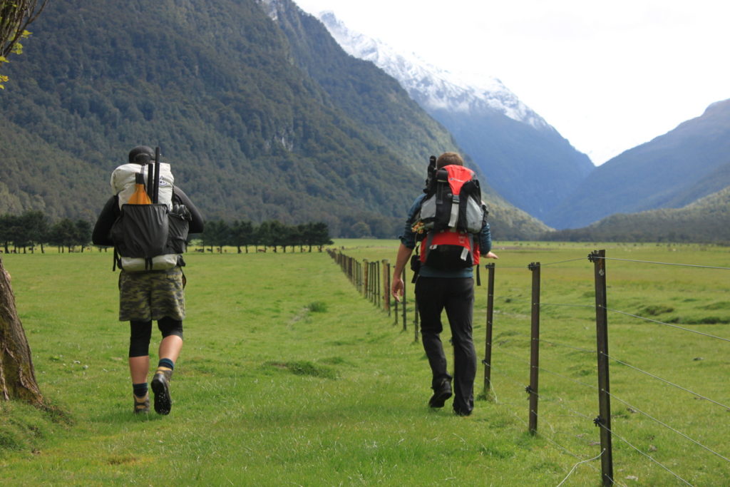
From Glacier Burn, the track enters the beech forest. A bit rough in places, there’s a few spots where you get down to the river to take a look.
If you want a shorter trip, you can put on at the un-named flat 1km south of Junction Flat, (which also has great camping). The track gets rougher from here, with some steep slips to traverse, which require care.
From Glacier burn, it is about 1.1.5-2hrs to Junction Flat, which is where most people put on.
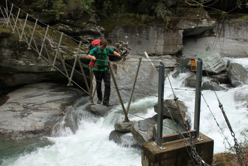
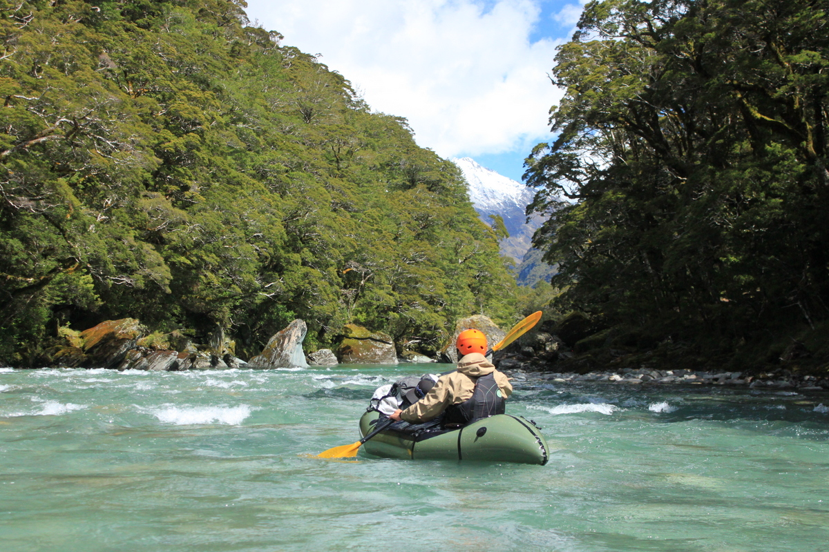
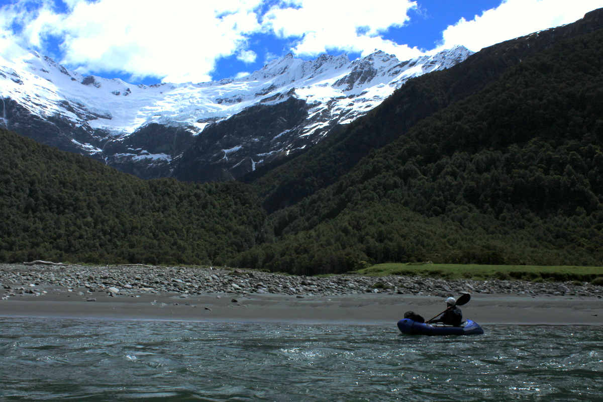
Crossing the Kitchener River swingbridge is worth it for the view, but it’s just as easy to cross the river on foot or put in at the confluence. Amazing views at Junction Flat of Mt Aspiring’s eastern aspects, Pope’s nose and the Kitchener Cirque.
You could easily turn this trip into an overnighter, either by camping on grassy flats at Junction Flat (or un-named flat), or heading up to the Rock of Ages Bivouac.
The upper Kitchener Valley is a real gem; its worth walking up to the base of the Turnbull Thompson Falls if you have the time. Packrafting the Kitchener is not an option. Super steep stacked boulders with multiple sieves and waterfalls….
Matukituki River East Branch (II / III-) Junction Flat to Glacier Burn
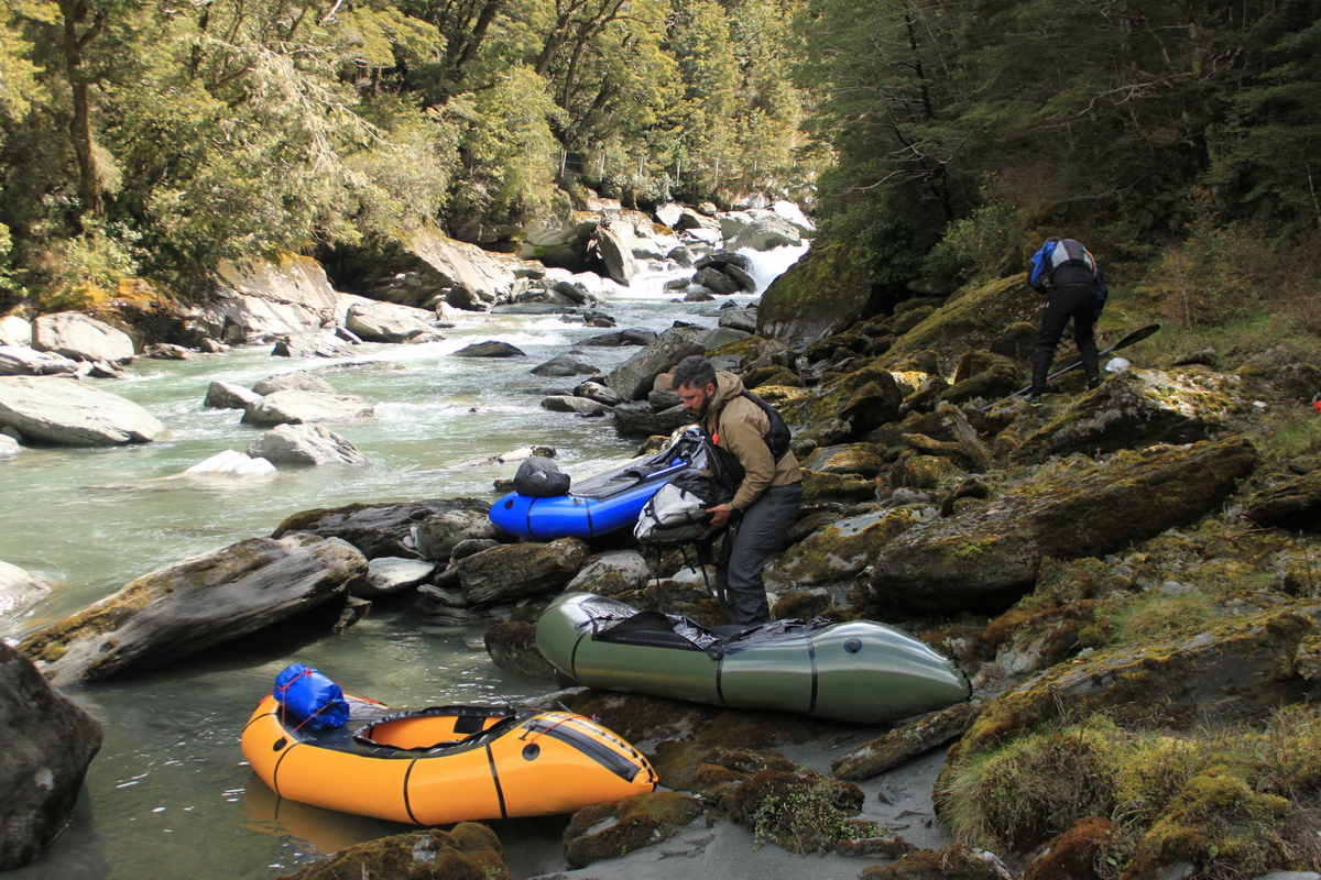
If you’ve timed your trip after rain and have good flows, you can start paddling just below the swing bridge. A few wave trains and a couple of nice class II rapids start the run.
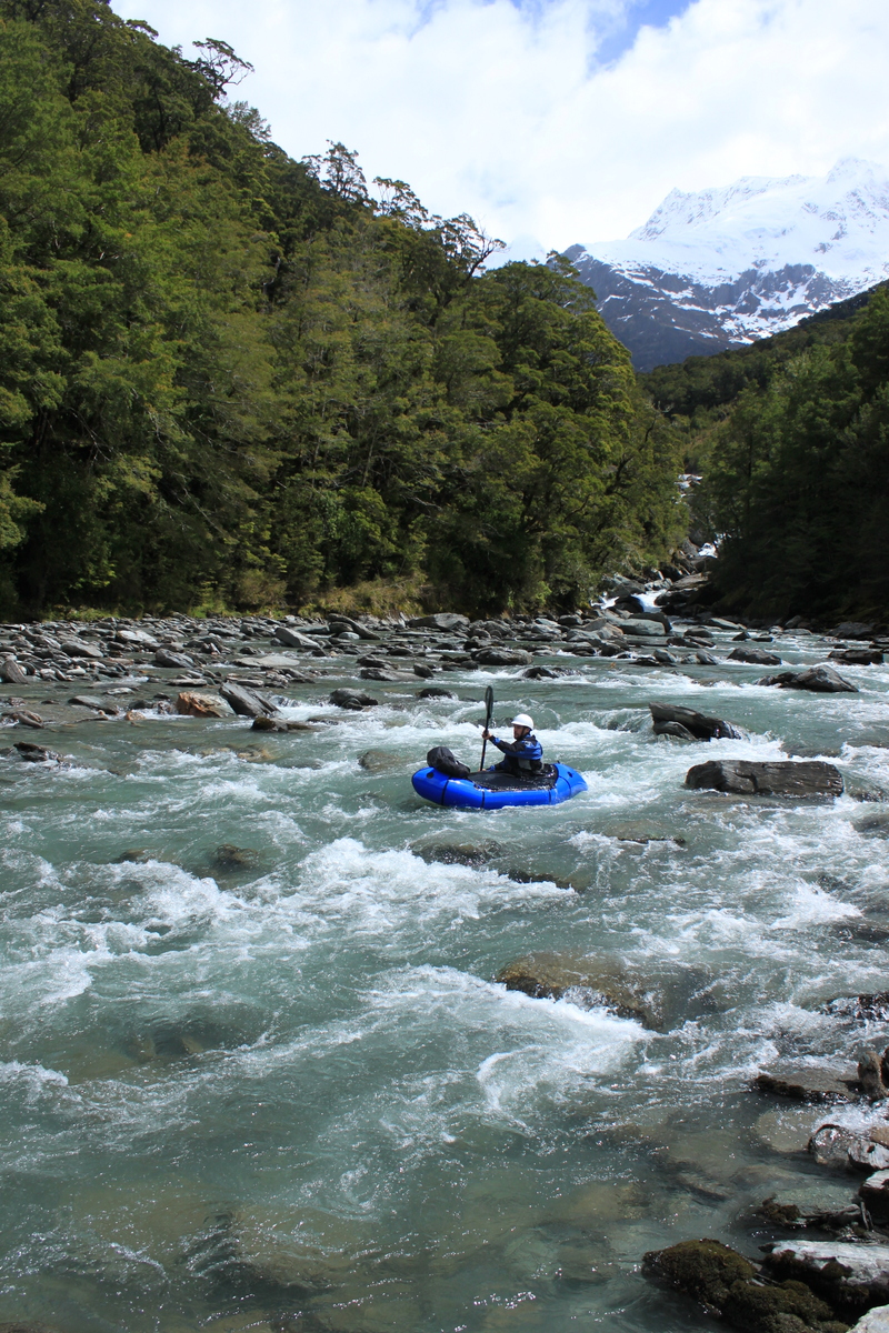
There’s two class III- rapids of note in the upper section, which are reasonably close together. Both are easy to scout and portage on river left.
The first is relatively straight forward. The second requires a bit more cross-current manueovering to avoid rocks and holes. The end of the rapid has bigger boulders which form entrapment hazards. Always a good idea to scout these rapids before you run them!
The river mellows, with long pools and a few more grade II rapids, and wave trains until the Glacier Burn confluence. About an hour from Junction Flat to Glacier Burn
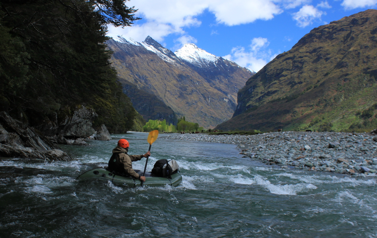
Matukituki River East Branch (I/II) Glacier Burn to the West Branch
From the Glacier Burn, the river braids up, with a few slightly larger class II wave trains. Great views up into the Avalanche Glacier and down to the Matukituki Valley. In low flows (<50 cumecs) you might have to get out in some shallow sections.
Another hour or so for this section.
Walk back to the Car
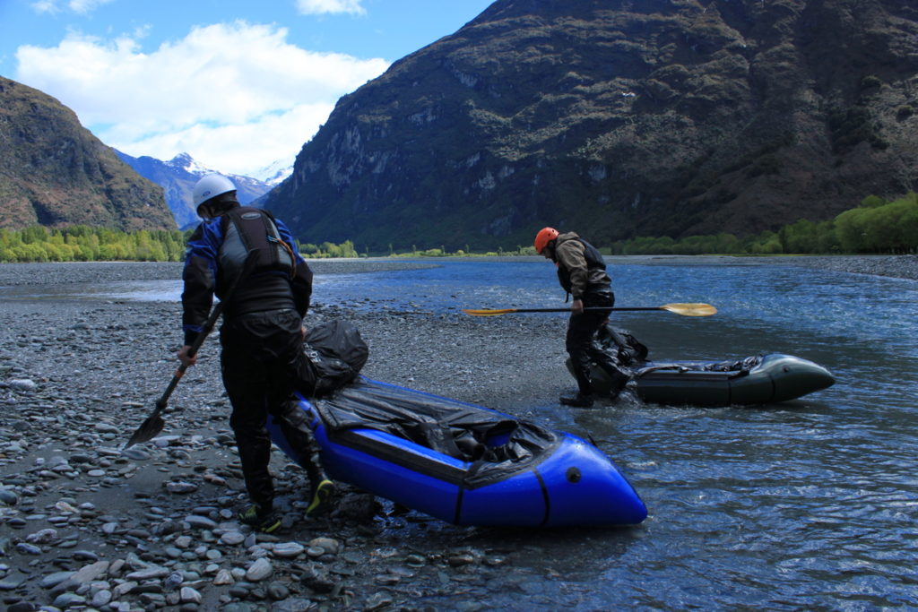
Where the east and west branch meet, its about a 15 minute carry across gravel flats to the car park.
Gauge
Matukituki Flow at West Wanaka.
The Matukituki is glacially fed. Even if it hasn’t rained for a while, the residual flow sits reasonably consistently around 40 cumecs at the river mouth.
At this level, the East Matukituki is still well worth a trip!
In the single channel section (above Glacier burn) the rapids are shallower, with more rocks and more features to navigate. The main grade III- rapid can be too low to safely paddle at these flows. Scout carefully, looking for entrapment hazards, which become more pronounced at these low flows.
Downstream of Glacier burn, low flows (40-50 cumecs) will probably mean you’ll encounter some shallow braids, probably needing to get out and walk over a few short sections. But overall, it doesn’t detract from the run.
At 70-80 cumecs the East Branch is nice and full, more boulders are covered and it is a really nice playful flow.
100 cumecs is probably the day after rain. At this level, it is very full, but still stays the same grades, just a bit faster, more pushy and requiring better technique in the technical bits.
Still well worth doing at this flow! The rapids were slightly steeper, with more exposed rocks, requiring a bit more maneuvering, which made it lots of fun!
Only had to get out twice in the lower braided section!
We did it recently (21 Dec 2022) with a dropping river flow, at or around 50cms and it was real good. A little boney below Glacier Burn, but still passable. Super scenic and consistently fun!
Paddled this at 65 cumecs (W Wanaka gauge) . We skipped the G3 bits and the two rapids below, but everything else was G2 and G1 and good fun at that flow. Some bony bits here and there after the river braids (below Glacier Burn) and got stranded on the odd boulder due to poor line choice, but overall runnable at that flow.
Walk in was definitely more than 2.5h. More like 3.5 with some scoping of rapids etc. and not much faffing. Also some rather dodgy pieces of trail to navigate closer to the Kirchener confluence.
Paul and I did this on 25 Jan. Gauge was on 60 cumics so we anticipated lowish flow but actually found it fast and full. No bony bits. We took 3 hrs for the walk in but we are getting on a bit.
The grade 3 bit was short fast and manageable. Barely enough time to maneuver between the turbulence.
Dust stormy tailwind drove us down the lower half.
We also accidentally stopped rafting too early but later realized that you could leave a bike where the river meets Glenfinian creek and get out there and the driver bikes back to the car at Cameron flat.
There was no view into Kitchener Circe due to clouds but we did see up into Avalanche Glacier.