


Hurunui River overview
The Hurunui is the most important River in Canterbury for paddlers. It has navigable flows all year round and offers a good variety of whitewater runs.
From Lake Sumner down, there are a variety of runs, catering for all types of paddlers.
Upper Hurunui (described as one run)
- Lake to Sisters (I/II) Hike into the Lake, and paddle to Sisters River (I/II)
- Sisters Gorge (II) from Sisters River to Jollie Brook
- Jollie Brook (II) from Jollie Brook to Seaward River
Middle Hurunui
- Maori Gully (III) from Seaward River to (almost) the Surveys stream
- Hawarden Gap (II+) from Surveyors Stream to Mandamus River
Lower Hurunui
It has something for everyone; for learners, the upper Hurunui is great,, for intermediate paddlers the Jollie Brook and Hawarden gap runs, and for those stepping up to Class III the Maori Gully run.
Packrafters can walk up to the Lake and paddle back to the top of Maori Gully in a day. It would be possible to link all the runs into an overnighter.
Upper Hurunui River: Lake to Seaward River (I/II)
Run overview
The Upper Hurunui run is a classic full-day packrafting trip, which includes the hardshell kayaker runs known as Sisters and Jollie Brook, all the way to the put in for Maori Gully.
With good road and track access, you can choose as much paddling as you like; just don’t miss the section below Jollie Brook, which is extremely popular (for good reason) and can have large groups of paddlers on it.
By Road
Head north up State Highway One from Christchurch, when you get to Waipara, turn left and head up State Highway Seven. Turn left at the past the tea rooms in Waikari and head down the Hawarden Waikari Road. Straight through Hawarden and along Horsley Down Road, which curves to the left to become Lake Sumner Road After Jacks Saddle the Hurunui Valley comes into view.
The take-out is beside a bridge over the Seaward River. Continue on Lake Sumner Road (alongside the Hurunui river) as far as the Sisters Stream where the road veers off to Lake Taylor. There is a car park here.
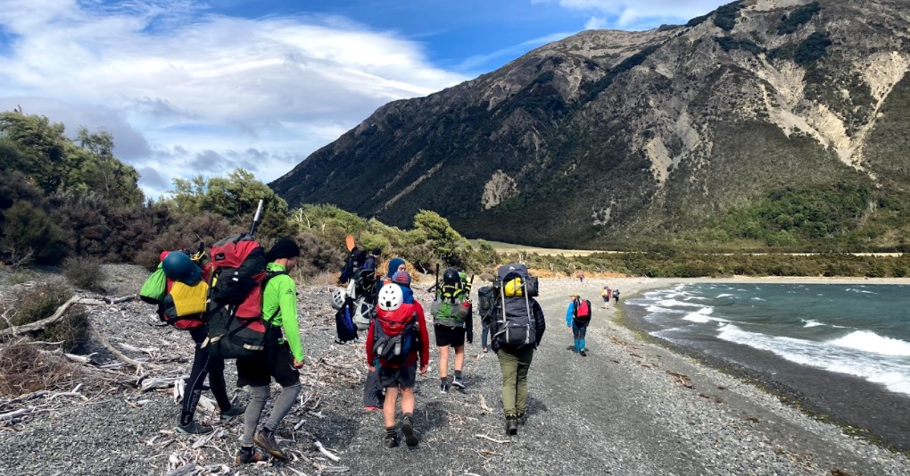
On Foot
From the Sisters stream car park follow the well marked track to the swing bridge. After crossing the bridge you can walk up the Hurunui on the tramping track and choose a put-in. The 9km walk to the Lake takes about 3.5 hrs.
On the Water
Lake outlet to Sisters Stream (I/II)
The run starts at the Lake outlet with an open gravel channel with rifles and pools, occasional boulder features and small wave trains. It is very scenic with some easy Class I-II rapids.

Sisters Gorge: Sisters Stream to Jollie Brook (II)
The character changes to a bedrock pool drop at “Sisters Gorge”. This gorge is a sort of mini Maori Gully and is quite steep with some nice drops. Eddy out and check each rapid by boat scouting.
After the gorge the river opens out into open boulder gardens, which can be boney at low flows. Admire the massive gravel fan sequences that the river is incised into and cruise through some lovely kowhai riverbank vegetation. A right-hand corner heralds a long run down to the crux rapid. The current hits a bluff and sets up an exciting wave train that is challenging for beginners. There is an eddy on river right just before the corner that can be used to buy some time before the wave train and buffer waves.
Jollie Brook: Jollie Brook to Seward Stream (II)
The swing bridge appears and the Jollie Brook run starts. There is an alternative put-in here below the Jollie Brook swing bridge. It is a popular area for teaching beginners, most Canterbury kayakers will have learned the basics here.
The run continues with boulder gardens, gravel chutes, rock dodge rapids and bluffs / corners. There are a few nice play waves and eddies.
The last rapid before south Branch has a great eddy against a bluff corner. At times there is a micro eddy on the apex of the bluff called the Mezanine Floor that is fun to catch.
**Update**
In October 2022, we received reports that the Devil’s Fang Falls rapid has ‘dissapeared’ by being filled in or washed out by recent floods. The info below is kept here as a historical record, and just incase the next flood shifts it back to how it was…
Devil’s Fang Falls is the gnarliest feature on this reach and is Class III that needs careful scouting and is usually portaged due to the prospects of a severe beating or pins on the bedrock outcrops and rocks that litter the right hand channel. At some flows it may be possible to run on the left.
This rapid is still evolving so check for current knowledge. At low flow the rapid may be two narrow streams separated by a big fang of bedrock. Below 35 cumecs there are rocks in the fluff at the bottom of the drop. From 35 – 70 cumecs it is a full width drop with a good stopper across the bottom of the drop. The guardian wave above it is still powerful.
At higher flows the rapid is a full width wave/hydraulic followed by a big wave full of fluff and turbulence. The run out is deep and safe.
This section can be scouted on the drive in. The key factor is not to under-estimate the lead up.

Gauge
This river is paddleable all year round, even at the height of summer. Low flow is around 15 cumecs at Mandamus, 25 cumecs is pretty cruisy, 30 to 40 cumecs is a good standard flow, above 100 cumecs Maori Gully becomes Class IV.
The gauge is here
View Larger Topographic Map