


The Taruarau River is a tributary of the Ngaruroro River it has a very steep and tricky gorge below the Napier Taihape Road. It is only runnable through winter and early spring or after rain. It has a great Class III+ – IV section known as the Hot Springs gorge, The run is very highly rated by whitewater kayakers. The water is a step up from the nearby Lower Ngaruroro run and is pushing the limits for most packrafters. With care and portages it is a great trip for the experienced advanced paddler. There are a number of trip options.
The description references Egarr with recent info from Greg Duley, Timon Maxey and Bill Thomson.
By Road
The put-in is the Taruarau River Bridge on the Napier Taihape road. Put a shuttle vehicle at the end of Comet Road or at Whanawhana depending on the trip option.
On the Water
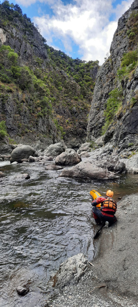
The run starts as easy Class II over a quiet shingle bed. Once in the gorge the nature of the river and grade changes. From here the river flows south through Class II to III+ rapids it is a rocky bottom with boulders. The rapids begin to increase in difficulty with steep drops as the river turns east at the southern end of the Sparrowhawk range.
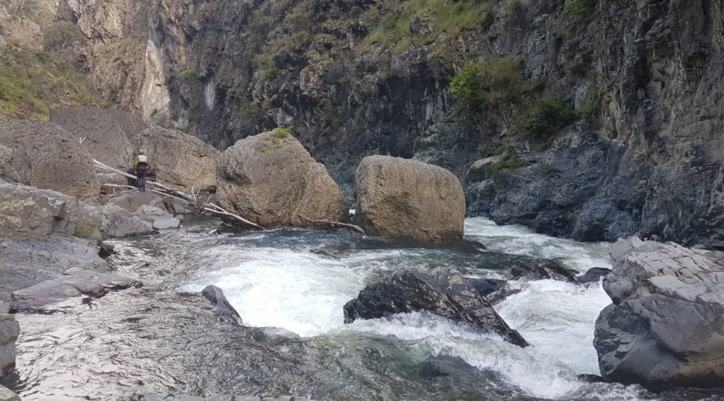
Farmland becomes visible and after about a kilometre before the Hot Springs Gorge is reached. This is a “must scout” gorge. The rapids are tight with large boulders in the Class III+ to IV range.
There are two named rapids; Waterfall Rapid at the entrance to the gorge (mislocated on Egarrs sketchmap) and the Slot. They are around the Class IV level at the recommended minimum flow. There are also about five Class IIIs through the Hot Springs gorge.
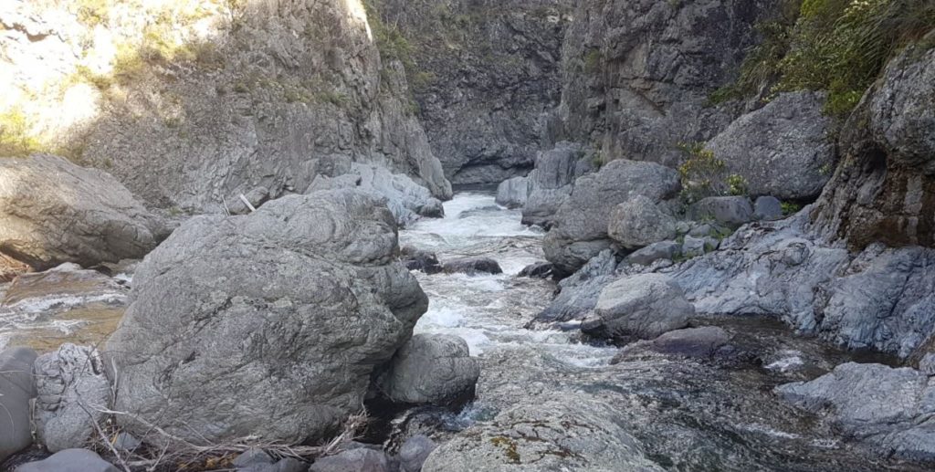
Hot Springs Gorge
The moment the Gorge constricts expect the Slot rapid – it needs a good shore scout.
The Approach to the Slot – no portage available at river level
Aim to boof the ramp on river right at the end of the slot – don’t swim this one by messing up the approach!
Fi Duley on the Slot
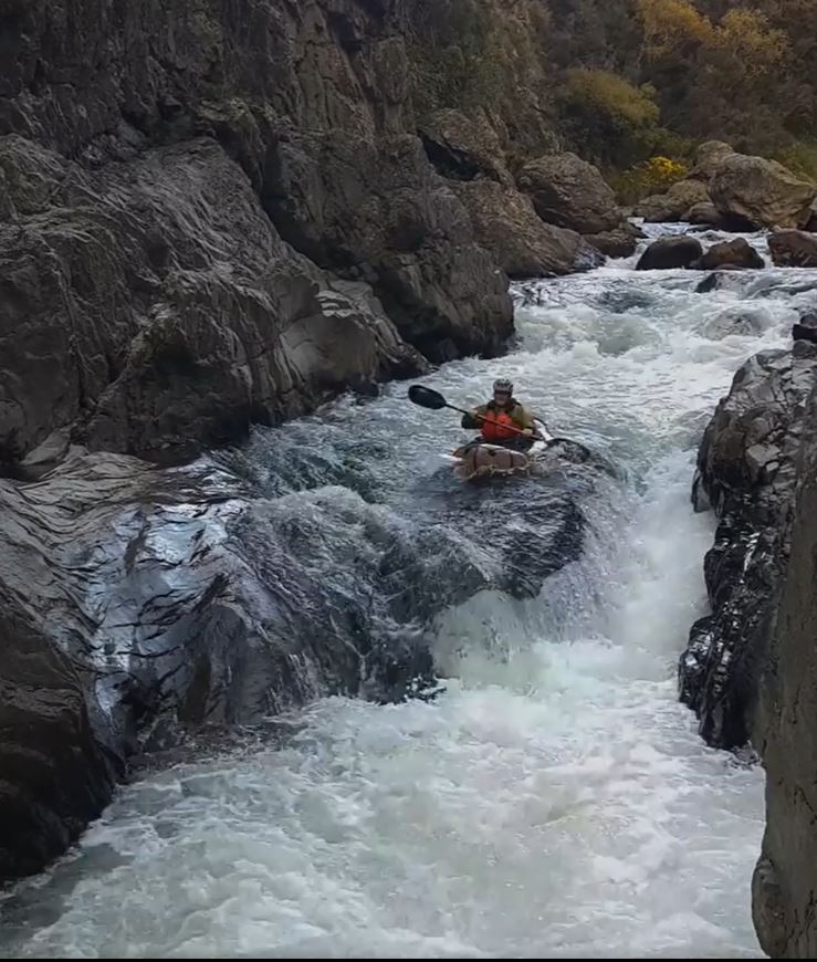
About half way through the gorge is the Waterfall Rapid. This has got milder over the years and is now quite small. Don’t underestimate the hazards below it,
Bill Thomson scouting the drop on Waterfall Rapid at low flow
Greg Duley checks hazards below the drop on Waterfall Rapid
Greg Duley recommends taking the drop on true left then quickly moving to river right to avoid the flow that goes underneath some large boulders. There is a serious entrapment risk. In a pushy current this requires advanced paddling skills – this means most packrafters will need to portage the rapid.
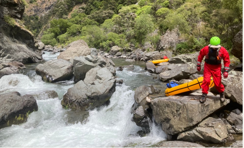
It’s a pretty busy hours boating, with not a lot of downtime between rapids. The gorge can turn into something pretty nasty with a lot more water down it. You definitely want to get out and scout those rapids, as the right line is important and the consequences of a swim in the wrong place are severe.
The Waipiropiro Hot Springs are on Timahanga Station, so you need to get permission to visit them. They are up a steep 100m bluff above the last rapid in the gorge.
Hot Springs (permission required) is at this point in the gorge
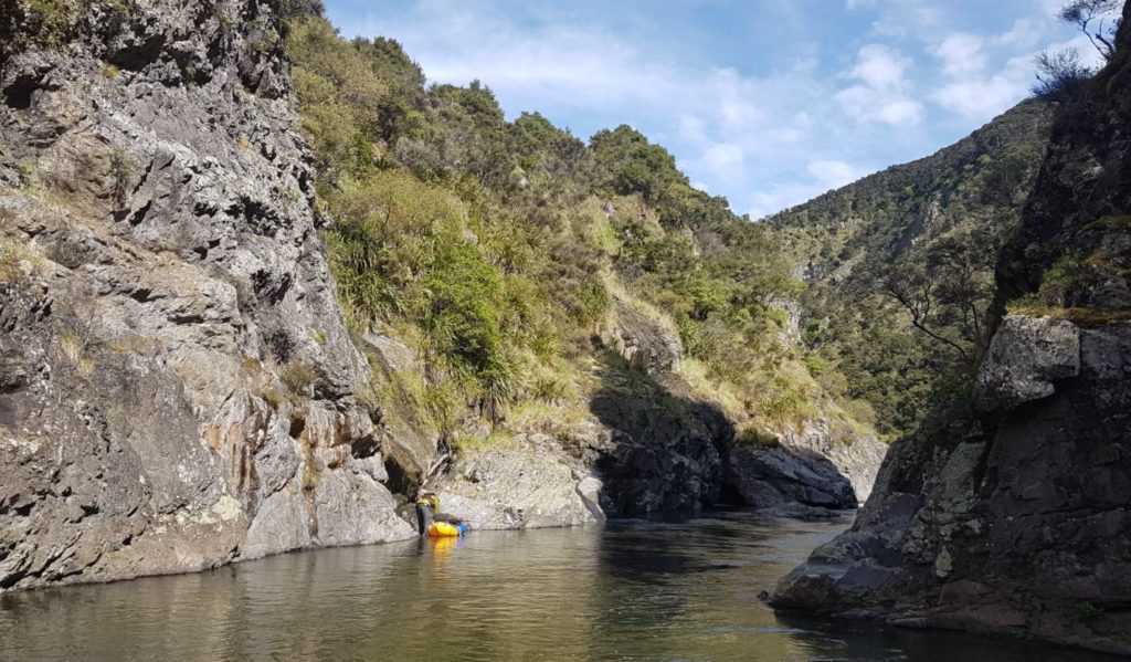
The gorge is less than 2 km long. Note Egarr called this the Top gorge. After the gorge the river eases to Class II, passes a farm bridge then, two kilometres below the gorge, the Ikawetea confluence.
The lower gorge then begins slowly with Class II and gradually picks up. About 5 km below the Ikawetea Stream confluence an orange marker on the left marks the tramping track to Shutes Hut. The hut is on the true right bank a steep 20 minute climb above the river.
The next 7 kilometres contain the crux of the lower gorge with the largest rapids starting a few km below the Comet – Shutes track and easing only about a kilometre above the Ngaruroro confluence. This section contains plenty of Class III rapids. Egarr records a number of bouldery class IV rapids and constrictions but this information may be dated.
From the confluence it is 20 odd km of easy Class I and II to the Whanwhana take out. Headwinds are common making this section a bit of a slog and it get’s progressively less interesting. It is described in the Lower Ngaruroro trip description. It’s also a much longer shuttle.
The best rapids in the lower gorge are downstream of the Comet Hut Track.
Options
You have to decide if you want a 3 hour gut buster up the gorge wall or a full day through to Whanawhana.
You can take out where the Shutes track crosses the river from the Comet Range. Then make the 800m vertical ascent over 4 km back to the Comet Hut carpark (about 30km river trip).
The longer, no walking trip, is about 55kn down to the Ngaruroro confluence and on down an increasingly tame river to Whanawhana take.
View Larger Topographic Map
Land Tenure
From the Hot Springs Gorge there is a DOC marginal strip on the true left. Then below the Ikawetea confluence Kaweka forest park starts about a kilometre below the Ikawetea confluence on true right (and a kilometre above on true left).
The upper river is private land on both banks. Permission must be obtained to camp on Timahanga Station.
The Gauge
Taruarau River requires spring flows or is a rain run. The gauge is here
A gauge of above 600 mm is considered the minimum for kayaks on the run is approximately 55 km. Its a very good trip in a packraft at this level (5 cumecs/600m level on the NIWA gauge), but down around 3 cumecs and it would get pretty boney.