


Thank you to Jenny Cossey and Andrew Esler for the information and photos for this trip page.
This is a mint little gorge that needs a bit of homework and weather watching to get the perfect packraft flow. Walking into Roaring Stag Hut and sitting out the rain is one option or you can do a day trip after watching the weather and crossing the fingers you catch the recession of a decent rain event.
The 130km Ruamahanga River rises in the north east of the Tararua Ranges on the eastern flanks of Banister and Dundas, makes an n shape bend south to join Ruapae Stream near Roaring Stag Hut (DOC). The river heads south for 3.5km to join Cleft Creek through pristine virgin forest, before turning ninety degrees east to flow through the narrow Ruamahanga Gorge that exits the ranges 9km later at Mount Bruce into open farmland. The headwaters have excellent water quality. From Mt Bruce the Ruamahanga flows south, then south west through farmland, before emptying into the Cook Strait.
Day trip option
Park at the start of the Ruamahanga Gorge DOC walking track on Ruamahanga Gorge Rd and walk 9km on the south side of the river to Cleft Creek. While the river only falls 100m over the 9km, the walk in has a few more ups and downs, ~400m ascent. The route is clearly marked with orange triangles on farm tracks and a well-maintained DOC track through native forest. There are large signs at the put in (the confluence of the Ruamahanga River and Cleft Creek) to Roaring Stag Hut and Cow Creek Saddle. There are only a few cliff top views of the gorge along the track. Allow 3 hours for the walk. If there is enough water you can carry on up the Ruamahanga towards Roaring Stag lodge (2 hours) to add some extra time on the water.
Overnight option
A nice through trip begins at Putara Road end. Walk 7km on the Roaring Stag Track (ascent 568m) to the 12 bunk DOC hut, 4 hours. Float (if there’s enough water) or walk 3.5km down the Ruamahanga River valley to Cleft Stream, a descent of 60m. Paddle out to Mt Bruce and shuttle to retrieve your car.
Ruamahanga (II+/III) Cleft Creek to Mt Bruce
The nine km paddle down the Ruamahanga Gorge is a delightful run of sustained grade II to II+ rapids that will go to III in higher flows. The river consists of boulder gardens and pool drops with some bedrock features. There is one solid grade III halfway down the gorge which could probably be portaged. Not all rapids are able to be portaged due to the gorge being narrow. There were no logs jams on our trip, but that doesn’t guarantee one hasn’t formed since. Be careful and always have an eddy in sight before you peer round blind corners!
Once in the gorge there were no obvious exits points on the true right to the DOC walking track. But with a vigorous scramble, you could probably get up in a few places in an emergency.
The additional 3.5km float, under Highway Two at Mt Bruce has longer pools, some delightful rapids through tight meanders, before the land opens out into farmland. Here the river begins to braid and willows appear.
It is worth taking a look at WAMS to understand the land tenure. Whilst there is an unformed public road down to the river and up the valley neither coincide with the marked tracks. Accordingly, before setting out please ask the farmer in the house near the start of the walking track for exit permission. There is an arrangement with DOC for the walking access up the valley. There is no take out at Mt Bruce Bridge on Highway two as the river is deeply incised in a narrow gorge beneath the bridge.
It is possible to continue on down the river through a scenic gorge but the water is only Class I to II and after 5km the river becomes braided. This exit is also on private land, please ask the farmer at the house before you put in to enable you to exit from this take out. A 4km walk/hitch is required to get back to your vehicle through farm tracks and along the verge of State Highway Two. This is the last take out point on the western side of the river for many km’s (near State Highway Two) as the Ruamahanga River enters another gorge through farmland.
Gauge
Below about 5m3 this river is a popular tubing trip but being contained in a gorge a packraft will scratch through at these low flows. Like many of these Tararua gorges the grade will change with flow. At just under 8m3, the flow in the pictures was perfect for Class II to II+ with one Class III. There is a large catchment above the gorge and limited options for exit so don’t enter it if heavy rain is forecast. It rises and falls quickly. This means it can take a bit of planning to get the flow in the sweet spot.
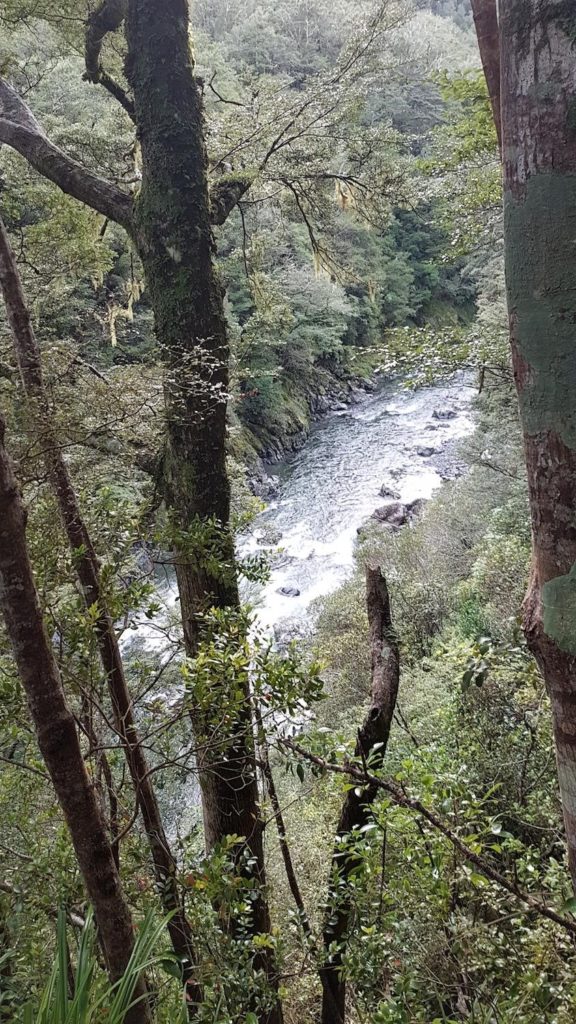
Ruamahanga – One of the few places the gorge can be seen on the walk into Cleft Creek. [Photo by Ben Kurtz] 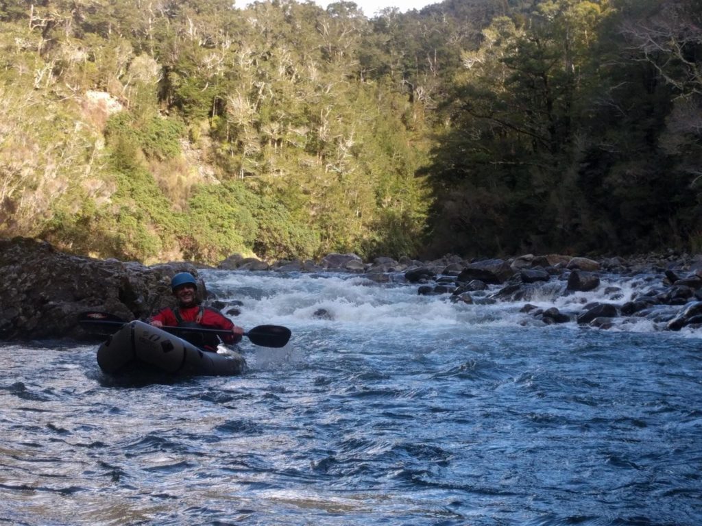
Some nice little rapids to warm up on [Photo by AJ Esler] 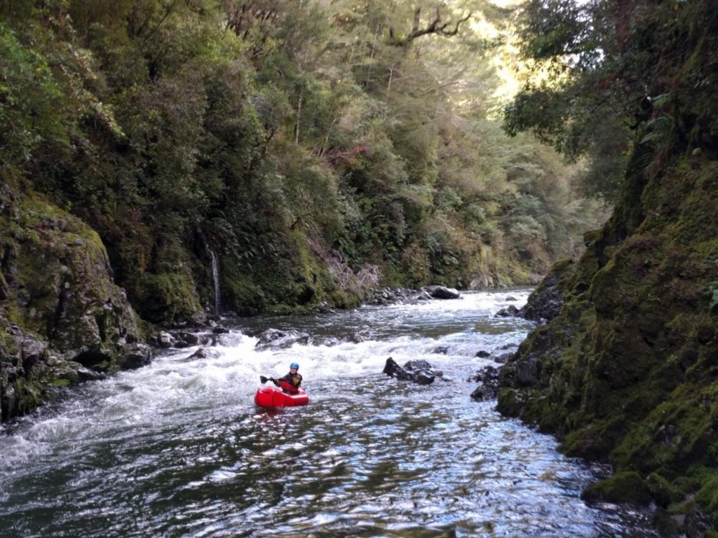
Entering a gorgy bit [Photo by AJ Esler] 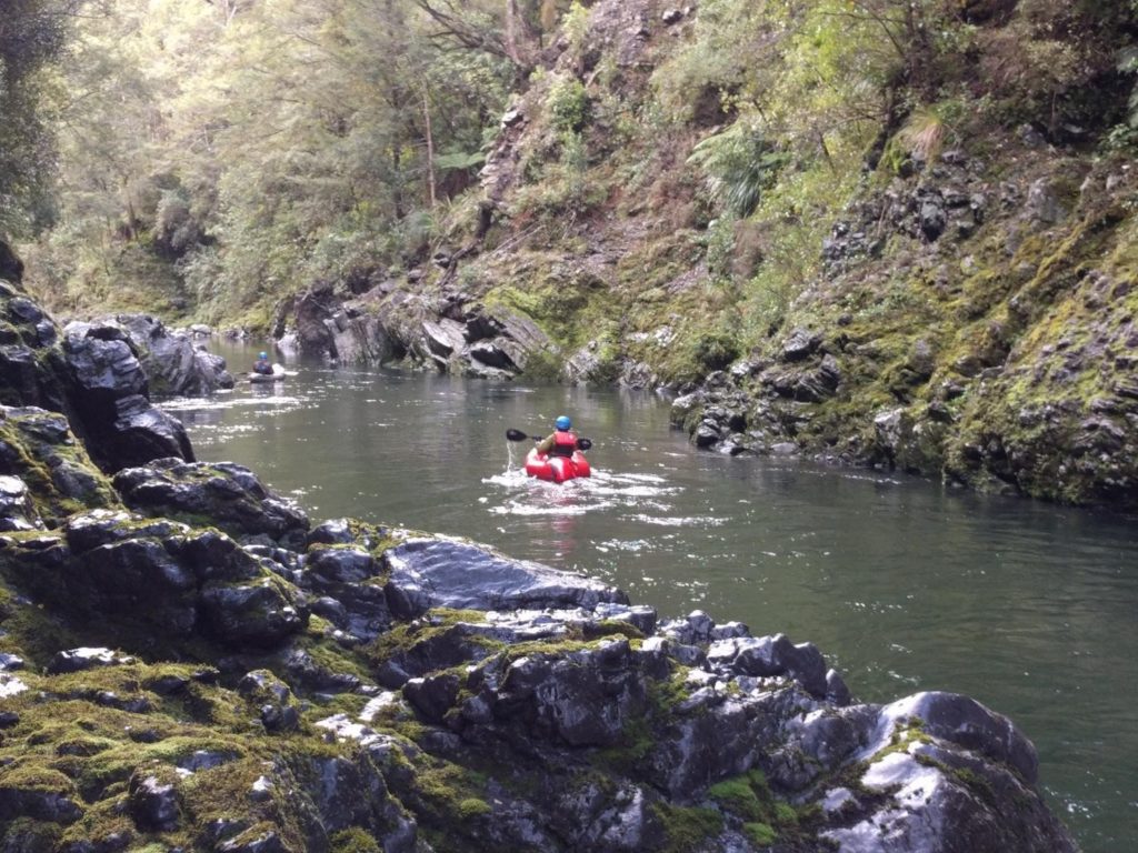
Cruising down a gorge. [Photo by AJ Esler] 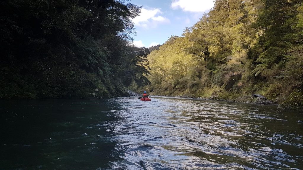
More gorge cruising [photo by Ben Kurtz]
View Larger Topographic Map
I did this yesterday from cleft creek down on 7 cumics which was just enough. No sun in the deep gorge at this time of year and the water felt like snow melt. The tricky bits are steep but quite short. 3hr walk in and 2 hr raft out. No new obstacles but there are some old logs still.